Showing posts with label Tauherenikau. Show all posts

Saturday, 13 January 2018

The fabulous Tararua earthquake lake

Kaikoura has a dramatically changed landscape - new land ripped from the sea, hills reshaped and roads smashed. And the Tararuas have an earthquake lake. We think it was from the same earthquake but nobody is really sure. Whatever - it's our earthquake lake. Although some may rather uncharitably apply quotation marks and even call it an "earthquake" pond.

Ever since hearing about it, I've intended to get in and have a look. Not least because there is a beautiful looking spur visible from Bull Mound that runs down from the Beehives on the Southern Crossing. There are also a few spot-heights in the valley, and the river itself is probably worth a visit.

It's not the sort of place I want to go on my own with winter river flows so it's just been sitting quietly on the back burner annoying the hell out of me.

What:   Navigation trip to earthquake lake, visit upper Tauherenikau and knock off some spot heights
When:  12-13 January 2018
Who:     Solo
Where:  Southern Tararuas
Map:      NZ Topo map

Arrow indicates approx. location of the lake
Have left off most of the boring track bits

There are a few options for the weekend and I don't make up my mind until midday Friday - despite being packed. The support crew is nothing if not accommodating and agrees to an after work drop-off at Otaki Forks.

The trouble with being a bit disorganised is that you forget stuff. Arriving at the road end I discover it's my belt - a shoelace is called into service as an effective if not elegant solution. Later, I discover I also forgot my lunch cheese.  Fortunately my packing list ensured nothing important was neglected.


Repurposing a shoe lace

Posing for the camera - Judd Ridge to right

The plan is to get to Kime Hut in the dark. Departing at 7.20pm I reckon I'll be there before 11.

It's a warm and calm evening as I amble on up. There's not a lot to progress but I know that when you get to the clearing with a view of Kapanui's rounded silhouette it's about 10 minutes to Field Hut.
 
The hut is empty and the log book full. I squeeze a few words in amidst some gormless twat's cribbage score inside the back cover and head for Kime. At 8:55 the light is waning but it should be better on the tops. Rounding Table Top though, there's clag on the ridge above and the wind is coming up.

Sometimes the Tararuas will give you a bit of a slap to see if you're paying attention. The clag thickens just above Dennan (1200m) and although not cold, the rising wind and mist whips heat away. To keep myself amused I've been thinking about types of risk (actual, perceived, managed, residual, acceptable ...) but the drop in light and temperature (and my glasses misting up) prompts a bit of a pause and attention to the risks at hand.

Hunkering down, I crack out the light and review the map. The route is very familiar but the pair from Te Papa that died in a blizzard are always front of mind up here.

The top of the ridge is wide and rounded. There are snow stakes with reflectors and a pretty good ground trail but there are also false trails and lots of scope to wander in circles. The clag is thick and the poles are only visible from about 10 paces away - with about 30 paces between poles this means pausing at each, taking a bearing and following the trail that leads in that direction.

It's slow progress but goes smoothly. I'm not aware that I've reached the hut until I blunder into the sign. It's 10:20pm and there are about 10 punters already in their pits. I get myself sorted in the vestibule and creep in to claim a mattress.

One party is up at 5am and away before 6. I'm a bit more leisurely and get away about 7:15 before the large group that came through from Kaitoke yesterday.


Kime - claggy but good visibility

Half an hour later I'm on Mt Hector in the usual conditions.


Kime in its element


Descending from Hector along the Southern Crossing I count the lumps. The second beehive is in thick clag so I take a bearing off the ridge and hope I'm dropping on to the spur. All good - the spur has some rocky knobs that can be scrambled over or sidled and fairly soon I've dropped out of a cloud ceiling at 1400m (with eddies dropping it to 1300m). The spur ahead is revealed and distant slopes catch the sun.


Looking down spur from just below the Beehives

Looking back up the spur to the Beehives

Looking down to the knob on the spur at 1280m

There's a few rocky scrambles that require care but overall it's a delightful wander down with some ground trail in places.

There's a knob marked on the map at 1280m (a trail sidles to the south of the knob). The main spur continues but a substantive side spur splits off SSE - I suspect others follow the main spur although it looks very steep at the bottom.

My spur is clearly visible from above and there's even a faint marks in the herbs underfoot leading down. I pause to relate the terrain to the map and fix it in my head.


My spur
The spur is beautiful. Mossy goblin forest, with beech and leatherwood then beech, totara and other stuff ... and lots of moss. It is straight and well defined with a pretty good trail in places - probably mostly animal. The trail breaks up near the bottom where I arrive at a wee terrace to fossick about for a way down to the river. It has taken about 30 minutes to get from the top to the bushline and another 50 to the river.


My spur
This is the Tauherenikau River and I'm going to be in it for a few kilometers. Although a bit larger than I was expecting it is really just a large stream. I figure the flow is a bit above average summer flow.

It's generally pretty good going - the usual occasional scrambles around deep pools and over log jambs. The plan is to head down stream to approach the earthquake lake from above and hopefully find a way through or around.

It's less than 15 minutes from the spur to the lake. The water level is a bit lower than when the photo on Stuff was taken but otherwise looks the same - steep bushy sides, clear deep water and a jumble of rocks blocking the river.


The 'Earthquake' lake
The water used to be up to the base of the foreground rock

Up to my waist in it

The flow is gentle and the bottom clean. An exploratory wade determines that I won't get through with my pack on. By dint of feeling my way on tiptoe I get through with my pack on my shoulder and the water just below neck level. It would be a painful grovel to try to work through the bush.

The massive slip has blocked the river, with trees smashed in among the rocks. The river is slowly washing away its foot and the opposite bank but there is plenty more material to come down. Looking at the modest size of the 'lake' and the mass of the slip I don't think there is danger of a sudden break through, but with the unstable slip and huge gashes that falling rocks have ripped in the logs it's not a place I want to hang around.


The dam

Last view of the lake

Looking up the slip
 Below the slip the river tumbles down through rocks and a jumble of logs. It's taken 20 minutes to get through (and take photos) and I'm keen to get moving as I'm soaked and starting to shiver.


Log jumble below the slip

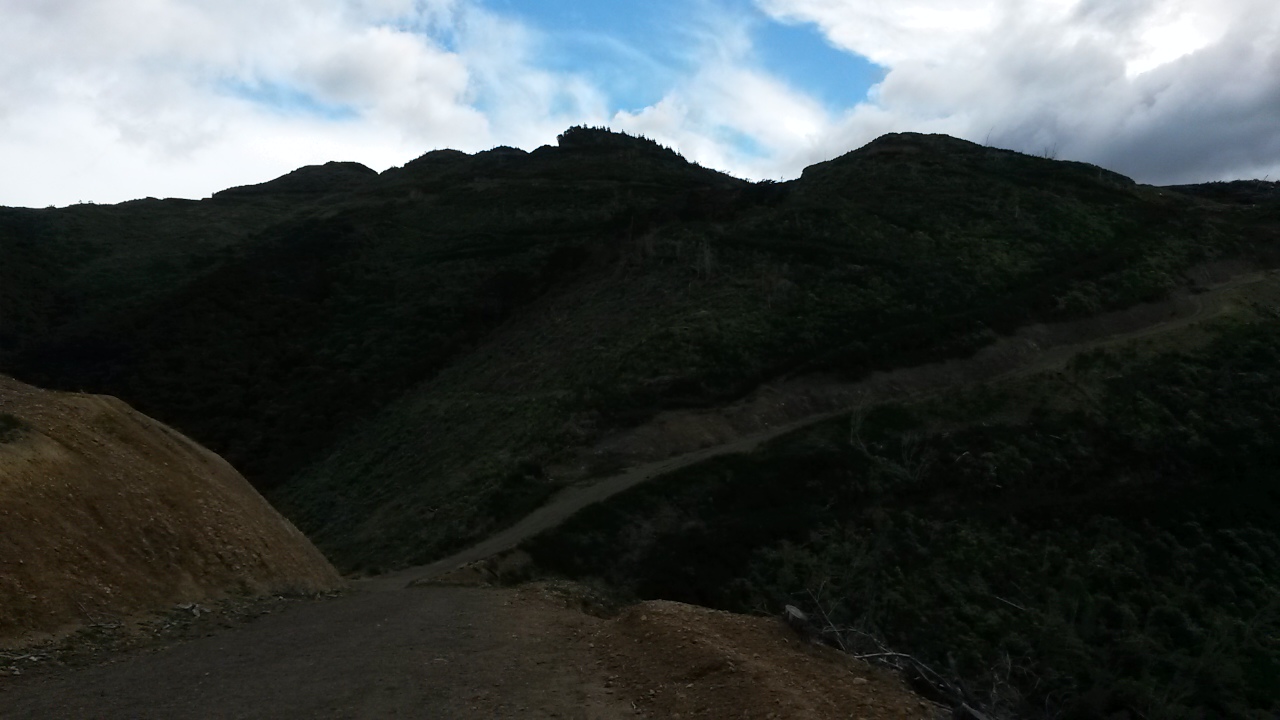
It's almost 2km and an hour to my next junction. The river tumbles through deep pools and an occasional slot but it's all navigable. At the intersection with the stream off Hell's Gate it's 10:55 - I stop for a bite and to plot the next move. The aim is to get to 892 and follow the spur down to 686. The slope up to 892 looks steep and little delineated.

At the first stream off the side of the side stream (following me?) I take a bearing and scramble up through the bush. It's the usual mucky lower level but pretty good going higher up. I note there are lot of Phyllocladus sp in the understory - I'm not sure which, but assume it is Mountain Toatoa. It's an interesting tree as the leaves aren't (they are flattened stems).

On the spur at 892 (11:55) I could imagine that people have been down this way but it's not that obvious and it is often necessary to take bearings as the spur top is wide in places and the shape not that obvious.


Typical bush on the spur

686 turns out to be on a wide flat top with an open under-story. Every now and then a passing patch of sun lances down to the floor - time for lunch.

From here there's little to choose between headings as the spur end is rounded. I opt for the most direct route down river.  It's easy going as there are an awful lot of animal trails.

This is the one of my assessment points - the river is likely to be much bigger and could be challenging - so much so that it could force a retreat back up a spur to Bull Mound. I peer through the trees to see what it looks like as I approach the bottom (1:14). It's noticeably larger but the valley floor much wider with a gentler slope so Plan A is go. The trick now is to count the side streams and not miss Josephson Creek.


The Tauherenikau looking much more river like

Pt 596
Rounding a corner a very steep knob swings into view - that's my next target.  The map shows some very closely spaced contours - so I study it carefully as I approach.

It's about 2pm as I clamber into the mouth of Josephson Creek to find a spot to start climbing the knob. Animal trails zigzag a way through the unclimable bits but it is hand-over-hand up through low scrub onto a sharp spur. Very steep but within my comfort zone.

Part way up I just about run into a deer rear. The stag is about 5m away and my 'Hey!' doesn't cause it to run away - it just turns to look, pauses and then ambles off. I hope they never forget they are vegetarians as it was a lot bigger than me and had the advantage from the terrain.

The top of the knob and a sit down. No view but there were some nice wee spots on the way up. I don't fancy down-climbing what I just came up so take a bearing south to swing around onto another spur where the bluffy bits seem to open out a little. It is a steep scramble through forest but again, animal trails help me avoid a creek slot and get me to the bottom.


The final crossing
This little spot-height excursion (exertion?) whilst fun has used an hour and there is now a 600m bash up to Bull Mound to contend with. I say good bye to the Tauherenikau and find a way into the bush.

Normally, the top of the spur provides the best travel but it is quite rounded and I can't see any evidence of people so I watch where the animals have been and follow, despite the somewhat meandering course. It seems to work well - particularly in the lower reaches where they have worn benches in the shingly floor just off the spur. However, I'm not feeling so sprightly and avoid looking at watch or altimeter.

After a long while, the slope lessens and rounds and the trees shorten and are interrupted by bands of scrub. Still no sign of human trails. Eventually the direction of the slope is barely perceptible and I break into a large clearing (huge) - this look familiar - the track must be around here somewhere.

It's nice to be out of the bush. I can see the Beehives and Mt Hector lurking in clag and cloud is piling in from the north west. It is sunny in the Wairarapa and calm here. Bull is a rounded top ridge below the bush line but with extensive boggy herb field and stunted bush. It's a good place to spot deer and I startle two today. My spur from this morning comes into view.

Hector in cloud, Beehives just to left
The knob at 1280m is at centre (faint 'A' in the middle of photo)
My spur is the left arm of it

North along Bull Mound, Tararua Peaks on horizon
Neill Ridge in middle distance


After hooking up with the Bull Mound track I wander along enjoying the openness. And thinking about the number of people likely to be at Alpha Hut. The plan is to exit via Quoin Ridge tomorrow, but the only piece of new territory that way is a tiny section from about the 700m contour down to Hutt Forks. I weigh it up and find it wanting - it can wait for another day.  If I put the hammer down along Marchant Ridge the road end should be achievable not too long after dark.

Fortunately Bull Mound has reception, although my cell phone is a little sulky about the moisture from the lake (despite a clip seal bag). A few texts to the support crew confirms the plan change. Right - it's about 5pm - I need a drink, a bite and a sit down then better get going.

The change in plan means that the water that would have seen me easily to Alpha is less than needed. A trickle draining the swampy hill crosses the track near 1107 and provides the solution - albeit, like Muldoon's view of Auckland in the '70's ... somewhat browner than I would wish.

DOC has done a great job of clearing the Marchant track - branches and deadfall have been cut through and vegetation cleared. A bit of mud but as near perfect as you could wish. I nurse the body along watching the time.

NZ bush will usually have a few blowflies hurtling about - most noticeably on hot days. There are a few about now and for some reason they find my head irresistible. Possibly all that delicious sweat - or it might be that the ripeness of my bush shirt is a carrion call they just can't ignore. Either way, the recurring pattern becomes the sound of a fly blundering past then a brief pause as it's tiny brain registers - 'Hellooo, what was that!' and it swings around to attempt a landing from behind. It's too hot to wear a hat and soon becomes infuriating. Must be tired.


Last of the sun catches 656 on the Dobson loop track (probably)

Finally, the long Marchant is over and the track turns sharply left to sidle and drop to the Dobson turn off (a lot of windfall cleaned out through here). Then the interminable saunter down from 650m to 500m. The evening sun slants in through the trees accentuating the greens and golds.

From the final descent at Pt 529 the track hasn't been cleared so there's a bit of gorse to contend with. It gets dimmer and dimmer but I'm determined not to get the headtorch out, just making it through the last forest section by Kiwi Ranch in the gloom. 9:20pm - and all milestones met.

Wrap up

A tiring day at 14 hours but very satisfying. The 'earthquake' 'lake' is hardly spectacular but is pretty much exactly what I anticipated. The level of the lake is likely to vary and I wouldn't rely on being able to wade it (it should be an easy pack-float though). It's great to have got to it and the upper Tauherenikau is well worth visiting.

The three spot-heights were a bonus that tested navigation and agility. As for the morning's spur - it's almost tempting to repeat that part of the trip. Plenty more spot-heights yet though.

Relatively few injuries but a full day afterwards making old man noises every time I moved. Kit all performed well with the exception of my 'new' gaiters which, at the current rate of depreciation, seem likely to last 5% as long as my last set.

Saturday, 9 September 2017

Coal Stream, Tait Stream and Mt Dick

It's been a while since we've seen brother number one and Janne, so this weekend is designed around dinner at Salute on Saturday evening with a bit of day tripping either side.

Coal stream can be seen from the Waiohine Bridge and, for most people, is just a distant sound that fades rapidly as you climb the track over to Cone Saddle.  If you've followed the track from the bridge up to the Mt Reeves track you will have forded Coal Stream - probably without any trouble.

The plan for day trip one is to head up stream to a spur which climbs to the main ridge and Mt Reeves. From here potter along to just short of Tauherenikau then dive down into the Tait Stream catchment to the east. After crossing the stream there's a long flat spur leading to the Mt Reeves track and a few options for getting back down to the Waiohine Bridge.

Day trip two will depend on energy levels after a slap up meal - one of a couple of short jaunts to knock off a few spot heights near Mt Dick is in the offing.

What:    Two day trips
Where:  Coal Stream and Tait Stream - Eastern Tararuas around Waiohine
Why:      Navigation
When:     9 and 10 September 2017
Who:      Solo
Map:  


Heading in towards the Waiohine gorge road the morning sun creates a stunning, bright double rainbow. As promises go, this one looks good, but the weather forecast is probably going to prove more accurate.

Sure enough it's drizzling at the road end which turns out to be a K and a half earlier then previous trips. The reason becomes apparent up the road where one half has dropped down a bank - in a fairly terminal looking way.

The Waiohine is up but not muddy - looking down stream from the swing bridge the confluence with Coal Stream indicates the start of this trip is going to be challenging. The energy in the stream is apparent as soon as it is in earshot and I'm thinking of plan Bs. However, at the crossing I figure that although the main current is not to be trifled with, there is potential to work along the sides. 

The stream would be an enjoyable scramble in normal flows and fine weather - through bouldery cascades, short slot gorges and up wee waterfalls. In higher flows it is not for the faint hearted, demanding care and frequent scrambles up the precipitous sides. The force in the water often precludes crossing the main current so I make slow progress up the true right.


Not big but a bit of a scramble
In true Tararua fashion the steep sides are covered in moss, black humus, and generous complements of kiekie and supplejack. Forgetting about the clock I triple check every hand and foothold; clinging to roots and trying not to rely on the treacherous kiekie stems.

That grassy stuff is kiekie - it may be good for weaving,
but a pain in the neck for climbing through

Mostly it is fairly grovelly - there is only one climb that is actually nerve wracking, requiring a vertical climb higher than I would like, and made more dramatic by the sound of the stream rushing through a slot below. There are solid trees to hold though so it is basically a ladder climb with really big rungs.  The climb emerges on to a large erosion chute for a scree slide back to the stream. 

There's a short respite but it's soon waist deep pools and careful edging around outcrops followed inevitably by another scramble. At the bottom of the steep sided valley it's gloomy, wet, and cold - but it's enjoyable work despite the battering from the stream.  Just before my target spur the sun breaks briefly through at the precise angle to shine directly into the stream bed - the scene is transformed - it is now cheerful, wet, cold, and hazardous.  It's taken about an hour 45 to get about a kilometre upstream.

The target forks are obvious - I head a short way up the true right branch to find a better line up the spur, it proves to be a good move; a clear understory with no kiekie. The noise of the stream serves to mask my movements so I'm less then 20m away when a deer crashes off down the hill. 


A nice day at the forks (momentarily)

As the noise of the stream drops below it becomes apparent how much it has dominated the senses. The rain, the bush and the occasional warbler re-establish their presence.

The spur is good travel and reasonably open. There's some pretty large beech trees and further up, dracophylum with moss underfoot. Animal trails come and go and I don't see any signs of people.

Up past 628 I eventually reach a wide flat top and a rocky outcrop which on a good day would give a good view.  At some point afterwards in quick succession there's an obvious ground trail then an old marker. I've joined the decommissioned track from Cone to Reeves. It's easy going now all the way to Reeves in the rain.

There is enough visibility under the cloud to spot the bottom parts of various hills and spurs (Bull mound, Cone ...). It's too cold to linger so a quick pause to empty river gravel our of the boots and it's on south towards Tauherenikau.

I've been along here a couple of times before so there's little call for compass and map. It should be fairly quick travel but there are a lot of branches down - attesting to a fairly tough winter.

At 1250 I'm at pt 855, time to turn east and south down to Tait Stream.

Tait stream drains a good chunk of land between the Tauherenikau ridge and the Wairarapa, it has cut deeply into the landscape, winding through its steep sided valley - and I didn't even know it existed.

It's a fine navigational challenge working down to the stream. It's reasonably easy down to 750 then becomes a bit indistinct as I head due east down to 540m requiring a bit of trust in the compass. I overshoot the turnoff to my target spur (running north) as the spur follows more naturally SSE and either my altimeter or the map is off.  Soon sorted though and I'm on a clear spur with plentiful pig rootings and beautiful beech forest.  At about 500m I take a bearing and drop through scrub with the occasional huge old forest giant in the hope of finding a steep spur down to just below a junction on Tait stream - it's gratifying to hit the spur bang on - and very lucky as the drops on either side are impressive. The spur drops steeply and despite threatening to bluff out it takes me all the way to the stream.

The spur in question running down from the high point
From Mt Reeves track


Tait stream is about twice the size of Coal stream and requires some respect - by keeping out of the main flow I work up to the junction and look for a place to cross and find a route up the other side.

It's been a fairly brief transit through the catchment and its dramatic bush, so it is with a bit of regret that I leave so quickly to scale the other side.  At some point the sun has come out but it's still pretty nippy so I stay rugged up despite the climb to pt 468.

The flat top ridge provides some respite and a brief view to snippets of fresh snow on the slopes of distant ridges - no wonder it's cold. There are pig rootings everywhere. It's easy navigation back towards the track over Mt Reeves. The closer I get the stronger the ground trail and even the odd tape marker.

At the track I'm aware that day light will be running out soon - but am hopeful that I might still stay on plan. At 745 there's a turn onto a yellow triangle track (I assume this means it is not an official DOC track) back down to Coal Stream and, in theory a point where I would depart for 668 but ... it's time to get all sensible and head back to the car.  I don't fancy crossing the stream in the dark.


Nippy on Mt Reeves track - Lake Wairarapa in the distance

It's a quick trot down the track to find that the stream hasn't dropped appreciably from the morning. A stick helps to cross the critical meter and a half through the worst of the current and it is the homeward stretch.

The road end is weird without cars or tents - now just the small matter of a K and a half walk along gravel back to the car.

There are some definite advantages of day walks. After a hot shower we're off to Salute in Greytown - under new management they have kept the old menu (so far) with an excellent selection of Tapas. A convivial evening followed by a warm bed with the sound of rain drumming on the roof.

Mt Dick

Brother number one is up bright early the next morning - I on the other hand ain't, choosing to sleep for a bit longer as the aches and pains from Saturday fade.

The plan today is to visit a few spot heights around Mt Dick, a hill in the foothills behind Carterton with unimpeded views across the plains and a public road to the top.  A lot of the area has been under pines and shows the associated devastation from logging tracks, haulage lines and clear felling. 

We leave a car at the bottom and brother no.1 ferries me to the top.  There's a walker and a biker plus the odd vehicle about. In the west some pretty foul looking weather is lurking and a decidedly icy wind is slicing in but it's still a sunny day over here. 


There are a few tactical options for getting to the marked high point (553) - I choose the wrong one, heading north along the ridge from the lookout through dense scrub interspersed with old man gorse. It's a painful thrash with no discernible tracks apart from pig trails and the top is indistinguishable apart from the absence of any further up to be had.


Looking north east up Wairarapa
From the middle of a gorse patch


Looking South east across the Wairarapa
From the middle of a gorse patch

Standing in a small tree
In the middle of a gorse patch


Rather than struggle back along the ridge I drop to the road through slightly higher scrub which allows some sliding underneath. It's a slightly surprised driver that witnesses a scratched and dishevelled tramper stumble down a scrubby bank onto the road side just as he drives past.

From the public road logging tracks head down the ridge towards the plain. The post forestry carnage is slowly being recolonised by natives and wilding pines. The positive is that apart from the top of 489 it's an easy trot to the target spot heights then down a spur to the road. All up, about an hour from 553.


Looking back up at Mt Dick lookout
From a different gorse patch  

Mt Dick from Pt 315
This time not in a gorse patch

It's pleasant to be out in sunlight for a change and the views are good - but otherwise you'd have to say that beyond the prospect of regeneration there is not a lot going for this particular corner of the Tararuas.  Tait stream on the other hand - it was pretty stunning - a longer visit could be on the cards at some point.

Saturday, 2 September 2017

Tauherenikau - West Bank

Between the long straight Marchant Ridge and the long straight Tauherenikau River 800 odd metres below, there's a south east facing valley wall. A couple of marked tracks plummet from the ridge (Block XVI and Omega) and there's a marked but fairly rough track down the true right - but most people hare along the ridge or valley bottom and pay little attention to the bits in between.  Ripe for a bit of an explore I reckon.

The weather forecast is wet and cold but not badly wet and cold so a good time to be fossicking around below the tops and (mostly) out of the rivers.  Rather than a random wander, the idea is to chart an efficient route and navigate to each of six spot heights marked on the Topo map.
 
What:  Navigation trip
Who:    Solo
Where: SE side of Marchant Ridge
When:   Weekend 2 September 2017
Why:     Nav practice - pick up some spot heights in interesting looking territory
Map:    


There's one van in the Kaitoke road end carpark, and one set of footprints in the mud heading up hill.  It's 0710, grey and drizzly - not likely that many others will be venturing out.

On the way up to Marchant ridge I pop off the track a couple of times to investigate some spot heights. 529 is hidden amidst pines, regenerating natives and some long overgrown vehicle tracks. 539 proves to be in a scrubby clearing with a broad flat top and probably reasonable access down to Dobson stream below, for those of a mind.

The track is muddy and slippery and the owner of the foot prints hasn't come this way. Climbing up to Marchant Ridge there is a lot of tree fall. It gets colder with altitude but fortunately not windy. There are no views to be had in the clag.


539 - moving on, nothing to see

Marchant Ridge is generally not talked about fondly - 'uphill in both directions' being the commonest reference. It's nice bush though and on a good day there are views spots. Today I'm paying more attention to the map as I need to find the right point to drop off and find my spur.

I get to the general area with a bit of reliance on the altimeter and take a bearing off track. This leads over lumpy mossy forest floor on the shoulders of 1060 and eventually safely down to where my spur forms - a little below the top necessitating some faith in the compass bearing.

It's a nicely turned spur that shadows the true right of the Omega Stream.  There are a couple of slightly tricky navigating moments on the way down but generally travel is good. There's a bit of ground trail but, judging by the amount of sign, probably more from deer than people.

The top of the spur is beautiful and mossy with occasional open patches. On a long flattish section approaching 853 a harsh screech and chatter announces a kaka in a nearby tree - it's my closest brush with them so far in the Tararuas. There's a reply from another tree and a bit of interchange before they both fly SE down valley.

The rest of the trip down is good apart from the steep lower slopes where the spur shape is less obvious.  At the bottom I find myself at the top of a scarp on the edge of an old terrace. There's a goat track down but a stumble at an inopportune time is a reminder to pay better attention to my footing - I reach the bottom safely but with some bruises as a memento.

So far so good. The next part of the plan is to head up valley then follow a spur up to pt 614 and return to the valley floor further up river via another spur.  There is precisely very little to be seen at 614, but time for a pause and a bite while I work the compass to pick up the slightly unformed spur down. The bush here is more mature then in some recent trips to the western part of the range - much nicer.

Back beside the river I can't find a track but the flats are easy travel and I pick up spot height 332 - or at least as near as makes no difference as it was pretty nondescript territory. 

With the tree fall and slightly slow navigation it's taken a little longer than expected but all according to plan.  The next stop is the foot of the Bull Mound track to see if my tree from a previous trip is still spanning the river.  Much to my delight it is, and as stable as ever - the river is a little high for my liking and this means I can walk (gingerly) across and stay the night in a comfortable hut rather than in a very small tent (aka the 'body bag') in the rain.

I pop up to Cone hut to make a note in the log book then head down river to Tutuwai hut for the night.  The going on the formed track is a lot quicker albeit very muddy.

It's about half past four and around 9 hours in the wet and cold so I'm thinking it's wishful thinking when I catch the tang of woodsmoke in the air some distance from the hut. It turns out to be real - Quaid is already in residence with a good fire going.  He's the owner of the foot prints this morning having come over the Puffer saddle with his dog and rifle. He's been ensconced for a good couple of hours.  With dry clothes I'm soon warming up by the fire.

We sit and chat for a bit - he's interested in where I've seen animal sign in my travels and I'm reminded how little I know about the behaviour of game animals. A thump from the varandah heralds two more trampers arrived from Kaitoke. A couple of Lower Hutt lads - proudly from NaeNae College (some years ago). They've brought in plenty of wine which they are happy to share while Quaid is content to polish off the tail end of a bottle of bourbon that some hunters had left him when they left by helicopter earlier in the day.

We sit around by candlelight (also left by the hunters) and yarn until after 10 - very late for a tramping night.

The next day is more of the same weatherwise.  I'm first out and head down valley - popping off the track regularly to see if there are any fordable sections of river.  I have a go at one point with the aid of a cut manuka pole someone has left, but get half way across and decide that at thigh deep and getting deeper the river is stronger than it looks and a strategic retreat is indicated.

I resign myself to travelling all the way down to the swing bridge and returning up river along the marked track on the true right.  It's pretty rough in places with some slips to work around and somewhat sporadic marking.  There are a lot of boggy sections and in one place I wander off track and find an old clearing with an ancient kettle and enamel pot. There's plenty of fresh pig sign on the flats.

I'm counting the streams to work out which ones are marked and which ones are just trickles swollen by rain. I'm pretty confident that I've reached Blue Rock Stream and cross to take a spur which rises sharply and steeply. Spot height 546, is also nondescript so I take a bearing and head off to follow another spur down - again mostly on animal trails. This deposits me on target near the mouth of Kotukutuku Stream.

There's still time left in the day so I head down river with the intention of reaching one last spot height for the day.  Crossing Boulder stream I miss the bottom of the spur so end up scrambling up a precipitous face to get onto the more gently shelving spur.  This climbs to a point where a very old cairn indicates people have been through before, although you wouldn't guess from the lack of ground trail. The spur drops to a saddle then climbs to a broad flat top.  It's cathedral like with magnificent old trees and a wide flat forest floor. It's also tricky to navigate - as I return from pt 586 I have to retrace my steps and start again when I'm a little too casual with my bearings and miss the saddle.

Back at the cairn I take a different spur down again. I'm not too fussed about sticking to it so just follow my nose and end up dropping down a very steep side spur to a bog among regrowth. A meandering course to avoid the supple jack eventually sees me back on the track.

The trip out is uneventful - foot prints on the track indicate that my hut companions are ahead and I meet one other tramper coming in.  It's another 9 hour day when I get to the car park a bit after 4.  A couple of cars are there including someone waiting for some runners coming through from Holdsworth.  Good on them - I'm off home for a good feed and a well earned sleep.


Saturday, 14 January 2017

Tauherenikau

Enough Christmas relaxation; time to get back into the bush. I'm a bit disorganised so head out Saturday afternoon for a not too demanding wander. The idea is to leave from Kaitoke, find a link to the Pylon Track, navigate down a spur to the mouth of Smith's Creek and head into Tutawai for the night. Next day; head along the Tauherenikau Ridge, drop down a spur at the south end and exit via the Puffer after visiting the Smith's Creek Waterfall. 

What:      Nav trip 
Where:    Tauherenikau area
Who:        Solo
When:     14 January 2017
Map:        Map

During the last year I have gone about getting into the hills on as many weekends as possible. In the course of this I have developed a strong preference for always doing something new, and gone to great lengths to avoid covering familiar ground. This weekend is no exception but - I will be covering a bit of ridge that was part of one of my first solo forays off the marked track. It will be interesting to see what I make of it this time.

It's 2pm on Saturday by the time I've got myself sorted and parked by Kiwi Ranch Camp. It's a bit overcast but there's good enough views on the way up the ridge.


View across Pakuratahi

On the map there's no track marked from the Puffer Saddle up to point 756 on the Pylon Track but it looks like an obvious route, and sure enough there is a pretty solid trail up through the bush, with occasional views over the Kaitoke/Pakuratahi Valley.


Pakuratahi from a little higher up

About 1 hr 20 from the car park, the track rolls over the top of the ridge and drops onto the 4WD track. There's little to indicate the intersection, but it should be pretty easy to find your way in reverse.

The well-formed road wanders along the ridge with views across to the Rimutaka Road and summit and beyond to Lake Wairarapa. The wind is getting up.


Rimutaka Hill Road

Gets a bit windy up here

I'm somewhat startled to come across a largish woman making heavy weather of it on the way up to 805. She is the tail marker in a family group that have come from the Rimutaka Summit, and are following the Pylon Track down to the twin bridges at the bottom. Shortly after, I run into the rest of the party who are lounging about on the road, waiting her approach. It's good to see people cracking into what is a bit of a grunt and somewhat of a logistical challenge.

My target is the spur that leaves the Pylon Track a few hundred meters past 805. At first I overshoot and find myself investigating the start of the Mt Frith Track; its marked with orange triangles from the 4WD track - I quickly identify the mistake and head back.

The going is pretty good down the spur, A ground trail comes and goes, but people have obviously been through before. There are a few view spots to look back towards the puffer saddle and up towards Marchant Ridge.

From spur looking west towards Puffer Saddle

I work down to point 714, which is where I figure it might get a little tricky. Sure enough there are some old markers, and it looks like there is a route running west down to Smith's Creek. I'm keen on trying to follow the spur further towards the junction with the Tauherenikau though.

The ground trail gets harder to discern, and a bit of casting about is required. Eventually, at about the 400m contour, there is no obvious spur and I end up just following a bearing and picking my own way down. Including through the kiekie-infested head waters of a few streams.


A bit of fungal flora

 Around 6.30pm I stagger off the bottom of the spur a few minutes up-stream from the Tauherenikau River. That part of the mission is accomplished.

Easy going on the track

The track here is wide and easy going. I amble along up valley to the swing bridge and then on to Tutuwai Hut arriving about 8.20 pm.

Last time I came through here was shortly before Christmas but in the opposite direction: pitch black and after a pretty tough day. It's kind of nice to  see the landscape this time.

There are a few parties at the hut but enough room for me. I'm a little unused to sharing with so many people and a dog though. I've brought the meths stove so heat up water for a dehy then turn in.  I may as well have stayed up given the noise as others sort out their sleeping arrangements.

The wind has got stronger during the day and it thrashes through the trees outside. The forecast for tomorrow is for more wind and some rain but I'll be below the bushline, so no worries.


In the morning I gather my things and head out onto the deck to pack, so as not to disturb others. I've decided to check out an old route onto the Mt Reeves Track, following a spur a little way up valley (true left Reeves Stream) that I've heard about.

I get away around 7.30 am and find the spur but don't identify anything like a track until I am well onto it - I suspect I left the main track a little early. It's pretty easy to follow up anyway and soon enough I've joined the Mt Reeves Track shortly before 646, about an hour after leaving the hut.

The bush is wet and the wind whips through overhead. I've brought a bush saw for the first time and soon have cause to use it to remove a windfall branch. As I potter up I think about the etiquette for hacking at the vegetation and work out a simple guide: only use it commensurate to the quality of track; - i.e. not at all if it is not marked on the map, through to use it lots to keep highly developed tracks easily navigable. Pretty obvious I guess.

This is the second time I have left the Mt Reeves Track to follow the ridge to Tauherenikau. The first time was my first real solo nav trip and I was somewhat nervous - I'm interested to see how the route compares to subsequent trips.

This time I find a more direct route onto the ridge and shortly a ground trail develops. I think I make slightly quicker progress, being a bit more confident about using map and compass. The ground trail is mostly pretty good, At times I found I've wandered off it, but there's no dramas. All up, no great difference to a lot of other ridges in the Tararuas really.

The top of Tauherenikau is every bit as underwhelming second time around. A pile of rocks, no view and, once again, wind whistling through the branches overhead. It's 10.40 am - time for a bit of Christmas cake soaked in whisky (thanks Iona!).

From here it is new territory. On the map I reckon there is a network of ridges and spurs that can be followed down to the top of the Tauherenikau Gorges. I'm planning to find my way along the ridge to 883, head west to 770, then west and south to the junction between Smith's Creek and the Tauherenikau River. It looks a little challenging, with plenty of opportunities to drift off down the wrong spur.

It all goes remarkably smoothly. The shape of the ridge is pretty clear at 883 and someone has put tape near the target spur. The trail at the start of the spur is a little unclear but pretty quickly becomes straight forward. I take some care to get to 770 and not head down the spur by Fan Stream. At one point I get a bit confused as there is an arrow indicating what feels like the wrong direction. Possibly a route down to the gorges. I soon work out where I want to be and unexpectedly discover orange DoC triangles at a couple of key points.

More fungi


Some open country

The bush is the normal mix but with a fair amount of open beech. Towards the bottom the ground trail peters out (or I wander off it), but there are occasional glimpses of the other side of the gorge so I just keep on bearing for the junction. As usual there is open beech that is easy to navigate but the lower slopes are lush and a bit more bashing is required.


High class pig wallow - wood lined

 About 1.50 pm I clamber down a couple of terraces and peer out at the river. If it's low enough I will find a crossing point. No such luck - it's up and a little turbid. I scramble back onto the terrace and start working up river to the swing bridge.


The Tauherenikau

I swap between terraces, and at one point some river flats, but it's fairly slow going. A little further along there are sporadic pink tape markers, and it gets easier closer to the bridge. A few minutes before it, I run across something called 'Camp Marchant.' Someone has taken time to set up a fire place and a bit of a camping area with a painted sign.

The bridge marks a return to civilised, wide tracks and somewhat quicker progress. With a lot of day left I figure I'm good to stay on plan and visit the waterfall in the headwaters of Smith's Creek.

At the last stream crossing before the climb up to the saddle, there is a flat spot after a wee clamber out of the stream.  I strike off into the bush, roughly south. A few minutes later I pop out at the stream, drop my pack and head on up.

The stream bed is pretty navigable although there are a few logs and pools to get around. The boulders can be slippery but I manage to keep my feet dry.

It takes about 40 minutes to get to the waterfall, halfway there the stream goes through a crumbling bluff requiring a wee scramble.


The stream drops off a bluff 15m or so high and down into a brown pool and that's as far as I'm going up stream. It isn't a particularly beautiful spot but streams and cliffs always have some drama about them, and there aren't that many waterfalls in the Tararua's so it's worth a visit.

I retrace my steps, pick up my pack, and head back to the track. Voices from down track indicate that someone is else is approaching the climb to the saddle, but they don't catch up so I'm left to my own devices.

A jogger passes on the way in and I take a few minutes to clear a couple of fallen branches but otherwise it is a sunny and uneventful trip out arriving at the car at 6 pm.

All up a highly successful trip. All milestones achieved and the weather mostly behaved itself.