Tuesday 29 May 2018

Taramea Stream

This post was going to be called 'Peak' - but that didn't quite eventuate ...

I've rabbited on about the hills behind Shannon before ... in a nutshell: scrub, hydro dams, and more scrub. You'd think I'd've learnt by now - you have to allow much more time than you think to travel off track in these parts.

This is the second in what is proving to be a series of trips into the interior to polish off the various points on the scrubby ridges and spurs around the Mangahao dams.

The mission is to wander through the little corner of the Tararuas defined to the north by the Mangahao gorge - which bears the dire warning: "River subject to rapid flooding." If that is not enough, it is renowned for its scrub, there are no marked tracks and no official road end in the east. In short, like someone clasping a handful of pamphlets on Lambton Quay, it sends the signal: 'avoid eye contact and do not approach.'

All going well (which you can assume won't happen) Sunday will see me sauntering over 'Peak' and down a curving spur back to reservoir two.


What:     Spot-heighting trip and explore around Taramea Stream
Where:   Near Mangahao River and Burn Hut
When:     26 - 27 May 2018
Who:       Solo
Map:


I park in the traditional spot by the dam to reservoir two. It's cold out but not raining, the breakfast pie from the Olde Beach Bakery in Waikanae is helping ward off the chill.

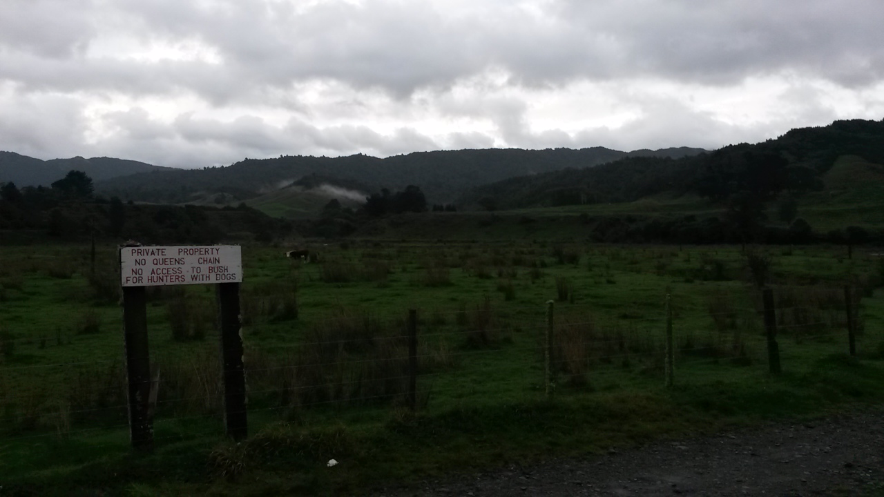
The floodway is spilling even more vigorously than last month and there is an actual river down stream. Across the dam is a grassy bank, scattered shards of pink indicate that someone has been shooting clay pigeons - hopefully not when anyone was coming up the track.

About 8.25 I enter the  bush.


The familiar track follows the river then ducks up a spur to pt 657 before there's any need for the map. A gap in the bush gives a view south, up the unnamed stream valley (below Burn Hut) to what has become a sunny day and peaks dusted with snow (possibly around West Peak).


A dot on the spur to the left is Burn Hut, and there's snow somewhere in the distance

When the track breaks out of the bush I start scanning for trails running north east along the flat topped ridge to pt 730. The planned route heads north east along the ridge that forms the west side of Taramea Stream, at some point I'll drop to the stream and climb the east ridge to follow it SSW to the head of the valley.

One of the track marker poles has tin wrapped around it, on the assumption that this is marking something important I slip off the track and into the scrub (no trails to be seen). I think it's about 0945.


Looking north - scrub

The scrub starts low with occasional animal trails but inevitably gets thicker and higher. I briefly pick up an old cut trail but this seems to drop too far east so I leave it to plow my way up to 730. This turns out to be an undistinguished scrubby knob (surprise!). I take a bearing and struggle on for 695. At times there is a bit of a trail on the east side of the ridge which gets me to the lump between 695 and 675.


730 - scrub
About now there's a brief period of cold rain. There's no view to be had in the high scrub so I take a bearing over the lump and start dropping through more thick scrub - too far left as it turns out. Sorting myself out I gain a bit of relief with a higher canopy on the NE of the spur where it flattens out.

Here things speed up with a ground trail and some very old spray markers. When this starts dropping I back track and bash to the spur top and pt 630. There's a wee clearing and sunlight. It's 1pm so time for a bite.


A little damp but the sun's back on pt 630

Back in the bush I backtrack up the trail but it disappears soon after the point I found it. More scrub bashing. At 675 I've had enough and rather than head further through the tangle, drop as directly as possible to Taramea Stream.  It's the usual sort of jumble of rotten, mossy logs on the steep valley side but it least it's not scrub.

The stream is a good size - and there are occasional glimpses of sun on large old trees on the eastern slope. At 1405 I'm starting to watch the clock - if it's good going on the eastern ridge I might have enough time to head north to pick up two spot-heights near the Mangahao River - but probably not.

I pick a random spot about 20 minutes down stream and climb a wee spur to the ridge. There's reasonable forest cover but in the 25 minutes to get to the top I've decided that time will be tight even if I don't divert north - the two spots will have to wait for another trip (probably from the eastern side of the range).


Ridge top - reasonable sized forest

At this point the ridge has a high canopy so going is good. Ground trails come and go and I don't see any signs of people. Inevitably, there are scrubby patches, often there is a bit of a foot trail on the east side but these soon peter out. There are a few clearings where wind has got in and knocked a strip of trees over. The further up (south) I get the worse it gets. A few pink ribbons below 730 raise hopes briefly but they soon disappear, as does any trail they might have been associated with.


Wind throw clearing

At pt 730 I stop and look up the ridge at the intervening scrub and figure it's a mugs game to keep fighting through - time for plan B. During trip planning (i.e. 6am when I was heading out the door) the support crew asked; 'what if you don't make it up the ridge?'  To which the reply was an airy - I'll just drop to the stream and follow it up to the hut - it will be impossible to miss!  Time to put that confidence to the test.

The scrub is not so keen to relinquish my tender flesh - it's a bit of a battle through bushlawyer before I can reach the trees and start dropping down the mossy slope.

The stream is smaller than earlier but still appreciable, I turn up stream (south) and make as good a time as I can in the remaining light. The river bed is reasonably wide and not gorgy, there's a few spots requiring a bit of a clamber but nothing dramatic.

The air is cold and soon, with headlight on, I'm breathing downwards to avoid the clouds of exhaled vapour. The world narrows to the section of stream in my head light. It gets tighter and the trees close in.

Towards the head of the valley I'm basically wading up the slot of the (now) small stream as it runs through cutty grass and leatherwood. My somewhat loose plan is to follow the stream til it runs out and if there is a choice, bear right to hit the saddle below the hut.

Something odd about the outline of a leatherwood's tortured branches makes me pause and look back at it. On closer inspection, one of the branches has been sawn through - many years ago. I haul myself out of the water and find more cut branches. There's an old track heading upwards.  It proves to be easy to follow and, as I climb, the close scrub gives way. No longer hemmed in there is a strong sense of emptiness and a wide, dark sky. The wind is decidedly cold accentuating the feeling of space. It's exactly the feeling you get climbing out of a cave on a dark night.

A large animal or two crash off through the scrub.

In the dark it's hard to tell directions and I'm intrigued as to where I will pop out. To my surprise the first thing I see are the water tanks on the back of the hut. The climb was probably only 60-70 meters but they would have been hellish meters if it was not for the track.

It's about 1815, the hut is empty, and I'm wet and cold. The rain sets in shortly after I arrive and I am doubly pleased to have found that track. With dry clothes and the billy on I'm on my way to setting things to rights - now to see to those blocks of ice that are passing for feet. The hot billy does the trick as I wait for the dehy to soak.

There's reception here so texts are possible, but I'm careful to conserve the battery as I haven't brought a power pack. With a full stomach and warm feet I select a book from the hut library (two books and a pile of old magazines) and read by candlelight before an early lights out.

Wind and hard rain buffet the hut and I'm just warm enough in my three season bag. I wonder drowsily what the next day will be like.

The day greets me with a weta in the sink. Releasing it back to the wild I look out at high cloud and no rain. It's decidedly cold so there may have been a bit of procrastination before finally donning wet gear (0820).

The track to the ridge is wide, I glance at the scrub hemming it on the left and for a third time am pleased to have found the old track in the dark. At the ridge there is, in theory, a short (600m?) hop along to Taramea. There are occasionally animal trails to the west of the ridge top but it's mostly scrub bashing and hard going.

At Taramea I stand chest deep in scrub and contemplate the surroundings. Down ridge is pt 730 and the limit of my travel last night - looking at the scrub it was a good call to exit to the stream - it would have been hours of pitch black misery to come up here. I find out later that Taramea is the name of wild spaniard - fortunately I did not have to contend with that as well (I assume it used to be plentiful here but the regenerating scrub may have out competed it).

Taramea
I make slightly better route choices on the way back to the track but it's still hard going. Eventually popping out pretty much bang on where the track from the hut hangs a right (south) to skirt below the ridge - leaving the swathe of the old track that follows the crest. It's 0935.

It's a quick zip around to pt 853, the map shows the track running over the knob - but it doesn't, and so the next round of scrub bashing starts.

The map shows a gentle descent to a saddle then a climb to Peak. I'm not even half way down to the saddle when it becomes clear (once again) that I will not be making my deadline if I have to bash through this stuff all the way to Peak and over (I'm supposed to be helping the parents shift in Tawa at 4pm). 

A deer bounds over the scrub about 50m ahead before stopping to check me out - once still, it merges into the landscape, becoming invisible. If I had a gun I would probably shoot it purely out of spite for the ease with which it negotiates this horrific vegetation.

My bail out plan is to drop into the stream running north east from the saddle (well, it worked last night didn't it!). Once again, the scrub band runs a long way down the slope and there's a lot of swearing required before I finally can duck beneath the canopy. It takes a bit of compass work and casting about to find pt 640 (there is no way I'm leaving that as an orphan). When I finally get on to it, the spur is well formed with reasonably open forest. Trails come and go but no real evidence that any are from human traffic.

The spur pops me into a clearing that gives quick access to the lower slopes and a last bit of a scramble down to the stream. It's a good size here and the valley is surprisingly wide and not gorgy. It's mostly scrub so feels open. At 12.45 it's touch and go to get out and to Tawa by 1600.

As I potter downstream it starts to rain and the river stones get decidedly slippery. The stream is quite navigable although the force of the water increases with each side stream.

As always the travel is slow and it takes longer than you expect to travel the distance on the map. Towards the bottom the valley narrows and the sides steepen and become more forested - at one point a steep spur in the rain and mist looks like something from Te Urewera.

The stream becomes more gorgy requiring a few sidles and occasionally a wet midriff. It's better than I had feared but the curved wooden bridge is a welcome sight about an hour after leaving the spur.


Signs of civilisation

It takes half an hour to whistle back along the track to the dam with the river on the right looking even more river like than yesterday.


I'm still finding the flood way a novelty

Wet kit and pack are quickly relegated to rubbish bags in the boot and I'm soon heading for Tawa (arriving about 1610 so how's that for timing?!).

Post Script

10 spot-heights knocked off, legs and hands covered in scratches, and numerous bruises. Not quite the haul I had in mind but not bad. The cold southerly front was relatively benign saving it's most savage efforts for the dead of night.

My best advice is that if you have to travel in these parts - stick to the stream beds or study the vegetation carefully before choosing a ridge or spur.


Wednesday 16 May 2018

Spot-heighting

I number of my earlier posts refer to spot-heighting - this refers to planning trips to visit the heights that are marked on the standard Topo 50 tramping map.  It's a bit of an odd pursuit so it justifies a bit of explanation.  It might be useful checking out the topo map should you feel the need to visualise what I'm banging on about.


Pt 953 in the above image was the final spot height  that I visited in the Tararua Range. 

Pre-Ramble

Humans are acquisitive by nature. Whether it's match boxes, money, flash cars, or locomotive numbers - you'll find someone that is intent on collecting the box set.

There are generally 'rules of the game', some codified in writing, others are more convention in nature.  And, of course people will exhibit different levels of commitment, from the social book collector to the militant geocacher.

In tramping circles the hut bagger is a well-known, and relatively socially acceptable example of the breed. Others will tick off tracks, peaks, or great walks. The one we're dealing with here is at the somewhat obsessive end of the spectrum - the spot-height bagger - those intent on visiting all the labelled heights in an area.

Why spot-height?

It is a natural tendency to seek out new tramping experiences - to walk a new track or climb a new peak. Inevitably, this leads to sorties off the marked tracks.  At some point, perusing the map for interesting streams and spurs, you note that your wanderings happen to have traversed all but one of the spot-heights in an area. The observation becomes an idea, which becomes an itch, and the itch becomes ... well, obsession is probably a little strong a term. 

Another 'why' that might have a little more resonance is that in pursuit of an isolated spot you will inevitably find yourself in a place that would not otherwise have caught your eye. I can think of many examples where I have unexpectedly dropped into a pretty stream valley or stumbled on a rocky outcrop with panoramic views. (It would be impolite to chip in at this point and inquire about the other inevitable experiences involving bluffs, swamps, kiekie, supplejack, and ongaonga.)

A variant of this last benefit is that designing a route to efficiently pick up a selection of spot-heights can create an unexpectedly delightful trip. Again, I can think of many examples but one of the more pleasurable was a mid-range crossing from Otaki Forks to Holdsworth via Kahiwiroa.

If these reasons are not enough, the process of navigating through clag and beneath high canopy forest to points that are sometimes pretty indistinguishable, will improve your bushcraft and navigation skills.

And finally, the physical challenge is almost reason enough. Dropping from Mt Holdsworth into Francis Creek in order to climb to spot 1120 provided all the pleasures and benefits outlined above, as well as a sense of achievement and the health benefits of working off at least half the pies eaten in the preceding week.

Having post-justified this rare affliction, I will take the liberty of defining my own collection rules -  more like guidelines really.  On the way I'll throw in a few explanations - what spot-heights are, which are in scope (and out), and when can one be considered to have been 'bagged.'

What are spot-heights?

A spot height is a dot on a map with a number next to it giving the altitude of that geographic location. For my purposes the map in question is the current version of the LINZ topo 50 maps - these are the standard tramping map with a scale of 1:50,000. I.e. each two centimeter grid line on the map represents a kilometer of terrain.

You'll find spot heights at obvious features such as the top of peaks and knobs - but others just seem to be scattered haphazardly across the landscape. So what are they for?

Best I can tell, they were determined when they created the contour lines on the map. This was initially done in the good old days - before the government flogged off the family silver.  A bunch of earnest types in the bowels of the Department of Lands and Survey Information would stick two overlapping aerial photos into a special machine. This would feed slightly offset images of the ground to two eye pieces - the brain of the observer looking through them would be fooled into seeing a three dimensional image of the terrain. 

To cut a long story short (and avoid revealing the depths of my ignorance), the machine would be focused in at different heights and lines drawn by hand to delineate the terrain at set contour intervals.  The spot heights were determined during this process - and if the machine was focused at a height in the middle of a featureless river flat (I'm talking about you, pt 332 in the Tauherenikau Valley) then that's where the spot height would be recorded.


Which spot-heights should be bagged? Just as a philatelist my elect to confine her interest to 19th century Finland and spurn pre-1895 imperforate Danish offerings, I have no particular interest in spot-heights outside the Tararuas. Which raises the question; what are the boundaries of the Tararuas? 

There's a lot of private land, reserves, stewardship land, and other esoteric land categories that are encompassed by what is collectively referred to as the Tararuas.  So, to keep things manageable I decided to confine my collection to spot-heights within the boundaries of what is legally defined as the Tararua Forest Park. It is a complex shape but LINZ has downloadable files that define it precisely (at least I assume they are precise).

Inevitably, you end up wandering over spot-heights on those other land categories - but for my purposes they're not 'in scope' (this is completely uninfluenced by the tendency for those places to be covered in scrub).

As to how many there are in the Tararua Forest Park.  I'd be happy for someone to volunteer to find the park boundary shape file and superimpose it on the right topo map overlays to create a definitive list - however, my rough count came up with 650 (ish).


When can a spot-height be considered to have been bagged?

Many spot-heights relate to features where there is no doubt when you have arrived, such as a peak or knob. With others, you know you have been there because they are bang on a linear feature such as a track or spur that you've traversed. Yet others may be on a broad ridge top, a river flat or otherwise indistinguishable from the surrounding area. 


Tricky to be exact

It's a bit of a cliché, but it is about the journey not the destination. I.e. provided I've clearly got to the immediate locale of a spot-height and there is no barrier to actually standing on it, I'm not bugged about locating the precise spot. In practice, this means that I don't bother with a GPS but am satisfied that I have navigated to the spot by map, compass and sometimes altimeter.

By way of example, traveling the old Waiotauru Road from the top of the Akatarawa Road to Maymorn Junction, there are five spot-heights that are quite close to the road. These are inside the park boundaries and, in my view, sufficiently far from the road to require some effort to get to them - most having at least one intervening contour line. These therefore required deviations from the road to knock them off (and what a pain it was). Conversely, pt 735 is not on the Roaring Stag track but is as near as damn it and, to mind, it would be pointlessly pedantic to insist on deviating in order to stand on it.


So there you go. I don't recommend it - far better to let someone else thrash about in trackless swamps and pursue nondescript points on unremarkable spurs. Just listen carefully and go directly to the occasional gem that they find and save yourself all the aggravation.


Saturday 12 May 2018

Makaretu Stream and Spion Kop

Call it confirmation bias, wishful thinking, stag fever, pattern matching ... our minds are easily fooled into seeing what we want (or are expecting) to see. I must have been a bit absent minded this weekend as I manage to illustrate a number of examples of this particular cognitive failure.

The first example of bias is wishful thinking - in this case looking at the map and hopelessly overestimating how much distance I will cover in a day.  I had been thinking to get into the Otaki headwaters before dark, but in the end sundown catches me at Lake Hollow on Oriwa.

As a result of this and the weather, the intended spot-height bagging returns a net score of nil. I do however visit Spion Kop (which sounds far more intriguing than it actually is) and circumnavigate the catchment of the Makaretu Stream.

According to Wikipedia, Spion Kop was the site of a battle in the second Boer War which was won by the Boers. It took place from 23-24 January 1900. Wikipedia is not so forth coming as to why the name has been attached to an obscure knob on the edge of marginal farmland in the Horowhenua.


What:    Navigation trip
Where:  Spion Kop and Makaretu Stream
When:   12-13 May 2018
Who:     Solo
Maps:

Large scale view

Start and end bits

Middle bits

The trip up the coast is punctuated by a successful foray off the express way to the Olde Beach Bakery - highly recommended purveyors of delicious baked products.

I had been intending to head out to Tangimoana Road to take a farm track up to Spion Kop (marked on the topo map), unfortunately the land owner there is less than obliging so that's off the cards. Instead, I follow Poads Road to the end and bump into the leaseholder in those parts as he is heading out with a boot full of chainsaws. He indicates that the land by the mouth of Makaretu stream has a new leasee but it should be ok to follow the stream bed.

I park by the bridge (next to the sign that says there is no Queen's chain) and at 0750 leave the car with a little bit of trepidation. This spot is a bit more visible and I wonder if it will still be in one piece on my return.


Car park

There's space between the fence and the river to walk to reach the stream - which is quite a good size (and a little up). The paddocks soon give way to bushy banks and a gorge, however the bottom is generally wide enough that there is only a couple of scrambles to avoid deep bits. There's a few terraces and flats with lots of lovely punga.


In the gorge

A little over 2 hours later I reach the flats. There's an initial false alarm (a small open area before diving back into a narrow section) before reaching a long series of flats with lots of cutty grass. It's generally pretty good going although you can get mired in the grass if you pick the wrong line. I discover that it is fairly easy to miss the side streams which is a little bit tricky when you are trying to navigate by them.

About 25 minutes up from the start of the flats there's a(nother bloody) hunters' camp on the true left. It looks like it got a lot of use once but is now just a pile of litter, like most of these structures.  I think this one might be near an old route to the ridge above Spion Kop, but I have my eye on a spur further up.


Hunters' rubbish


The flats - Panatewaewae to right of centre (probably)

There's another camp about 15 minutes later in a similar state and 10 minutes after that (about 1050) I just about miss my stream as it flows out between clumps of cutty grass.


Another camp

It's a bit of scramble onto the base of the spur with no signs of tracks. It's relatively young forest - lots of slippery black humus and healthy fungus but open enough. A little over an hour later (1100) I emerge on the ridge top to find a good ground trail with old orange spray blazes. I follow this down to the edge of the farm land where it pops out onto a grassy knoll with a survey pipe by an old farm track. The track leads down to a series of little knobs - one of which is Spion Kop (about 12.30).


Not Spion Kop but it does have feet


Magnificent vista from Spion Kop (I think)

The cloud ceiling is about 1500m so it's a bit of a gloomy view to look at while I have a bite. The farm here consists of a narrow strip of land around the tops of the spurs - there's a few cattle beasts about. 

Back in the bush it's getting cool and the wind is coming up. The track leads nicely up to Panatawaewae where the markings finish and the trail becomes far less distinct.  There are only two spots though where the compass is needed - both where the ridge drops into a saddle. The bush up here is reasonably mature with some windfall to contend with. I assume it is largely regrowth following logging and the 1936 storm.

For some reason I'm feeling a bit tired so stop for a breather - after which I set off purposefully in the direction from whence I had come. This could possibly be characterised as some sort of bias, but I think it is more an example of some sort of stupid. Fortunately I twig before I've gone too far.

It's taken a lot longer than I had thought to get this far so, by the time I reach the ridge junction south of 890 I've decided I won't be dropping into the Otaki headwaters tonight. Depending on progress from here I will either stay near the top of Oriwa (Lake Hollow where this is a roof with a water tank and plenty of camping spots) or maybe pop through to Waiopehu hut.


Look, a marker - this must be a track ...

I have been along this part of the ridge twice before - both times finding it easy to get mislaid in the flattish, swampy bit just south of the junction point. It's 1530 and fairly cool but not raining. There's a few old plastic markers but little ground trail until the ridge top sharpens on the stretch towards 918.

The drop to the saddle is a little tricky - it's the sort of place you would expect to see a useful marker because people must come through here. I don't notice anything and overshoot slightly, following what turns out to be another one of those ubiquitous disappearing game trails (another example of bias?).

A bit of a scramble brings me back onto a better formed spur with occasional wee windows down Makaretu Stream, it's about 1610.  I suspect the trick through this saddle is to keep close to the north face and follow the spur NE into the saddle then grab one of the two sketchy spurs that head SE up to Oriwa and Lake Hollow (I think I follow the later and can't say there is a significant ground trail).


Makaretu Stream

The bush is quite mixed through the saddle but ends up with a climb through reasonably open trunks chasing shafts of burnt orange sunset up the hill. At 1710 I'm at the ridge top seeing the last of the sun dip below the horizon beneath a lowering sky.


Lake Hollow in the last of the light


A roof without a hut
(second time my only photo here has been rubbish)

Lake hollow is as soggy as usual, I pause to clear the guttering on the roof then get a move on to make the most of the rapidly fading light - sights firmly set on a dry hut for the expected overnight southerly rain.

There are a few tape markers and a reasonable ground trail but both rapidly become invisible in the gloom. The ridge is well formed and, following the compass, I manage to keep to a line, although frequently wander off and end up clambering through more tree falls than you would in daylight.

The wind rises and it starts getting quite cold - the odd piece of orange tape is a welcome confirmation of progress.

Finally, the ridge starts climbing steeply and the trees give way to leatherwood before the canopy disappears completely. The open sky swallows the headlight and this lone tramper suddenly feels a lot more exposed and vulnerable. Shortly afterwards I lose the trail in the tussock and thrash around the slope expecting to drop onto the track at any moment.

Here the dreaded bias comes back into play - when I eventually reach the track it is running at an unexpected angle - my brain runs a convincing argument that the only way it would be running in this direction is that I crossed it at some point and have circled back. Full of confidence I turn in the wrong direction and head off  thinking that the lights on my left (probably Palmerston North) are Levin. Ironically, this direction is taking me to  Twin Peaks - the site of a memorial to some trampers that died in that storm of 1936.

The track drops and then starts climbing - finally my brain accumulates enough dissonant feedback to suggest that we stop and regroup. The compass seems to be pointing in the wrong direction and I can see a light behind me. I think the light must be the hut but taking a bearing on it makes no sense whatsoever (it was probably around Lake Hollow but I didn't see anyone there when I came through). Finally - trusting the compass and the line of the track, and applying some logic (the muddy track has such high use it can only be the main thoroughfare) I turn around and trudge back into the saddle and up to Waiopehu to finally drop down to the hut.

At 1930 I came in from the cold to be met by candlelight and a growling dog. A party of three (plus dog) are retiree friends who came in Wednesday aiming for a northern crossing but wisely turning back with poor weather on the tops. The two women have turned in but the chap obligingly heats water while I slough off wet and muddy kit. 

Things are decidedly more cheerful in dry clothes and with a full stomach. My hut companions are reasonably quiet (once the dog settles down).

For the record - although the dog was reasonably well behaved I am still of the view that dogs don't belong in huts. I'm not about to start an argument though so keep my thoughts to myself.

The rain starts in the early hours of the morning and keeps a steady blatter against the windows - in the morning it transpires that it is driving straight into the porch so some of the things left to dry are not as dry as hoped. The dog takes one look outside and decides it can hold on a bit longer.

As usual, my brain has come to some conclusions during the night - in this case, that we won't drop down a spur to what might be a swollen Makaretu Stream so the most practical exit is straight down the track.

I'm first out at about 0800 - it's raining but not windy and the cloud ceiling is a good 100m higher than the ridge. The track itself is alternately a bog and a stream stream, but once under the canopy I warm up and soon shed gloves and balaclava and start regretting the merino layer.


Morning

It gets quite dim under the canopy but the rain stops and it's nice to potter down through the wet bush.

The rest of the trip? Not much to report really - the intersection with 6 discs track at 0930; the bottom of the spur about 1010. The paradise ducks set up their habitual racket as I wander across the farm flats to arrive at the usual road end at 1020. 10 minutes later I'm reunited with the car, which I'm delighted to find in one piece.


6 discs intersection

Postscript

Not all boxes ticked but some new countryside and a satisfying wee explore. Makaretu is worth a look but watch for hunters and be careful about access. The Otaki headwaters are still very much unfinished business - unfortunately there is now one less unexplored route to get there.

Nil spot-heights for the weekend? Oh yeah - the rules (more like guidelines really) are that only spot-heights in the forest park count - most of this trip was actually outside the park boundaries or covered points I've already been.