Easter provides four days for exploration - the autumnal weather and impending roar introducing interesting wildcards. I have my eye on crossing east-west via the craggy Bannister ridge, returning along the well-traveled Tarn Ridge (with a number of diversions of course).
Before you notice that I didn't fully cross to the other side (the west) ... I admit I didn't take the extra few hours to head downstream from South Ohau Hut to the western park boundary. The climb and crossing of the tops is the challenge I was after - adding the stream section would just have been tedious.
What: There and back northern crossing of the Tararua main range, plus spot-heighting
Where: In at Kiriwhakapapa, cross Bannister Ridge, return via Tarn Ridge to Mikimiki
When: Easter 2018 (30 March - 2 April)
Who: Solo
Maps:

Large scale
 |
| Start and finish |

The middle bits
It's dark at Kiriwhakapapa. A bit north of Masterton, this is one of the tidier road ends with shelter, toilet block and smooth grass for camping. Brother number one has (again) kindly offered to do the pick-up and drop-off as I will be exiting at the next road end south (Mikimiki). At the last moment he offers me a reflective vest as the roar is about to start and not getting shot is fairly high on my priority list.
Another party is gearing up - four plus a dog. They are heading to Arete Hut too and joke that they'll race me for the bunks (two only) then say they have tents so no worries. I'm hoping I'll get beyond Arete but it's my first decision point.
7am I head out by head torch. The track up to Blue Range hives off immediately into a Redwood groove but (as usual) there is a spot-height I want to pick up. So I follow the old logging tramway bench south west by a creek until a loop track crosses the creek and climbs onto the foot of a spur. I leave this track to push up through sparse undergrowth and a bit of supplejack to pt 510. The dawn sun angles in between the hills to scatter orange light across the tree trunks.

Dawn
It's a pretty easy climb to join the main track at about 760m to arrive at the ridge track at 8.45. Judging from marks on the track the other party have been through already.
Blue Range is part of the series of hills that I think of as the eastern foothills of the Tararuas. They are flanked on the west by the rivers (Ruamahanga, Waingawa, Atiwhakatu, Waiohine, Tauherenikau) and the Wairarapa plains to the east. They offer a lot of below bushline offtrack exploration.
Today I follow the track over the top and towards the descent to the Waingawa River, pausing at the odd window that gives views to the tops. I catch up with the other party just before the descent. The day is promising to be clear and hot.

End of Table Ridge
The party are intending to drop to the river then climb to Cow Saddle but decide to follow my lead down a spur directly to the Saddle. Fortunately it goes smoothly (happy to get myself lost but wouldn't like to be responsible for doing it to others). I'm aware that the route is traveled and there does turn out to be some old markers and a bit of a foot trail but it isn't always that obvious.
There's a couple of lasses that are new vets in Dargaville and their blokes. The lass with the dog seems to be the experienced one with a fair amount of tramping and climbing down south under her belt.
A bit after 10.30 I leave them in the saddle after pointing where to drop to the creek for a top up. The saddle here is broad and shelves gently to the north east (Ruamahanga), there's a couple of tents off the track - a reminder that there will be a few people about because of Easter.
The day is decidedly hot now and I am regretting opting for a bushshirt as I sweat my way up - it will be hotter on the open tops. There's still more windfall on the track than there really should be on a marked route. The wee stream crossing near the bushline is barely trickling today.

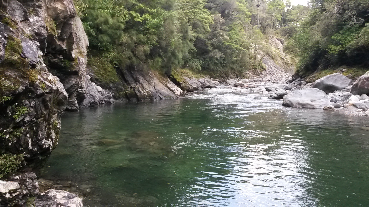
Waingawa River
At less than 1000m the bushline is low. The last piece of shade prompts a pause to lose the bush-shirt (retaining the fluoro-vest) and slather on sunscreen. Onwards and upwards.
Apart from the odd fluffy cloud this is the sort of day where you get to identify more and more of the surrounding landscape as the vistas open up with your ascent. I'm most keen to study Table Ridge (which I will be traversing on Monday) and, when they come into view, Bannister Ridge (today) and Tarn Ridge (Sunday).

Table Ridge
There's a few deer barks drifting up from the slopes to the south of Waingawa but I'm more focused on the view so get a hell of a fright when a head pops out of a shrub and whispers a greeting. A hunter is guiding a couple of his mates to stalk a stag just off the north of this spur. He has a sawn-off soft drink bottle and uses it to give a few roars - prompting a response from the gully. They are the owners of the tents in the saddle and have already got one deer this morning. At midday he reckons it's getting a bit hot and the deer will be heading back into the scrub to rest up, but this one is worth a crack.
I watch for a while before continuing up and leaving them to it - reaching Cattle Ridge about 12.30.

Waingawa - left. Ridge to Bannister runs right
Waingawa itself is an easy wander up. There's a modest tarn on the way up and a larger one near the top but I'm past both before I see them and can't be bothered heading back to top up from the brown looking water. It's a bit surprising that the larger one isn't marked on the map (I had been alerted to this).
From Waingawa I'm expecting it to get interesting. The ridge is reportedly fairly lumpy with some rocky scrambles - it's supposed to take about 4 hours to travel the approx 3km to the main range. To the left (south) steep spurs and faces drop to Arete Stream up to 800m below (potential exit routes and a hut). On the right, the remote and rugged headwaters of the Ruamahanga River (gorges, no hut and not recommended).

After a while, a fluro pink dot indicates the party of four is weaving their way down through the tussock off Waingawa. A couple of times a bark drifts my way on the breeze. I hear later that the dog was fine most of the time but freaked out on one climb so they had to find a bypass on the north side of the ridge.
Overall the route is straight forward. It's quite physical with lots of up and down and there are about four hand-over-hand sections where you know you have to be careful, but they are generally pretty short. For those of a nervous disposition there are options to scramble through scrub and up gullies on the north face to avoid the climbs.
Although it starts hot, I notice that the clouds are starting to gather in the west. However, running out of water is the more immediate issue.
Climbing to the point before 1513 I see some heads peeking over the horizon above - 5, no 6 deer line the ridge and are gazing down at me with ears perked. They watch for minutes while I swelter upwards, one is a stag with a fairly modest rack. Finally, a hind barks and the heads swing around to follow her down and away.
At the top there is a large and very fresh wallow - a lovely way for a hot deer to cool down. The deer themselves have disappeared down into Bannister Basin and are nowhere to be seen. Later, a hunter tells me that deer will frequently create wallows, including below the bushline. And all this time I have been blaming pigs.
About now I notice that the sporadic fluffy clouds are starting to get organised and hold hands in the west. It's still hot with little wind. At the top of Bannister (1537m and about 2.15pm) the view has disappeared. I'm feeling the affects of the sun and lack of water so keep on at a slower pace. There are a couple of puddles on one of the Twins which I normally wouldn't look at but make an exception on this occasion. I'm pleased that at least the dog is behind me.

The view disappears
 |
| and comes back - last approach to Bannister (I think) |
A few breaks in the clag show the basin at the top of Arete stream - it's like a wee hanging valley forming a gentle U from the ridge I'm on across to Arete biv. I reckon it could be a short cut from this ridge rather than climbing right up to the Main Range. Sure enough, a bit later, a couple of cairns lead off the side of the ridge into the cloud. It develops into a ground trail which sidles then drops into the basin. At the bottom I expect to see a stream but it seems to be buried. There's an old sign indicating that the hut is not so long away, I work my way up the other side and past the loo.
It's 16:15, cloudy and still. There's one chap at the hut and I quickly bags the other bed before guzzling down a belly full of water. There's plenty of daylight left but the options for going further would involve finishing under torchlight and camping out - put it down to heat stroke but I'm wimping out and staying put.
The other chap has been out for a few days already compared to my one. We are shortly joined by another solo tramper who admits he hasn't got a tent and claims the floor. Chap number one gives him a hard time about turning up at a two bed hut at Easter with no tent - then admits he doesn't have one either. I don't mention that I have a fly and biv bag.
Voices drift out of the mist from above (Arete), and from the basin I crossed. It seems a party of three is descending from the main range and the party of four is dropping from Bannister Ridge into the basin (it turns out their voices were carrying about 500m). It looks like 10 people and a dog have designs on a two bed hut.
Three voices must have got wind of four voices because they turn around and head back over the top. The clag parts and four voices (plus dog) become briefly visible making their way down into the basin. When they arrive I find out that the hunters got their second stag and we exchange our experiences of the crossing. They then get busy pitching their tents among the tussocks.
Much to the delight of chap number one, it turns out that one of the tents has arrived sans poles. It's not easy to bodge a fix for a modern, flexi pole tent without its poles. However, a couple of walking poles and the collective creative capacity of the group is up to it (I don't mention that I have a fly and biv bag - but prepare to produce them if needed).
As the shadows lengthen, the clag recedes and Bannister Ridge emerges into the afternoon sun. Soon after the shadows have chased the last of the light up the slopes, we are treated to the full moon rising over Bannister.
 |
| Bannister Ridge |

The hut is comfortable - more so when the wind comes up during the night, periodically buffeting the hut with squalls of rain. A little before dawn, raised voices outside indicate that the bodge job has given up and the tent has collapsed. We wait for a knock on the door but the party packs up and heads off while I'm still drowsing.
Morning light reveals the sort of day best stayed in bed for. It is also the sort of day where the camera stays wrapped up - so no pictures I'm afraid. The other two get sorted and out while I potter about giving the hut a tidy before rugging up and following them. They are both heading over Arete towards Te Matatwai.
In the conditions (and still feeling a bit drained from yesterday and the lingering effects of a cold) I've decided not to pursue the more ... optimistic option of climbing to Dundas and following a spur to the Mangahao valley. On the ridge, the wind is whipping up from the western slopes carrying a bit of rain.
Over Arete and down, then a short rise to Pukematawai - a good ground trail and no navigation challenge despite the low visibility. This area is an interesting nexus. Major river and stream systems originate nearby and radiate to all points of the compass - the Otaki, Park, Mangahao, Ruamahanga, and Arete Stream (flows to the Waingawa). It is also where the main range intersects with the two significant northern crossing routes and Te Araroa heads off south.
I pass chap number two on the way up Pukematawai then hunker in the tussock to wait for him after taking a bearing for my spur - the last thing I want is to have him follow me off the top in the clag.
After he follows the track through, I head north dropping easily onto an obvious spur which, if all goes well, will drop me gently down to the Mangahao River.
It starts well, tussock with some ground trail - but there is fairly extensive scrub. Sometimes there seems to be an old route through but it is easily lost so there is a lot bashing. In the clag I keep a close eye on the compass but there is one spot (about 950m) where I drop off the main spur - the clag clears just enough to take a bearing on Girdlestone Saddle and correct the deviation.
Finally, below the bushline the going gets easier and the faint trail is back again. On the lower reaches there is even evidence of an(other) old hunters camp. The rain is steady but not too cold and, at the bottom the river is crossable (unlike last (and first) time up this way).
Back on the track I head down river diverting once onto the base of Triangle Spur to pick up pt 630. There is a trail on the spur marked with sporadic pink tape but I lose it at the bottom to follow my nose across a broad terrace back to the track.
The rain settles in and I just about walk into a party coming the other way - I think it's the first time I've seen anyone else on this track although it is reasonably well travelled.
The next order of business is to drop to the river and climb the east valley wall (after sheltering under a tree for lunch). There's no trail on the steep spur I choose but at the top there is a faint old trail along the ridge. I head up ridge a short way to pick up pt 918 but flag the more distant pt 1025 as it's a bit scrubby and the weather is getting worse.
Coming back along the ridge I reach familiar territory at the spur down to North Ohau Hut. The track is now pretty easy to follow with old tape marking - we part company as it starts to drop towards Girdlestone Saddle. I navigate to the spur that drops towards the location of South Ohau Hut. It has some trail and is mostly good going with just a couple of tricky points. The bottom is mucky and loose as usual but I pop out in the right place in sight of the hut.
The Ohau is up but I'm comfortable making the crossing to the hut which is empty. It's 5.30.

The hut is a bit of a favourite, on a terrace at the junction of two streams - a pretty location.
 |
| View from hut |
In the morning I'm heading out just before 7am - water levels have dropped and the rain has cleared. My route is upstream (wet feet) to Dowling Falls and Girdlestone Saddle. It's easy to follow although the first junction is not brilliantly marked (pretty obvious if you are following the map though). There are a few goats around this morning.

The junction to Dowling Falls and Girdlestone Saddle is well marked (not signposted). What the marking indicates (and the map doesn't) is that you climb the foot of the spur just before the stream junction.
I head up the stream bed which is narrow and slippery. The falls (7.35) are a short distance up and it is immediately apparent that you don't try to climb up the series of cascades. There are log jams and its all lethally slippery.
Rather than head back to the junction I bash up an old slip covered in rotten trees and bush lawyer (yeah ok, it probably does sound a bit stupid when you describe it like that).
On the spur top there's a marked track through some ridiculous tree fall. The track drops back to the stream aways above the falls and (I assume) meets a marked track to Girdlestone Saddle - I figure to bash straight up the spur to the track above the saddle. It's steepish but navigable - the sun is now beaming in but not quite enough to dry wet gear. On the way up a Piwakawaka takes an interest and approaches within 40cm of my face.
On the ridge (8.50) I turn right and follow the broad track to the intersection leading right to Te Matawai Hut (9.10) - I turn left for the climb to the main range under a clear sky.

Spur to Pukematawai
There are some fresh prints on the track and a couple of figures high above - I close but don't quite catch them before they head south at the top.
On the way up I am treated to the sight of the spur down from yesterday morning - now naked to the sky. It's also clear why there are 'here-be-dragons' warnings about dropping into the Mangahao headwaters from Pukematawai - it is steep and the water course has some spectacular cascades.
At the ridge I head north to rejoin my tracks from yesterday - with plenty of pauses to look at the views.

Mangahao headwaters

Yesterday's spur

Yesterday's spur - Girdlestone Saddle behind

Arete

Across upper Park Valley

Spur down on right, up on left

Pukematawai - yesterday's spur running right

From Arete to Mitre

Bannister Ridge from south east face of Arete

Arete Hut terrace
Back at Arete Biv around 11am, I make a note in the log and head off for Tarn Ridge. I traveled part of this route with some mates when I was at school, but have no recollection of which bits - just that it was clagged in and we kept on getting blown off our feet. So, this is pretty much all new.
There's a bit of cloud in the west that periodically blows in but it stays pretty clear.
Rather than take the direct route along the ridge to my destination for the night (Tarn Ridge Hut) I have two side trips. A short one up to Lancaster (1504m at the top end of Carkeek Ridge) and a longer one to a spot-height (1295) on Pinnacle Spur (on the route down to Arete Forks Hut).
Lancaster takes a few minutes and gives lovely views over the upper Waiohine Valley and along Carkeek Ridge - reviving memories of another trip. It's about 12.10 now so plenty of time in the day.


Pinnacle Spur is not so quick - it's a steep descent with a number of lumps. There's a reasonable trail but still a bit of a scramble. It goes give nice views though - north east across the valley, the afternoon sun throws shadows that accentuate the rugged faces of the Bannister Ridge. At 1pm I'm still relaxed about the time.

Bannister Ridge

Upper Waiohine

Tarn Ridge to right
Pinnacle Spur is not so quick - it's a steep descent with a number of lumps. There's a reasonable trail but still a bit of a scramble. It goes give nice views though - north east across the valley, the afternoon sun throws shadows that accentuate the rugged faces of the Bannister Ridge. At 1pm I'm still relaxed about the time.


Pinnacle spur towards Tarn Ridge Hut

Bannister Ridge
Back on the ridge there's a few lumps to navigate before the broad flat top of Tarn Ridge. I can imagine that this would be interminable in clag and somewhat difficult to find the right exit point.

Another lump
There's a wee saddle after Tarn Ridge, then a few lumps before the hut. On one of these is the grave of a hunter that perished in atrocious conditions (1959). The cross is well weathered, and the remains are propped in a cairn. behind is the hunter's intended destination - Dorset Ridge.

Back to Tarn Ridge

Waiohine Valley, Dorset Ridge on left

Shortly after the grave the next knob gives a view of the hut.

There are clothes hanging on the deck - indicating zero chance of an empty hut. At 1530 I could keep going over the top but I've had enough for the day.
There's one crook hunter in his pit and a messy hut. His mates are out hunting down into the Waiohine basin. I give him some panadol and relax in the afternoon sun.
The hut has two double layer sleeping platforms so there's plenty of space for four of us. They're not too noisy but I'm not feeling chatty so pretty much keep to myself.

The morning brings clag and wind. The hunters are heading out via Mitre so I'm up first and out at 7am, before anyone else stirs.

Although not cold the wind is strong and there's a bit of all-fours required to get to the top of Girdlestone. From here is new territory. There's a good ground trail along to Brockett (0800) but from here I leave the main trail to Mitre and head off along Table Ridge.
In the clag I pause often to take bearings. It would be a doddle on a clear day but in order to stick to a bearing I find myself (more than once) among clumps of spiky spaniard, and once plunge thigh deep into a foot width hole.
The wind is smashing into the nor-west slope and howling gleefully over the tops. I lurch and stagger along like a drunken sailor but there are no real challenges until dropping into the saddle after pt 1478. It's a bit rockier and the ridge is sharper. There's cause to pause in the lee of the ridge a few times to regroup and a few diversions to avoid the most exposed edges in the wind.
I reckon I've got to 1390 - the last high point before I find my spur down. The top is broad again and it's still clagged in so I'm taking bearings when I sense a lightening in the sky. I race for the edge of the ridge and sure enough, the clag swirls away to reveal a sunlit spur plunging to the bushy valley far below (a little to the left of where I was aiming). It disappears quickly but it's enough.

It's still quite a proposition to get off the tops - the wind chucks me over more than once and, although there's some ground trail, it's quite a staggery, stumbly course that I set. The lower I get though, the more the clag is shredded off the tops and the more sunlight on the tussock.
At 0950 I hunker down inside the bushline and take a breather - the wind is slashing through the low canopy but my ringing ears are settling and it's calm on the mossy floor.
It takes about 1hr10 to the bottom (1100) picking up the spot-height that is the objective of the exercise (550). The spur has a good shape and a ground trail most of the way. There's a bit of a mucky bit towards the bottom where it is somewhat broad and indeterminate, but nothing the compass can't solve. It would be a good route up.
I'm now following the main trail down the Waingawa but leave it to scramble up to pt 610, finding a hunters rubbish heap on the way (beside the stream just north of the Mitre peak track spur).

610
It's approaching 1pm and I have a river and a ridge between me and the road end at Mikimiki. The wind is still strong and more than once I find myself casting a weather eye upwards for branches. It pushes me around a bit on the river crossing but I'm soon back in the bush climbing steeply up towards Lookout Point.
I don't know why it's got that name because there sure ain't any view spots - today I figure it is a warning about falling branches. Where there is a choice I am avoiding areas with higher likelihood of branches dropping on one's head.
The canopy starts high but towards the top it has dropped and there is a lot of totara and other saplings. About 1435 I have reached Bruce Hill and found a trail with milk bottle cap markers. Last time I came through was a day trip the length of Blue Range - I got tripped up a bit and ended up on the wrong spur whilst negotiating a change between maps. This time the strongly marked track running south east is my friend.
Part way down there are some breaks in the canopy and I can see cloud, rounded by wind, still hugging the tops.

Someone has gone to some effort to mark the route down. There are patches of windfall though, so more than once I have to cast around to find the trail again - still, progress is a lot quicker than I was expecting. I lose the track near the bottom but not before I have polished off the final spot-height for the weekend - 535. I crash down through supplejack and slide over a steep bank to drop onto the tramway track. Suddenly it's literally a stroll in the park for 10 minutes to the park boundary.
At the boundary a sign informs me that it's two hours to Kiriwhakapapa via the old tramway - I reflect that at four days, my route was hardly a short cut, but it was far more interesting.