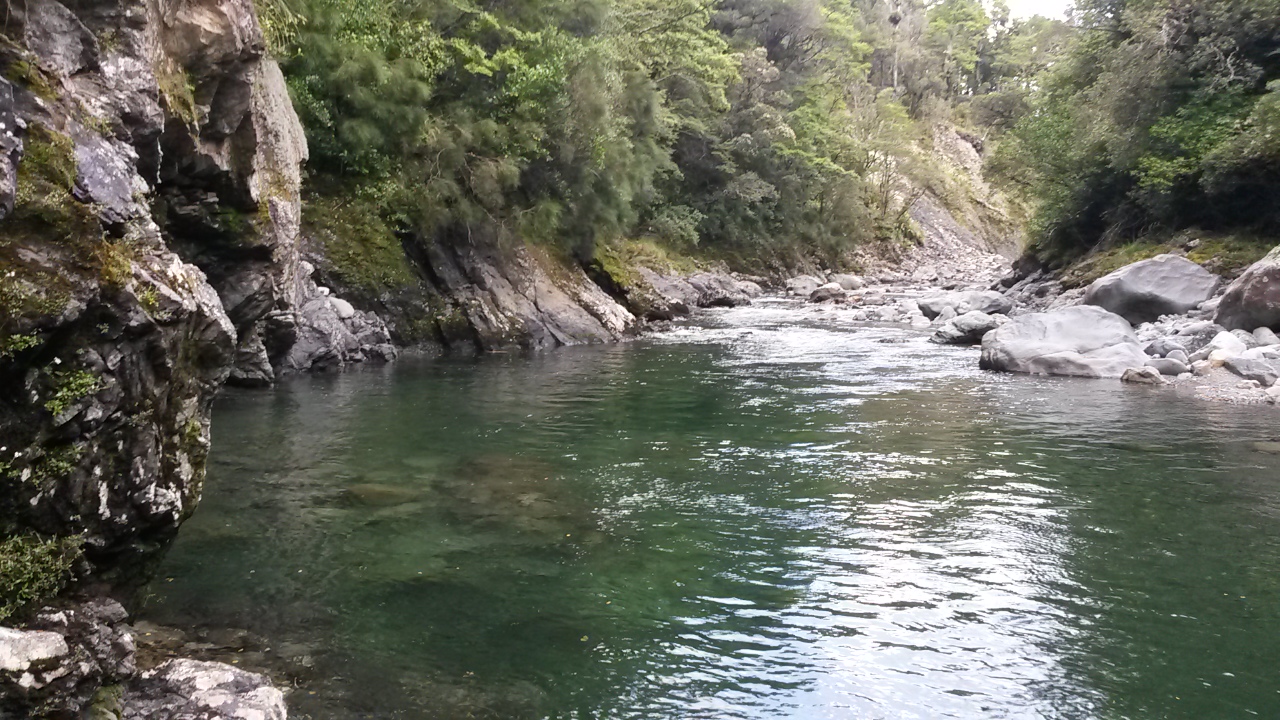
A bit of a non-event this weekend. Some misbegotten cartographer placed a spot on a terrace on the other side of Smith's Creek from the track. A rotten weather forecast indicates the perfect time to knock this one off - and reduce the remaining tally to 18.
You reach Smith's Creek from the Kaitoke road end north of Upper Hutt - a traditional route into the Tararuas. It's the closest to Wellington, giving good access to the hills. Generations of trampers have caught the Upper Hutt express and pooled funds for a taxi, or crammed into the club truck to be disgorged in the carpark late on a Friday afternoon.
The marked tracks take you either up Marchant Ridge towards the Southern Crossing, or over the Puffer Saddle to Smith's Creek and down to the Tauherenikau Valley.
I've whistled up and down that track many times but only noticed pt 270 when I took a serious look at the spot heights I haven't picked up yet. The good thing is that it will be a short trip on a good track with just a little bit of thrashing around off track.
What: Half day trip spot heighting
Where: Smith's Creek
When: 24 Feb 2019
Who: Solo
Map
The weather forecast is for heavy rain so I keep putting the trip off until 1pm on Sunday when the rain has really set in. That's also the time I remember that the car wipers are on the blink - I'll have to take the soft top.
The road end at Kaitoke is much improved now it's by the Kiwi Ranch gate. Back in the day, the rutted track and clay parking area up the hill was more like the tip face at Porirua landfill in the 1970s. The wee white car would not have coped at all well with it.
As it is, there's water running across the parking area. Unsurprisingly there are no other vehicles.
It's 2.45 when I trot through the rain into the bush. About half an hour later I'm at the saddle having managed not to fall over on the greasy wet yellow clay. There's a stream running down the track and I'm glad to have my walking poles (well, trotting poles).
The track sidles gently down for a long while before dropping more steeply to a creek. I check the map and trot down valley veering off track to follow the next sizable stream down to Smith's Creek. I meet it at the intended point and have to treat it with a little respect as it is considerably up (but nowhere near risky).
I find the next stream junction and take a bearing for spot height 270. It turns out to be on an old terrace which is sizable but covered in wind fall, so not really a camping spot. I thrash around for a while but there are no obvious knobs so eventually accept that I've crossed it and head back and across the creek.
With an uncanny knack I have chosen an area of regrowth and dense undergrowth where the track has sidled a little way up the hill - it takes a while to grovel back onto it and I'm missing my tramping boots by the time I get there. Running shoes don't really cut it in this stuff.
The rain has eased by before I clear the saddle and start jogging back to the car. The trotting poles are really useful on the slippery sections but occasionally catch the undergrowth and do their best to scuttle between my legs.
About 1hr 50 after leaving I'm peeling off sopping kit and chucking it in a rubbish bag in the boot. All done and just the drive home.
Showing posts with label smiths creek. Show all posts
Tuesday, 26 February 2019
Smiths Creek
Labels:
day trip
,
puffer saddle
,
smiths creek
,
solo
,
spot-heighting
,
tararua
Saturday, 14 January 2017
Tauherenikau
Enough Christmas relaxation; time to get back into the bush. I'm a bit disorganised so head out Saturday afternoon for a not too demanding wander. The idea is to leave from Kaitoke, find a link to the Pylon Track, navigate down a spur to the mouth of Smith's Creek and head into Tutawai for the night. Next day; head along the Tauherenikau Ridge, drop down a spur at the south end and exit via the Puffer after visiting the Smith's Creek Waterfall.
What: Nav trip
Where: Tauherenikau area
Who: Solo
When: 14 January 2017
Map: Map
During the last year I have gone about getting into the hills on as many weekends as possible. In the course of this I have developed a strong preference for always doing something new, and gone to great lengths to avoid covering familiar ground. This weekend is no exception but - I will be covering a bit of ridge that was part of one of my first solo forays off the marked track. It will be interesting to see what I make of it this time.
It's 2pm on Saturday by the time I've got myself sorted and parked by Kiwi Ranch Camp. It's a bit overcast but there's good enough views on the way up the ridge.
![]() |
| View across Pakuratahi |
On the map there's no track marked from the Puffer Saddle up to point 756 on the Pylon Track but it looks like an obvious route, and sure enough there is a pretty solid trail up through the bush, with occasional views over the Kaitoke/Pakuratahi Valley.
![]() |
| Pakuratahi from a little higher up |
About 1 hr 20 from the car park, the track rolls over the top of the ridge and drops onto the 4WD track. There's little to indicate the intersection, but it should be pretty easy to find your way in reverse.
The well-formed road wanders along the ridge with views across to the Rimutaka Road and summit and beyond to Lake Wairarapa. The wind is getting up.
![]() |
| Rimutaka Hill Road |
![]() |
| Gets a bit windy up here |
I'm somewhat startled to come across a largish woman making heavy weather of it on the way up to 805. She is the tail marker in a family group that have come from the Rimutaka Summit, and are following the Pylon Track down to the twin bridges at the bottom. Shortly after, I run into the rest of the party who are lounging about on the road, waiting her approach. It's good to see people cracking into what is a bit of a grunt and somewhat of a logistical challenge.
My target is the spur that leaves the Pylon Track a few hundred meters past 805. At first I overshoot and find myself investigating the start of the Mt Frith Track; its marked with orange triangles from the 4WD track - I quickly identify the mistake and head back.
The going is pretty good down the spur, A ground trail comes and goes, but people have obviously been through before. There are a few view spots to look back towards the puffer saddle and up towards Marchant Ridge.
![]() |
| From spur looking west towards Puffer Saddle |
I work down to point 714, which is where I figure it might get a little tricky. Sure enough there are some old markers, and it looks like there is a route running west down to Smith's Creek. I'm keen on trying to follow the spur further towards the junction with the Tauherenikau though.
The ground trail gets harder to discern, and a bit of casting about is required. Eventually, at about the 400m contour, there is no obvious spur and I end up just following a bearing and picking my own way down. Including through the kiekie-infested head waters of a few streams.
![]() |
| A bit of fungal flora |
Around 6.30pm I stagger off the bottom of the spur a few minutes up-stream from the Tauherenikau River. That part of the mission is accomplished.
![]() |
| Easy going on the track |
The track here is wide and easy going. I amble along up valley to the swing bridge and then on to Tutuwai Hut arriving about 8.20 pm.
Last time I came through here was shortly before Christmas but in the opposite direction: pitch black and after a pretty tough day. It's kind of nice to see the landscape this time.
There are a few parties at the hut but enough room for me. I'm a little unused to sharing with so many people and a dog though. I've brought the meths stove so heat up water for a dehy then turn in. I may as well have stayed up given the noise as others sort out their sleeping arrangements.
The wind has got stronger during the day and it thrashes through the trees outside. The forecast for tomorrow is for more wind and some rain but I'll be below the bushline, so no worries.
In the morning I gather my things and head out onto the deck to pack, so as not to disturb others. I've decided to check out an old route onto the Mt Reeves Track, following a spur a little way up valley (true left Reeves Stream) that I've heard about.
I get away around 7.30 am and find the spur but don't identify anything like a track until I am well onto it - I suspect I left the main track a little early. It's pretty easy to follow up anyway and soon enough I've joined the Mt Reeves Track shortly before 646, about an hour after leaving the hut.
The bush is wet and the wind whips through overhead. I've brought a bush saw for the first time and soon have cause to use it to remove a windfall branch. As I potter up I think about the etiquette for hacking at the vegetation and work out a simple guide: only use it commensurate to the quality of track; - i.e. not at all if it is not marked on the map, through to use it lots to keep highly developed tracks easily navigable. Pretty obvious I guess.
This is the second time I have left the Mt Reeves Track to follow the ridge to Tauherenikau. The first time was my first real solo nav trip and I was somewhat nervous - I'm interested to see how the route compares to subsequent trips.
This time I find a more direct route onto the ridge and shortly a ground trail develops. I think I make slightly quicker progress, being a bit more confident about using map and compass. The ground trail is mostly pretty good, At times I found I've wandered off it, but there's no dramas. All up, no great difference to a lot of other ridges in the Tararuas really.
The top of Tauherenikau is every bit as underwhelming second time around. A pile of rocks, no view and, once again, wind whistling through the branches overhead. It's 10.40 am - time for a bit of Christmas cake soaked in whisky (thanks Iona!).
From here it is new territory. On the map I reckon there is a network of ridges and spurs that can be followed down to the top of the Tauherenikau Gorges. I'm planning to find my way along the ridge to 883, head west to 770, then west and south to the junction between Smith's Creek and the Tauherenikau River. It looks a little challenging, with plenty of opportunities to drift off down the wrong spur.
It all goes remarkably smoothly. The shape of the ridge is pretty clear at 883 and someone has put tape near the target spur. The trail at the start of the spur is a little unclear but pretty quickly becomes straight forward. I take some care to get to 770 and not head down the spur by Fan Stream. At one point I get a bit confused as there is an arrow indicating what feels like the wrong direction. Possibly a route down to the gorges. I soon work out where I want to be and unexpectedly discover orange DoC triangles at a couple of key points.
![]() |
| More fungi |
![]() |
| Some open country |
The bush is the normal mix but with a fair amount of open beech. Towards the bottom the ground trail peters out (or I wander off it), but there are occasional glimpses of the other side of the gorge so I just keep on bearing for the junction. As usual there is open beech that is easy to navigate but the lower slopes are lush and a bit more bashing is required.
![]() |
| High class pig wallow - wood lined |
About 1.50 pm I clamber down a couple of terraces and peer out at the river. If it's low enough I will find a crossing point. No such luck - it's up and a little turbid. I scramble back onto the terrace and start working up river to the swing bridge.
![]() |
| The Tauherenikau |
I swap between terraces, and at one point some river flats, but it's fairly slow going. A little further along there are sporadic pink tape markers, and it gets easier closer to the bridge. A few minutes before it, I run across something called 'Camp Marchant.' Someone has taken time to set up a fire place and a bit of a camping area with a painted sign.
The bridge marks a return to civilised, wide tracks and somewhat quicker progress. With a lot of day left I figure I'm good to stay on plan and visit the waterfall in the headwaters of Smith's Creek.
At the last stream crossing before the climb up to the saddle, there is a flat spot after a wee clamber out of the stream. I strike off into the bush, roughly south. A few minutes later I pop out at the stream, drop my pack and head on up.
The stream bed is pretty navigable although there are a few logs and pools to get around. The boulders can be slippery but I manage to keep my feet dry.
It takes about 40 minutes to get to the waterfall, halfway there the stream goes through a crumbling bluff requiring a wee scramble.
![]() |
The stream drops off a bluff 15m or so high and down into a brown pool and that's as far as I'm going up stream. It isn't a particularly beautiful spot but streams and cliffs always have some drama about them, and there aren't that many waterfalls in the Tararua's so it's worth a visit.
I retrace my steps, pick up my pack, and head back to the track. Voices from down track indicate that someone is else is approaching the climb to the saddle, but they don't catch up so I'm left to my own devices.
A jogger passes on the way in and I take a few minutes to clear a couple of fallen branches but otherwise it is a sunny and uneventful trip out arriving at the car at 6 pm.
All up a highly successful trip. All milestones achieved and the weather mostly behaved itself.
Labels:
kaitoke
,
navigation
,
pylon track
,
smiths creek
,
solo
,
Tauherenikau
,
tutuwai
,
waterfall
Saturday, 10 December 2016
SK Valleys
A few years back someone rather carelessly told me about a traditional challenge of 'doing' the length of the Tararuas in the space of a weekend. They should have had more care - the idea lodged and it was pretty much inevitable that at some point I would have a go. Without going into all the details, it is called the 'SK', or the Schormanns - Kaitoke, after the start and finish points. The Schormanns Track no longer exists so you leave from the nearby Putara Road end, but somehow 'PK' has not caught on - shame, it has a bit of a ring to it.
There are a couple of main options and lots of variations - the Valleys route is easier and more direct. The tops is longer and, not surprisingly, more exposed with considerably more up and down. Records exist for assisted and solo efforts, and the times being posted now are superhuman.
When I say 'easier' the Valley SK is still a small matter of 74km and a net climb of a little under 3400m. I'm not chasing a record though - I'd just like to get the idea out of my head.
What: SK Valleys
Where: P to K
Why: Because it'll bug me until I've done it
Who: Solo, unassisted
When: 10 December 2016
Map: Map
On Wednesday I figure I've recovered from the previous weekend's exertions but the forecast is marginal - the story of this summer so far. The Ruamahanga River gauge drops gently over the next few days though, so at midday on Friday I decide it's a goer.
The plan is to start early Saturday morning, see how the day goes, and either soldier on into the night or sleep at one of the huts en route. I have a weekender hut pack (i.e. sleeping bag, no tent, warm layers, food, emergency gear) which means more weight but also more peace of mind. All up weight (with water) is 6.7 kg.
I complete the usual intentions sheet and send it to my PLB contacts with outlines of various contingency options.
The route follows the major river systems in turn as they run parallel to the length of the Tararuas in the east of the range, before each exits into the Wairarapa to join the Ruamahanga. This means a series of saddles and rivers, with huts around the more popular areas. It also provides regular milestones to mark progress: 6 saddles, 5 river systems (not counting the Mangatainoka) and 7 huts.
The final act is climbing up Smith Creek to Puffer Saddle and the long sidle and descent to the new (to me) road end at Kaitoke.
The junction (right to the Main Range, left to Roaring Stag) after 0:52 is my first saddle and at 1:40 Roaring Stag is my first hut (score: 1,1,0). The wind is strong in the tree tops - the sort where you get a little jumpy at creaks and cracks from overhead.
There's no-one in Roaring Stag as I fill in the log book, pause briefly, and checkout the river. Probably half a metre lower than two weeks back so it is looking good not to use the terraces (the high route that avoids the gorge section at Cleft Creek).
It's much easier travel down river this time. I hardly use the terraces, and boulder hop most of the way to the bluffs, about 0:45 min after leaving Roaring Stag. It's still deep, and I can't touch the bottom in places through the bluffs, but a lot less of a proposition than last time.
0:20 min later the gorge above Cleft Creek is unmistakable. The river runs onto the right bank forming a deep section against the rocky side. It's no drama to cross upstream in thigh deep water with just a little help from a koro stick.
The other side provides bouldery travel and a short scramble along a rock face opposite Cleft Creek. The river broadens and slows and another thigh deep crossing is easily accomplished. The track is on the right somewhere up on a terrace; I potter down stream a short distance to find a way to scramble up. Three hours after leaving the carpark I'm standing on the track (1,1,1).
The first thing that is apparent is that a track team has been through - ferns, grasses and saplings have been cleaned off at ground level and markers have been added - fairly recently by the look of it.
The track climbs alongside then joins Cleft Creek and I am soon standing at the stream junction, which two weeks ago took 2:26 from Stag Hut with the river up and using the terraces route. This time, using the river route and the new track, it has taken 1:38.
The next surprise is that the track takes a completely different route to the saddle. Instead of following a side stream, it dives into the bush and grunts straight up a spur. Eventually it bears right and sidles and rises for a long while to eventually hit the junction in the saddle, right beside the sign post to Waingawa. I'm stunned - I had stood at this point two weeks ago and saw no sign of this track.
However, right now I'm a little more focused on ticking off the top of the second saddle. It's 09:06, about 3:50 in, score: 2,1,1.
It's a short hop down to wade across the Waingawa and arrive at Cow Creek Hut 18 minutes later (2,2,1).
The track is now a fairly typical Tararua River track. It potters along in the bush, on grassy flats, across slips and in and out of side streams.
About 1:50 later the rather elegant Mitre Flats Hut hoves into view (2,3,1). The weather is still holding.
I don't have fond memories of the Barton Track that climbs to the next saddle. It is pretty much as I remember: a bit of a climb up, a long sidle with a wee descent, then a drop into a creek, and a bit of a mucky scramble out and up again. I'm also starting to feel the distance already traveled. It is nice however to get to the intersection with Baldy Track and join the track I traveled last week (12:54, 7:37 elapsed, score: 3,3,2).
Descending from the saddle, heavy drops start pattering through the canopy, and by Atiwhakatu Stream the rain has set in. It's warm enough though, so I don't bother with a jacket. Between the two routes up to Jumbo I meet my first people - a group of three women who are following the old track up to Jumbo. We chat briefly but I can't tell them much about that route.
40 min from the saddle Atiwhakatu Hut (3,4,2) and I'm chatting to a couple who are just leaving having come in for a day walk. After filling in the log book, I take a bit of time for lunch out of the rain. I'm thinking now about when dark will become a factor. It's looking good to get through Cone Saddle which I hadn't fancied doing at night (it's years since I've been up through there).
The track now is a veritable highway and familiar from last week. It is also crowded as I run into a couple more parties and pass the couple from earlier.
Leaving the Atiwhakatu Stream (3,4,3) and climbing the River Ridge I start feeling a bit under the weather. Consequently it's a slow ascent. I figure I haven't been getting enough energy in, and focus on slowly nibbling through bars despite not feeling like eating. Voices ahead indicate I've reached Pig Flat. This is the route to Powell Hut and Mt Holdsworth but, more importantly, another saddle (4,4,3). It's 9:50 on the go now.
The Totara Creek Track is new territory. Last time I traveled in this direction it followed down the creek. Now it stays on the ridge above, then drops down a spur to cross on a solid swing bridge. The track is well bedded in now. This part of the trip should be quick going but I'm still making somewhat heavy weather of it and concentrate on just ticking along.
Totara Flats Hut is pumping when I arrive at 4:50 (4,5,3). It's hard finding a space to sit and drip and fill in the log book. A tourist kindly offers me some gourmet chocolate, and is understandably a little nonplussed that I am intending to leave a perfectly good hut at this time of day and in this weather.
The grass on Totara Flats is carrying as much water as it can hold and consequently deposits cascades of it as I brush through. A pause for the customary gaze across to the location of Sayers Hut - no-one to be seen but there's a waft of wood smoke in the trees almost indistinguishable from the mist. A little further on, a distinctive tang on the breeze removes any doubt.
A 'new' bridge has improved access to Cone Saddle Track. I remember a trip with school mates when Makaka Creek was a torrent and we sensibly turned back for an extra night at the old Totara Flats Hut. While we were there Greame Dingle came through with a bunch of hard youngsters and a camera crew. Later we heard a helicopter go over and I think the story goes that someone got swept away in a river crossing - not fatally fortunately.
I plod up Cone Saddle and meet a party of young women doing a trip for their Duke of Ed, together with adult chaperons. They are off to Totara Flats.
My memories of Cone Saddle is of a false top followed by a long sidle then a final wee 'up' to the saddle. I'm downright slow now and it takes ages to get through the sidle. Two creeks are significantly up but still quite passable.
At the saddle it's 7:28 and still light, but I arrived at Totara Flats Hut 2:40 ago so it has been slow. Still, 5,5,4 feels like progress.
21 minutes later I take a break at Cone Hut (5,6,4). There's a chap from the Rotorua Tramping Club in residence. He has come down from Alpha but spent the day in the hut. He has plenty of time, no firm plans and - hell, why flounder around in the wet when you don't need to!
I take a good wee time to drip on the floor, don jacket (it's not so warm now), fill in the log book, chat and ... yep, basically farf about and avoid getting back out there.
With head torch ready in pocket I eventually drag myself away. By now I have pretty much resolved that I may as well see this through, so there's a long evening walking ahead.
The Tauherenikau is making itself heard today. It's considerably up and you would not contemplate crossing to the Bull Mound Track. I am slightly concerned that I will hit a creek that is impassible somewhere down river.
Just before 9pm the very last of the light sees me to Tutuwai Hut: 5,7,4 and 15:40 on the go. A couple have a tent on the flats - he is in the hut and is tossing up whether to sleep out or in. The rain has finally abated so I switch on my light, top up my water and head on into the night.
It's hard to gauge progress in the dark. The only thing that provides information about the world beyond my torch light is the roar of the river. I know there are some slips to scramble around and the track does potter along and up and down - at one point there's a knotted rope but there's not much to indicate what's in the blackness below - very comforting!
I see numerous possums; ghostly in the light - twin pin prick eyes that look, disappear, then look again before heading up the nearest tree. A couple of times larger animals slip off into the undergrowth. When the track bears away from the river the odd Morepork can be heard. Otherwise I follow the tunnel through the trees and try to watch for markers and my footing at the same time until suddenly, I'm trying to make sense of what turns out to be a swing bridge support.
This is a major milestone. There have been no real navigational difficulties or impassable streams. I find out later that the rain had hardly touched the Wairarapa so the streams on my side of the river had hardly received anything whereas the Tauherenikau had had an ample dump in its head waters.
The interminable meander down river is now reduced to less than two km to Smith's Creek on a gentle track then the final climb to the final saddle. I don't even notice the shelter as I head past.
I confess to disliking this part - it can never be over fast enough. Smith's Creek represents the worst of accessibility, with the shelter often filthy and abused. The clay track beyond the saddle is lethal in running shoes and there's gorse among the scrub. Not good reasons to be so down on it - it's more likely to be something to do with usually being pretty much buggered by the time I get to this point and just wanting the pain to stop.
Picking my time I pop a gel tube with the idea that it will have well kicked in by the time I start up the wee climb to the saddle. Along the way there is a long standing bypass around a slip which I ignore - the route through is perfectly serviceable, even at night. Then the long drag up the valley, hanging out for the last stream crossing, which marks the short climb then sidle to the saddle: 6,7,5 - it's after midnight and, at last, I have run out of numbers.
There's cell reception now so I wake the long suffering support crew from her slumbers and she very gamely agrees to meet me at the road end. I'm somewhat surprised that it is quite a distance down to the new carpark by the entrance to Kiwi Ranch so she arrives only 10 minutes or so after me.
In the end, according to the time stamp on my start and finish photos, it took 19 hours and 43 minutes from P to K. Nice to finally get that out of my head - just the Tops version to do now. But not in one go I think.
My food choices were somewhat random; an assortment of bars, some emergency gels and can of sardines. I had enough but the bars proved to be a bit rich and hard to get down when I was feeling the pinch. Definitely need a little more thought.
A nasty case of chaff that had me walking like a cowboy for the next few days could have been prevented - tights are great for cool weather travel but do tend to rub a bit.
There are plenty of escape routes - I should have committed and not carried the extra weight of a sleeping bag and one of the extra layers.
I had a bit of a scrape on my forearm from last week and was a bit concerned about ripping the scab off and getting it infected. A telfa pad with a sleeve made from a nitrile glove with the fingers cut off to keep it in place worked brilliantly.
I was pretty stiff and sore for the next few days with the normal odd bruises, numb toes and the like, also a few wee spots where friction from clothing or pack straps had rubbed the skin off. Nothing that a bit more fitness and care wouldn't prevent. I also developed an interesting facial rash that could have been chloracne but for the absence of dioxin. It took a few days to clear - probably not shingles - possibly a heat rash, but seems a bit weird.
Running shoes were good and light but were lethally slippery on wet roots and rocks. Surprisingly I only got a couple of wee blisters but by the end it felt like someone had taken a rattan cane to my feet. I think I need something with a more aggressive tread, a bit of an instep and slightly more rigid sole.
There are a couple of main options and lots of variations - the Valleys route is easier and more direct. The tops is longer and, not surprisingly, more exposed with considerably more up and down. Records exist for assisted and solo efforts, and the times being posted now are superhuman.
When I say 'easier' the Valley SK is still a small matter of 74km and a net climb of a little under 3400m. I'm not chasing a record though - I'd just like to get the idea out of my head.
What: SK Valleys
Where: P to K
Why: Because it'll bug me until I've done it
Who: Solo, unassisted
When: 10 December 2016
Map: Map
Preparation
With regular trips over recent months my fitness is at a suitable level and gear all well tested. The trip is on marked tracks, apart from a section at the start down the Ruamahanga River. I don't like rivers at the best of times, so checked it out a couple of weeks back. I've been over almost all the rest of it at some time, although it's been a while for some parts, and I'm not looking forward to scrambling around slips on the Tauherenikau (the subject of a long standing DoC warning).On Wednesday I figure I've recovered from the previous weekend's exertions but the forecast is marginal - the story of this summer so far. The Ruamahanga River gauge drops gently over the next few days though, so at midday on Friday I decide it's a goer.
The plan is to start early Saturday morning, see how the day goes, and either soldier on into the night or sleep at one of the huts en route. I have a weekender hut pack (i.e. sleeping bag, no tent, warm layers, food, emergency gear) which means more weight but also more peace of mind. All up weight (with water) is 6.7 kg.
I complete the usual intentions sheet and send it to my PLB contacts with outlines of various contingency options.
The route
The original SKs involved trains, rail cars and taxis to get from Wellington to the track end on a Friday night after work. In the grand tradition I intend to catch the Wairarapa train, but then to spend the night in Carterton for a comfortable sleep and a drop off at the track end by an understanding brother.The route follows the major river systems in turn as they run parallel to the length of the Tararuas in the east of the range, before each exits into the Wairarapa to join the Ruamahanga. This means a series of saddles and rivers, with huts around the more popular areas. It also provides regular milestones to mark progress: 6 saddles, 5 river systems (not counting the Mangatainoka) and 7 huts.
The final act is climbing up Smith Creek to Puffer Saddle and the long sidle and descent to the new (to me) road end at Kaitoke.
Kick off
At about 0515 it is dim in the bush but more than enough light to not need a torch. The clouds are gathered and threatening in the west, but it's not cold. The track along the stream and up to the junction is familiar territory.![]() |
| Record shot - 0517 |
The junction (right to the Main Range, left to Roaring Stag) after 0:52 is my first saddle and at 1:40 Roaring Stag is my first hut (score: 1,1,0). The wind is strong in the tree tops - the sort where you get a little jumpy at creaks and cracks from overhead.
There's no-one in Roaring Stag as I fill in the log book, pause briefly, and checkout the river. Probably half a metre lower than two weeks back so it is looking good not to use the terraces (the high route that avoids the gorge section at Cleft Creek).
![]() |
| First sunlight creeping down one of the many slips |
It's much easier travel down river this time. I hardly use the terraces, and boulder hop most of the way to the bluffs, about 0:45 min after leaving Roaring Stag. It's still deep, and I can't touch the bottom in places through the bluffs, but a lot less of a proposition than last time.
![]() |
| Looking back up through the bluff section - deep on the true right but navigable by holding onto the rock |
0:20 min later the gorge above Cleft Creek is unmistakable. The river runs onto the right bank forming a deep section against the rocky side. It's no drama to cross upstream in thigh deep water with just a little help from a koro stick.
![]() |
| Start of the gorge above Cleft Creek |
The other side provides bouldery travel and a short scramble along a rock face opposite Cleft Creek. The river broadens and slows and another thigh deep crossing is easily accomplished. The track is on the right somewhere up on a terrace; I potter down stream a short distance to find a way to scramble up. Three hours after leaving the carpark I'm standing on the track (1,1,1).
![]() |
| Cleft Creek |
![]() |
| Gorge above Cleft Creek |
![]() |
| River below Cleft Creek |
The first thing that is apparent is that a track team has been through - ferns, grasses and saplings have been cleaned off at ground level and markers have been added - fairly recently by the look of it.
The track climbs alongside then joins Cleft Creek and I am soon standing at the stream junction, which two weeks ago took 2:26 from Stag Hut with the river up and using the terraces route. This time, using the river route and the new track, it has taken 1:38.
![]() |
| Bear right but keep an eye on the markers because the track soon takes a new route |
The next surprise is that the track takes a completely different route to the saddle. Instead of following a side stream, it dives into the bush and grunts straight up a spur. Eventually it bears right and sidles and rises for a long while to eventually hit the junction in the saddle, right beside the sign post to Waingawa. I'm stunned - I had stood at this point two weeks ago and saw no sign of this track.
However, right now I'm a little more focused on ticking off the top of the second saddle. It's 09:06, about 3:50 in, score: 2,1,1.
It's a short hop down to wade across the Waingawa and arrive at Cow Creek Hut 18 minutes later (2,2,1).
![]() |
| Cow Creek Hut |
The track is now a fairly typical Tararua River track. It potters along in the bush, on grassy flats, across slips and in and out of side streams.
About 1:50 later the rather elegant Mitre Flats Hut hoves into view (2,3,1). The weather is still holding.
![]() |
| Mitre Flats |
I don't have fond memories of the Barton Track that climbs to the next saddle. It is pretty much as I remember: a bit of a climb up, a long sidle with a wee descent, then a drop into a creek, and a bit of a mucky scramble out and up again. I'm also starting to feel the distance already traveled. It is nice however to get to the intersection with Baldy Track and join the track I traveled last week (12:54, 7:37 elapsed, score: 3,3,2).
Descending from the saddle, heavy drops start pattering through the canopy, and by Atiwhakatu Stream the rain has set in. It's warm enough though, so I don't bother with a jacket. Between the two routes up to Jumbo I meet my first people - a group of three women who are following the old track up to Jumbo. We chat briefly but I can't tell them much about that route.
40 min from the saddle Atiwhakatu Hut (3,4,2) and I'm chatting to a couple who are just leaving having come in for a day walk. After filling in the log book, I take a bit of time for lunch out of the rain. I'm thinking now about when dark will become a factor. It's looking good to get through Cone Saddle which I hadn't fancied doing at night (it's years since I've been up through there).
The track now is a veritable highway and familiar from last week. It is also crowded as I run into a couple more parties and pass the couple from earlier.
Leaving the Atiwhakatu Stream (3,4,3) and climbing the River Ridge I start feeling a bit under the weather. Consequently it's a slow ascent. I figure I haven't been getting enough energy in, and focus on slowly nibbling through bars despite not feeling like eating. Voices ahead indicate I've reached Pig Flat. This is the route to Powell Hut and Mt Holdsworth but, more importantly, another saddle (4,4,3). It's 9:50 on the go now.
The Totara Creek Track is new territory. Last time I traveled in this direction it followed down the creek. Now it stays on the ridge above, then drops down a spur to cross on a solid swing bridge. The track is well bedded in now. This part of the trip should be quick going but I'm still making somewhat heavy weather of it and concentrate on just ticking along.
Totara Flats Hut is pumping when I arrive at 4:50 (4,5,3). It's hard finding a space to sit and drip and fill in the log book. A tourist kindly offers me some gourmet chocolate, and is understandably a little nonplussed that I am intending to leave a perfectly good hut at this time of day and in this weather.
The grass on Totara Flats is carrying as much water as it can hold and consequently deposits cascades of it as I brush through. A pause for the customary gaze across to the location of Sayers Hut - no-one to be seen but there's a waft of wood smoke in the trees almost indistinguishable from the mist. A little further on, a distinctive tang on the breeze removes any doubt.
A 'new' bridge has improved access to Cone Saddle Track. I remember a trip with school mates when Makaka Creek was a torrent and we sensibly turned back for an extra night at the old Totara Flats Hut. While we were there Greame Dingle came through with a bunch of hard youngsters and a camera crew. Later we heard a helicopter go over and I think the story goes that someone got swept away in a river crossing - not fatally fortunately.
![]() |
| Cone Saddle - camera in bag because of rain |
My memories of Cone Saddle is of a false top followed by a long sidle then a final wee 'up' to the saddle. I'm downright slow now and it takes ages to get through the sidle. Two creeks are significantly up but still quite passable.
At the saddle it's 7:28 and still light, but I arrived at Totara Flats Hut 2:40 ago so it has been slow. Still, 5,5,4 feels like progress.
21 minutes later I take a break at Cone Hut (5,6,4). There's a chap from the Rotorua Tramping Club in residence. He has come down from Alpha but spent the day in the hut. He has plenty of time, no firm plans and - hell, why flounder around in the wet when you don't need to!
I take a good wee time to drip on the floor, don jacket (it's not so warm now), fill in the log book, chat and ... yep, basically farf about and avoid getting back out there.
With head torch ready in pocket I eventually drag myself away. By now I have pretty much resolved that I may as well see this through, so there's a long evening walking ahead.
The Tauherenikau is making itself heard today. It's considerably up and you would not contemplate crossing to the Bull Mound Track. I am slightly concerned that I will hit a creek that is impassible somewhere down river.
Just before 9pm the very last of the light sees me to Tutuwai Hut: 5,7,4 and 15:40 on the go. A couple have a tent on the flats - he is in the hut and is tossing up whether to sleep out or in. The rain has finally abated so I switch on my light, top up my water and head on into the night.
It's hard to gauge progress in the dark. The only thing that provides information about the world beyond my torch light is the roar of the river. I know there are some slips to scramble around and the track does potter along and up and down - at one point there's a knotted rope but there's not much to indicate what's in the blackness below - very comforting!
I see numerous possums; ghostly in the light - twin pin prick eyes that look, disappear, then look again before heading up the nearest tree. A couple of times larger animals slip off into the undergrowth. When the track bears away from the river the odd Morepork can be heard. Otherwise I follow the tunnel through the trees and try to watch for markers and my footing at the same time until suddenly, I'm trying to make sense of what turns out to be a swing bridge support.
This is a major milestone. There have been no real navigational difficulties or impassable streams. I find out later that the rain had hardly touched the Wairarapa so the streams on my side of the river had hardly received anything whereas the Tauherenikau had had an ample dump in its head waters.
The interminable meander down river is now reduced to less than two km to Smith's Creek on a gentle track then the final climb to the final saddle. I don't even notice the shelter as I head past.
I confess to disliking this part - it can never be over fast enough. Smith's Creek represents the worst of accessibility, with the shelter often filthy and abused. The clay track beyond the saddle is lethal in running shoes and there's gorse among the scrub. Not good reasons to be so down on it - it's more likely to be something to do with usually being pretty much buggered by the time I get to this point and just wanting the pain to stop.
Picking my time I pop a gel tube with the idea that it will have well kicked in by the time I start up the wee climb to the saddle. Along the way there is a long standing bypass around a slip which I ignore - the route through is perfectly serviceable, even at night. Then the long drag up the valley, hanging out for the last stream crossing, which marks the short climb then sidle to the saddle: 6,7,5 - it's after midnight and, at last, I have run out of numbers.
There's cell reception now so I wake the long suffering support crew from her slumbers and she very gamely agrees to meet me at the road end. I'm somewhat surprised that it is quite a distance down to the new carpark by the entrance to Kiwi Ranch so she arrives only 10 minutes or so after me.
In the end, according to the time stamp on my start and finish photos, it took 19 hours and 43 minutes from P to K. Nice to finally get that out of my head - just the Tops version to do now. But not in one go I think.
Lessons
There's a few things that I would do differently when I don't ever do this again ...My food choices were somewhat random; an assortment of bars, some emergency gels and can of sardines. I had enough but the bars proved to be a bit rich and hard to get down when I was feeling the pinch. Definitely need a little more thought.
A nasty case of chaff that had me walking like a cowboy for the next few days could have been prevented - tights are great for cool weather travel but do tend to rub a bit.
There are plenty of escape routes - I should have committed and not carried the extra weight of a sleeping bag and one of the extra layers.
I had a bit of a scrape on my forearm from last week and was a bit concerned about ripping the scab off and getting it infected. A telfa pad with a sleeve made from a nitrile glove with the fingers cut off to keep it in place worked brilliantly.
I was pretty stiff and sore for the next few days with the normal odd bruises, numb toes and the like, also a few wee spots where friction from clothing or pack straps had rubbed the skin off. Nothing that a bit more fitness and care wouldn't prevent. I also developed an interesting facial rash that could have been chloracne but for the absence of dioxin. It took a few days to clear - probably not shingles - possibly a heat rash, but seems a bit weird.
Running shoes were good and light but were lethally slippery on wet roots and rocks. Surprisingly I only got a couple of wee blisters but by the end it felt like someone had taken a rattan cane to my feet. I think I need something with a more aggressive tread, a bit of an instep and slightly more rigid sole.
Labels:
Atiwhakatu
,
Barton track
,
cone hut
,
Cone Saddle
,
Cow Creek
,
kaitoke
,
Mitre flats
,
puffer saddle
,
Putara
,
Roaring Stag
,
Ruamahanga
,
SK
,
smiths creek
,
Tauherenikau
,
totara flats
,
tutuwai
,
Valleys
,
waingawa
Subscribe to:
Posts
(
Atom
)