Sunday 24 January 2016

Cape Palliser to Cape Reinga

Mangapurua Track

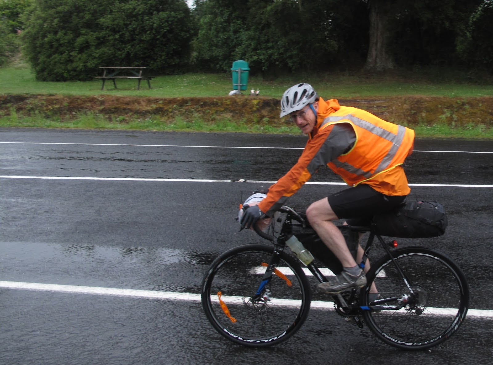
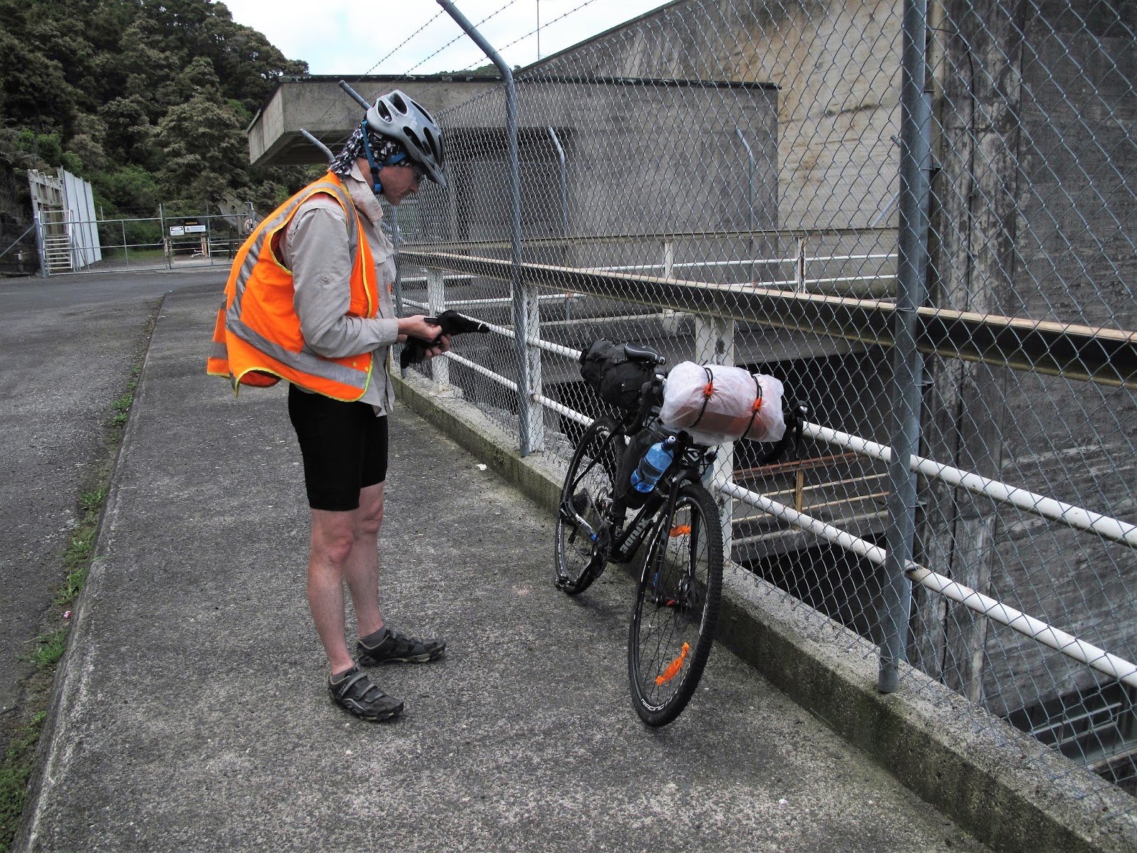
At the start of 2015 I took a bit of a trip up the South Island on the bike so this year it seemed appropriate to finish the job with a similar trip through the North.  The same philosophy applied, i.e. carry enough to be self-sufficient on the road but ok for pick-up and return to points where accommodation is available.

This time it would be South to North again for no better reason than the support crew could kick around home for a few days before setting off in pursuit.  The Tour Aotearoa brevet covering the length of both islands was tempting but I wouldn’t be fit enough and timing was not the best.   However, the Tour provided a good starting point for a route with some variations: most notably starting at Cape Palliser (southern-most part of the North Island), including the lower part of the Manawatu Gorges-to-Sea cycle route instead of touring the hills north of Ashhurst, and crossing Waiheke Island instead of traversing the whole of Auckland.

A map of my route is here.  But in summary:

Start: Cape Palliser to White Rock then inland to Carterton, join the Tour route at Masterton and follow it through Wairarapa back roads and over the Pahiatua track to Palmerston North.  Depart from the Tour route to join the Gorges to Sea Cycleway near Tangimoana to just North of Marton, then back country roads re-joining the Tour route through to Whanganui, up the river to Pipiriki, jet boat to the Bridge to Nowhere track and on to the Kaiwhakauka track to Whakahoro then back roads to Owhango.  More back roads through Tauramanui to Ongarue and join the Timber Trail.  Forestry and rural roads to the Waikato River Trail through to Lake Karapiro than across the plains to join the Hauraki Rail Trail to Thames.  Another departure from the Tour route at this point to head to Coromandel and catch a ferry to Waiheke.  Cross Waiheke and another ferry to Auckland to do battle with the cycleways and emerge in Helensville to catch another boat across the Kaipara Harbour to the northern heads at Poutu Point.  Back roads to Dargaville and beyond to the Waipoua Forest through to Hokianga Harbour and the ferry at Rawene.  Back roads to Ahipara then up 90 Mile Beach to follow SH1 for the final leg up to Cape Reinga.

A few numbers ...

12 days cycling
1 rest day
5 boats
1,423 km (not including boats)
2 bikes
1 puncture

With basically no cycling since January, fitness was a bit lacking but I figured on starting gently to get back into the swing of it.  The bike was the next thing, I had a cyclo-cross bike on order from Torpedo7 but as the start date drew near there was no news and they didn’t seem keen on answering e-mails.  So plan B; the mechanic checks over the old MTB but doesn’t have the parts to deal with the forks (still dodgy from last trip).  They would have to do with a bit of judicious pumping and hopefully the new bike will arrive before the support crew sets off.

Link to day one: Cape Palliser to Carterton

Table of contents

Day four     Koriniti to Whakahoro 
Day six       Owhango to Piropiro
Day seven   Piropiro to Waipapa
Day eight    Waipapa to Paeroa
Day nine     Paeroa to Ostend
Day ten       Ostend to Dargaville
Day eleven  Dargaville to Ahipara


Cape to Cape day one: Palliser to Carterton

Saturday 2 January 2016

Route
Cape Palliser Lighthouse, coast track to White Rock Road, inland to Carterton via Tuturumuri, Te Muna Road, Longbush Road and Millar Road.

Link to Map

Distance: 108 Km

Cape Palliser - first light
It’s not exactly early but getting from the Hutt to Cape Palliser in time for an 8am start is as much as can be expected from any long-suffering support crew.  It’s overcast and threatening rain as the bike is assembled at the road-end, below the lighthouse.  The peculiar, rank and sweaty smell of seals pervades the air.

The track up the coast continues from the Lighthouse carpark.  The signs on the gate are relatively mild but are more fierce at the north end so in retrospect it is probably best to seek permission from the landowners (the number is in the Kennett's Classic MTB rides book).  Today I’m only following the coast as far as White Rock Road but an alternative is to seek permission from various landowners and continue up the coast before heading inland and over Admiral Hill to Gladstone – maybe another time.

It’s about 10 km of coastal track to White Rock Road.  Somewhat bumpy and a bit of pushing required through a long sandy stretch but pretty straight forward.  It’s typically South Coast: bleak with wind battered scrub and angular sand collected in the lee of ridges.  The riding surface improves and after the northern gate it’s pretty good quality gravel.  White Rock is obvious with a cluster of camping surfers starting to stir then the road turns inland to follow the river and eventually a bit of climbing.  It starts to spit and pretty much keeps it up all day but that keeps the temperature down.

Getting started
The foothills to the Aorangi Forest Park lie to the left but there’s only a couple of climbs on the road, the last of which is after Tuturumuri and climbs steepishly to the wind farm (on seal to about 350m). But with little traffic it’s pleasant riding.  There’s no need to visit Martinborough so I take a right into Te Muna Rd (after Ruakokoputuna Rd on the left).  There’s some interesting vineyards along the road, which is a mix of gravel and seal, and pops you out on Hinakura Road a few kms before the left into Longbush Road (the famous Bell Tea corner - well, famous for old people that remember the TV ad).

The unaccustomed exercise calls for a bit of a rest on a soggy roadside before heading up to Millars Road (goes near Aotearoa Henge – well worth a visit) and a zigzag across the flats to Carterton and the comfort of number one brother’s house with a steep driveway designed to finish off weary cyclists.

After 108 or so km it’s a little after 3 and the bike is requiring a bit of TLC.  The body is also muttering about the unaccustomed treatment but a good meal and comfortable bed compensates.


Link to day two: Carterton to Palmerston North

Cape to Cape day two: Carterton to Palmerston North

Route
SH 1 through Masterton, back roads from Opaki to Mauriceville West, Hastwell and Eketahuna, Mangaone Valley to Pahiatua, Pahiatua track to Palmerston North.

Link to Map

Distance: 132 Km

It’s not an early start but eventually I potter off up SH 1 to join the Tour route from Masterton.   It’s an interesting section, somewhat hilly with gravel and seal. The day gets hot but there’s a few things to stop and look at including the site of a camp which housed Scandinavians who had come across to tend land that was not ready for them so they worked on the roads. Also a Norwegian Church on a hill.

About 1pm the route comes into Eketahuna from the east (after crossing SH 2).  It’s as busy as I’ve ever seen it and one of the cafés supplies toasties and ginger beer. A quick pump of the shocks and its off east along the Alfredton Road before turning for a long delightful run down Mangaone Valley Road to Pahiatua, with little traffic and a kind wind.

Busy morning in Eketahuna

The weather packs in so I take a snooze on the pavement under an awning, it doesn’t clear so eventually I have to harden up and leave during a lull.  In short order it’s dumping down and the lights are on.

The route leaves the main road and follows the windy gravel Tararua Road to the foot of the climb over the range.  The road surface is a bit rough which slows things down and I’m happy enough to start the climb on seal in the cool rain.

At 6.30 pm I’m pulling into sister number one’s place nursing some fine saddle sores and feeling every inch of the lack of fitness.  The bike is ok but the shocks need pumping twice a day.


Link to day three: Palmerston North to Koriniti


Cape to Cape day three: Palmerston North to Koriniti

Route
Across the plains via Rongotea to Tangimoana Road, follow the Gorges to Sea Cycle way to North of Marton, leaving it to follow Makahou Road to Turakina Valley and up to join the Wild Rover (and the Tour route) at Mangatipona Road,  Wild Rover to Whanganui, then Whanganui River Road to Koriniti.

Link to Map

Distance: 192 Km

Today marks a serious diversion from the Tour route.  After a good breakfast and a leisurely start, instead of heading north to Ashhurst and thrashing around in the hills around Apiti, its west across the plains via the small town of Rongotea to join the Manawatu Gorges to Sea Cycle Trail.
It’s gloriously flat and the wind is largely tail so it’s quick travel across SH1 to follow Tangimoana and other roads up beside the Rangitikei river.

This part of the cycle route is not spectacular; basically flat farm land, a few busy  road crossings and not a lot to see.  During a pause for a snack three cyclists heading north up Tangimoana Rd stop for a chat.  They are walking Te Araroa and borrowed bikes from the backpackers in Bulls but have decided to return them and walk as the wind is making things too unpleasant. They have a pretty tedious day in front of them but seem pretty cheerful about it.

My route crosses the Rangitikei River via Kakariki Road before a short section of SH 1 (wide shoulder and easy going) then across to Marton for lunch and essential supplies (iced coffee, pie and Vaseline).

The unfortunately named Tutaenui Road takes me north and into some gentle and picturesque hills to Turakina Valley Road, then up to join the tour route on Mangatipona Road on the route between Hunterville and Whanganui (the Wild Rover).  Calls to the jet boat companies around 4pm determined that one is booked out so I reserve a space on the other. Bookings are not refundable so I have to cover the 110 km to Pipiriki by 10am tomorrow. No pressure.

Taking a break - Mangatipona Road
I have found a clever short cut on Google to join SH 4 and avoid Whanganui, so take a right into Mangamahu Road only to find that “Te Rimu Rd” is private.  There’s no cell coverage and no-one at the farm house I stop at, so nothing for it but to trudge back to the main road and on to Whanganui with 15 Km wasted.

It’s well after 5pm when I leave Whanganui up SH 4 so I’m pretty sure I won’t make the 78 odd km to Pipiriki tonight but intend to make a start.    At the turn off to Whanganui Road the sun is setting, giving the chance to bask in the last light, fuel up, study the information boards, and put the lights on.  There are a few settlements with accommodation including Koriniti which I figure is as far as I’m likely to get.

The Gentle Annie Hill is not high (170m) but I’m pretty pleased to get to the top and pause over the view across peaceful farming flats around the river surrounded by bush clad hills.  The light dims as the road follows the winding river valley.  It turns out that the whole length is sealed (barring road works) – last time I came through a fair chunk was gravel.  The names are intriguing Atene (Athens), Koriniti (Corinth), Ranana (London) and Hiruharama (Jerusalem).

Many settlements have a Marae that seem to be in good shape and the roads are virtually deserted.  I give one local a bit of a fright as he is hunting along the edge of the road with his rifle and is not expecting a bike to drift by in the gloom.

I’m aiming to stop at the Flying Fox at Koriniti but they have a sign insisting that bookings are required.  I’m pretty weary now so stagger up the road a short distance and find a corner by a bridge to pitch my bivvy. It’s not a very comfortable night but I keep dry and am relieved to be off my feet.


Link to day four: Koriniti to Whakahoro

Cape to Cape day four: Koriniti to Whakahoro

Route
Whanganui River Road to Pipiriki, Jet boat to Mangapurua landing, Kaiwhakauka track to Whakahoro.

Link to Map

Distance: 72 Km (by bike)

Dawn reveals that the tent is nowhere near as secluded as I had fondly imagined last night.  No cars pass as I quickly pack and head off.  My new MacPac bivvy ‘tent’ has done the job – no condensation and the wee hoop keeps the material off your face.  I’m still tired and pretty sore so take a leisurely pace eventually seeing the distinctive spire of St Joseph’s in Jerusalem, marking the final leg to Pipiriki.

Whanganui Jet Boat Adventures is based at the old school (accommodation available) and provides complimentary tea and coffee.   I top up, air my sleeping kit and soak up the morning sun.   An Aussie cyclist gets chatting about biking kit; he’s taking a good few weeks to get some biking in NZ and today is heading up river in the jet boat in order to kayak back down.

Bike on boat number one

It’s $90 dollars for the one way trip with the bike to the Bridge to Nowhere track and I’m asked more than once if that’s what I am wanting – evidently not many people travel in this direction.  The punters for the trip are a mix of kayakers, those just taking the jet boat trip, and a woman returning to a family home on the river.  We are all fitted with life jackets and the sole bike is lashed to the frame at the back of the boat.


Just don't fall out, OK?


Our guide and driver gives the obligatory safety briefing and we head off up river past the opposition’s boat which is also about to set out. I’m sitting next to a young chap whose father is driving another boat loaded with kayaks, he knows the ropes and keeps an eye out that the punters are following the rules.  He reckons that he will be driving one day.


Cycling up the river


The guide points out various sights - a large eel traps like those used in the past, a waterfall in a cave, various rapids the kayakers will have to be careful of, sockets formed in the rock where Maori poled their waka up-river, eyelets for winching the larger river boats when the river was a major passage north, and points where Maori villages were located on bluffs high above the river.  There are plenty of kayakers coming down river. The driver doesn’t pull any stunts on the way up (evidently available on request on the return trip).

Unloading is straight forward.  There’s a couple of bikes waiting to get on and a few steps to wrestle up but from there it’s easy riding a couple of km through bush up to the bridge.  Despite the expectation the bridge is a surprise – DoC have done a good job of cleaning it up and it fair sparkles in the sun.  It spans a small gorge with a modest stream between steep bush clad banks. There’s quite a crowd before long, with two boat loads and a group of local blokes that have come down valley as far as they could on quads and walked the rest.

The bridge

The day is hot as anything and I’m still not feeling great so keep going after a short stop.  It’s interesting single track riding with some pretty views down to the tea coloured stream against white papa cliffs. There’s plenty of sites to camp.  The small swing bridges require hoisting the bike onto the back wheel and I’m pleased I don’t have panniers sticking out the sides.  Periodically there are grassy meadows and wooden plaques with names next to the track – presumably these are those who received the original farm ballots.

Yep - the water is that colour
Before long (8 Km?) the track turns into a quad track, it’s well formed and in good nick (but apparently it can get a bit cut up) and hot.  The quads eventually rattle past back up the valley and a school group passes on the way down.  Things reach a bit of low point physically and with low energy and unable to keep anything down, it’s a relief to reach the top and start coasting downhill.


The turn into Maungapurua Road is well marked but is not as well formed as I had thought from Google.  There’s a digger part way down repairing the track but towards the bottom there’s the long single Kaiwhakauka Track which would be great fun riding at another time.  I’m going slower and slower and eventually trickle into Whakahoro on dusk.  There’s no meal or accommodation available at Blue Duck Lodge but there’s space in the DoC cabin across the road and a hot shower for $4 at the Lodge which I take advantage of.

There’s plenty of kayakers at the camp site, all with fresh food and luxuries that they can carry on their boats.  I’m sitting gathering my thoughts when one stops by offering chocolate – “you look like you need it!” it’s a measure of how I feel that I can’t say yes.  A can of Sprite from the lodge is all I can manage before turning in.  An older couple (one a retired botanist) and a couple with 10 year old son are also in the cabin.


Link to day five: Whakahoro to Owhango

Cape to Cape day five: Whakahoro to Owhango and a rest day

Route
Oio Road and Kawautahi Road to Owhango.

Link to Map

Distance: 43 km

Despite a good sleep I’m still feeling wrung out but a ‘serves two’ dinner for breakfast helps and I take time to chat to some of the kayakers.  A couple of sisters, one running a cooking school in Germany are taking a holiday prior to sorting out an estate, and the 10 year old runs me through the marathon holiday his family from Christchurch are on – after kayaking they are doing the Tongariro Crossing before climbing Taranaki and heading to Rainbows End in Auckland.

Waterfall by Kawautahi Road
After they’ve all packed up and gone I get things together and head up Oio Road for Owhango via Kawautahi road.  It’s pleasant travel with a bit of traffic at the start.  I stop for a chat with a farmer replacing some fencing before the final climb then the run down into Owhango where there’s a decent café and Spark cell coverage.  Sally just happens to be driving through from Wellington when I ring and turns up within five minutes.  

It turns out that my new bike is still in Hamilton. I call it quits for the day with a view to picking it up tomorrow and resuming the trip the day after.  The Forgotten World Motel in Taumaranui is perfectly comfortable accommodation with dinner at the RSA.

Thursday:  A new bike

Not much to say – a road trip to Hamilton (compulsory stop at Haddad’s in Otorohanga) leaving the old bike at the genteel (i.e. flash) Cambridge Coach House out of Cambridge on the way.  Pick up the new bike (full name: Ridley 2015 X-Ride 20 Disc Cyclocross), bring it back to the accommodation and test their tolerance by spreading gear across the landscape stripping down old bike, setting up the new bike, fiddling, adjusting and readjusting etc.

Finally!

A bike that will make me very happy,
from a company that wants to serve the children of my children  

Fiddling
More fiddling with some supervisory assistance

And ready for action
It takes a lot of fiddling to get the luggage to fit as the frame bag is the wrong shape and the drop bars require a different bed roll arrangement - but it comes together well in the end.  Note the quick draw bottles in two cages hose clipped to the down tube.

It’s going to be interesting – my first cyclo-cross bike: narrower tyres, no front suspension and overall less robust than the MTB but lighter and hopefully quicker.  After all the farfing about there’s still time for dinner with number two brother and sister in-law in Cambridge.


Link to day six: Owhango to Piropiro

Cape to Cape day six: Owhango to Piropiro

Route
Hikumutu Road to Taumaranui, Ongarue Back Road to Ongarue than up the Timber Trail to Piropiro

Link to Map

Distance: 108 km

Putting off the moment - it's wet out there!

It’s a fair drive back to Owhango so it’s 9.45 by the time I hit the road in the rain – this time wearing two pairs of cycle shorts – for the rest of the trip in fact.  The back road (Hikumutu) to Taumaranui is a good chance to check out the new bike.  First impressions: geared much higher than the MTB (have to work on the hills!), twitchy on the down hills in gravel, have to take care to avoid larger bits of loose metal.  Basically feels like it’s built for acceleration; a bit of a grey hound (although more like a Labrador given my current pace and the propensity for the seat bag to wag the tail end).


And he's off
I surprise (and vice versa) a group of black piglets that squeal and try to out race the bike briefly, fortunately the mother isn’t in the offing and they’re behind before any tangle with the bike.  A long stop is required in Taumaranui at 11 to adjust the gears then it’s off again up the back road to Ongarue at 12.30 in rain and wind.

More fiddling in Taumaranui
Not the brightest of days in Ongarue
It’s a lovely little road – sealed for a fair way then pretty good gravel road after.  Sally turns up at Ongarue and we stop in at an accommodation place around 2pm in steady rain which has chairs under a veranda.  The owner is making the most of the Timber Trail providing accommodation and some bikes for hire.  He’s a bit of a character and charges us Wellington prices for a terrible coffee offset by a huge pot of tea.  A couple from Wellington have just completed the second half of the trail and seem to have enjoyed it having stayed at the Blackfern Lodge (accessible from the trail).

The Timber Trail

The start of the trail proper
There is good info on the web about the trail from NZ Cycle trails, the trail website, and Tread Routes including section distances, descriptions, accommodation options, photos, shuttles and elevation charts.  Every kilometre along the timber trail is marked and there are information boards.

On a general note, there are useful pamphlets available at visitruapehu which include the timber trail as well as a ton of other local rides and useful maps linking them all.

Once again it seems that everyone does the route from the other end.  The point is moot however as I set out at 2.45 and see one pair of cyclists at the start and no more for the rest of the day.  Piropiro campsite is about halfway and I figure on staying there.

Still raining - looking back down from the spiral
The track is easy to follow and has a good grade (as expected of a tramway).  The spiral and various information boards about opening the area up for logging provide some interest to offset the complete absence of view behind the clouds.  The track is still firm underfoot, and the bush is verdant in the wet.  It’s sweet riding and the bike handles the conditions without problems.  The bridges are long but wide and solid – definitely suspension not swing bridges.

I toy with the idea of continuing through to dark but at 6pm it’s still raining and there’s a shelter free at the Piropiro campsite.  Sleeping under the table means the leaks in the roof can be avoided. There’s also a stack of newspapers to spread on the concrete under the air mattress.  Perfect: so much better than a cramped biv.

Home for the night

More comfortable than it might look
Warm dry clothes, a trip for water, a dehy meal on the penny stove and hanging everything out to drip passes time before dark.  The light goes off early as I’m not keen on the Huhu beetles that are hurtling around smashing into anything close to the light.


Link to day seven: Piropiro to Waipapa Dam

Cape to Cape day seven: Piropiro to Waipapa

Route
Just before the end of the Timber Trail transfer to Link Road, then forestry roads and a foot track to Arataki Road, back roads to Lake Maraetai and Waikato River Trail to Mangakino, continuing on Waikato River Trail to Waipapa Dam.

Link to Map

Distance: 104 Km

Morning on the Timber Trail
It’s not raining at 8 am when I set out although the bush is still saturated.  The trail flicks between track and forestry roads for a bit before getting into the serious business of climbing towards the high point.  The bush is steaming as it dries in the morning sun.  It’s obvious that it’s no longer following an old tramway, the track surface has softened with the rain so it’s a little harder going and some sections are bordering on challenging with the narrow tyres.  A few steep bits require pushing but it’s good riding through gorgeous bush with spectacular gorges and occasional views across to Lake Taupo.

I haven’t seen anyone until I round a corner and a woman screams.   Not the usual reaction and she apologises at least three times before her bike disappears behind.  She’s part of a group of four, with light gear who have clearly set out from the road end very early. 

Another bridge another gorge - this trail is well engineered
The track sidles below the summit of Pureora (optional walk to the top) at about 980m before eventually dropping steeply, the bike handles the decent comfortably but there are increasing numbers of bikers coming up so some discretion is required. The bush edge is a marked transition and a reminder of how much damage logging does to the landscape.  Shortly after, rather than dropping all the way to the start of the track, I take Cabbage Tree Road and leave the Timber Trail behind with some regret.  Probably the most enjoyable single track of the whole trip.

Link Road leads across the northern flanks of Pureora (a bit up and down). The rain of yesterday is well gone and the sun has dried the gravel roads.  A few of the roads have changed a bit with forestry use but the trip notes work OK and my turn off is marked as leading to a YMCA facility and the centre of the North Island.  A short side road (marked) and a short bush walk (ridable) lead to a concrete post in the bush.  The plaques outline how the centre was found (see photo below); this was done in the ‘60s and you’d think that someone would have come up with a more accurate method since then!

The centre of the North Island?


Plaque one: who


Plaque two: how

On the way out three elderly people are sitting by their car having a rest from the excitement of seeing the centre of the island - they are as bemused as I am about the place.

The road drops steeply and I stop to chat with a chap on a single speed pushing up the hill.  Markus is following the same route in reverse, but as part of an around the world effort starting in Scotland.  We exchange notes about the ground we have just covered, which turns out to be quite useful for me anyway.  He’s heading to Queenstown via a few days in Wellington where he lived for a couple of years.  Coincidentally, the next day my cousin in Scotland sends a Facebook message asking if I have come across him.

The road finishes abruptly at a T intersection – to the left a gate and to the right an overgrown track, both marked as forestry roads in Google.  I follow Markus’ tracks down to the right it’s pretty rough going with blackberry invading the path and eventually seems to peter out.  I cast around and find some beaten grass dropping off the left of the track (marked in Google as a foot track) which eventually leads to an old (short) swing bridge.  This is where the GPS would have been helpful.  However, there’s a couple at the other side who confirm I’m heading for Arataki Road.  They live in Tokoroa and are out in the 4WD for the afternoon exploring a few places they hadn’t been for a while. They offer me a lift and water, which I somewhat regretfully decline. Twenty minutes later they pass me on the road and again offer the water, which I gratefully accept – it’s cold and doesn’t taste of plastic – bliss!

The route follows quiet, undulating back roads to cross SH 30 and join the Waikato River Cycle Trail along the shores of Lake Maraetai and into Mangakino.  There’s a bunch of people enjoying the lake shore at Mangakino at 3.30 and I lie in the shade in the heat for a good while before refuelling at the Bus Stop Café (decent toasties and the right cold drinks - Bunderburgs Ginger Beer and Lipton’s Iced Peach Tea).  Brother number 2 slept on the deck on one bike trip; the proprietor remembers that he was also through a few days ago.

A well provisioned bus stop
 The support team turns up having explored the back roads between Mangakino and Te Kuiti.  There’s an outside tap at the toilets by the bus to fill up bottles and it’s back on the road at 5.45 to the next section of the Waikato River trail.  Info is available at the trail website including a brochure with elevations

Leaving Mangakino

The Waipapa section is 19 km and graded advanced riding because of some steep bits.  It is a mix between single track and wide, soft logging tracks covered in a carpet of pine needles (watch out for pinecones and deadfalls).  Out of the heat of the day it is pleasant riding and the odd bit of pushing isn’t so bad.  The drop down to the edge of Lake Waipapa is entertaining and the far shore is basking in the late afternoon light.


Last light on day seven


The final run down to the Waipapa Dam is on a grit track beside the road and in the absence of traffic I take the road beneath the cliffs, arriving about 7.15.  It’s a bit of a cheat tonight, there is no identified accommodation around the dam but we have arranged to stay with brother number 2 in Cambridge so stretch the point on this occasion and head up Waipapa Road for a comfortable and convivial evening.


On stripping the bike down I discover that the seat bag has made a good start on abrading through the seat stays plus a few other rub points.  Probably not helped by the pumice hereabouts.  A few miles of tape, a bit of carbon fibre and a change in packing solves it for the rest of the trip.


Link to day eight: Waipapa to Paeroa


Cape to Cape day eight: Waipapa to Paeroa

Route
River Trail to Pokaiwhenua car park, various back roads to Te Aroha, then on to the Hauraki Rail Trail.

Link to Map

Distance: 133 Km

Not so early morning start at Waipapa Dam


Another late start at 10.45 after the commute from Cambridge.  The Arapuni section of the cycle way is noted for a flight of steps near the start, a steep climb through switchbacks and a technical section into Arapuni.  At about 2km in the 6 flights of steps are soon out of the way, there’s a board on the edge to push the bike up and once the technique is sorted it’s not hard although I’m glad to be packing light.
There’s a bit of up and down and a fair amount of forestry road, one of which furnishes the first and only puncture of the trip – a drawback of the lighter tyres.  A short way after the Mangarewa Bridge (similar to the Pureora bridges) I stop to talk to a woman with her shoes off at a picnic table.  She announces that she is 90 and can walk about 20km a day but won’t go further than the bridge as she hates heights.  She is touring her campervan and is ticking off a number of walks and is intending to have a look at Pureora next.

The climb when it comes is steep, with apparently 37 switch backs and about 200m gain in elevation.  I take it slow with a break and frequent breathers and manage a mix of riding and pushing.  Two overseas cyclists pass going down (carefully) and commiserate on what’s ahead.  There’s a fair amount of bush which thins towards the top and afterwards a long downhill on seal (ignoring the detour through Bennetts Bush) to Jones Landing.

The section from Jones Landing to Arapuni is noted as advanced and I decide not to put the bike through it, taking the longer road option and re-joining the trail where Arapuni Road crosses the river for a smooth run into Arapuni, impressive views of the power house and another imposing swing bridge.  It’s 1.45 so time for a 45 minute break, lunch with the support crew at Rhubarb Café and top up water bottles before heading off again.

Arapuni Power House
The next section to Waipa Domain is easy, sweet single track followed by a bit of a tedious section beside the road and a final stretch by Lake Karapiro to arrive at the Pokaiwhenua Bridge Carpark 45 minutes later.

The carpark marks the end of the Waikato River Trail.  Overall it’s a bit of a mixed bag with a fair amount of road riding and a lot of exotic forest but some entertaining sections and pretty scenery.  It’s a bit tough judging it after doing the Timber Trail.

The carpark also marks a change in the route – there’s a long commute ahead across the plains to the Hauraki Rail Trail.  But the wind is not so bad so I truck on aiming to get to at least Te Aroha before calling it quits.

The short section of SH 1 is nuts with traffic and SH 29 is not much better.  It’s a relief to turn off onto quieter roads at Puketutu Road that winds into some easy hills past Hobbiton and into Matamata via Station Road.   After drinks and snacks at the Gull on Tower Road, its off along long straights towards the Kaimais in the distance, gradually turning more north to parallel the range.

The support crew is waiting at the start of the Rail Trail in Te Aroha (6.30pm) and doesn’t complain when I decide that Paeroa is not so far (21 km) and may as well be knocked off before calling it quits for the day.


Te Aroha - Waiting for a Rail Trail

The Trail runs straight and flat through farmland with numerous road and farm track crossings.  It’s well formed but quickly becomes monotonous.  The signage is not as well done as the previous two trails although it is generally pretty quickly worked out.  There’s not much to say about it beyond that really, which is pretty unfair as the trail is maintained by volunteers who have done an outstanding job and there is plenty to see and do if you have time to seek it out – the Hauraki Rail Trail website has more info and there is a booklet available at i-sites.

After less than an hour the trail eventually does a weird wee kink into Paeroa and the bike goes on the back of the car for the commute back to Cambridge.


Link to day nine: Paeroa to Waiheke

Cape to Cape day nine: Paeroa to Waiheke

Route
Hauraki Rail Trail to Thames, Main Road to Te Kouma near Coromandel, ferry to Orapiu on Waiheke, then roads to Ostend via Stony Battery.

Link to Map

Distance: 118 Km

It’s an 8.45 start for the final 33 km from Paeroa to Thames on the Rail Trail.  It’s similar riding to the first part although I regret that I didn’t stop at the Cheese Barn in Matatoki.  I see a couple of other people during the morning and that’s pretty much it.  Plastic garden chairs are periodically screwed to trees along the way for those that want a rest. The scenery changes when the trail crosses SH 25 then follows the Waihou River to Thames at its mouth.

Cruising into Thames at 10 am it’s a little difficult to work out where the Trail starts/ends – there’s a carpark and little else.  I choose to mark it as the wharf which has a good wee café and a view into the mangroves at the mouth of the Kauaeranga River.

Unofficial end point of the Rail Trail

Delightful wee cafe just beside the unofficial end point

For the next section I'm leaving the Tour route, not fancying the commute through Auckland, and preferring to visit Waiheke Island.  Fuller’s provide pretty good ferry services around the Gulf – but you have to check as timetables seem to vary and it probably pays to book (although they didn’t require this for the morning commuter ferry to Auckland).  Orapiu is at the eastern end of Waiheke Island and is listed separately in the ferry timetables to the Island itself. The ferry from the Coromandel end leaves from Hannafords Wharf at Te Kouma about 10 km south of Coromandel Township – there’s no facilities at the wharf but there is apparently a shuttle from the township and I had Sparkcell phone cover at the wharf.

Today the ferry leaves at 3pm, so I reserve a spot for me and bike.  It’s 10.30 so plenty of time to cover the 52 odd km from Thames to the wharf.

The road winds north along the coast with views across the Firth of Thames and through numerous wee settlements (some with a shop).  The traffic is busy with plenty of SUVs with boats and not much shoulder but it doesn’t feel too bad.  At Wilson Bay the road turns abruptly inland and upwards.  It’s a long hot slow climb over one hill to Manaia (a bit over 200m) and then over another lower hill with a hard left at the bottom to skirt around the coast 3.7 km to Hannafords Wharf in Te Kouma (past the commercial wharf at the western headland of Waipapa Bay).

Te Kouma - Fuller's pick up point

The Ferry


It’s 1.30 so time for a snooze in the shade of a Pohutakawa, until people start materialising and the boat turns up to load about 20 passengers plus one bike. It’s about an hour across to Orapiu, with a pickup at Rotoroa Island en route (the ferry continues to Auckland), ample time for a pretty good pie and ginger beer from the bar.  The captain is fairly young and has two attentive crew who seem set on competing for his attention but it seems a pretty professional outfit.


Another bike, another boat


I wheel the bike off the boat a bit after 4, and a chap with a European accent looks up from his fishing to offer some useful advice: there’s potable water at the end of the wharf and he confirms the two options for getting across the island (long, hilly and scenic or short).

The road winds up the hill from the wharf and I take a right into Cowes Bay Road: the long option on a hot, brown gravel road.   It winds along the hills before diving down to Man ‘o War Bay where the winery of the same name has a café and tasting room with seating in the shade around an immaculate lawn.  The bay is very pretty and well cared for with a wee church: a perfect spot for a swim, wine tasting and meal.  It’s hard to resist but I continue and follow the road up and away from the Bay to Stony Batter Reserve (road on the right).

The tunnels at the Batter are closed but there’s info boards about.  The Battery was started late in the Second World War as a 9.2 inch Counter Bombardment Heavy Coast Defence Battery with three concrete gun emplacements and an extensive system of underground chambers connected by stairs and tunnels (more info available from DOC).  The area also sports a field of fluted basalt boulders; apparently eroded by humic acid when the area was covered in bush.

Stony Battery - there's some interesting bits down there somewhere
The day has clouded over and it’s time to head across the island to find accommodation.  I visit the DoC loo on the way out of the reserve and as I exit a chap from a ute approaches.  He seems keen for a chat about something so I engage in the usual small talk until he says “you know your life is very important” I wonder if he’s about to criticise me for hurtling down some hill recklessly or the iniquities of cyclists in general … but no – he wants to tell me about his friend Jesus. Ah well.

Getting a bit gloomy (looking West along the North Coast)

The road is in noticeably worse condition across the north eastern part of the Island with corrugations.  It’s mostly farmland but patches of grapes and a few patches of bush.  I hang a right onto the sealed Waiheke Road to traverse the last patch of rural land before winding through the built up areas of first Onetangi Bay and then into Ostend around 6.45 pm where I figure I had better start to try to find somewhere to sleep.  The internet isn’t much help and I end up at a basic but overpriced motel in the absence of other options.   They recommend a local Chinese takeaways (Sing Tao – not flash).  Although the motel price is annoying it is comfortable and provides opportunity to wash and dry clothes, chill water bottles etc.


Link to day ten: Waiheke to Dargaville

Cape to Cape day ten: Waiheke to Dargaville

Route
Ferry to Central Auckland, various cycle routes to Old North Road to Helensville, boat from Parakai to Poutu Point, then road to Dargaville.

Link to Map

Distance: 128 Km

It’s 5.30 as I head out under lights in drizzle for the first ferry off the Island.   I’ve been surprised by Waiheke. I have not seen anywhere enough of it to make any judgements, but it seemed to be an island of two halves: an eastern rural area of farms, vineyards and bush reserves, and a pretty extensive urban area in the west.  I thought it would all be pretty affluent but there seemed to be the usual mix of people and clearly quite a few workers servicing the local industries.

It’s a little over 6 km to Matiatia wharf so I arrive in good time for the 6.05 sailing.  The plan is to traverse Auckland as early as possible and head for Helensville and reassess.  There’s a boat (Shamrock Charters) crossing the Kaipara at 10am - they only take bikes when they have a fishing charter so it’s a bit hit and miss – they may be going out again tomorrow.  The other company is definite that the weather precludes them taking the trip.  I figure I have little chance of navigating Auckland in time so another option is to enlist the support team for a dummy crossing (i.e. drive the bike around to the other end).

The early ferry crowd is what you expect – commuters who seem to know each other and a few tag-alongs like myself.  It’s a sombre day as we pass the emblematic Rangiototo and a cruise ship in stream.

That unmistakable silhouette  


Auckland has been drizzling but it’s relatively quiet as I head up Queen Street to hopefully join the cycle ways heading north and west.  I find them ok but get mislaid pretty quickly and realise I am heading in the wrong direction – a quick Google check and I make my way back, eventually taking advantage of the off road tyres to navigate a steep bank down to the correct path.   There are a reasonable number of commuters who seem pretty cheerful and one is happy to provide directions when I find myself on one of the many diversions off the cycleway.  A lot of the cycle way is great riding and it will be fantastic when they are finished and have added good signposting.

The tour route strikes out onto semi-rural roads at Massey then joins up with Old North Road to roll through the hills to Parakai.  Somewhere along the way I realise that there is a chance that I will make the boat and sure enough I get there with 15 minutes to spare.  This turns out to be three minutes early as it is leaving a little early.

The support crew turns up having been slumming it in Parakai, and we briefly exchange news before the bike is lashed to yet another boat, and we motor off through the mangroves down the muddy Kaipara River.

Bike being loaded onto boat number four

And they're off down the Kaipara River


The captain of the Lady Frances is a bit of a character and reminds me of Spike Milligan.  He’s been plying these waters for a considerable time and is well matched by his competent wife who manages the shore end of things during the day.  An English chap is already aboard who is out for a day’s sightseeing from his holiday home at Shelly Beach. His experience of boating in the Med doesn’t seem to translate too readily to the shallow waters of the Kaipara.  We pass barges extracting loads of  gravel from somewhere in the harbour.  Where the river enters the Kawau Parua Inlet it looks like a wide bay but the charts show that the channel is still pretty narrow and we stick to it.  There’s a brief stop at Shelly Beach where 18 punters get on for their fishing charter.

Many are clearly regulars. They file on board and take their stations laying out chilly bins, bait, lines, and other essentials.  The captain puts the kettle on and we potter on towards South Head.

I get chatting to Kathy, who is studying the minutes from the Niue Health Trust meetings she attends.  We talk about her family, the work of the Trust and the challenge of reaching those that need to change to healthier behaviours.  She also lets me in on some of the (to me) arcane fishing lore.  She and her husband come out regularly but often give away most of their catch.  She has pockets of traces so that she can have her bait at set depths and talks about what bait works and how she knows when to change.

I’ve completely lost my sense of direction by the time the captain drops anchor and starts cheerfully shouting at the punters to get fishing.  The boat explodes into activity and soon they are reeling snapper in at a great rate.  The captain keeps an eye on proceedings making sure that too small fish are thrown back and moving the boat if things slack off.  A large ray is pulled in (after the barb is removed), and a 1.5m shark refuses to be reeled in.  One of the Asian gentlemen is quietly sick over the side and loses interest in proceedings.  Another chap is looking after an elderly man who hands him his rod every time he hooks anything which keeps chap one frantically busy.  People hook other people’s lines, fish flap briefly as they disappear into ice boxes and it’s generally highly entertaining, semi-controlled mayhem.

As we watch the captain mutters about the survival rate of released fish (“10%”) and is critical of TV shows that release fish so they can catch bigger fish – “I told one of them he wasn’t welcome on my boat because of his fishing practices.”

Eventually we up anchor and motor off – I take the opportunity for a snooze until suddenly we are pulling into Poutu Point.  A household ladder has appeared from somewhere and is leaning up on the bow.  We come in close and run gently into the rock, I think he leaves the engines on forward while he runs the ladder across (almost horizontal on this tide) and I gingerly disembark to grapple with the bike he runs down after me.  He shouts at anyone that offers to help (“I don’t want anyone else to worry about!”).  It’s all highly precarious and amusing.

The boat backs off and I’m left on a rock at the end of a peninsula with my bike, in the distance I can hear the captain cheerfully shouting at someone. It’s 3.30 – I had planned on a three hour crossing; it’s been five and a half but still plenty of daylight left.

The 70 km trip up Poutu Road is not particularly memorable.  The 25 km of gravel is in a poor state and it’s mostly farms and forestry.  I tuck the head down and head for Dargaville.

A bit of a planning glitch means accommodation for the night is in Omapere but there’s time for a café dinner in Dargaville and pizza for the road.


Link to day eleven: Dargaville to Ahipara