Other members of the team at work are covering the phones for the Easter weekend, so I figure I can slip away for a local overnight trip. I've always had a bit of a soft spot for the Turere Stream, starting from reading a TTC report on a trip to a waterfall that was marked in the wrong place on the map. I've visited the waterfall a couple of times subsequently, most recently in August 2020.
What: Local overnighter
Where: Orongorongo - Turere Stream
When: 4 April 2021
Who: Solo
The trip plan is to bash up Skerret's Stream, pop over the ridge to follow Turere Stream all the way down to the Orongorongo River. Pop up river to Whakanui Creek and follow it to its headwaters and back out via the Whakanui track.
 |
| Overnight pack and 'don't shoot me' vest |
The support crew drops me at the end of Sunny Grove around 11am and I follow the track up to Skerrets Creek before leaving it to follow the creek. There are some remains of old water supply infrastructure in the creek bed - interesting given how long the Wainuiomata and Orongorongo water supply sources have been established.
There's a waterfall marked on a side stream so I pop up for a look - somewhat underwhelming but only 20 minutes from the road and a short diversion.

A little while later I find some bits of metal near the creek - I've heard that there are the remains of a steam engine in here and assume this is part of the remains washing down, I don't see anything bigger but understand that it is there to be found.


The creek gets smaller and more scrambly, until I eventually leave it to clamber up through scrub and regenerating bush to the ridgeline. I think I ended up on the true right spur between the marked headwater creeks. I didn't note any signs of other traffic so there may be an easier route than mine. It's 12.35 when I join the McKerrow Track.
 |
| McKerrow Track |
I don't follow it though - just cross and start dropping on a spur into the Turere headwaters.
 |
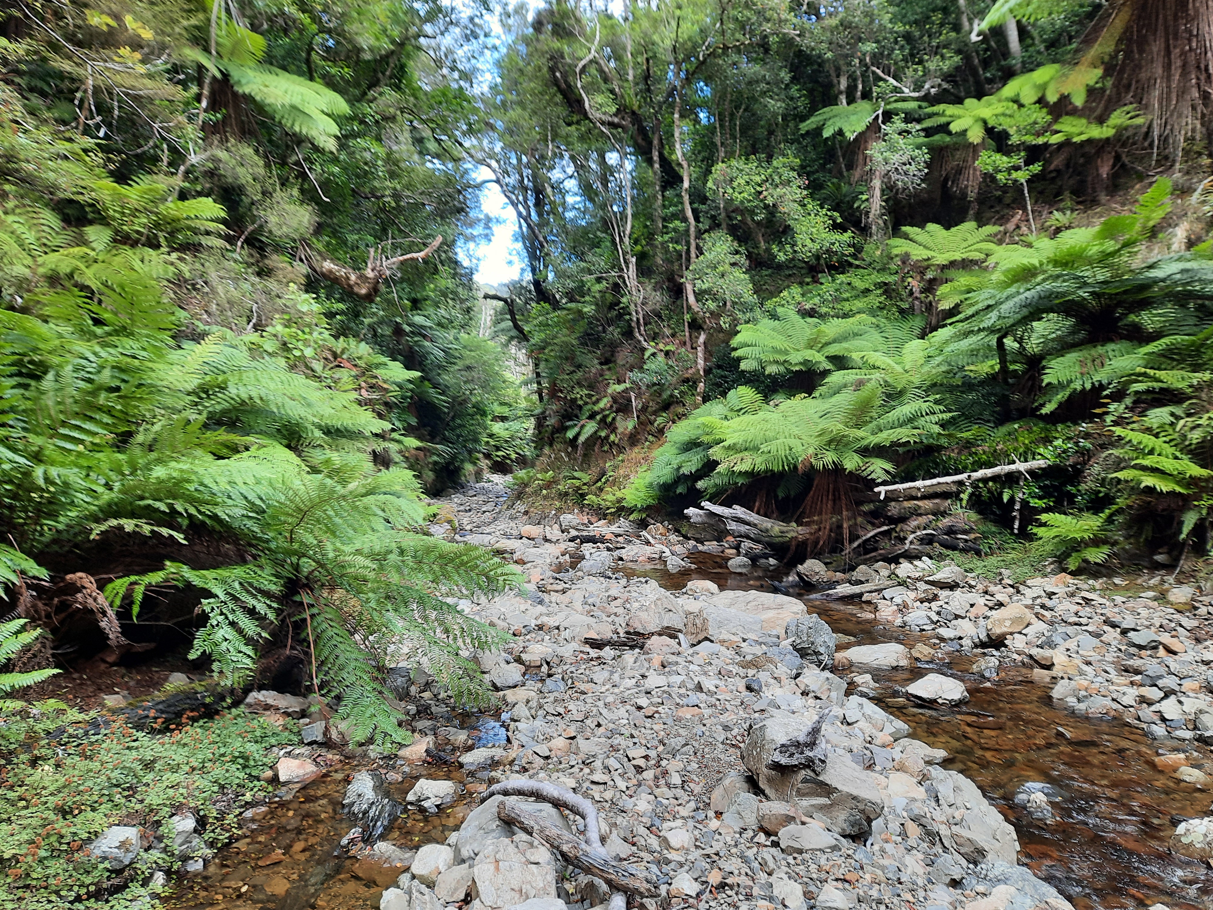
| First contact with the Turere |
It's not too bad travel down stream, there's a few log jambs to negotiate but I keep my boots dry.
 |
| Log jamb at 1.30pm |
Soon I'm in familiar territory from the last trip - still with dry feet.

There's a bit of a cascade which can be scrambled on the true right but it's a bit sketchy and probably best to take the hit of a waist deep wade on the left through the pool. After that, the big slip and tree trunks in the stream indicate the main waterfall is close. At 2.50 I round the corner to see the water disappearing through the slot and over the edge.


It takes a little under 10 minutes to scramble up the true right and follow a ground trail down to drop down a slippery wee slope to the stream below the falls. There's a wee cairn in the stream to mark the spot. 10 minutes after that I pass where we joined the stream last time. It's new territory now, but uneventful - it's standard stream travel to arrive at the bent bridge around 5.40. It's taken about 5 hours from the top to bottom of the catchment.
The afternoon sun is throwing golden light on the face of the Remutaka Range across the Orongorongo River reminding me that I will need to be thinking about finding a camping spot soon.

As I head up river on Big Bend Track I'm forcefully reminded that it is Easter. There are two 4WDs visible across the river and the sounds of different family groups drift up from the river bed. I quickly discard the idea of seeing if there is a spare bed at Turere Lodge and head on in the rapidly gathering twilight.
It's dark by the time I get to Whakanui stream - I follow the Whakanui track a short way then head towards the stream and find a flat spot to pitch 'the coffin' (so named because it is slightly more spacious then the body bag (bivvy bag) - but I'm regretting not packing the fly).
 |
| Home for the night |
I'm a little disappointed that rather than hearing Kiwi in the night, I can hear people at one of the private huts a little way off in the bush.
In daylight I discover that I am not far off the track and have found one of the few suitable flat spots. I get away a little after 8 to see where the Whakanui Creek will take me.

The stream narrows and I keep following it. Towards the top of the catchment it gets a little hard to work out which is the most significant fork and there are a couple of spots where I have to leave the water to climb up the side. They creek is barely a trickle when I take a bearing and head for the ridge - in the process of which I stumble on another wee headwater trickle between me and the saddle (so I think I must have been on the eastern of the three branches marked).

There are a few scrambles and it strikes me as being closer and greener than the Turere Stream. My notes record a junction about 2 hours upstream and a wee water fall that requires a bit of scrambling up a mossy log after 3 hr 35.
 |
| A bit of a scramble - about an 2 hour 50 upstream |
 |
| A slightly more tricky one |
The stream narrows and I keep following it. Towards the top of the catchment it gets a little hard to work out which is the most significant fork and there are a couple of spots where I have to leave the water to climb up the side. They creek is barely a trickle when I take a bearing and head for the ridge - in the process of which I stumble on another wee headwater trickle between me and the saddle (so I think I must have been on the eastern of the three branches marked).
After a steep wee scramble I emerge on the ridge close to the saddle. It's 12.35 and it's taken about four and a half hours to navigate the catchment. It's cool and claggy so I keep moving.

I take the track from pt 644 to Nikau Stream arriving at the bottom at 2.10 and the car park by 2.20. A good use of a day and a half in the local bush and it got me out of the house.
