Monday 24 June 2013

A weekend riding in the Wairarapa

Angela and Andrew plus support crew
22-23 June 2013

An enthusiastic southerly had given Wellington a bit of a beating so what better time to get away from the storm damage for a couple of days?  Also I made a promise to my knees to lay off the hills for a weekend or two. 

At 8am it looks pretty horrible out; there's still a bit of wag in the tail of the storm and it is cold. Rather than leave us to catch the train to Upper Hutt, Mike good naturedly agrees to drop us out to Maymorn via a certain fast-food chain for breakfast.

Out of the car it's cold and wet but there's not much wind.  Mist is smoking through the pines and there is a distant thrum in the air.  The noise builds until somewhere out of sight the Wairarapa train emerges from the long tunnel and rounds the corner.  It's just about empty but there are a few curious passengers that glance out at the wet landscape and the pair of bikers dressed for the cold.

We are away by 9am and head up to the first tunnel.  The surface is good which is lucky as we have both left our road slicks on.  The wind is behind so it is pleasant riding despite the rain.  There are also few people about although a few minutes after passing through the Kaitoke car park we see a chap being dragged on a buggy by a couple of dogs then two women so wrapped up just their noses are showing.

There is a bit of storm damage but nothing serious, just branches and a few rocks on the track.  We take a short stop for a photo at the Summit.

Bedraggled but cheerful at the top
The normally small trickle across the track before the top tunnel looks the same but has carved an interestingly deep channel which just about sees Andrew into the track.  Through the tunnel the steeper descent has more water damage but again, nothing dramatic.  The stream in the gully at Siberia is up and has washed away parts of the track but we ford it without any trouble.

A few goats get a bit of exercise as they rocket ahead down the track but we don't see anyone until a couple and a lone man with dogs coming along the delightful single track before reaching the car-park around 11:15.

We get a couple of K towards Featherston before the support crew arrive with hot soup, road bikes and the necessary kit.  A giant old Macracapa provides shelter from the rain while we change and try to warm up.  All too soon its back in the saddle and onwards in the rain which stays reasonably constant and cold, occasionally getting heavy but what wind there is is mostly from behind.

There's a lot less traffic when we turn left at Martinborough and head towards Ponatahi.  The road is not too hilly but it seems to get colder and the rain heavier so it is very good to see Mike in the support car with more hot soup.  The support contingent has settled into the Solway and are enjoying the café and heated swimming pool.  We stand in the cold rain wrapping ourselves around the hot cups and trying to ignore the weather.  Somewhere on the nearby hill is the Wairarapa Stonehenge.

After one low rise the road is flat all the way now, it's just a question of enduring those long straights.  But at last we turn onto SH2 and the last few Kms to Masterton arriving at 2.45.

We both discover that we have wicked cold rash and it takes a considerable time in a hot bath to thaw out. 

The hotel has something for everyone; café, swimming pool, air hockey, pool even a golf driving range but I'm more interested in a snooze before dinner.  Aidan and Janne have joined us so it's a social affair made more entertaining by watching participants turning up for a local school's ball.  Vehicles vary from trucks and muscle cars to a tractor and a fire engine.

After a generous and good value dinner we watch the All Blacks just beat France and turn in.

Sunday

After a big breakfast we kit up for a late start.  There's a light southerly and although cold it could be clearing to the east.  We head off towards Gladstone and the back road to Martinborough.

The sun breaks out for longer periods and it's an enjoyable ride through pretty country.  Eventually we reach bell tea corner and as we stare off the bridge at the swollen stream, the support crew turns up.  Today we don't need soup so after a chat we head off for the last 13k to Martinborough.  And into the rain.

The rain is just clearing when we pass through road works just before Martinborough which ensure the bikes are thoroughly filthy.  At the wine centre we hope the muddy roster tails up our backs are not too obvious as we tuck into more good food.

Angela elects to join the support crew in the car whilst Andrew decides for a pick up in Featherston after a few more Km and another shower or two.  In Featherston the car is loaded with four bikes and five people for the trip home. 

Review

The incline is always good although the weather was a bit of a challenge this time.  Starting at Maymorn is a good option giving a longer ride (about 26 instead of 17K).  The roads we took out of and into Martinborough were good riding with relatively little traffic.  We will be back as there's plenty of scope for short or long loops.   Overall it wasn't a long ride but a very successful piece of research.

Saturday 15 June 2013

Penn Creek one day loop

A bit of a knee wrecker

Solo day trip

Click to access map in new window

To make the most of these winter days you've got to be about early; I'd say 5am classifies.  It's five to seven when the car door slams at Otaki Forks car park and the beam from my head torch picks out the ghostly white of frosty grass.  A bit of a jog is indicated to stave off the chill and get the day moving.

The plan is to do a loop from Otaki Forks, past Field Hut to drop into Penn creek, climb Pakihore Ridge to McIntosh on the Tararua Range, follow the range back to Kime Hut and return back down Judd Ridge to Field Hut and the car park.  The two thirds I have done before is fine; the Penn Creek segment is a bit of an unknown so I'm a bit fixated on watching the clock today.

The pre-dawn light is not yet quite bright enough but the path is a real highway so I could probably have got by without a torch for all but the first couple of hundred metres.

An hour later at Tirotiro Knob (855m) the sun lances in under the high cloud and briefly lights the bush.  There's not much more sight of it for the rest of the day.  A few minutes on is a clearing where Mike and I saw a pretty sunset over Kapakapanui (1102m); this time Kapa' is picking up the morning sun and the bare tops and slip are clearly visible.  A photo stop is a must; having recently visited the top for the first time I feel I have a proprietorial interest.

Kapakapanui catches the first and last of the sun

Field at 0810 has a couple if groups gearing up for the day.  A group of five from Vic Uni got in late last night and are just waking up for a trip up to Hector.  An older 2 blokes and a woman from Tararua Tramping Club are intending to visit Kime before returning.  I identify myself as being from WTMC, despite everyone being in a club none of us are on club trips.

It's good to chat as they make their tea and exchange plans for the day.  One of to the TTC blokes notes that there are warnings about dangerous slips on Penn track.  I'm aware that the old gorge track is dodgy but this is the first I've heard that my route for the day might be a problem.

Heading up the hill the frost is getting decidedly firm and puddles are iced over.  Across the Penn catchment is Pakihore Ridge.  My track plunges into the depths of the valley then struggles onto Pakihore which will take me up to the main range (which is looking decidedly long and lumpy from this angle).  Out of sight is Hut Mound and Kime Hut which is where I will begin the descent back down the ridge I'm standing on.  It's all looking a bit daunting  but being ahead of time is a good start.

Judd Ridge near Penn turn off, a bit of frost on the track.
Bridge Peak on right

Some photo attempts have limited success in the dim light and it is twenty to nine when the track to Penn Creek peels off at about 1050m.  A short way along there is a stern sign warning about slips and people having to be rescued. I figure that I'll head on down and decide when I see the slips in question.  The track is a little rough but fine and easy to follow. It wends across the tussocks before diving through the scrub and into the bush where it drops and drops. 

On the left at about 700m a stream appears in a deep gully and the sound of Penn Creek drifts up on the right.  Eventually the bottom and a stream crossing which has been known to be impassable but is fine today.

The track continues down the valley climbing onto and following old terraces.  Somewhere on the left is a navigable route up a spur but there's no time to try to find it today.

It's 0940 when the track opens to a small grassy flat and Penn Hut (220m).  There was no slip damage evident anywhere on the track and I'm a bit tetchy about the DoC sign which inaccurately warns people out of the catchment when there is access to the hut and another exit route.  The sign is repeated down stream of the hut which is where the access to the old gorge route is and where I would expect the slips to be.

The hut is a standard 6 birth and is clean and tidy. The last resident was last Sunday.  Heading off at 0950 the first order is crossing the creek. Its a good size and nippy so I grab a stick, although not really necessary, the third leg is helpful.

This was always going to be the tough part of the day. The climb is about 1,000m on a track that is not as well maintained as some. The start is chaotic as the foot of the slope is wet and loose so there are a number of tree falls to negotiate with lots of loose soil and rock and rotting vegetation. The track is marked but with the tree falls it is easy to miss. However, the track soon dives upwards and into drier forest providing easier going. It climbs steeply to 973m where the spur meets the Pakihore Ridge, here it turns right and meanders upwards at a more leisurely pace. It takes 2 hrs to get to the intersection with the Tararua Range just before McIntosh (1286m).

On the way as the trees thin there are views across to Judd Ridge and up to the main range. At one point the Tararua Peaks can be glimpsed but are soon hidden.

Tunui and Tuiti, quite close together from this angle

The whole way up the ridge there are fresh deer prints on the track. Just after seeing the peaks I round a corner and am at least as startled as the deer standing 10m away (not for long), it quickly moves away and is lost to sight.  It looked fat and healthy on all that good native forest kai.

Reaching the main ridge is a milestone; it's semi familiar territory and there are no more big climbs (oh, except for a small matter of 300m up Bridge peak and a few intervening knobs). There's more ice about and the wind has got up. An extra layer and gloves are necessary, as is some voltarin for a couple of knees that are complaining about the outrageous abuse.

The trip along the ridge is a little slow due to tired legs and a few stops to look at the stunning views.  The cloud ceiling is so high that no peak is obscured and the South Island is clear to see.  Kapiti Island hovers just off the coast and patches of sun pick out parts of the Wairarapa.

Finally the next lump on the ridge is the last 300m up to Bridge Peak. I take the sidle to Hut Mound and over to New Kime Hut.  On the way noting that the tarns are covered in thin ice and some poor bugger has dropped his cell phone in the track.  It has water in it so is probably stuffed but I pick it up to leave in the hut to dry.

Approaching Kime the ground is frozen but it's the new hut that is of interest, it looks pretty flash; larger and more comfortable than its predecessor. It's 1340 when I open the door to the new vestibule.

New Kime

I expect to see one of the groups from this morning but there is another solo chap from Levin chatting to his wife on his cell phone.  He's just up for the day but has brought a reasonable amount of gear including a billy.  I decline a cup of tea as I want to keep moving.  Then stick around and talk for 15 minutes; twit!

Inside new Kime

Despite the double glazing and orientation it's cold inside but I can imagine that with a full house it would get pretty warm.  Apparently the TTC group have been through already and the Vic group haven't got back from Hector yet.  They start turning up as I leave, taking photos behind as I go.

New Kime from a distance.  Old Kime was just in front of it

It's down hill now so a bit of pace is possible despite cold and tired legs.  A couple of people have pottered a short way along the track down to Penn but they're not from a group I have seen today.

Just above Field two lasses are heading up for what I suspect will be a dim arrival and cold night at Kime.  Given the front that is coming they are also likely to be in for a bit of a wet and wild trip down on Sunday.

Field seems to be full but this may be due to the presence of some children (and possibly the reason for the lasses departure?).  The TTC group are about to head out and I'm just in front of them at 1500, after filling in the hut log.

The trot down is uninterrupted with only one new person a few minutes from the bottom.  She seems a bit young to be out on her own but is heading out on a good track so I jog past.  Heading out onto the flats the first fingers of cramp start poking my left calf at each step.  Lifting the toes and leading with the heel is just enough to stave them off until arrival at the car just before 1555.

Post Match Analysis

Everything went according to plan and the weather agreed with the forecast.  The time up to Field (1:15) set things up well to keep ahead of schedule all day.  The tracks down and out of Penn were rough in places and steep but navigable.  The main ridge is exposed (Duh!) even in mild weather and the amount of climbing slows estimated progress. The track from Kime down is good and getting better allowing a cracking pace; 2 hours back to the car despite photos and chatting at Field.  So about 9 hours all up making this a feasible one day trip.

And why call it the knee wrecker? A rough estimate is that there is something over 2,800 vertical metres of climbing with (obviously) the same amount of descent.  I think I might go back to biking for a couple of weekends.

Saturday 8 June 2013

Arete via Waiopehu

A day walk and jog


Solo day trip

Click to access map in new window

The amended plans from last weekend meant a group of interesting looking tracks in a part of the Western Tararuas that I was expecting to get into but hadn't.  This sort of thing can prey on ones mind so to avoid prolonging such an unacceptable situation, the activity for this weekend was pretty much preordained.

With one day available it was always going to be a challenge to set a route that would meet the objectives, i.e.: check out as many of the tracks as possible, get up high for a view of the area, get out before dark (5pm) and all from the same road end.  That said, there was really only going to be one plan; up the long way (Waiopehu track), along to Te Matawai hut, as far up towards Arete as possible in the time available, back past Te Matawai and out the short way (Gable end track).  The routes down the Ohau river will have to wait for another day.

It's an hour 15 to the road end and 0720 by the time I head out across the dewy grass. A K or so later the track dives into the bush and heads up reasonably easily about 400m.  It's still dim but the track is pretty good. 45 minutes later at the top of the climb the track up from the Blackwater Stream Bridge joins from the left.

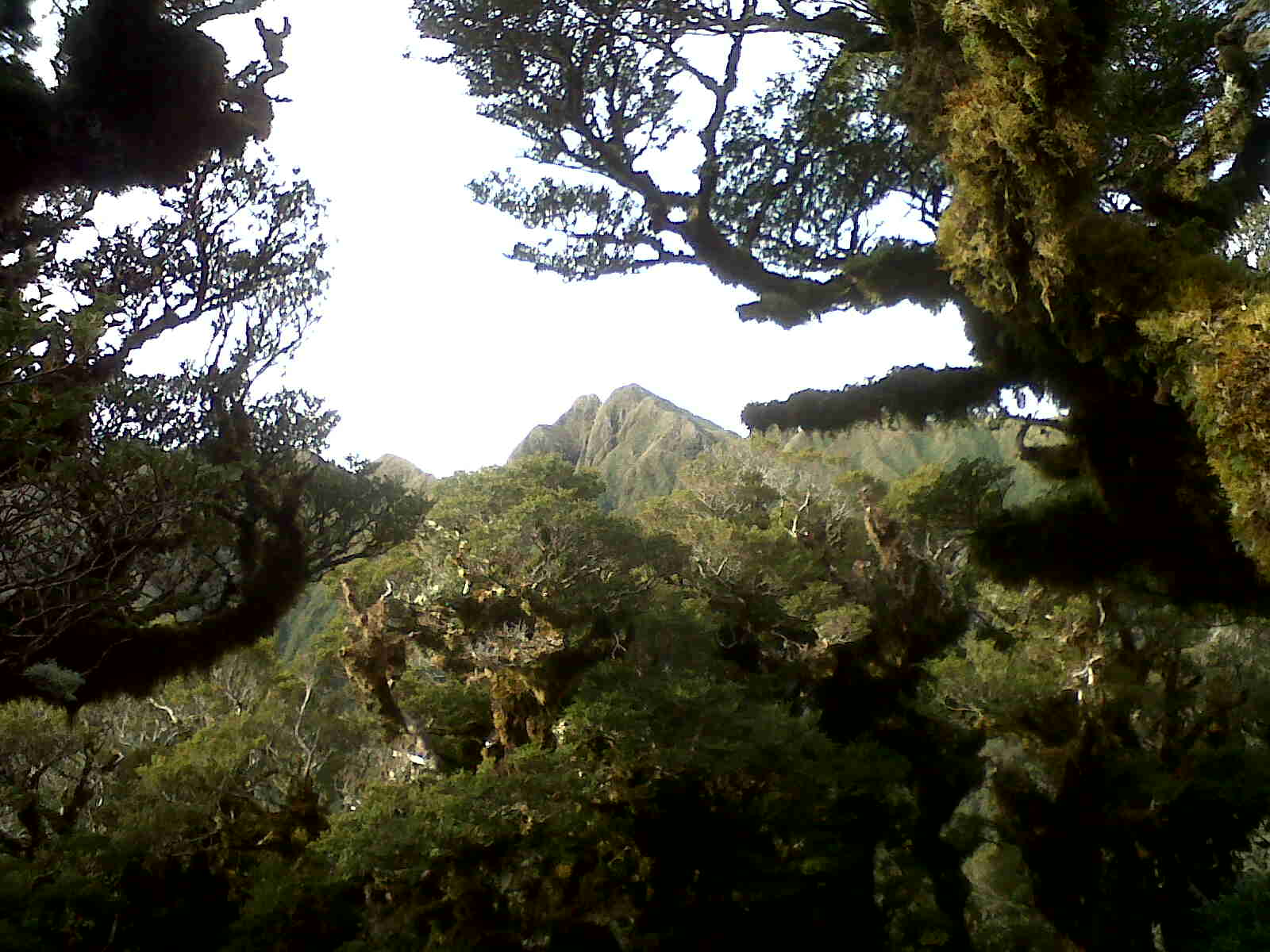
The leaf litter is dry and brown in comparison to the slippery, slimy black layer last weekend so the going is good and once on the ridge it's possible to trot along. The sun breaks through briefly on the way up but that's about the last of it for the day. Occasionally a window opens westwards showing an expanding view over the next ridge to the coastal plain.  There are a few tree falls where large trees have ripped up a plate of roots and soil. They are surprisingly thin, showing that there's not a lot of traction in the bony soil.

In recent months I've seen a lot of large animal sign on the tracks and often heard something moving off into the bush as I approach.  Only once or twice has the culprit been visible.  I suppose I would see a bit more if I wasn't intent on crashing along as fast as I could.  Today is no exception as there are frequent prints in the track.

The track passes the old hut site, now just a flat spot in the bush with a faded sign.  The bushline is low here possibly due to a vicious storm in 1936 that apparently dealt to a lot of trees.  Shortly after the old hut site and not too far before the new hut the path breaks into low scrub but just before it does I hear a large animal move off into the bush.


It's about 0915 when Waiopehu hut (960m) appears.  It's a tidy facility with great views; west to the Coast, north to a blue Ruapehu against a blue grey sky (Taranaki too if it's clear) and east to the Tararua Main Range.  An older family of three are in residence having arrived yesterday; they are just getting ready to depart. From Raumati they haven't been up here before; it's good to chat to people that are just starting to explore their fantastic backyard.  They're taking three days to do the same loop (minus the trip up to Arete) so I'm pretty sure we'll be seeing each other again today. 

Waiopehu Hut looking east to Dundas

The track continues up around Waiopehu (1094m) and on to twin peak (1097m) with the memorial to Ralph Wood, apparently killed in the same storm in 1936 that did so much damage to the bush.  The views are now panoramic and with bush cover being light there are many good viewing stops to divert the procrastinator. The Manawatu plains look huge, stretching to the coast and disappearing into haze in the North. Behind the main range more of the Tararua ridges and peaks are coming into view. And although there is high cloud, the peaks are all clear.

From Waiopehu hut; Arete and Pukematawai on the right (probably!)


;

man with a disreputable hat on the left


The track now becomes a bit of a switch back; dropping 200m and climbing 100m to Richards Knob (985m) where I will be turning off for Gable End Ridge before the end of the day.  Then dropping, rising and dropping to 690m at Butcher Saddle (where I hear a large animal moving off into the bush), climbing to the turn off down to South Ohau hut (810m - well signed) and eventually easing up to Te Matawai Hut (900m - a goat's bleating floats up from a gully).

By now it's 1120 and my turn around time of 1pm is far enough away that it looks like there is a reasonable chance of making Arete.  With the obligatory log entry and stop for a One Square Meal it's off for the climb up to Pukematawai; Arete is hidden behind.

About 500m from the hut the track I should have been on last weekend joins from the left.  There is now a small matter of 2-3km of track and a river crossing left untrod; it will keep.

As the track climbs the spur to the Main Range the wind becomes nippier and ice and snow starts appearing in sheltered spots.  The ground shows the signs of having been buried under a substantial dump in the last week or so.  For the last 100m or so the DoC sign on the ridge is visible providing a sense of scale to the target.

There's no time to spare for Pukematawai (1432m) as Arete (1505m) is less than 30 minutes away to the West.  I'm glad I donned gloves at Te Matawai but it's decidedly cold now and my light top is no match for this environment.  At the top of Arete the first order is to don a heavier layer before taking photos and admiring the view.  There's quite a bit of snow about now and the higher peaks all have remnants from the Southerly storm.


Pukematawai on right, Kapiti Island upper left


Below to the South East is a plateau with the small Arete hut and loo; probably lashed securely to the ground.  The Main Range stretches North East past Dundas (1499m) and South West where it dips below the bushline.  The peaks around Mitre (1571m) in the SSE are lit by the sun and the route of the Northern crossing can be traced across the long expanse of tops travel required. 


Looking NE up main range, Dundas on left, Logan next

From Arete; Mitre mid frame behind Table Ridge in sun,
Pinnacle spur in shadow descending to left
Far to the South is Mt Hector and the Southern crossing.  I know that Mike is up there somewhere and I note that his is the only peak in the whole range in cloud.  I contemplate texting him but it's just too cold to take the gloves off again and I need to keep moving.  Later, I see his photos on Facebook and realise we may well have been on top of our particular peaks at the same time.

Mike in cloud on Hector on horizon
It's around 1230 so well within my window but once the photos are taken it's straight back for Pukematawai and the drop to warmer country.  The down hill pretty quickly ascertains that the knees have already been working quite hard.

Back at Te Matawai hut the male members of the family have just arrived and are waiting for mum to turn up.  It's a good excuse to stop for a chat about photography in the hills (I'm in the light school of thinking which means I have sporadic record shots taken on a substandard cell phone and pretty much none when it means I might have to dry my hands) and discover that the younger chap has just returned from the UK so can spend weekdays with his folks in the hills.

It's interesting to compare the different motivations for our trips; them to spend family time at a leisurely pace with evenings in the various huts; me to rocket through bagging a peak and checking out as much of the geography as I can cram in.  Both perfectly legit, the only difference being that I don't think they're crazy and they're too polite to voice an opinion.

Around 1320 just as mum turns up I leave them to their afternoon and head along the roller coaster for Richard's Knob.  It's a relief to get there and leave all the climbing (bar the odd modest rise) behind.

By now I'm conscious of how tired I'm getting and that it will be starting to get decidedly dim by the time I get out.  It seems to take a long time to travel the flatish couple of kilometers before the track starts to drop.  It is pretty good going despite the odd boggy section.  Again, there is a lack of large trees anywhere what you would consider the normal bush line so there are good views at the start but eventually the track drops into low goblin forest and then more usual bush.  Between the bogs it's dry underfoot and a reasonable trot is possible.

A couple of wee climbs to 690m and then to 600m serve as markers of progress as the track takes a very leisurely drop down a narrow ridge to the junction of two rivers at 200m.  Another marker of progress is when the sounds of water can be heard drifting out of the valleys to the left (Blackwater Stream) and right (Ohau River).

From the bottom it's 4.4km back to the road end and as you would expect this pretty much takes forever.  Although sidling along a gorge, the track is pretty well formed and despite more occasional boggy sections it is surprisingly level. However the steep hills sides above means it is getting very gloomy as 5pm rolls closer.  There is also a concert I need to be at this evening so try to keep a bit of pace on.

At last, the sign post at the edge of the farmland comes into view marking where I headed up almost 10 hours ago.  The last trot through the farmland and past inquisitive steers (one had to be dissuaded from trotting along behind me) gets me back to the car five minutes before 5pm and home in time for my evening out.

Post Mortem

Things went pretty much exactly to plan and although I had thought it was an outside chance, I was surprised and quite chuffed to reach Arete.  It might have been more sensible to bite off a little less ambitious trip by taking the more direct Gable End Ridge both coming and going but I was keen to get around the Waiopehu track as well; Arete was a bonus and I had worked out a time to turn back should it be getting too late.

The tracks were all pretty good and easy to follow.  The Main Range section is rougher and less travelled but the ridges are pretty clear and it was a relatively short distance.  The hardest stretch was between Richard's Knob and Te Matawai; it keeps dipping up and down and every time it drops you know you just have to climb it all again.


Arriving five minutes from my estimated time out was partly a fluke and partly keeping as much pace as tired legs could muster down Gable End (which wasn't very fast by that point).  I should add that I had a good head torch in my pack and the tail end of the track is quite navigable in the dark.  Almost 10 hours on the go was enough for me; god knows how I'll fare in summer when there's more daylight hours.

Saturday 1 June 2013

Mangahao River

An Exercise in Discretion


Solo weekend trip

So much for plans. The idea was to leave a car at the Ohau River Road end (Poads road, off Stratton Road southeast of Levin) then get dropped off at the upper Mangahao Reservoir behind Shannon to tramp up the Mangahao River past the hut, over Girdlestone Saddle to Te Matawai Hut for the night; next day up to Arete then out via Waiopehu Track to the car.

I dimly recall visiting the area in 7th Form to do the Northern Crossing, and my mother informs me we camped at the upper reservoir when I was in nappies.  In other words, it's high time to get reacquainted.

Saturday

We're up at 5am and ready to leave Wellington but the plan takes its first hit when one of the cars has a flat battery.  It turns out the last time we filled it up with petrol was 6 months ago so hardly surprising really.   After a jump start we're away half an hour late.  It's light by the time we cross the cute wee bridge at Poads Road and leave one of the cars. 

Shannon is next and we head into the hills past the 126 GW Mangahao power station and the white water canoeing course.  Over the top of the first ridge we realise it's a lot further in then expected and the petrol is low.  So back we go. 

The road in is well formed with a few roughish spots but fine for any car.  It's about 21K from Shannon to the road end over two ridges and past two reservoirs before reaching the upper reservoir.  The mist is hugging the hills and shrouds the other side of the first reservoir.  The occasional shower wanders through.

At 0950 the warmth of the car is exchanged for a sudden dump of rain as I head into the bush.  The DoC sign indicates 5 hours to the Mangahao Flats Hut and up to 10 hours to Te Matawai.  If I want to make it before dark I better get a move on.

The track is rough, rooty and muddy in spots.  A layer of slippery black leaves cover the ground making footing tricky.  From the map the track looks like it follows up beside the river but knowing Tararua tracks, this means it is going to be ducking and diving up and down spurs and into side creeks; which is exactly what it does.


There are four bridges between the dam and the hut which help mark progress.  The second swing bridge crosses the main river and is relatively new (the old one still hasn't been taken out but is blocked off by magic "make-it-safe" plastic tape).

The first real look at the river reveals it is a lot bigger than I was expecting.  I keep a weather eye on it during the morning as the track will be crossing it further up valley.  

In the steep sided valley the sides of the track are a bit crumbly in places and there is quite a bit of clambering required.  On the flat sections tree roots twist across the ground trying to find a toe hold in the stony ground.  This all makes for interesting travel and a couple of rolled ankles; on the same foot worse luck.

Further up the valley a few flats open up, one even has a picnic table; they would be very pleasant stops on a hot day.  

Harris Creek is a bit over half way and it's very high, I seem to be making good time and sure enough it's about 1215 when the Mangahao Flats Hut suddenly appears. Something large moves off into the bush but I don't get a glimpse, I suspect a deer as I've seen no pig sign and haven't smelled any goats.  

The hut is a good size and clean.  Hemmed in by bush it looks down across a small flat to the river.  A quick break to write in the log and a bite before heading on.  It appears that no-one has been here since 13 May.

The track continues up beside the river crossing occasional side streams.  Each one is a welcome sight as it means that much less water in the main river as the crossing point gets nearer.  Glimpses of the Mangahao River shows it is still big and fast flowing.  I manage to catch an eye on a branch which fortunately doesn't knock the contact lens out but is annoyingly sore (and spectacularly bloodshot the next day).

There's one big side stream which at first glance looks dicey, however it's a bit wider down stream so a quick bush bash finds a suitable spot and a handy rock midstream gives something to grab onto.

It's about 2k to the main crossing and one look gives the answer ... nah.  There's no way I'm going into that on my own.  Bush bashing up river shows it is steep with white water rushing over large rocks and the map confirms that I'm not likely to find anything better within a reasonable distance.  Down stream provides no better news.

I figure that it doesn't pay to think about the transport aggravations that are contingent on the decision to cross or not.  It's a bit of a pain but turning back is the right call.  There's no time pressure so it's a more leisurely pace back to the hut. And the rain starts in earnest. 

Back at the first stream, water is now lapping over my mid-stream rock.  I find a suitable branch, remove coat, loop the PLB over my neck and undo waist and chest straps. It's actually an easy crossing but with the main river a few metres away I'm not taking any chances. [A couple of less than ideal calls here - should have left the hip harness done up and it can be risky crossing too close to the confluence with another (especially larger) river - should have tried up stream first]

Back at the hut four early-20 year olds from Palmerston North (and Ohakea) are in residence.  It turns out they arrived at the road end just as Sally was leaving.  They are friendly and chatty and have brought mountains of food, drink and games.  The two women are students and they seem to have been friends from school days.  They invite the solo old (surely not!) tramper to join games of Monopoly cards and Five Crowns while it gets dark outside.  The hut fills with smoke from the fire.
  

Sunday

The morning is misty and with a fair amount of rain in the night there's no point heading back up river to see if a crossing is possible.  The task for the day is to get into cellphone coverage in order to call for a pick up.  This means heading back to the road end and climbing a ridge (either Puketurua track or to Burn Hut) or walking out.  I figure that walking out is the best bet; if there's no coverage on the ridge I've just wasted time and effort.

The other party are just starting to stir when I head out into the saturated bush.  The rain comes and goes and it's quite dim under the trees. The river has certainly not dropped overnight.

The four bridges pass and finally the upper reservoir. There is a lot of water where there wasn't any before.  At about 11.35 it's taken about 2hr45 to get to the road end.  On the road it is initially a jog on the flat and downhills then just on the downhills and finally just walking the long kilometres into town.  Cellphone coverage doesn't come in until a couple of kms short of the power house.  

The walk gives the opportunity to study the hydro set up.  The top dam regulates water flow into the lower Mangahao Reservoir where a tunnel takes water out of that catchment and into the Tokomaru Reservoir in the upper catchment of the Tokomaru River.  Another tunnel takes water from there through the hill and I reckon about 160m down to the power house.

The Mangahao River drains naturally from the 2nd reservoir north and east joining the Manawatu River just before it flows through the gorge.   The Tokomaru River heads north and east before swinging west and south to join the Manawatu River a few kilometres from Shannon.  Water from the power house joins the Mangaore Stream which enters the Manawatu River just down from the Tokomaru confluence.  So the water all ends up in the same place but takes completely different paths on the way.

Apart from the rain the only other things of note are a track marker for Te Araroa (the walkway that runs the length of the country) and the only car on the road; driven by a miserable .... that doesn't stop to pick up a wet tramper 6km from the power house.

In the end there are no lifts and I walk all the 21+ km to the Horseman Cafe on the main street of Shannon, arriving about 2.15 (coincidentally taking about the same time as we took to walk the St Claire half marathon in Marlborough last year).  A hot chocolate revives spirits and it's not long before my infinitely patient driver arrives for her second foray to Shannon in as many days.  Next stop Poads Road and maybe just a quick nip into Levin to visit the Swazi shop.

Although the main aim of the trip wasn't realised and the weather was a bit damp, it was good to get a look at and feel for this part of the Tararuas.  And I didn't mind the rain so much.  There's definitely scope for another trip or two into the area but I think I'll be looking to try that river crossing with someone else.