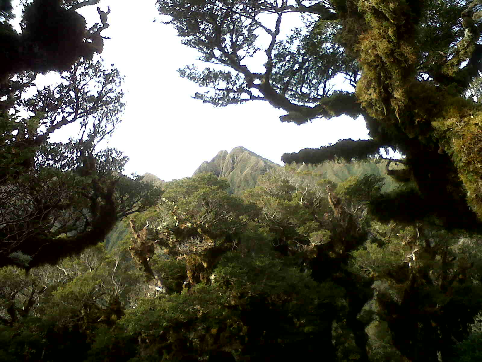
Showing posts with label Main Range. Show all posts

Sunday, 27 March 2016

Poads Road to Waiohine

Easter is looming and a few ideas are percolating around possible routes. Otaki Gorge being closed puts a dampener on a few plans, but eventually Plan A crystallises: Thursday arvo follow Te Araroa  into the north-western Tararuas (behind Levin), travel down the Main Range to exit via Waitewaewae, Otaki Forks and Waiotauru to Akatarawa Saddle. However, a number of Plan Bs are noted on the intentions sheet left with home command ... the main one being to connect at Waiohine with Mike, Angela and Toby who are over-nighting Saturday at Totara Flats. That is provided I can call-in the change - how did we ever tramp without cell phones?

Thursday 24th

We leave for the coast about 2pm smug in the knowledge that we will be beating the usual long weekend Kapiti traffic fiasco. Wrong; nose to tail until Waikanae and over an hour later than expected.

       
Kapiti traffic - Roll on the Express Way.
Much better at Poads Road Bridge
A little gloomy though.


Ready for action
At 5pm with sunset due around 7.30, the trip up to Te Matawai is looking ever more likely to end  in a bivvy beside the track. Te Araroa heads up Waiopehu Ridge giving the opportunity to stay at the hut at the bush line, but I'm taking the Ohau Gorge Track and up Gable End Ridge - so named (I assume) because it's a little like climbing the side of a house and wandering along the roof.

It's overcast and warm, so much so that at the bottom the shirt goes into the pack. The light gets dimmer until (7.15pm) the last gasp of evening sun angles in just under the cloud bank and just over the Waiopehu Ridge. The dim bush takes on the golden highlights for a few short minutes before fading into deeper gloom.

The track is reasonably easy to follow but eventually the fading light calls for the head torch. There's no signs of life from Waiopehu Hut across the valley as I come up and over Richard's Knob and join Te Araroa. The lights of Levin and possibly Palmerston North are briefly visible through the cloud.

It's quite a different proposition in the pitch black but I manage not to lose the track or fall off the edge. As it drops towards Butcher Saddle I'm concentrating on keeping upright on the slippery roots and only gradually notice the white noise of the river filtering up from the valley below. A couple of Morepork are exchanging calls from close by but not a chance of seeming them, otherwise it's a still and humid evening.

In the saddle the cloud filters through the trees scattering the headlight but finally there's a sign advising that left will take you to South Ohau Hut via Yeates Track or half an hour upwards to Te Matawai - and that's pretty much how long it takes, arriving a little before 10pm.

Judging by the log book, Te Matawai gets pretty good use and I'm lucky to have it to myself. The log is full of references to 'NOBO' and 'SOBO' - finally it clicks - it distinguishes between the NOrth BOund and SOuth BOund Te Araroa travellers.

Flashes and grumbles from a distant thunderstorm fail to materialise into anything more than some heavy drops on the roof and a bit of wind during a restful night.

Friday 25th

It looks pretty foul on the tops as I head away from the hut bright and early (well, 8.45). Pukematawai and the range to the north are invisible, but my route south down the main range intermittently peeks through. The view behind (norwest) however remains bright, with Te Matawai Hut gleaming in the sun staying visible most of the way up the ridge.  Beyond, Waiopehu Hut is just discernible if you know where to look.

Looking Back - Te Matawai Hut is the bright spec mid-left.     The near ridge runs down to Girdlestone Saddle, Gable End Ridge behind it and Waiopehu somewhere on the horizon

Looking up towards Pukematawai (obscured)
A little over an hour after leaving the hut, Pukematawai is inside a cloud with a decidedly cool and boisterous wind whipping over the ridge and trying to nick my cap. The sign at the top looms out of the clag with the cheerful advice that Dracophylum and Nichol Huts are a mere 3 to 7 hours away ... unspoken is the amount of exposed ridge between here and there.


Top of Pukematawai 200m away 
However the ridge drops away from Pukematawai and soon there is a reasonable view ahead with the Park River head waters below to the left and Te Matawai yet again visible in the distance - to the north now. I'm even thinking I might need to crack out the sunscreen. However, for the rest of the day there's more wind and clag and very little view to the east.

A more encouraging view south above Park Valley. 

The track is good going and easy to follow although the cloud soon closes in again. Across the valley a helicopter is operating - possibly on Carkeek Ridge - hopefully hunters and not a rescue.

I had been thinking of stopping for lunch at Dracophylum Hut, which is a small cheerful looking two berther, but it's only 11.30 so elect to head on for Nichols.

One for the hut baggers.

Coming over Nichols it's getting more seriously unpleasant and I'm conscious that there's a good few kilometers of exposed tops ahead including the highest point of my trip at Mt Crawford. I'm looking forward to a bit of shelter and a chance to fill up and rug up at the hut, which proves to be in good nick.

Around 2pm, cheese, salami and pita bread feed the inner man and raincoat and other pieces of kit are relocated from pack to person. The forecast is for the weather to clear. I'm quite comfortable in the conditions as they stand, and have extra layers should it deteriorate, so am happy to leave the hut and head on.

Leaving a perfectly good hut - Nichols.

With little view there's little point hanging around the tops so I count off the spot heights to and past Mt Crawford. I also grumble at myself for bringing glasses instead of contact lenses - the east-most lens misting over rapidly after each abortive wipe. Things are going well and I'm feeling pretty good so fish out the cell phone and text my intentions to switch to Plan B and the Waiohine Road end. A confirmatory response means a short stint further along the ridge to Anderson's rather than the long plunge to Waitewaewae.

There's two sets of fresh foot prints on the track so I'm half expecting company when I arrive at Anderson's Memorial Hut at 4.30. However, the log book indicates that the owners of the feet are heading on to Aokaparangi Hut. Being a two bunker I figure I might be a little less than welcome if I follow them, so call it quits for the day, hoping for another night with a hut to myself.

Anderson's Memorial Hut.


I was taken with this hut the first time I passed through with its situation on the edge of an alpine terrace enfolded on three sides by the bush. It's pleasing to see it in good nick and with an intact log book including my entry from three years ago.  There's also one SOBO entry from a poor soul who missed the Te Araroa turn off at Junction knob and has a little back tracking to do.

I don't need the fire as I'm looking forward to an early dinner, bed and undisturbed sleep.

Saturday 26th

The clag is still drifting past the windows in the morning but it could be a bit thinner above, so I'm hopeful of some better weather today. The clothes are not noticeably drier than yesterday afternoon, but it's not cold enough to be unpleasant. 

Departure time

The track dives straight into mossy beech forest to dip and then climb. 35 minutes after leaving I'm looking back from the flanks of Kahiwiroa at a bank of cloud with Mt Crawford above in the distance.


Mount Crawford and the range disappearing to the North
An hour 45 after leaving (and having shed some kit) I'm enjoying changing cloudscapes from Aokaparangi. A lot of the ridge travel may be in clag but the wind is light and the breaks provide some beautifully typical Tararua views.

North from Aokaparangi

I'm still following the footprints from the party that came through yesterday afternoon with some occasional fresh deer prints. After the turn off to the hut, the prints re-appear fresh so they have clearly regained the trail after a nights rest.

The way forward and South - a little gloomy

Forty five minutes later - much better!

My recollection of the next section is of several steep clambers and losing track of the number of spot heights. I do a little better this time but it is quite lumpy and I'm still expecting one more when I realise I'm ascending Maungahuka. The clag drops away behind and more of the main range is visible north and south. The wind has also dropped to a most uncharacteristic calm.

North from the shoulder of Maungahuka ...

... looking up to the hut ...

... and southwest to the Tararua Peaks ...
I swear I could see the ladder when I took the photo but can't spot it now.

Just before 12 I stop in at the hut to find that the footprinters have left 45 minutes ago after noting in the log book their nervousness about tackling the ladder.

At the top of Maungahuka I see two figures angling up a steep face beyond the peaks and can hear their voices in the still air.  They have clearly overcome any nervousness about the clamber but are too far away to be able to exchange information.

The peaks scarcely register with climbers but they are a little daunting to trampers for the first time. I was a bit hesitant about tackling them on my own so follow their progress with proprietorial interest, imagining how they'll be feeling and expecting that their enjoyment will be all the sharper for the passing nerves.

Decisions
Although it's tempting to carry on along the range, about 1230 I turn my back to follow my ridge down into cloud and a thousand metre knee-curdling descent.  The sun is hot for a brief period but thins as the mists thicken long before the bushline (1100m).

Down into the gloom

There's not much to say about the rest of the descent - the 100m rise over Concertina knob prolongs the agony but is a good excuse to stop for lunch. I also pass through the territory of a couple of fantails who flick by to see what's up and three rifleman who just go about their business barely giving a glance to my pathetic attempts to imitate their high-pitched sounds.

Eventually there are glimpses of bush rather than cloud across the valley and river noise from below. After the final scramble down, the trees open to show the crystal clear Hector River flowing over clean grey boulders. Also the gleaming white form of a naked man gingerly easing himself into the frigid water. I pause briefly until he's fully committed then trot out onto the swing bridge calling a cheerful greeting and condolences about the cold (hmm, that could be misinterpreted).  I'm probably the first person down the tracks in days so his luck is not in. Kudos to him though for a full immersion in a cold river on a cloudy day.

Naked man just out of shot to the left

It's 2.20 and Neill Forks Hut is just across the bridge. It's also full with a party from the Hutt Tramping Club including Naked Man. There's a couple of semi-pointed remarks about my intentions and the number of bunks, so I accept a cup of tea and indicate that I will be heading on.

Half an hour later I'm on the way up Cone Ridge for the second time in as many weeks, but from a different direction.  The knees quite rightly grumble about a 600m climb after the mistreatment down from Maungahuka. However, an hour later the ridge provides for more relaxing travel south in recently familiar territory.

Phew.


It's a little before 5 when I reach the tops at Cone. The cloud keeps coming and going and it is a little different to a couple of weeks back ...


Cone


Then and now ...

I figure I can make the road end before it's too dark, and there's cell coverage, but Brother Number 1 is away from home so can't do a pick up, and I don't relish camping at the road end. Cone Hut it is then.

It's a pretty quick trip down the ridge to the saddle stopping briefly for (another) fruitless attempt to capture the magic of sunlight through goblin forest.

As good as I think I'll ever get on my phone

There's another pause when I run into the tail end of a party of seven. It's 5.30 and he's going pretty slow, so too is his wife five minutes further on, and two young woman another five minutes later. At 6pm at the Saddle the other three are not particularly concerned about the progress of the rest of the party and elect to follow me down to the hut - I'm figuring the rest will be hobbling in well after dark.

At 6.30 I'm first at the hut and get dibs on the sleeping platform. A solo chap soon turns up from Kaitoke having eschewed the crowded Tutuwai, despite which he's keen for a chat and a chain smoke.

A little later the two women from the saddle turn up having left the third chap behind. The mystery of the mixed party is resolved - four of them are from Marsden College doing a Duke of Ed. trip accompanied by the required adult supervision that they arranged via face book. The son of said adults makes up the party. The parents and the other two students eventually turn up just before 9pm - much to my relief as, very selfishly, I wasn't keen on being on a search party.

They are having a fairly eventful time - the trip from Totara Flats Hut via Cone Ridge has taken almost 10 hours; one of them has impressively bruised her ankle (and is pretty upbeat about it), and the father is going through all sorts of agony due to various health conditions including the aftermath of a broken back.

After a few days of my own company it's pretty full-on, but the students are quite competent with what they are setting about and considerate.

The sleeping arrangements resolve into six in the hut, parents under a fly (by preference), and the solo chap on the table outside. I thought this was a little mad but it didn't rain and he was adamant he didn't require floor space in the hut.

Sunday 27th

There's is absolutely no hurry for me in the morning so I let the mayhem clear a little before I exit pit and arrange breakfast. Solo chap is tossing up exiting via Marchant or Dobson Loop and the other party is aiming to exit over Mt Reeves. The lass with the injured ankle is strapped up and the father decants gear to his family to lighten his massive load. The Duke of Ed team are packed first and have remarkably economical packs. Eventually the last of them head off and the hut is suddenly quiet in the morning sun.

Built in 1946 Cone hut has survived some recent vandalism but shows signs of continuing graffiti assaults by the mindless. A rather nice slab woodshed has been built with a small water butt from the roof and the uneven dirt floor has been covered with tidy plywood. I remember being very relieved to reach this hut on a previous occasion and hope it serves for many more years.

The sun streams through the trees for the trip over to Walls Whare which is becoming quite familiar. I meet a man and woman with rifle and dog on the way up but no-one else until the swing bridge. About an hour and a half after leaving the hut I'm hunting out Mike and Angela's car on a hot sunny day. They turn up a couple of hours later with Toby having enjoyed camping out on Totara Flats. In the meantime I've had a wash, dried my gear and brewed my last coffee sachet.

Coda

I was happy with how all my kit performed and it was great to finally negotiate the territory from Pukematawai to Junction Knob. The route was interesting and varied, with the capacity to be significantly challenging in bad weather. I reckon it would be doable in two days by the fit, but two and a half to three allows a little more time to enjoy the views, take a few pics and not have to leap out of bed early.

All up, a mighty fine long weekend.

Gear notes

Mostly used standard kit. The penny stove performed fine inside and in the open at the Waiohine carpark. Still wouldn't want to rely on it for trips not involving huts. Macpac bivvy tent was carried but still remains to be rigorously tested. Zamberlan boots continue to impress with their comfort, lightness and (so far) durability.


Saturday, 15 June 2013

Penn Creek one day loop

A bit of a knee wrecker

Solo day trip

Click to access map in new window

To make the most of these winter days you've got to be about early; I'd say 5am classifies.  It's five to seven when the car door slams at Otaki Forks car park and the beam from my head torch picks out the ghostly white of frosty grass.  A bit of a jog is indicated to stave off the chill and get the day moving.

The plan is to do a loop from Otaki Forks, past Field Hut to drop into Penn creek, climb Pakihore Ridge to McIntosh on the Tararua Range, follow the range back to Kime Hut and return back down Judd Ridge to Field Hut and the car park.  The two thirds I have done before is fine; the Penn Creek segment is a bit of an unknown so I'm a bit fixated on watching the clock today.

The pre-dawn light is not yet quite bright enough but the path is a real highway so I could probably have got by without a torch for all but the first couple of hundred metres.

An hour later at Tirotiro Knob (855m) the sun lances in under the high cloud and briefly lights the bush.  There's not much more sight of it for the rest of the day.  A few minutes on is a clearing where Mike and I saw a pretty sunset over Kapakapanui (1102m); this time Kapa' is picking up the morning sun and the bare tops and slip are clearly visible.  A photo stop is a must; having recently visited the top for the first time I feel I have a proprietorial interest.

Kapakapanui catches the first and last of the sun

Field at 0810 has a couple if groups gearing up for the day.  A group of five from Vic Uni got in late last night and are just waking up for a trip up to Hector.  An older 2 blokes and a woman from Tararua Tramping Club are intending to visit Kime before returning.  I identify myself as being from WTMC, despite everyone being in a club none of us are on club trips.

It's good to chat as they make their tea and exchange plans for the day.  One of to the TTC blokes notes that there are warnings about dangerous slips on Penn track.  I'm aware that the old gorge track is dodgy but this is the first I've heard that my route for the day might be a problem.

Heading up the hill the frost is getting decidedly firm and puddles are iced over.  Across the Penn catchment is Pakihore Ridge.  My track plunges into the depths of the valley then struggles onto Pakihore which will take me up to the main range (which is looking decidedly long and lumpy from this angle).  Out of sight is Hut Mound and Kime Hut which is where I will begin the descent back down the ridge I'm standing on.  It's all looking a bit daunting  but being ahead of time is a good start.

Judd Ridge near Penn turn off, a bit of frost on the track.
Bridge Peak on right

Some photo attempts have limited success in the dim light and it is twenty to nine when the track to Penn Creek peels off at about 1050m.  A short way along there is a stern sign warning about slips and people having to be rescued. I figure that I'll head on down and decide when I see the slips in question.  The track is a little rough but fine and easy to follow. It wends across the tussocks before diving through the scrub and into the bush where it drops and drops. 

On the left at about 700m a stream appears in a deep gully and the sound of Penn Creek drifts up on the right.  Eventually the bottom and a stream crossing which has been known to be impassable but is fine today.

The track continues down the valley climbing onto and following old terraces.  Somewhere on the left is a navigable route up a spur but there's no time to try to find it today.

It's 0940 when the track opens to a small grassy flat and Penn Hut (220m).  There was no slip damage evident anywhere on the track and I'm a bit tetchy about the DoC sign which inaccurately warns people out of the catchment when there is access to the hut and another exit route.  The sign is repeated down stream of the hut which is where the access to the old gorge route is and where I would expect the slips to be.

The hut is a standard 6 birth and is clean and tidy. The last resident was last Sunday.  Heading off at 0950 the first order is crossing the creek. Its a good size and nippy so I grab a stick, although not really necessary, the third leg is helpful.

This was always going to be the tough part of the day. The climb is about 1,000m on a track that is not as well maintained as some. The start is chaotic as the foot of the slope is wet and loose so there are a number of tree falls to negotiate with lots of loose soil and rock and rotting vegetation. The track is marked but with the tree falls it is easy to miss. However, the track soon dives upwards and into drier forest providing easier going. It climbs steeply to 973m where the spur meets the Pakihore Ridge, here it turns right and meanders upwards at a more leisurely pace. It takes 2 hrs to get to the intersection with the Tararua Range just before McIntosh (1286m).

On the way as the trees thin there are views across to Judd Ridge and up to the main range. At one point the Tararua Peaks can be glimpsed but are soon hidden.

Tunui and Tuiti, quite close together from this angle

The whole way up the ridge there are fresh deer prints on the track. Just after seeing the peaks I round a corner and am at least as startled as the deer standing 10m away (not for long), it quickly moves away and is lost to sight.  It looked fat and healthy on all that good native forest kai.

Reaching the main ridge is a milestone; it's semi familiar territory and there are no more big climbs (oh, except for a small matter of 300m up Bridge peak and a few intervening knobs). There's more ice about and the wind has got up. An extra layer and gloves are necessary, as is some voltarin for a couple of knees that are complaining about the outrageous abuse.

The trip along the ridge is a little slow due to tired legs and a few stops to look at the stunning views.  The cloud ceiling is so high that no peak is obscured and the South Island is clear to see.  Kapiti Island hovers just off the coast and patches of sun pick out parts of the Wairarapa.

Finally the next lump on the ridge is the last 300m up to Bridge Peak. I take the sidle to Hut Mound and over to New Kime Hut.  On the way noting that the tarns are covered in thin ice and some poor bugger has dropped his cell phone in the track.  It has water in it so is probably stuffed but I pick it up to leave in the hut to dry.

Approaching Kime the ground is frozen but it's the new hut that is of interest, it looks pretty flash; larger and more comfortable than its predecessor. It's 1340 when I open the door to the new vestibule.

New Kime

I expect to see one of the groups from this morning but there is another solo chap from Levin chatting to his wife on his cell phone.  He's just up for the day but has brought a reasonable amount of gear including a billy.  I decline a cup of tea as I want to keep moving.  Then stick around and talk for 15 minutes; twit!

Inside new Kime

Despite the double glazing and orientation it's cold inside but I can imagine that with a full house it would get pretty warm.  Apparently the TTC group have been through already and the Vic group haven't got back from Hector yet.  They start turning up as I leave, taking photos behind as I go.

New Kime from a distance.  Old Kime was just in front of it

It's down hill now so a bit of pace is possible despite cold and tired legs.  A couple of people have pottered a short way along the track down to Penn but they're not from a group I have seen today.

Just above Field two lasses are heading up for what I suspect will be a dim arrival and cold night at Kime.  Given the front that is coming they are also likely to be in for a bit of a wet and wild trip down on Sunday.

Field seems to be full but this may be due to the presence of some children (and possibly the reason for the lasses departure?).  The TTC group are about to head out and I'm just in front of them at 1500, after filling in the hut log.

The trot down is uninterrupted with only one new person a few minutes from the bottom.  She seems a bit young to be out on her own but is heading out on a good track so I jog past.  Heading out onto the flats the first fingers of cramp start poking my left calf at each step.  Lifting the toes and leading with the heel is just enough to stave them off until arrival at the car just before 1555.

Post Match Analysis

Everything went according to plan and the weather agreed with the forecast.  The time up to Field (1:15) set things up well to keep ahead of schedule all day.  The tracks down and out of Penn were rough in places and steep but navigable.  The main ridge is exposed (Duh!) even in mild weather and the amount of climbing slows estimated progress. The track from Kime down is good and getting better allowing a cracking pace; 2 hours back to the car despite photos and chatting at Field.  So about 9 hours all up making this a feasible one day trip.

And why call it the knee wrecker? A rough estimate is that there is something over 2,800 vertical metres of climbing with (obviously) the same amount of descent.  I think I might go back to biking for a couple of weekends.

Friday, 22 February 2013

Tararua - Southern Main Range

Otaki, Kime, Waitewaewae loop

22 – 24 February 2013
Solo

The good thing about picking up tramping in the Tararuas after many years’ break is that everything is new and most trips go somewhere you’ve either been meaning to go for ages, or have forgotten most of the details from school and ‘varsity years.

The southern end of the Main Range is one of these. It sits there on the map and is visible from many vantage points, but weather and circumstances kept conspiring against knocking the bugger off.

This weekend I finally manage to get around to it.

After reading various accounts of parts of the trip on the web I decide to start from the south. The reasons are simple: I’m comfortable with a torchlight trip up the Judd ridge which gets the main climb out of the way before Saturday morning, the Tararua peaks are knocked off early in the trip, and as Kime Hut is going to be ripped down in two weeks, it’s the final chance to spend a night there.

The trip has loomed as a slightly daunting unknown. Looking at the maps it looks like a lot of exposed travel and there is the matter of the ladder and chains around Tuiti and Tunui; anything requiring that amount of engineering has got to be intimidating.

Friday – Otaki Forks to Kime

The weather forecast is good, but then 4 days out starts predicting cloud with strong southerlies on the Friday, and possibly cloud on the Saturday with winds dying. It stabilises at this, and I watch with a jaundiced eye as clouds bowl through Wellington all Friday. However, I decide to reserve judgement until Field Hut.

The phone goes just as I am about to beat an early exit so it is not until 5 that I’m in the car and heading for a traffic jam starting at Whenuatapu and lasting until Waikanae. Imagine doing this every day. The wind is whipping the trees around on the coast but the clouds clear quickly apart from some suspicious characters lurking around the hills.

In the end it’s 7.10pm when I leave the car at the overnight park (140m) and set out. The sun has left the grass flats, but I catch it on the toe of the ridge. This part is familiar after coming up with Mike under similar conditions a couple of weeks back. The sun is a little lower this time, so I see the same views but with sunset well advanced, and the air is once again perfectly still.

The new head torch comes out just before reaching Field Hut (830m) around 8.45. I stop long enough to have a chat to a couple of older guys doing the same loop over a couple more days, top up my water, jot a note in the log and head on up. By now it’s dark but above the bushline a half moon makes itself useful.

The wind picks up a little but I’m still just OK in a microfibre T-shirt and shorts.

At first there seems to be nothing to see outside the pool of torchlight on the track. But then the white flowers scattered along the track catch the eye as they seem to fluoresce in the light. And climbing higher the lights of Otaki then Paraparaumu show as clusters of orange on the horizon. The moonlight bathes the clouds which sit like a bad wig along the main ridge. At one point there is an almost invisible glow in the middle of the dark valley on the north of the ridge. Possibly Penn Hut, although I’ve never noted it by day.

The ridge climbs south-east and there’s only one direction to go on the easy-to-follow track. However, this also means the Southern Cross and Pointers are positioned for easy confirmation of the direction of travel. I keep this in mind for Bridge Peak and Hut Mound where the route flattens out and there are a couple of junctions.  More for practice than any real need.

The wind picks up further near the top of Bridge Peak (1400m) and it’s tempting to stop and rug up but it’s not long now so I settle for eating a late night dinner sandwich as I potter along under the moon. Far off the lights of the Hutt and Wellington smear the horizon. Eastwards the clouds hug the length of the main range, and I have already climbed above the lowest of them. I assume the light southerly is keeping my ridge clear.

The turn off for the main ridge at the top of Bridge Peak arrives and I think of Te Papa boss Seddon Bennington and his friend Rosie Jackson who died up here in poor conditions in 2009. It’s not 100% clear what happened but it seems that they didn’t act on weather forecasts and signs, or the warnings of other trampers. They may well have been in a frame of mind of the hut being so close they just had to push on and make it. Whatever the reason they ended up 800m down the main ridge track, 90 degrees off course. Without a tent they huddled in their bags under a survival blanket, she died there while at some point he left and died 300m up the track towards Kime. It gets you thinking about risk assessment and decision making in the hills.

Although familiar with the turn I take particular care to check tonight and take another fix from the Southern Cross. After Bridge Peak the track climbs over Hut Mound (1440m) and can be a little tricky to find as the rusted warratahs are not exactly high-vis. However it is on the same bearing and over the top of the Mound the wind instantly drops to nothing. There are no lights visible as I make my way down the water channels towards the hut.

Its 2220 when I arrive and I’m pleased to be there, after a little over 3 hours steady tramping and a climb of 1.3km, after a hard week sitting in meetings or in front of the computer. The hut is half full of building materials and there are two beds left. I waste no time in getting into my bag and settling down.

During the night two things get my attention; the wind gets up and slaps the hut around a little and I wonder what it will be like in the morning; then I hear something scampering around the hut, it sounds like a rat the size of a dog – I can even hear its toe nails clicking on the floor. However, I’m too tired to do anything except note that my pack (and food) is beside me on the top bunk and relax back into sleep.

Saturday – Kime to Waitewaewae

The hut is slow to rise, so with one of the builders I’m the first up. He confirms that they are up for 15 days at a stretch; that this hut will be closed on March 4 and that they will probably be pulling it down during the following week. His dog wakes and wanders around the hut sounding for all the world like a large rat.

Muesli from a bag for breakfast then I poke around the building site (framed up to roof height – just adding the final strapping before putting the roof trusses on), and take a few nostalgic pictures of the old hut on my phone. It’s 7.30 and the sun is up by the time I leave, taking pictures backwards as I go. It’s nippy enough for two layers and the wind is variable but not too bad.


From Hut Mound there is a track that cuts the corner to the Main Ridge Track. On reaching the track  the range can be seen to be mostly free of cloud although there are some wisps forming through some of the dips. The plan for today is to get to Anderson Memorial Hut and assess options.

The first action is to lose about 300 precious metres then meander up and down along the ridge, ticking off progress by the high points reached (ranging from 1138m at Boyd-Wilson to 1325m at the peaks). The Wairarapa is invisible under cloud which spills towards the range but never quite makes it. Behind, the stretch of Judd Ridge to the west is laid out in increasing detail and Field and Hector are bare against a clear sky. To the south, Winchcombe and Neill Ridge claim the horizon, dropping away from Hector and reminding me of a very similar morning when I was looking from there to here.


There is never quite anything seriously resembling cloud on the ridge today, wisps form in the air at a couple of points but these are dragged apart in the light wind and don’t form into anything significant. The light to mild southerly stays for the morning and becomes a very helpful coolant in the hot afternoon. Taking advantage of the conditions I stop frequently to take pictures, deeply regretting that I only have a very ordinary camera on my phone.

For most of the way along the ridge that morning I am trying to identify the Tararua Peaks and the location of the (in)famous ladder. I’m still a little apprehensive but can’t help thinking that it can’t be too much worse than some of the clambering on Neill Ridge. Finally the approach begins. The first action is a short scramble up a rocky climb and the drop off beside the (now very narrow) track starts to become precipitous rather than just steep. Ahead there is what looks like a vertical rocky wall across the route; in shadow it looks like the track can’t possibly go over it. It does and isn’t too bad, a scramble sure, but I reach the top without feeling that I have had to take undue risks.


At the top of Tuiti (which is where you find yourself) there is a short scramble across the north face of the peak and you make your way down to a rope that leads down into the cleft between Tuiti and Tunui. To me, this was the hairiest point but in the conditions not a sweat. The rope takes you across the cleft between the two peaks (from where you can really appreciate how steep these things are) to the top of the ladder. It was easy to step onto the ladder and although conscious of the amount of air below your heels it’s just a reminder to hold on tight and develop a bit of rhythm to the descent.

At the bottom of the ladder there are chains to sidle around and up onto the shoulders of Tunui but mostly I thought these were for comfort rather than strict necessity. Sitting to take a photo of the ladder (which will never quite capture the height and psychological impact of the thing) I hear from behind and above “Ah, here’s the ladder!”


The couple have left Maungahuka an hour ago and are making their way around the same loop as me (but in a clockwise direction). We chat for a while, me talking down the navigation of the peaks (no sense winding them up!), them giving me some information of the route they have travelled.

It takes considerably less than an hour to get over the unnamed bump then climb up to Maungahuka Hut (past the turn off to Neill Fork Hut at 1330m). I take a welcome break at around 1030 to send a text, top up water, put on sunscreen and leave a message in the log (which I think I put yesterday’s date on – damn!).

After a bit of mucking about it’s 11 before I leave. The day is now clear, the clouds have disappeared from the eastern valleys and over the next few hours from the Wairarapa also. Maungahuka is new and tidy nestled next to its tarn.


On the map there are 5 significant high points between here and Anderson Memorial Hut: 2 then bear east, 3 then drop to bush before AM hut. Over the next 3:20 I tick these off as the heat and light winds take their toll of moisture and energy. No complaining though; the views are stunning all about; the South Island is visible and as Hector drops behind, Holdsworth takes the eastern horizon and more and more of the days progress can be seen laid out behind. The shape of the surrounding hills are less familiar as this is territory in which I have not spent much time, I resolve that this is something to be put right.

Aokaparangi (1354m) is the middle of the 3 high points mentioned above. It is noted for the drop off to Mid-Waiohine Hut (and access to Mt Holdsworth; 1470m) and for a two berth Bivvy (small hut). I had hoped to spot this but didn’t look at the right time. I suspect taking some bearings at known points would be helpful if you were keen to find it in the clag. At 200 vertical metres off the top I decide I won’t visit today.


The climbs are getting tiring now and I have got through a fair amount of water. As you drop off Kahiwiroa (1320m) and into the bush it's in the knowledge that when the track emerges again it will be at Anderson Memorial Hut(1140m). I don’t stop to check the distance on the map so the kilometre and half through the twisted mossy forest is interminable.  Eventually the hut appears through the trees with tussocks behind just as the last mouthful of water disappears.

Normally the degree of pleasure experienced on reaching a hut is related to the end of a long day or respite from atrocious weather. Today the 20 min break at Anderson Memorial Hut is a chance to top up water, stop, cool down and rest for a while. The water is welcome and I drink as much as I comfortably can, and it’s still not quite enough. Anderson Memorial Hut itself has a good feel beyond the need for relief. It’s an endearing 6 berths and a pot belly, cosy but light and clean.

There’s still a good amount of day left so I decide to soldier on to Waitewaewae. Departing at 2.40 I carefully note the climb required as the pace is not quite so sprightly as it was this morning.

50min later, Junction Knob (1375m) marks the point of departure from the Main Range and a turn west towards the great plummet. It's a chance to enjoy the view, take a few photos and try to send texts. Mt Crawford (1462m), just a kilometre to the north is not even tempting in my current desire to get somewhere to swim, eat and sleep. The other tops to the north and east are not familiar but there is a certain quiet satisfaction at how far away Mt Hector and Field Peak look.


There’s a short final drop across to Shoulder Knob (1310m) then a rapid descent to the bushline and down to Waitewaewae, about a vertical kilometre below Junction Knob. The descent is as interminable and punishing on tired legs as it looks on the map. A self-photo shortly below the bush line on first review hardly has the look of a tramper enjoying the excursion. On the second go it still looks like a painful grimace on a cadaver so no more attempts are made.

The bush is dry, spleen worts are blackened and shrivelled and the moss is crisp to the touch, but still the green of the ferns is surprisingly intense after the colours of the tops. The upside is that the mossy, bouldery, rooty track is less slippery than usual. There is a lot of leaf and branch litter on the track demanding constant attention. There seems to be a lot of branches of that particular length that the heel of one boot lifts the end of the branch to catch the toe of the following foot. The result is the foot can go up but not forward. These are often found at the top of a step off.

The trip down passes slowly. At around 750m there are a few more birds around and most of the rest of the way the track passes through the territory of Riflemans that twitter and squeak at the intrusion. As usual though, there are fewer birds then I recall from 20 years ago. It was not until I startle a group of three goats that I realise that the understory is not very dense. They crash away leaving a smell reminiscent of certain types of cheese.

The hill finishes fairly abruptly and it’s a short trip across the Otaki River on the swing bridge and around the spur to Waitewaewae Hut. The hut is packed and more are arriving. I give up any thought of getting a mattress and put my pack next to a bench under the veranda.

The prime swimming hole just in front of the hut is taken so I head a short distance back up the track to a shingle fan that promises to catch the last of the sun. Only boots and socks are spared a dip and it is exceedingly pleasant to feel the sweat and smell wash away. Afterwards the sun drives off a lot of the moisture leaving the gear tolerable for the morning and less offensive. It is also a relief to sit in the sun away from the noisy hut.

Back at the hut a family group have appropriated my bench and seem set for the duration so unless I can find another berth I’m going to have to wait for them to turn in. The MkII 10 cent stove heats dinner and I chat to a few people to pick up some gen on the track out. Most say that it is up and down and hard work. One woman who has accompanied her family took 8 hours and was clearly not looking forward to the return trip. I’m glad I hadn’t tried to torch light my way out.

A friendly chap gives me a spare mattress so I carve out a niche on the floor by the fire and turn in hoping people will settle down before long.  Eventually people stop stumbling about and shining torches and even the family group comes in to settle.

Sunday – Waitewaewae to Otaki Forks

Around 6am, one by one people stagger out to the loo with the inevitable stamping, banging and rustling this entails. Still the hut sleeps and there is no sign of anyone getting up. I’ve pretty much had enough so quietly carry my gear outside, and pack and go before 7am. An OSM suffices for breakfast and there is only one person up when I leave.

The track back is not quite as bad or long as painted. Waitewaewae Hut is at about 300m on the banks of the Otaki River. The track to Otaki Forks from the hut cuts off a long southwards dip in the river. It climbs up beside Arapito Stream to Plateau at 530m. This part is rooty and meanders up through the bush and across creeks. The Plateau section is easy going, although in the wet promises to be exceedingly muddy. The track then tumbles down Saddle Creek. At the top of which, if you’re lucky, is a glimpse of grass land in the distance (south west), if you’re slightly less lucky you also take the time to tape a blister on one heel. This section is not so well marked and the catchment is quite active so there is bit of scrambling around rocks, fallen trees and washouts.

On the way down Saddle Creek the sun cracks through the saddle behind and lights the gully. Eventually (around 220m) the track swings south leaving the creek behind and starts the long sidle along the Waitatapia Stream. The main thing to watch for is a 60m climb around a large and active slip. The track is then of much better quality, often following an old bush railway with sections of sleepers and rails still in place. At one point an old boiler for a log hauler is mouldering into the bush.

By now a decent lunch is front of mind so it's a steady clip and a bit of jogging on the down slopes. Grass lands open up below and eventually the track drops down to cross the Otaki River. Then it’s just the final grass flats. It's dry and although a lot of feet have passed since Friday night some of the prints in the dust were made by the same boots that are supporting my aching feet now.

It’s getting quite warm when the bridge over the Waiotauru River comes into sight marking the end of the morning’s activity at 1010; about 3:20 after leaving the hut.

Someone is sitting in the information shelter by the bridge. I enquire if she’s waiting for a bus and she asks if it was me at the Tararua Peaks the day before. They have just come down from Field and we swap notes about our experiences. I had noted a couple of hut log entries from them in which she was apparently feeling the burn. However the only sentiment apparent now is pride in what they have done. We agree on the luck of having such excellent conditions on the Tops which is way more memorable than sore feet.

Gear Notes

Everything behaved. The new black Diamond head torch was very good. It has a number of features that were used: the 2 diode mode is good for general illumination whilst walking; the dimming function is great for around huts and reading; the lock function is comforting when chucking it in the pack and the battery indicator is a great feature. It was lighter than another one checked in the shop. It takes three AAA batteries.

The camel back needs a clip on the harness. Sitting it under the lid of the pack has the added bonus of one half running out first meaning you have some warning before all the water is gone. However, I need to carry a second flexible bottle as 2L isn’t enough in the heat (a second bottle can function as the reserve tank).

The MkII stove may have used a little more fuel than expected. I think it sits too high on the stand, however it heated 500ml in reasonable time.