Showing posts with label Coal Stream. Show all posts

Saturday, 14 October 2017

Waiohine spot-height mop-up

One thing about deciding to try to visit all the spot heights in the Tararua Forest Park is that your  planning changes completely. Convoluted trips evolve that string together isolated locations which are not on the way from any special A to any particular B.  A side effect is finding yourself in unexpectedly delightful corners  - a case in point being Tait Stream, a lovely accidental 'find' I would not otherwise have thought to visit. Sometimes however, you find that there are very good reasons why no-one apparently bothers going to a place. 

This weekend is a final mop-up around the Waiohine gorge, hopefully picking up 11 spot-heights left behind from previous excursions.  The plan for Saturday is a figure of 8 to be expanded (all going well) into a three lobed loop - a deformed clover if you like.

What:   Navigation day trip
Where: Hills around Waiohine Road end
Who:    Solo
When:  14 October 2017
Why:    Tidy up some loose ends

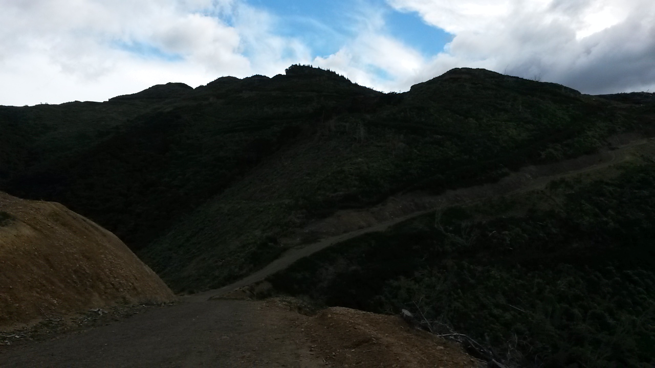
Ignore the loop on the right - that's Sunday's effort

There are 5 or 6 cars at the temporary(!) car park and, most uncharacteristically, sun on the surrounding hills. I head off about 7am, passing the hole in the access road which shows no sign of repair efforts.


The road may not be fixed anytime soon


The potter up the Cone Saddle track is very familiar now. The sun streaming through the trees - not so familiar but very welcome after this unrelentingly soggy winter. At 7:50ish, where the track levels off towards pt 572, I turn and take a bearing for the spur to 480 (just before I notice the wee bit of ribbon on a track marker that indicates the spot).


Blue skies!
480 spur


The spur shelves gently along and down through tall trunks with a clear under-story. There's a good foot trail but little marking. The odd view of blue skies is a novel experience.

At 480 it takes a bit of casting about to find the spur running east (it probably shouldn't have). I follow this to a hunters camp rotting into the forest, then (with one false start) hook off down a steep side spur above a marked but unnamed creek. The foot trail pretty much disappears and animal trails come and go. Towards the bottom it becomes a steep scramble through mucky bush, but deposits me on the track near the stream as planned. It's about 9:05.


This is the main route through to Totara Flats and fresh foot prints indicate people have been in this morning. I don't see anyone as I amble back to the swing bridge to briefly follow the same stretch of track as this morning to the Cone Saddle track - but this time continuing SSW to cross Coal Stream - with dry feet unlike last time. The first leaf of the clover is complete.


Coal Stream Track - well marked but not official

Where the track levels briefly above the other side of the stream, there are yellow squares on the left indicating a loop track over pt 308. The trail is easy to follow and well marked. There's a nice view of the swing bridge on the way up through open forest. 308 marks the second spot-height for the day. The trail dips through a wee saddle then climbs to meet the main track up towards Mt Reeves again at about 400m. 9:50 and all's well.


The spider's web in centre is perhaps the biggest swing bridge in the Tararuas

Junction at about 400m

Perfect

Things are going well and it's weird to be in warm air - it really has been a miserable winter. I'm humming along and receive a short sharp lesson about paying attention when I take a step up and ram my head into a solid branch. No lasting harm but I have a fair headache for the rest of the day. It's a little bit like biting your tongue - you can't quite believe how stupid you've just been.

The track may not be official but it is well marked with yellow triangles and some old-school tin circles. Some of these have scratches on them including one at about 525m that seems to indicate a turn, but the map just shows a tricky spur down to Coal Stream. Could be worth a look.


How to remember when and where you saw something 


A bit of compass watching and I pick where to leave for pt 668 without having to resort to the altimeter (a lazy practice I am trying to wean myself off). As usual on the more obvious spurs, a bit of ground trail comes and goes. Suddenly I'm looking at a rock face - I clamber up to discover a couple of rocky knobs emerging from the bush. It's a perfect spot on a sunny day and well worth a visit.


Pt 668

Pt 668 - a bit closer


North towards spur above car park

The view at Pt 515

The downside is that they mark the end of mature forest and the start of mixed scrub. The travel is pretty variable and generally a bit better if you hang off into more mature forest on the south side of the ridge. A few gun shots from the valley below have me a bit wary but they stay in the distance. At 515 I mentally tick off the third spot-height and confirm that there is absolutely nothing to see, so retrace my steps to try to find a spur running down towards the river terrace.

There is plenty of pig sign all the way down but they are not very assiduous about forming trails that people can follow, or for sticking to the spur. I crash down through the scrub trying to avoid the thicker patches of gorse. The occasional break gives glimpses across the river to the busy car park.

After struggling down I reach a point where I have to decide whether to go around the next spur or over a small saddle. I figure that direct is better and drop off the spur to the creek below and struggle up the opposite bank.

Part way up I discover the fabled supplejack breeding ground. There's no option but to just scramble through the carnal tangle; stepping on the vines where possible but more often than not getting them caught behind the pack and tangled in gator buckles. The top provides relief and a tantalisingly closer view of the car-park.


Yep - had to get through that


On the map the flats look like forest and from across the river tall trees can be seen. Surely this will be a pleasant wander? It turns into hell. Dense stands of supplejack merge into 3m deep kiekie. Progress is glacial and, as often as not, above the ground until something gives way and you plunge through into dank humus. The odd emergent forest giant does nothing to ease progress.


Yep - had to get through that too

I recheck bearings every 5m or so and struggle through until some clearer land catches my eye to the left. This sees me back in forest with a high canopy closer to the foot of the hill, some very old tape indicates someone has been through and headed off up the hill. I continue towards 308 eventually finding some markers leading to the top and a bit of a lie down.


Pt 308 - Part two 

It's not too late so I head back to the swing bridge (making three trips today on that short stretch of track) - leaf two complete and eying up the third.


A bend in the Waiohine - on the way off 308

On the other side of the Waiohine on the track to the car park I pick a spot and duck north into the bush to follow a terrace above Fern Creek. Last time I tried to find this spur I was a bit too casual and followed the terrace too far - ending up climbing a completely different spur. I got to Mt Dick ok but left two unvisited spot-heights behind (not that I was consciously hunting them at that time).

Since then I have discovered that when I was a nipper the family used to come and camp close to here somewhere. This was when Walls Whare was still there and hordes of unwashed children marauding through the bush frightening the wildlife was considered to be acceptable parenting.

This time there are odd, critically placed markers that indicate where to drop to the creek and cross to climb the spur north. There also seems to be a trail that may head around the base of the spur towards the gorge. I head on up - a little breathless so the long flat section after pt 295 is welcome.

The ground trail is good. I take a short rest at 532 but the wind is getting a bit cool so follow along the ridge and climb to 632 - still on a good ground trail.


Pt 632 - one pt can be pretty much the same as another
 

In theory, 632 is familiar territory but I can't say as I recognise it. The ground trail remains strong barring a bit of uncertainty towards pt 545.  Then it's onto old logging trails and things speed up markedly. So much so that I gallop past my spur and have to back track.

A bit foolishly I get impatient and take what looks like a trail leading down a sharp spur - bad call. It soon degenerates into scrub and regrowth under replanted pines. There's no trail so I eventually drop to the stream and thrash down to the road edge - it would have been quicker to head further back up hill and cast around to find the correct spur which had 4WD tracks on it.

Post script

The spur to 480 is very pleasant travel. There looks to be a better route down a little to the north of the one I took but I was looking for a challenge. The rocky knobs at 668 are well worth a visit - for lunch preferably. The terrace would be worth an explore but I think the best option would be to see where the trail leads to off 308. The old maps indicate a bridge across the Waiohine at that point and there could well be routes along the terrace edge that avoid the tangle in the middle. The terrain close to the base of the hill is also likely to be easier travel.  The hills around Walls Whare have a lot of trails - probably have a lot of hunters too. They're a bit mixed with pines on the margins, some scrubby bits and a lot of not very much view. Not my favourite corner.

Saturday, 9 September 2017

Coal Stream, Tait Stream and Mt Dick

It's been a while since we've seen brother number one and Janne, so this weekend is designed around dinner at Salute on Saturday evening with a bit of day tripping either side.

Coal stream can be seen from the Waiohine Bridge and, for most people, is just a distant sound that fades rapidly as you climb the track over to Cone Saddle.  If you've followed the track from the bridge up to the Mt Reeves track you will have forded Coal Stream - probably without any trouble.

The plan for day trip one is to head up stream to a spur which climbs to the main ridge and Mt Reeves. From here potter along to just short of Tauherenikau then dive down into the Tait Stream catchment to the east. After crossing the stream there's a long flat spur leading to the Mt Reeves track and a few options for getting back down to the Waiohine Bridge.

Day trip two will depend on energy levels after a slap up meal - one of a couple of short jaunts to knock off a few spot heights near Mt Dick is in the offing.

What:    Two day trips
Where:  Coal Stream and Tait Stream - Eastern Tararuas around Waiohine
Why:      Navigation
When:     9 and 10 September 2017
Who:      Solo
Map:  


Heading in towards the Waiohine gorge road the morning sun creates a stunning, bright double rainbow. As promises go, this one looks good, but the weather forecast is probably going to prove more accurate.

Sure enough it's drizzling at the road end which turns out to be a K and a half earlier then previous trips. The reason becomes apparent up the road where one half has dropped down a bank - in a fairly terminal looking way.

The Waiohine is up but not muddy - looking down stream from the swing bridge the confluence with Coal Stream indicates the start of this trip is going to be challenging. The energy in the stream is apparent as soon as it is in earshot and I'm thinking of plan Bs. However, at the crossing I figure that although the main current is not to be trifled with, there is potential to work along the sides. 

The stream would be an enjoyable scramble in normal flows and fine weather - through bouldery cascades, short slot gorges and up wee waterfalls. In higher flows it is not for the faint hearted, demanding care and frequent scrambles up the precipitous sides. The force in the water often precludes crossing the main current so I make slow progress up the true right.


Not big but a bit of a scramble
In true Tararua fashion the steep sides are covered in moss, black humus, and generous complements of kiekie and supplejack. Forgetting about the clock I triple check every hand and foothold; clinging to roots and trying not to rely on the treacherous kiekie stems.

That grassy stuff is kiekie - it may be good for weaving,
but a pain in the neck for climbing through

Mostly it is fairly grovelly - there is only one climb that is actually nerve wracking, requiring a vertical climb higher than I would like, and made more dramatic by the sound of the stream rushing through a slot below. There are solid trees to hold though so it is basically a ladder climb with really big rungs.  The climb emerges on to a large erosion chute for a scree slide back to the stream. 

There's a short respite but it's soon waist deep pools and careful edging around outcrops followed inevitably by another scramble. At the bottom of the steep sided valley it's gloomy, wet, and cold - but it's enjoyable work despite the battering from the stream.  Just before my target spur the sun breaks briefly through at the precise angle to shine directly into the stream bed - the scene is transformed - it is now cheerful, wet, cold, and hazardous.  It's taken about an hour 45 to get about a kilometre upstream.

The target forks are obvious - I head a short way up the true right branch to find a better line up the spur, it proves to be a good move; a clear understory with no kiekie. The noise of the stream serves to mask my movements so I'm less then 20m away when a deer crashes off down the hill. 


A nice day at the forks (momentarily)

As the noise of the stream drops below it becomes apparent how much it has dominated the senses. The rain, the bush and the occasional warbler re-establish their presence.

The spur is good travel and reasonably open. There's some pretty large beech trees and further up, dracophylum with moss underfoot. Animal trails come and go and I don't see any signs of people.

Up past 628 I eventually reach a wide flat top and a rocky outcrop which on a good day would give a good view.  At some point afterwards in quick succession there's an obvious ground trail then an old marker. I've joined the decommissioned track from Cone to Reeves. It's easy going now all the way to Reeves in the rain.

There is enough visibility under the cloud to spot the bottom parts of various hills and spurs (Bull mound, Cone ...). It's too cold to linger so a quick pause to empty river gravel our of the boots and it's on south towards Tauherenikau.

I've been along here a couple of times before so there's little call for compass and map. It should be fairly quick travel but there are a lot of branches down - attesting to a fairly tough winter.

At 1250 I'm at pt 855, time to turn east and south down to Tait Stream.

Tait stream drains a good chunk of land between the Tauherenikau ridge and the Wairarapa, it has cut deeply into the landscape, winding through its steep sided valley - and I didn't even know it existed.

It's a fine navigational challenge working down to the stream. It's reasonably easy down to 750 then becomes a bit indistinct as I head due east down to 540m requiring a bit of trust in the compass. I overshoot the turnoff to my target spur (running north) as the spur follows more naturally SSE and either my altimeter or the map is off.  Soon sorted though and I'm on a clear spur with plentiful pig rootings and beautiful beech forest.  At about 500m I take a bearing and drop through scrub with the occasional huge old forest giant in the hope of finding a steep spur down to just below a junction on Tait stream - it's gratifying to hit the spur bang on - and very lucky as the drops on either side are impressive. The spur drops steeply and despite threatening to bluff out it takes me all the way to the stream.

The spur in question running down from the high point
From Mt Reeves track


Tait stream is about twice the size of Coal stream and requires some respect - by keeping out of the main flow I work up to the junction and look for a place to cross and find a route up the other side.

It's been a fairly brief transit through the catchment and its dramatic bush, so it is with a bit of regret that I leave so quickly to scale the other side.  At some point the sun has come out but it's still pretty nippy so I stay rugged up despite the climb to pt 468.

The flat top ridge provides some respite and a brief view to snippets of fresh snow on the slopes of distant ridges - no wonder it's cold. There are pig rootings everywhere. It's easy navigation back towards the track over Mt Reeves. The closer I get the stronger the ground trail and even the odd tape marker.

At the track I'm aware that day light will be running out soon - but am hopeful that I might still stay on plan. At 745 there's a turn onto a yellow triangle track (I assume this means it is not an official DOC track) back down to Coal Stream and, in theory a point where I would depart for 668 but ... it's time to get all sensible and head back to the car.  I don't fancy crossing the stream in the dark.


Nippy on Mt Reeves track - Lake Wairarapa in the distance

It's a quick trot down the track to find that the stream hasn't dropped appreciably from the morning. A stick helps to cross the critical meter and a half through the worst of the current and it is the homeward stretch.

The road end is weird without cars or tents - now just the small matter of a K and a half walk along gravel back to the car.

There are some definite advantages of day walks. After a hot shower we're off to Salute in Greytown - under new management they have kept the old menu (so far) with an excellent selection of Tapas. A convivial evening followed by a warm bed with the sound of rain drumming on the roof.

Mt Dick

Brother number one is up bright early the next morning - I on the other hand ain't, choosing to sleep for a bit longer as the aches and pains from Saturday fade.

The plan today is to visit a few spot heights around Mt Dick, a hill in the foothills behind Carterton with unimpeded views across the plains and a public road to the top.  A lot of the area has been under pines and shows the associated devastation from logging tracks, haulage lines and clear felling. 

We leave a car at the bottom and brother no.1 ferries me to the top.  There's a walker and a biker plus the odd vehicle about. In the west some pretty foul looking weather is lurking and a decidedly icy wind is slicing in but it's still a sunny day over here. 


There are a few tactical options for getting to the marked high point (553) - I choose the wrong one, heading north along the ridge from the lookout through dense scrub interspersed with old man gorse. It's a painful thrash with no discernible tracks apart from pig trails and the top is indistinguishable apart from the absence of any further up to be had.


Looking north east up Wairarapa
From the middle of a gorse patch


Looking South east across the Wairarapa
From the middle of a gorse patch

Standing in a small tree
In the middle of a gorse patch


Rather than struggle back along the ridge I drop to the road through slightly higher scrub which allows some sliding underneath. It's a slightly surprised driver that witnesses a scratched and dishevelled tramper stumble down a scrubby bank onto the road side just as he drives past.

From the public road logging tracks head down the ridge towards the plain. The post forestry carnage is slowly being recolonised by natives and wilding pines. The positive is that apart from the top of 489 it's an easy trot to the target spot heights then down a spur to the road. All up, about an hour from 553.


Looking back up at Mt Dick lookout
From a different gorse patch  

Mt Dick from Pt 315
This time not in a gorse patch

It's pleasant to be out in sunlight for a change and the views are good - but otherwise you'd have to say that beyond the prospect of regeneration there is not a lot going for this particular corner of the Tararuas.  Tait stream on the other hand - it was pretty stunning - a longer visit could be on the cards at some point.

Saturday, 14 May 2016

Mt Reeves Navigation trip

The first winter storms arrived late this year. After an uncharacteristically mild start to autumn, this week provided Wellington with a sharp reminder of what wet and windy is like. The forecast for the weekend is equally unpleasant but suits a short trip into the Tararua foothills to practice navigation, knock off a section of route I'd been anticipating, and get a bit of bad weather experience without river crossings and staying off the tops. As you will see, two out of three ain't bad.

The plan is: to enter at Walls Whare and ascend to follow the ridge line south from the Cone Saddle track towards Mt Reeves, find an unnamed spur and descend to the Tauherenikau, stop in at Tutuwai Hut and maybe stay the night, then exit over Mt Reeves via Coal Stream.  And as you will see, five out of four ain't bad (click to see map of area).

I'm packed on Friday night so in the morning it's short work to get out the door at 05.15 and head-off over the Rimutaka Hill in the dark.  It's light  at 07.15 as I leave an empty car park at the Waiohine road end (not surprising given the forecast).

The bush is damp but not wet - the rain over the last week has softened the ground but it has been so dry that it is still just soaking in. A work colleague had remarked on this being the first week for a long time when the forest floor hasn't been dusty. Like him, I note that the undergrowth has perked up appreciably.

The track to Cone Saddle is very familiar territory now but I pay more attention knowing that I will shortly be leaving it to find my way along the ridge south.  Overhead the sky is clear and the sun starts filtering through the canopy from about halfway up. The wind also picks up, and the amount of dead fall on the track has me keeping a weather eye (and ear) out for falling branches.

It's dead easy to find my point of departure about an hour later near spot height 682: the track runs straight and suddenly turns right, someone has also put a marker on a tree indicating Cone Saddle (or Cone Hut?).


Near the turnoff to the Reeves Stream spur

The route turns out to be easy to follow, with a reasonably obvious ground trail: not too much overgrowth and sporadic markers (orange tape). Although not marked on the topo map, this route is clearly used often.  I practice taking bearings anyway, to make sure I will know when I reach my intended spur  - which I reach in about 35 minutes, a lot quicker than estimated. I had intended to keep going up to Mt Reeve and then return to the spur but decide that it's not providing much practice and if I get to Tutuwai early, I can reassess and maybe make this a day trip.

Again there are markers on trees indicating Mt Reeves in one direction and Cone Saddle/Walls Whare in the other - they don't point to the spur itself, but seeing as it diverges from the ridge exactly between the markers it is pretty obvious why they are there.


The spur travels down the true right of the Reeves Stream catchment and is pretty easy to follow. There aren't any markers that I can see, but enough ground trail to keep going with some compass and altimeter assistance. Near the top, the bush is a bit mossy with undergrowth and the route skirts off to the left of the spur, but it opens up pretty soon for very easy travel with little undergrowth.  A more authoritative account of a Tararua Tramping Club trip around this catchment is available here.


Easy going down the spur

I happily potter down bearing right at around 600m but lose the trail around 460m amidst game trails and a much busier under-story. I think I hit the edge of the clearing marked on the map at that point, as there is a lot of young Rimu and a break in the canopy. I don't try to regain the track as it's pretty straight forward to pick a way down to eventually reach the flats (mind the swampy bits) and eventually the main track. The Tauherenikau River is rushing along under sunny blue skies but doesn't seem overly swollen and it's easy going to lope along the track down to Tutuwai Hut to arrive at 10:00. The hut is empty and the last log entry is a week old.


Tutuwai picking up the morning sun

I had been thinking I would be thrashing around in untracked undergrowth for hours longer than this and might even stay the night at the hut, so this is just embarrassing.  After a look at the map I come up with a suitable plan B involving a sortie further south along the ridge from Mt Reeves. But for now it's back into the bush and a steep 600m climb back on to the ridge I've just left (Tutuwai is at about 300m).

Looking down track to where route to
spur diverges, to right of center tree 


The ground is soft but not slippery, some sections of track look like someone has bum-slid down, piling leaves up in large drifts; a result of enough rain to turn the spur-line track into a stream so it must have been a bit wild during the week. The wind is rocking the tops of the trees and occasionally attains that solid roar that is associated with the wildest days. There's plenty of windfall on this track also, so I'm inclined to be a little jumpy.

A steady pace sees me break into scrub at the 800m contour, 45 minutes later. There's clearly been an old burn or storm because the altitude is too low for this to be the bushline.  On the way up I see that before spot height 646 there is an obvious ground trail leading towards a spur that hits the valley floor near the mouth of Reeves Stream. Noted for another day.

The scrub provides views west showing a bit of cloud above the western Tararuas. It's not looking too bad at present but that's where the foul weather will be coming from.


Looking across to Marchant Ridge. Quoin ridge behind on the horizon at left, dropping right into a notch then climbing to Alpha in the cloud. Spot height 1060 on Marchant in front of Alpha, Omega is the next lump up ridge to right of 1060, the indistinct knob to left of 1060 is 953; the top of the Block XVI track.

Sharp knob on horizon to right of center Winchcombe(?), cloud over Hector to left of it.  Bull mound on ridge in front rising gently to Omega to the left. Rounded top of Cone on right of photo. Tauherenikau River below seen through mouth of Reeves Stream catchment. 

The catchment down to the left is Reeves Stream, the spur in the middle distance (just above the top of the shrub) is the route down from the ridge to the right.

The first requirement of Plan B is cellphone coverage. There's plenty so I call in my changed intentions and turn my attention to finding a route south along the ridge. It's a little after 11, so lots of day left.

I miss the spot and flail about in the Draccaphylum before finally working my around to the correct line. The ground trail is obvious in places but much less so than earlier in the morning.  There is also a lot more undergrowth and I find it's a little tricky picking your way through teenage Totara.  Because it's the main ridge line it would be pretty hard to get really lost but it's quite wide in a couple of spots so it's good compass practice. I successfully navigate to and over three spot heights before reaching Tauherenikau, the highest point on the ridge at a not so startling 899m. It is also, like the rest of this section, under the canopy so there is little view apart from the odd window across to the Marchant Ridge. Still, it's 12:50 so time for lunch tucked into the lee below the modest cairn that marks the 'summit'.


Cairn at top of Tauherenikau - not much to see here.

The trip back along the ridge is a little easier as I have a better feel for the route although still wander on and off it.  The last hundred meters to the Mt Reeves track is not so obvious but I struggle onto the track and sure enough there is a nondescript marker on a tree that I had missed at the start. It's 2:40 - about 3 and a half hours  after I left this track. I figure it will be getting dim around 5pm so turn east for the short climb onto Reeves. After a few photos I take my wobbly knees and descend the wide track to spot height 745 arriving at 3.25.


Nondescript turn off south to Tauherenikau just before leaving bush

Same shrub in foreground as earlier photo - bad weather spilling in from the west


South from Reeves; spur on left horizon runs up to Tauherenikau,
 the ridge between here and there provided the entertainment for the last few hours


From top of Reeves looking north; nice day to the east, rubbish coming in from the west


My topo map does not show the route from spot height 745 to the Waioine Road end swing bridge where I started, but it is on the newer online map, suggesting that DoC might be reinstating it as a recognised track. It's an old route following a definite spur and I've heard it's not so hard to follow. However, any delay route finding or struggling through undergrowth will mean it's dark on the steeper lower section meaning an uncomfortable night in a bivvy bag under a tree (I'm not so keen on night time nav through a slippery gully).


Turn-off to Coal Stream track


The online and printed maps differ as to how the track starts in relation to spot height 745. On the ground there is a large DoC sign on the Mt Reeves side of the spot height. The main track down skirts to the south of the knob and the Coal Stream track climbs onto the knob from behind the sign. There are also some old markers on the trees and all the way down the track.  The sign warns that the three wire bridge over Coal Stream has been removed - I figure the catchment is small and there's been no rain today so this is not likely to be an issue.

Navigational concerns disappear as there are lovely new yellow triangles marking the way and an obvious track. I'm thinking it's not far to go now but there is a small matter of 600m to lose. There's a bit of undergrowth to work through at the top but it's mostly under open beech providing good going. Towards the bottom it steepens and drops into lush bush with a rich, slippery humus so it gets a little treacherous. The stream is as expected - requiring wet feet but not large flows (although it could be).  It's dimming in the bottom of the gully but there's still plenty of light. There's a short scramble up to the terrace where my track diverged this morning - the turn off to Coal Stream is not marked but it is obvious, and just where the Cone Saddle track heads right and starts climbing.


Cone Saddle to the right, Coal Stream to the left


I drag my protesting knees back across the swing bridge to arrive at the carpark at 4:20. There's three other cars in the park and a camper van in the camping area, so people are clearly heeding the forecasts. The trip home is a little slow as the car starts overheating on the Rimutaka Hill but with a little nursing I get home in the early evening. A soak in a hot bath then a warm bed is somewhat more pleasant than a bivvy bag in the rain.

Coda

This was a great day trip achieving everything I had set out to do and more (apart from the lack of the forecast foul weather, but no complaints on that score). Although I always keep an eye on the map I have generally been hoofing along marked tracks entailing paying attention in a completely different way. The ridge was perfect: the canopy forcing a reliance on map, compass and watch, rather than observation of visible landmarks. The morning provided a gentle introduction and the afternoon a little more challenge. It is also relatively forgiving in that marked tracks are generally not too far away and many spurs look navigable (although I wouldn't recommend dropping into Tait's Stream).

The Coal Stream track is a really good option to and from the main carpark (much better than the grovely bottom section of the Reeves track and providing a good loop trip option). The trip to Tauherenikau which had been in the far recesses of my mind was the icing on the cake.

For future reference I need to get better at estimating travel times through various types of terrain and remembering exactly when I left the last point. At present I am using the altimeter to confirm location but would like to reduce reliance on this.