Coal stream can be seen from the Waiohine Bridge and, for most people, is just a distant sound that fades rapidly as you climb the track over to Cone Saddle. If you've followed the track from the bridge up to the Mt Reeves track you will have forded Coal Stream - probably without any trouble.
The plan for day trip one is to head up stream to a spur which climbs to the main ridge and Mt Reeves. From here potter along to just short of Tauherenikau then dive down into the Tait Stream catchment to the east. After crossing the stream there's a long flat spur leading to the Mt Reeves track and a few options for getting back down to the Waiohine Bridge.
Day trip two will depend on energy levels after a slap up meal - one of a couple of short jaunts to knock off a few spot heights near Mt Dick is in the offing.
What: Two day trips
Where: Coal Stream and Tait Stream - Eastern Tararuas around Waiohine
Why: Navigation
When: 9 and 10 September 2017
Who: Solo
Map:

Heading in towards the Waiohine gorge road the morning sun creates a stunning, bright double rainbow. As promises go, this one looks good, but the weather forecast is probably going to prove more accurate.
Sure enough it's drizzling at the road end which turns out to be a K and a half earlier then previous trips. The reason becomes apparent up the road where one half has dropped down a bank - in a fairly terminal looking way.
The Waiohine is up but not muddy - looking down stream from the swing bridge the confluence with Coal Stream indicates the start of this trip is going to be challenging. The energy in the stream is apparent as soon as it is in earshot and I'm thinking of plan Bs. However, at the crossing I figure that although the main current is not to be trifled with, there is potential to work along the sides.
The stream would be an enjoyable scramble in normal flows and fine weather - through bouldery cascades, short slot gorges and up wee waterfalls. In higher flows it is not for the faint hearted, demanding care and frequent scrambles up the precipitous sides. The force in the water often precludes crossing the main current so I make slow progress up the true right.
 |
| Not big but a bit of a scramble |
 |
| That grassy stuff is kiekie - it may be good for weaving, but a pain in the neck for climbing through |
Mostly it is fairly grovelly - there is only one climb that is actually nerve wracking, requiring a vertical climb higher than I would like, and made more dramatic by the sound of the stream rushing through a slot below. There are solid trees to hold though so it is basically a ladder climb with really big rungs. The climb emerges on to a large erosion chute for a scree slide back to the stream.
There's a short respite but it's soon waist deep pools and careful edging around outcrops followed inevitably by another scramble. At the bottom of the steep sided valley it's gloomy, wet, and cold - but it's enjoyable work despite the battering from the stream. Just before my target spur the sun breaks briefly through at the precise angle to shine directly into the stream bed - the scene is transformed - it is now cheerful, wet, cold, and hazardous. It's taken about an hour 45 to get about a kilometre upstream.
The target forks are obvious - I head a short way up the true right branch to find a better line up the spur, it proves to be a good move; a clear understory with no kiekie. The noise of the stream serves to mask my movements so I'm less then 20m away when a deer crashes off down the hill.
 |
| A nice day at the forks (momentarily) |
As the noise of the stream drops below it becomes apparent how much it has dominated the senses. The rain, the bush and the occasional warbler re-establish their presence.
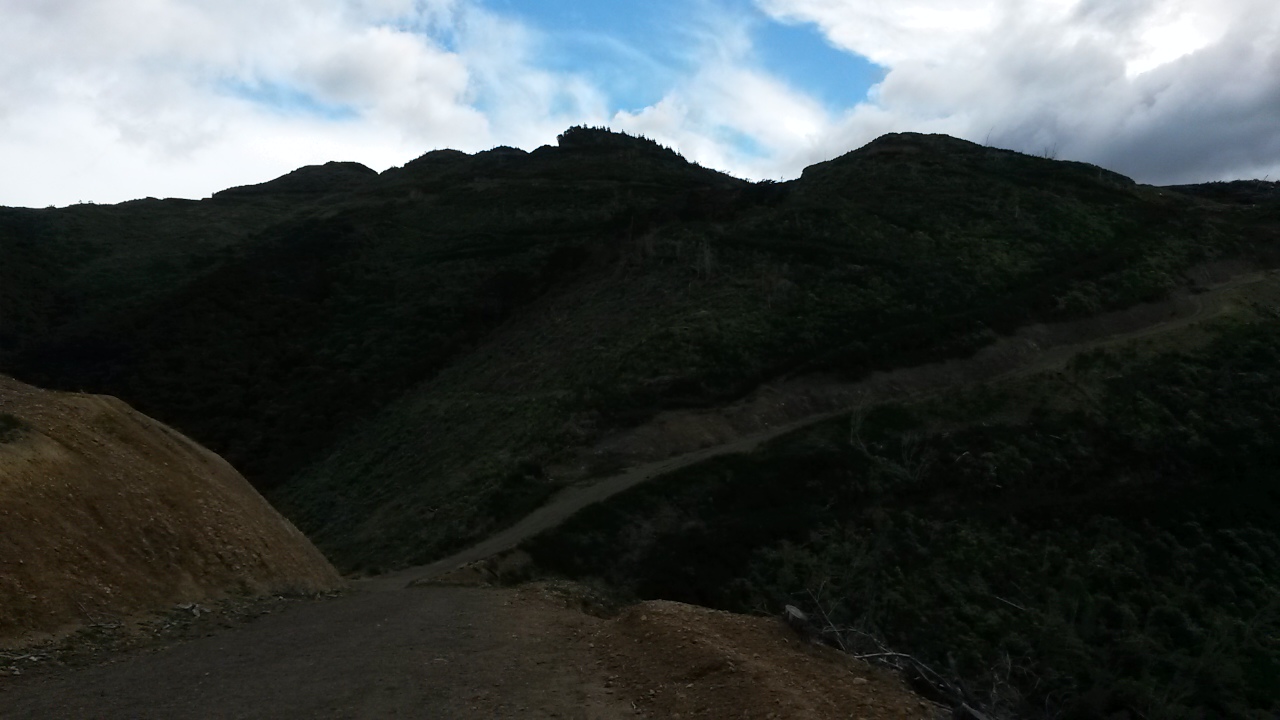
The spur is good travel and reasonably open. There's some pretty large beech trees and further up, dracophylum with moss underfoot. Animal trails come and go and I don't see any signs of people.
Up past 628 I eventually reach a wide flat top and a rocky outcrop which on a good day would give a good view. At some point afterwards in quick succession there's an obvious ground trail then an old marker. I've joined the decommissioned track from Cone to Reeves. It's easy going now all the way to Reeves in the rain.
There is enough visibility under the cloud to spot the bottom parts of various hills and spurs (Bull mound, Cone ...). It's too cold to linger so a quick pause to empty river gravel our of the boots and it's on south towards Tauherenikau.
I've been along here a couple of times before so there's little call for compass and map. It should be fairly quick travel but there are a lot of branches down - attesting to a fairly tough winter.
At 1250 I'm at pt 855, time to turn east and south down to Tait Stream.
Tait stream drains a good chunk of land between the Tauherenikau ridge and the Wairarapa, it has cut deeply into the landscape, winding through its steep sided valley - and I didn't even know it existed.
It's a fine navigational challenge working down to the stream. It's reasonably easy down to 750 then becomes a bit indistinct as I head due east down to 540m requiring a bit of trust in the compass. I overshoot the turnoff to my target spur (running north) as the spur follows more naturally SSE and either my altimeter or the map is off. Soon sorted though and I'm on a clear spur with plentiful pig rootings and beautiful beech forest. At about 500m I take a bearing and drop through scrub with the occasional huge old forest giant in the hope of finding a steep spur down to just below a junction on Tait stream - it's gratifying to hit the spur bang on - and very lucky as the drops on either side are impressive. The spur drops steeply and despite threatening to bluff out it takes me all the way to the stream.
 |
| The spur in question running down from the high point From Mt Reeves track |
Tait stream is about twice the size of Coal stream and requires some respect - by keeping out of the main flow I work up to the junction and look for a place to cross and find a route up the other side.
It's been a fairly brief transit through the catchment and its dramatic bush, so it is with a bit of regret that I leave so quickly to scale the other side. At some point the sun has come out but it's still pretty nippy so I stay rugged up despite the climb to pt 468.
The flat top ridge provides some respite and a brief view to snippets of fresh snow on the slopes of distant ridges - no wonder it's cold. There are pig rootings everywhere. It's easy navigation back towards the track over Mt Reeves. The closer I get the stronger the ground trail and even the odd tape marker.
At the track I'm aware that day light will be running out soon - but am hopeful that I might still stay on plan. At 745 there's a turn onto a yellow triangle track (I assume this means it is not an official DOC track) back down to Coal Stream and, in theory a point where I would depart for 668 but ... it's time to get all sensible and head back to the car. I don't fancy crossing the stream in the dark.
 |
| Nippy on Mt Reeves track - Lake Wairarapa in the distance |
It's a quick trot down the track to find that the stream hasn't dropped appreciably from the morning. A stick helps to cross the critical meter and a half through the worst of the current and it is the homeward stretch.
The road end is weird without cars or tents - now just the small matter of a K and a half walk along gravel back to the car.
There are some definite advantages of day walks. After a hot shower we're off to Salute in Greytown - under new management they have kept the old menu (so far) with an excellent selection of Tapas. A convivial evening followed by a warm bed with the sound of rain drumming on the roof.
Mt Dick
Brother number one is up bright early the next morning - I on the other hand ain't, choosing to sleep for a bit longer as the aches and pains from Saturday fade.The plan today is to visit a few spot heights around Mt Dick, a hill in the foothills behind Carterton with unimpeded views across the plains and a public road to the top. A lot of the area has been under pines and shows the associated devastation from logging tracks, haulage lines and clear felling.
We leave a car at the bottom and brother no.1 ferries me to the top. There's a walker and a biker plus the odd vehicle about. In the west some pretty foul looking weather is lurking and a decidedly icy wind is slicing in but it's still a sunny day over here.

There are a few tactical options for getting to the marked high point (553) - I choose the wrong one, heading north along the ridge from the lookout through dense scrub interspersed with old man gorse. It's a painful thrash with no discernible tracks apart from pig trails and the top is indistinguishable apart from the absence of any further up to be had.
 |
| Looking north east up Wairarapa From the middle of a gorse patch |
 |
| Looking South east across the Wairarapa From the middle of a gorse patch |
 |
| Standing in a small tree In the middle of a gorse patch |
Rather than struggle back along the ridge I drop to the road through slightly higher scrub which allows some sliding underneath. It's a slightly surprised driver that witnesses a scratched and dishevelled tramper stumble down a scrubby bank onto the road side just as he drives past.
From the public road logging tracks head down the ridge towards the plain. The post forestry carnage is slowly being recolonised by natives and wilding pines. The positive is that apart from the top of 489 it's an easy trot to the target spot heights then down a spur to the road. All up, about an hour from 553.
 |
| Looking back up at Mt Dick lookout From a different gorse patch |
 |
| Mt Dick from Pt 315 This time not in a gorse patch |
It's pleasant to be out in sunlight for a change and the views are good - but otherwise you'd have to say that beyond the prospect of regeneration there is not a lot going for this particular corner of the Tararuas. Tait stream on the other hand - it was pretty stunning - a longer visit could be on the cards at some point.
No comments :
Post a Comment