Friday, 30 December 2016

Wangapeka

In an idle moment when the end of the year was far off, Angela and I agreed that a Rees-Dart trip would be just the thing over Christmas. People then got busy, other plans were laid and we discovered that a chunk of the track was closed because of a slip. In the meantime I had also been contemplating the Wangapeka Track, having read about it in the Wilderness magazine and hearing about the sterling whio recovery work.

Being closer to Wellington the logistics promised to be somewhat easier. It also looked like we could just wedge it in between Mike and Angela arriving back from Australia and Mike's commitment to meet a bunch of people at Quinney's Bush Camping Ground in the new year - but with absolutely no leeway.

What:    Wangapeka Track (west to east)
Where:  Kahurangi National Park
Why:     Multi-day tramp somewhere other than in the Tararuas
Who:     Mike, Angela and me
Map:     Map

There was a fair amount of logistics required to string it all together - I've dumped some notes about this at the end for those interested in costs etc.

With Mike and Angela in Australia, I nobly volunteer to sort the food out. In other words this was an opportunity to finally get rid of all those time-expired Back-Country dehy meals (although the pasta vegetariano somehow managed to survive the trip).

The weather forecast is for a couple of days of rain on Sunday and Monday but I'm not too concerned, figuring we have some time up our sleeves if we get holed up in a hut.

Friday 30 December - Wellington to Belltown Manunui Hut

Mike and Angela arrive on the midnight flight from Sydney, meaning there's not a lot of time to get some sleep and pack before heading to the airport.

The Sounds Air plane is full (9), and as everyone is there we leave early. The flight down is stunning. At the cruising altitude of these small planes you get great views and we spend the whole flight going; "Oh look! It's [insert name of  scenic spot ...] the Queen Charlotte track, Nydia track, Kaikouras, Pelorus, Richmond Range, Mangatapu saddle, our house in Nelson, Rabbit Island, Mt Arthur, the Wangapeka track, the rugged ridges of the Kahurangis, the Denniston Plateau, ... " and eventually  "... Westport".

Our driver from Karamea Express meets us at the airport and we stash packs in the boot of what is evidently the family Camry. Carl hands over a couple of butane canisters we had pre-ordered (a bit of a relief - cold dehy for the next few days does not appeal) and we head out into a sunny West Coast afternoon. Angela has a hankering for a pie and we end up at the third best pie shop in Westport (the others are closed) before we leave for parts north.

Carl is happy to answer our questions about the area - the coal mining downturn and impact, Old Ghost Road, possible future developments, etc. and is also happy to stop at the top of the Karamea Bluffs so we can look back at the Denniston Plateau. We note a lot of dead trees, which he says is from Cyclone Ita in April 2014 (stuff article). It's one thing hearing about it but it's another thing to see entire ridges with mature trees flattened. He works in the roading department at the council and has some entertaining stories about getting the roads cleared.

Shortly before the car park we stop at the location of the no-longer-extant road-end phone to fill out the intentions book. Carl heads off and I discover I have left my brand new MacPac cap on the plane. A lone black chicken sees us off.


Road-end chicken


Little Wanganui River - Radiant Range beyond


We follow the track beside farmland and before long meet the Little Wanganui River. The water is clear and the granite boulders in the river bed are white in the afternoon sun. In the distance the Radiant Range (c1300m) marches across the horizon. I'm quietly enjoying that sense of heading into the unknown.


That look you get when trying to identify a bird-call
The track is well formed and easy to follow - it looks like much of it was once an old vehicle track, sometimes cut away by the river or buried in old slips. After two or three km it turns away from the river on a wide and well formed old road, which loops out and then back towards the river.

There are stoat traps every 100m meters or so and these keep up pretty much for the whole trip. Someones are doing fantastic work to protect the whio - at every opportunity I'm scanning the river in the hope of spotting one.

There isn't much wildlife apparent at this time of day but there are a few fantails and later on we hear weka calling as evening approaches.

The track continues across grassy flats (Gilmour Clearing), sidles by a steep hill, and crosses Pigeon Creek. Shortly after, we enter an area of tree fall, it's labyrinthine and we feel like midgets working our way between the large trees that were pushed over by the wind.
Gilmore Clearing - checking the map (or maybe just posing)


Upper end of Gilmore Clearing


Looking up valley in the early evening 

Radiant Range on horizon - we think those are dead trees from Cyclone Ita in the mid-ground

We arrive at Belltown Manunui Hut at 2130 with just enough light to walk without torches; a little over the DoC time.

A party of five has already turned in for the night and there is a couple in a tent below the hut. A weka stooges around as we remove boots and swat at the swarm of sandflies. The hut is standard and comfortable. A little warm tonight even without the fire, due to the number of bodies.Mike decides to settle on the veranda while Angela and I claim a mattress each inside. We settle to the distant sound of Morepork.


Belltown Mananui Hut

Saturday 31 December - Belltown to Taipo swing bridge

I think I have said before that Mike is not his best before his morning coffee. Today it almost has disastrous consequences but he manages to catch the weka before it makes off with the bag containing cellphone, PLB, and other important electronicalia.

There are a couple of younger weka in attendance this time but no wasted sentiment from mum - she sees the younger ones off rapidly if they get in her space.

The party in the hut has come down the Leslie possibly from the Cobb and have been 7 days on the track. They are looking forward to a leisurely 3 hour hike out but are not overjoyed to hear that the road end phone has gone. In turn, they give us some dire warnings about the likely state of the Karamea River after rain.

We don't get to talk to the other couple who are off first thing to try to get ahead of the weather. We're not going to race with them as there's a few side streams below Taipo Hut that could get up, but it's really the Karamea River after Helicopter Flat that would be the concern and we have no delusions about getting past there before evening.

There's some fairly rough sections of track in the morning as we work our way up the valley beside a narrowing and steepening river (still no whio). The track sidles, climbs and drops, clambers through fallen trees, and edges across slippy faces. I'm not too bothered as it's a bit like a Tararua track but Angela finds some of it a little daunting. However, it's me that steps on the wrong log and tips arse-over-kite (minor bruises only).

The day is overcast but no rain yet and all the side streams are low. At one point we see something large slip into the bush on the opposite bank and the odd branch waves as it moves off. The consensus is deer, based on the height.


Scrambling up out of another creek


Getting into the upper reaches of the Little Wanganui River 


There is ample sign that there are goats about. One particularly species of tree seems to be getting a hammering with gnaw marks on the bark, I think it was a coprosma.


Nora the goat was here

Swing Bridge near Wangapeka Biv


A couple pass us heading down valley and we exchange news about track conditions.  Shortly after we reach the swing bridge which takes us to the Wangapeka Biv (on the other side of the track to where it is marked on the map). It's new and a very tidy little set up - there's even a couple of plastic chairs. The log book indicates reasonably regular use including last night.


Wangapeka Biv - pretty palacious 


Mike enjoying the last of the flat

The track keeps climbing steadily then steepens. In the absence of any views we stop at an arbitrary point for lunch - the pate and cherry tomatoes are particular hits. We are now into Mountain Cabbage Tree territory with its large strappy leaves and soon the zigzagging climb to the saddle starts with cliffs above and granite boulders underfoot.

Navigating a stream bed near the saddle


Mike is making heavy weather of it and it turns out that he has a migraine coming on - not the best place to get one but understandable given the last 24 hours. He soldiers on and up.

Water fall from the lower tarn


The final approach


In the final approaches to the saddle there are a couple of wee waterfalls and I'm looking forward to the track leveling off.


The first (lower) tarn
The first couple of spots of drizzle start as we steep out of the bush edge and see the first tarn laid out in it's wee bowl surrounded by alpine herbs, Hebe, Spaniard and Leatherwood. Behind us there's a not particularly remarkable view down valley to clouds thickening about the ridges in the west, and it's pretty clear that the drizzle isn't going away. Rain coat time.


Back down the Little Wanganui Valley

The saddle is pretty with granite boulders emerging from the mossy herb garden with wee sun dew and the Allen Range hemming the valley beyond. The grassy Stag Flats nestle below, promising a knee curdling 200m descent to come. Out of sight to the right is the Zetland Basin below Mt Zetland.


Top of the saddle - Allen Range behind


The weather following us

It's a steepish drop to Stag Flats where we emerge from the beech forest by a stream winding across a grassy meadow. A board walk leads to the Stag Flat emergency shelter. Not quite as beautiful as the Wangapeka Biv but well lined and clean. We later hear a story that the size of the first hut up here had been dictated by the length of timbers surviving, after being dropped from a fixed wing aircraft. The rain has settled in now.


Stag Flat

Shortly after the biv we are surprised to find a chap sitting on the side of the track with two packs. He's pleased to hear the biv is near by. We encounter his partner a minute later coming up the track - she seems to have a stiff neck but is cheerful enough and wishes us a happy new year for tomorrow.

The track follows down beside an increasing stream and through moss. We steadily lose height to the valley floor and a swing bridge, which has a decidedly steep and treacherous descent off it. The track now ambles along the flat in mossy beech forest

Taipo Hut is an oldish Forest Service hut but in good nick. We stop for soup and to assess options. The original plan had us staying here but we decide that with the rain we will push on for Helicopter Flats to get past some of the side streams that might become problematic. In retrospect we would have been better off to have stayed put.


Taipo hut

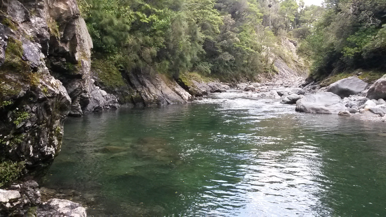
The rain is persistent now but the pleasant travel down valley continues with none of the side streams up and Herbert Creek empty. The Taipo River is beautiful with clear, deep, blue pools, with high rocky sides. A swim would be irresistible on any other day.


Taipo River

The pace has dropped markedly so we confer and decide on the shorter, flatter and closer route to Trevor Carter Hut even if it means a bit of a back track in the morning. However, when we reach the swing bridge to Helicopter Flats it's clear that the party is a bit too tired so we elect to find a spot to camp.

Scouting around we find the best site - avoiding the patch with some signs of previous ponding. A South Island Bush Robin takes an interest in proceedings and joins in the scratching game - this is where a human scratches up the ground at its feet and the robin hops in and extracts any edibles unearthed.

With tents up we eat dinner in our rain coats and turn in to the sound of light rain on nylon. It becomes not so light during the course of the evening. At one point Mike gets up and we realise that it is five minutes past 2016 - 'Happy New Year!'  The rain gets heavier still and gusts of wind dump deluges of drops from the sodden trees.

Monday 1 January Taipo Swingbridge to Helicopter Flat

About 5am Mike asks Angela what the floor is like on her side of the tent - answer: "it's like a water bed!" They call out and I discover I am similarly floating. Looking outside our wee flat spot has turned into a stream about 10cm deep but both tents have kept the water out. There's a fairly hasty exit and striking of camp. The river is up a good couple of meters and is raging and turbid. A water fall has appeared from nowhere above us and part of it is now flowing through our campsite. With head torches on and somewhat bedraggled we cross the bridge and start for Helicopter Flat, following a track that has become a stream.

In better conditions we would have enjoyed this section of track with views down valley, the site of the 'Tabernacle' where the chap who did a lot of the track building built a hut, and a side trip to where the Karamea River flows over the Saxon Falls. We trudge past all these focused on the vision of a warm dry hut.

The first significant stream cascades across the track and drops over the edge. A chain has been installed by some thoughtful soul to assist passage and it gets good use as we cling on to avoid our footing being swept away.

A little after the turn off to Trevor Carter Hut (via Saxon Falls) we come across a stream that is a completely different proposition. The track crosses a granite ledge through a water fall with an iron railing bolted into the granite. The water is crashing into the ledge and plummeting in a dirty torrent precipitously down through the bush. Hands welded to the rail I edge into the tempest, wedging feet against the uprights. Water smashes down from above pummeling my head and shoulders and battering my legs. About half way through I can't see anything ,and I figure that if I am having trouble reaching for the next foot hold then it's not going to be a goer for anyone with a shorter wheel base. I give it up and head back to safety - we're certainly not going through that.

A quick reccy down through the bush confirms that there's no safe crossing point lower down and little prospect of climbing to the track on the other side in any event. Defeated we reassess and head back the way we have come. The decision is to head towards Trevor Carter Hut via the swing bridge to dry out and wait the weather out.

We can't help but smile as we pass the stream that was our campsite to clamber up the water fall above. Here we discover that it is just an off-shoot from an even bigger stream - it just gets better! We link up, fight across the current and head on down the valley.  Not long after we come across a large stream off Mt Herbert. After one look we set up camp.

Prospects improve after climbing into sleeping bags and with the application of hot soup - fortunately it's not cold (particularly given that my sleeping bag is damp). It's a bit after 11 am and there is plenty of daylight ahead so we plan to wait to see if the rain eases enough for the streams to subside before having another go for Helicopter Flat - otherwise it will be a long afternoon and night in our tents.


Impromptu camp-site. Note the Heath Robinson rain shield over my biv.

The 'view' for the afternoon

I'm not delighted about the prospect of 18 hours in tents as my MacPac bush cocoon is adequate, but more closely resembles a body bag than a tent.

After a while the rain does ease and a sortie outside shows that the stream has dropped some. At around 3pm we decide that Helicopter Flats is on. As we strike camp we see a lone tramper on the other side of the stream, who scouts around then makes her way carefully across the dropping stream. It turns out that she has spent an extra day at Trevor Carter Hut to wait out the rain and is keen to get on up the valley.

She's obviously quite confident and competent - although much lower than it was,  I'm not so sure I would have ventured into that water. We set off after her to retrace our steps and see her once more - but that's after she has spent half an hour following the wrong track so we won't say too much about that.

All the water courses have dropped significantly and the main river is at least a metre lower and less turbid. It's amazing how quickly the flood water is just draining out of the landscape.

A little bedraggled

The chain is still useful but the stream has virtually disappeared.

Don't know what the problem was


The Tabernacle

You turned back because of this!?

The water fall and railing are a doddle and we barely need to put our hoods up. Further up the track there are a couple of other water courses that show every sign of having been impassable a few hours ago. So we made the right decision not to risk the railing traverse. The rest of the way to Helicopter Flat is uneventful and we start to dry out.


Helicopter Flats Hut

There is one occupant at the hut when we arrive around 6pm. Barry is good company and an experienced tramper. He exhibits impeccable hut etiquette starting with offering a hot drink as soon as we arrive and politely overlooking the way our packs disgorge wet gear to dry around the hut.

Barry has found a camera beside the track and he and Mike settle down to run through the photos to sleuth any clues as to the owner. He also has stories of seeing a family of Whio in the river by Stone Hut; I'm frankly envious.

The Karamea River drops as the evening progresses and a family of Riflemans emit high pitched 'chips' as they fossick around the branches of the beech trees. Later on I hear whistling from the river which I fondly imagine might be Whio - still haven't seen one but...

After dehy for dinner and a bit of a chat we have a comfortable night in the dry - quite a contrast to the last 24 hours.

Tuesday 2 January Helicopter Flat to Kings Creek

The morning sun signals that the bad weather has passed through and the prospects are good for the three crossings of the upper Karamea River that lie ahead.

Apparently the hut is named after an event when a chap had a heart attack and they had to get a helicopter in and required a clearing to do so - one of the earliest such extractions apparently. A few days later we run into a relative of the chap who confirms the veracity of the story.

We don't hurry to leave. The river has returned to normal flows and the crossings are no problem although we link up for practice anyway. It's a thoroughly pleasant stroll up the valley.


After crossing number two - Angela shamelessly exaggerates the depth of the river 


Navigating another washout

It's a landscape that is highly active in geological terms although relatively static to us - the river is under-cutting banks where mature trees are frozen at various angles of collapse into the water; shingle fans are building up around the skeleton of trees that have been inundated by the slow river of rock and vegetation is claiming back flats that the river has forgotten.


Tree stumps indicating a change in the river course at some point 

The valley narrows and we take advantage of the sun - stopping for a prolonged morning tea and a little more drying of gear. A nearby waterfall provides water.


We disturb a family of goats as we cross the Karamea for the final time and start up a benched track above Chime Creek. There's some pretty little cataracts and deep pools, with rocky outcrops crying out to be jumped off. The crossing point is easy but we head a little further to the three wire bridge anyway.


The last crossing

Mike ambling up Chime Creek

Angela's first go on a three wire bridge

The benched track continues on the other side steadily towards Wangapeka Saddle with the exception of a violent climb up and down around a big erosion scar. We leave the Karamea catchment and the sun behind and enter the saddle.

More erosion - approaching Wangapeka Saddle

Is tha' it?!

The saddle is uneventful - in forest there is no view, a copse of DoC signs to indicate the cross roads between various routes, and a pole. There is however a wee clearing off the track that provides dryish moss to rest on and have lunch.


More land slips
The descent starts gently than steepens entering the Wangapeka catchment and, officially, Nelson. There are some big slips on the valley sides and massive boulders that have smashed through the bush.

It's steepish at times but pretty easy to follow.


Stone Hut is pumping when we arrive about 3pm. Three parties are passing through - two have been up to Mt Luna and a couple are heading to Helicopter Flats. One chap delights in showing photos of the Whio they saw here last night teaching their chicks how to surf the rapids. Bastard - I still haven't seen one.

The camera mystery is also solved - someone has left a note in the log book and one of the chaps has taken the number and also has Barry's number - a happy resolution is on its way.


Stone Hut

The stream past the hut has rearranged the track a bit but we are soon back on a well benched track. high above a gorgeous, gorgish river. It's a different feel to the rest of the track - a little more civilised, a few mildly gnarly bits with slips but still beautiful.

Following the pattern of the last few days I'm taking every opportunity to scan the river below for Whio and failing miserably. The river itself is well worth the effort though with white water, tumbling falls and deep, dark sections.


'Let's hope he takes the picture soon - I feel like a prat.'


The ubiquitous stoat traps

Time for a breather

Towards the end of the day the map shows a climb and a couple of river crossings to come but we are suddenly at the historic Cecil King Hut without any sign of these - weird. We're not complaining though as Angela's new boots are causing a bit of damage.

The historic hut has been well restored and appears to be respected by passers by. The story runs that it was built in the mid 1930's for depression mining (no, mining during the depression). One of the original builders - Cecil King clearly took to the place as he kept returning for the next 46 years.


A couple of old timers outside their slab hut

We decide that a warmer, more sand-fly and rodent proof night will be afforded by the modern hut five minutes along the trail.


Kings Creek Hut

There are parties of three, two, one and one - as well as us. One turns out to be a WTMC member now resident in Nelson on whose floor we once crashed. There's plenty of space.

I'm taking a breath of fresh air before bed and swatting sandflies when a chap from another party says there's a Whio down in the river. We are far above and the light is dim but eventually I see a grey boulder partly occluded by a tree turn it's head to reveal a distinctive beak. Hardly up close and personal but ... finally a real Whio.

Back in the hut someone introduces a simple card game which serves to while a way an hour before bed.

Wednesday 3 January Kings Creek to Rolling River Carpark

A light rain greets us in the morning. Angela can't quite face another day of dehy cooked breakfast but Mike and I are still pretty happy with it. She sets off first while Mike and I farf about and head off a little later, in light drizzle, to catch up.

An Aussie couple are booked in the same shuttle as us and are walking a little faster than us so pass us on the way out. We have plenty of time so are content to potter along in the rain.

The track edges along beside and above the river and we have a long stop to watch five Whio cruising around the shallows and feeding. A bit far away for good photos but it is brilliant to see what looks like a family group with chicks big enough that they have surely survived a season.

We come to an earthquake lake with warnings about not hanging about on the slip.  It's not too hard to clamber across but there's some pretty big boulders that have come down.


Drowned trees - earthquake lake

Mike and Angela clamber across

The view upwards

Towards the end, the valley widens and the track crosses some large and very wet grassy flats with a lot of pig damage. There are still some pretty good swimming holes that would be well worth a visit on a summer's day. We also find some wild strawberries, which although minuscule and pretty green, are definitely strawberry flavoured. It's still raining and the clag is close around the hills.


Misty afternoon - lower Wangapeka

A last swing bridge gets us over Rolling River. It has a completely different bed to the other rivers we've seen - I put it down to the limestone in the catchment around Mt Owen, and nobody knows any different to contradict the theory. Straight afterwards is the Rolling River car park and that's the end of the track.


Dunnit!

The shuttle company have made it very clear that they won't drive past the Dart River Ford if there is water over the concrete base. This is fine but as the Ford is 8 km from the end of the track there's no way of knowing whether this rain has had any effect. So, after a cup of soup we set off up the road.

Angela has done well in her new boots but they are taking their toll, eventually she has a brain wave and reverts to Tivas to walk the gravel road - problem solved although the water she pours out of her boot is coloured with blood.

For all that they live in Brisbane, the Aussie couple have spent an awful lot of time tramping and orienteering in New Zealand. On this trip they have been through the Heaphy and the Wangapeka. Quite impressive. I trot along ahead with him to make sure we can hold the van for the others.

The rain peters out and we walk along the widening valley past a camp site and through farms. I keep half an eye on the river, not expecting to see anything but get a last reward of three more Whio drifting and feeding their way up the edge of the river.

Invisible Whio

Angela enjoying not having bleeding feet
We reach the ford, which is clear, with an hour to spare but just as we dump packs the shuttle arrives. The driver is an older chap who is quite chatty and thought we might be early so was prepared to wait at the road end with a book.

We drive back to pick the others up and head for Nelson.

Post script. 

This is just half way through the holiday - the shuttle drops us at Nelson airport where we lower the tone - drying our gear in the sun outside the terminal while we wait for our hire car. Angela pours more bloody water out of her boot - ouch!


Pies and sun - oh yes!

In a plan of Gilbertian complexity we head out to Kaiteriteri to pick up some camping gear a friend of Mike's had brought across for him. Then to Motueka for dinner and finally up the Motueka highway to Tapawera and Quinney's Bush.

Pub grub in Mot

Over the next few days we stay at the quirky Quinney's Bush, explore the Motueka West Bank road ends, kayak in the Abel Tasman and make knives (oh yes - make knives! - it's more fun than you would believe and you actually get a halfway decent result by the end of the day).


Quinney's bush - more drying

Living advice on the toilet door

Mt Arthur from outside the kiosk at Flora Saddle car park

A tractor convention at Marahau Beach


Kayaking in the Abel Tasman

Thor wields his mighty hammer 

Before and after


The almost finished products

When you can make anything from a machete to a broad sword ...
who would make a paring knife and a herb chopper!?

An all too short four days later we are back at the airport for another stunning Sounds Air flight across the Marlborough Sounds and back to a somewhat windy Wellington.


Havelock and the Sounds

Logistics

Sounds Air provided an excellent service at $320 each, from Wellington to Westport and Nelson to Wellington. Their timetable meant that we were arriving in Westport in the afternoon. We decided to head in to the first hut (Beltown Mananui) rather than arrange accommodation in Westport or Karamea.  We had to get butane in Westport (you can't carry it on the plane) and as we were arriving after 4pm the was a potential to miss the shops. Karamea Express were happy to pick up a couple of canisters before they met us.

There are plenty of companies around that offer transfers between road ends, airports and wherever else you might want to go. Mike notes that a lot of them share the same phone number so we suspect that there have been a few mergers. If you want to avoid the cost you can risk hitching or bring your own car down on the ferry. It cost us $250 for a pick up from Westport Airport to the start of the track (about 90 km) and $150 ($50 each) for a pick up and transfer to Nelson Airport at the Wangapeka end (about 84 km).

The landline has been removed from the Karamea end of the track which could complicate arranging pick ups. Because the shuttle won't cross the Dart River Ford if the water is over the concrete base you need to allow time to walk 8km from the track end to the ford (and if it's been raining you don't know if the ford is clear or not until you get there). There is a phone at the camp site a short distance from the end of the track.




Saturday, 10 December 2016

SK Valleys

A few years back someone rather carelessly told me about a traditional challenge of 'doing' the length of the Tararuas in the space of a weekend. They should have had more care - the idea lodged and it was pretty much inevitable that at some point I would have a go. Without going into all the details, it is called the 'SK', or the Schormanns - Kaitoke, after the start and finish points. The Schormanns Track no longer exists so you leave from the nearby Putara Road end, but somehow 'PK' has not caught on - shame, it has a bit of a ring to it.

There are a couple of main options and lots of variations - the Valleys route is easier and more direct. The tops is longer and, not surprisingly, more exposed with considerably more up and down. Records exist for assisted and solo efforts, and the times being posted now are superhuman.

When I say 'easier' the Valley SK is still a small matter of 74km and a net climb of a little under 3400m.  I'm not chasing a record though - I'd just like to get the idea out of my head.

What:   SK Valleys
Where:  P to K
Why:     Because it'll bug me until I've done it
Who:     Solo, unassisted
When:   10 December 2016
Map:     Map

Preparation

With regular trips over recent months my fitness is at a suitable level and gear all well tested. The trip is on marked tracks, apart from a section at the start down the Ruamahanga River. I don't like rivers at the best of times, so checked it out a couple of weeks back. I've been over almost all the rest of it at some time, although it's been a while for some parts, and I'm not looking forward to scrambling around slips on the Tauherenikau (the subject of a long standing DoC warning).

On Wednesday I figure I've recovered from the previous weekend's exertions but the forecast is marginal - the story of this summer so far. The Ruamahanga River gauge drops gently over the next few days though, so at midday on Friday I decide it's a goer.

The plan is to start early Saturday morning, see how the day goes, and either soldier on into the night or sleep at one of the huts en route. I have a weekender hut pack (i.e. sleeping bag, no tent, warm layers, food, emergency gear) which means more weight but also more peace of mind. All up weight (with water) is 6.7 kg.

I complete the usual intentions sheet and send it to my PLB contacts with outlines of various contingency options.

The route

The original SKs involved trains, rail cars and taxis to get from Wellington to the track end on a Friday night after work. In the grand tradition I intend to catch the Wairarapa train, but then to spend the night in Carterton for a comfortable sleep and a drop off at the track end by an understanding brother.

The route follows the major river systems in turn as they run parallel to the length of the Tararuas in the east of the range, before each exits into the Wairarapa to join the Ruamahanga. This means a series of saddles and rivers, with huts around the more popular areas. It also provides regular milestones to mark progress: 6 saddles, 5 river systems (not counting the Mangatainoka) and 7 huts.

The final act is climbing up Smith Creek to Puffer Saddle and the long sidle and descent to the new (to me) road end at Kaitoke.

Kick off

At about 0515 it is dim in the bush but more than enough light to not need a torch. The clouds are gathered and threatening in the west, but it's not cold. The track along the stream and up to the junction is familiar territory.


Record shot - 0517

The junction (right to the Main Range, left to Roaring Stag) after 0:52 is my first saddle and at 1:40 Roaring Stag is my first hut (score: 1,1,0). The wind is strong in the tree tops - the sort where you get a little jumpy at creaks and cracks from overhead.

There's no-one in Roaring Stag as I fill in the log book, pause briefly, and checkout the river. Probably half a metre lower than two weeks back so it is looking good not to use the terraces (the high route that avoids the gorge section at Cleft Creek).


First sunlight creeping down one of the many slips

It's much easier travel down river this time. I hardly use the terraces, and boulder hop most of the way to the bluffs, about 0:45 min after leaving Roaring Stag. It's still deep, and I can't touch the bottom in places through the bluffs, but a lot less of a proposition than last time.


Looking back up through the bluff section -
deep on the true right but navigable by holding onto the rock

0:20 min later the gorge above Cleft Creek is unmistakable. The river runs onto the right bank forming a deep section against the rocky side. It's no drama to cross upstream in thigh deep water with just a little help from a koro stick.


Start of the gorge above Cleft Creek

The other side provides bouldery travel and a short scramble along a rock face opposite Cleft Creek. The river broadens and slows and another thigh deep crossing is easily accomplished. The track is on the right somewhere up on a terrace; I potter down stream a short distance to find a way to scramble up. Three hours after leaving the carpark I'm standing on the track (1,1,1).

Cleft Creek


Gorge above Cleft Creek


River below Cleft Creek


The first thing that is apparent is that a track team has been through - ferns, grasses and saplings have been cleaned off at ground level and markers have been added - fairly recently by the look of it.

The track climbs alongside then joins Cleft Creek and I am soon standing at the stream junction, which two weeks ago took 2:26 from Stag Hut with the river up and using the terraces route. This time, using the river route and the new track, it has taken 1:38.


Bear right but keep an eye on the markers because the track soon takes a new route

The next surprise is that the track takes a completely different route to the saddle. Instead of following a side stream, it dives into the bush and grunts straight up a spur. Eventually it bears right and sidles and rises for a long while to eventually hit the junction in the saddle, right beside the sign post to Waingawa. I'm stunned - I had stood at this point two weeks ago and saw no sign of this track.

However, right now I'm a little more focused on ticking off the top of the second saddle. It's 09:06, about 3:50 in, score: 2,1,1.

It's a short hop down to wade across the Waingawa and arrive at Cow Creek Hut 18 minutes later (2,2,1).


Cow Creek Hut

The track is now a fairly typical Tararua River track. It potters along in the bush, on grassy flats, across slips and in and out of side streams.

About 1:50 later the rather elegant Mitre Flats Hut hoves into view (2,3,1). The weather is still holding.


Mitre Flats 

I don't have fond memories of the Barton Track that climbs to the next saddle. It is pretty much as I remember: a bit of a climb up, a long sidle with a wee descent, then a drop into a creek, and a bit of a mucky scramble out and up again. I'm also starting to feel the distance already traveled. It is nice however to get to the intersection with Baldy Track and join the track I traveled last week (12:54, 7:37 elapsed, score: 3,3,2).

Descending from the saddle, heavy drops start pattering through the canopy, and by Atiwhakatu Stream the rain has set in. It's warm enough though, so I don't bother with a jacket. Between the two routes up to Jumbo I meet my first people - a group of three women who are following the old track up to Jumbo. We chat briefly but I can't tell them much about that route.

40 min from the saddle Atiwhakatu Hut (3,4,2) and I'm chatting to a couple who are just leaving having come in for a day walk. After filling in the log book, I take a bit of time for lunch out of the rain. I'm thinking now about when dark will become a factor. It's looking good to get through Cone Saddle which I hadn't fancied doing at night (it's years since I've been up through there).

The track now is a veritable highway and familiar from last week. It is also crowded as I run into a couple more parties and pass the couple from earlier.

Leaving the Atiwhakatu Stream (3,4,3) and climbing the River Ridge I start feeling a bit under the weather. Consequently it's a slow ascent. I figure I haven't been getting enough energy in, and focus on slowly nibbling through bars despite not feeling like eating. Voices ahead indicate I've reached Pig Flat. This is the route to Powell Hut and Mt Holdsworth but, more importantly, another saddle (4,4,3). It's 9:50 on the go now.

The Totara Creek Track is new territory. Last time I traveled in this direction it followed down the creek. Now it stays on the ridge above, then drops down a spur to cross on a solid swing bridge. The track is well bedded in now. This part of the trip should be quick going but I'm still making somewhat heavy weather of it and concentrate on just ticking along.

Totara Flats Hut is pumping when I arrive at 4:50 (4,5,3). It's hard finding a space to sit and drip and fill in the log book. A tourist kindly offers me some gourmet chocolate, and is understandably a little nonplussed that I am intending to leave a perfectly good hut at this time of day and in this weather.

The grass on Totara Flats is carrying as much water as it can hold and consequently deposits cascades of it as I brush through. A pause for the customary gaze across to the location of Sayers Hut - no-one to be seen but there's a waft of wood smoke in the trees almost indistinguishable from the mist. A little further on, a distinctive tang on the breeze removes any doubt.

A 'new' bridge has improved access to Cone Saddle Track. I remember a trip with school mates when Makaka Creek was a torrent and we sensibly turned back for an extra night at the old Totara Flats Hut. While we were there Greame Dingle came through with a bunch of hard youngsters and a camera crew. Later we heard a helicopter go over and I think the story goes that someone got swept away in a river crossing - not fatally fortunately.

Cone Saddle - camera in bag because of rain
I plod up Cone Saddle and meet a party of young women doing a trip for their Duke of Ed, together with adult chaperons. They are off to Totara Flats.

My memories of Cone Saddle is of a false top followed by a long sidle then a final wee 'up' to the saddle. I'm downright slow now and it takes ages to get through the sidle. Two creeks are significantly up but still quite passable.

At the saddle it's 7:28 and still light, but I arrived at Totara Flats Hut 2:40 ago so it has been slow. Still, 5,5,4 feels like progress.

21 minutes later I take a break at Cone Hut (5,6,4). There's a chap from the Rotorua Tramping Club in residence. He has come down from Alpha but spent the day in the hut. He has plenty of time, no firm plans and - hell, why flounder around in the wet when you don't need to!

I take a good wee time to drip on the floor, don jacket (it's not so warm now), fill in the log book, chat and ... yep, basically farf about and avoid getting back out there.

With head torch ready in pocket I eventually drag myself away. By now I have pretty much resolved that I may as well see this through, so there's a long evening walking ahead.

The Tauherenikau is making itself heard today. It's considerably up and you would not contemplate crossing to the Bull Mound Track. I am slightly concerned that I will hit a creek that is impassible somewhere down river.

Just before 9pm the very last of the light sees me to Tutuwai Hut: 5,7,4 and 15:40 on the go. A couple have a tent on the flats - he is in the hut and is tossing up whether to sleep out or in. The rain has finally abated so I switch on my light, top up my water and head on into the night.

It's hard to gauge progress in the dark. The only thing that provides information about the world beyond my torch light is the roar of the river. I know there are some slips to scramble around and the track does potter along and up and down - at one point there's a knotted rope but there's not much to indicate what's in the blackness below - very comforting!

I see numerous possums; ghostly in the light - twin pin prick eyes that look, disappear, then look again before heading up the nearest tree. A couple of times larger animals slip off into the undergrowth. When the track bears away from the river the odd Morepork can be heard. Otherwise I follow the tunnel through the trees and try to watch for markers and my footing at the same time until suddenly, I'm trying to make sense of what turns out to be a swing bridge support.

This is a major milestone. There have been no real navigational difficulties or impassable streams. I find out later that the rain had hardly touched the Wairarapa so the streams on my side of the river had hardly received anything whereas the Tauherenikau had had an ample dump in its head waters.

The interminable meander down river is now reduced to less than two km to Smith's Creek on a gentle track then the final climb to the final saddle. I don't even notice the shelter as I head past.

I confess to disliking this part - it can never be over fast enough. Smith's Creek represents the worst of accessibility, with the shelter often filthy and abused. The clay track beyond the saddle is lethal in running shoes and there's gorse among the scrub. Not good reasons to be so down on it - it's more likely to be something to do with usually being pretty much buggered by the time I get to this point and just wanting the pain to stop.

Picking my time I pop a gel tube with the idea that it will have well kicked in by the time I start up the wee climb to the saddle. Along the way there is a long standing bypass around a slip which I ignore - the route through is perfectly serviceable, even at night. Then the long drag up the valley, hanging out for the last stream crossing, which marks the short climb then sidle to the saddle: 6,7,5 - it's after midnight and, at last, I have run out of numbers.

There's cell reception now so I wake the long suffering support crew from her slumbers and she very gamely agrees to meet me at the road end. I'm somewhat surprised that it is quite a distance down to the new carpark by the entrance to Kiwi Ranch so she arrives only 10 minutes or so after me.

In the end, according to the time stamp on my start and finish photos, it took 19 hours and 43 minutes from P to K. Nice to finally get that out of my head - just the Tops version to do now. But not in one go I think.

Lessons

There's a few things that I would do differently when I don't ever do this again ...

My food choices were somewhat random; an assortment of bars, some emergency gels and can of sardines. I had enough but the bars proved to be a bit rich and hard to get down when I was feeling the pinch. Definitely need a little more thought.

A nasty case of chaff that had me walking like a cowboy for the next few days could have been prevented - tights are great for cool weather travel but do tend to rub a bit.

There are plenty of escape routes - I should have committed and not carried the extra weight of a sleeping bag and one of the extra layers.

I had a bit of a scrape on my forearm from last week and was a bit concerned about ripping the scab off and getting it infected. A telfa pad with a sleeve made from a nitrile glove with the fingers cut off to keep it in place worked brilliantly.

I was pretty stiff and sore for the next few days with the normal odd bruises, numb toes and the like, also a few wee spots where friction from clothing or pack straps had rubbed the skin off. Nothing that a bit more fitness and care wouldn't prevent. I also developed an interesting facial rash that could have been chloracne but for the absence of dioxin. It took a few days to clear - probably not shingles - possibly a heat rash, but seems a bit weird.

Running shoes were good and light but were lethally slippery on wet roots and rocks. Surprisingly I only got a couple of wee blisters but by the end it felt like someone had taken a rattan cane to my feet. I think I need something with a more aggressive tread, a bit of an instep and slightly more rigid sole.

Wednesday, 7 December 2016

Dorset Ridge, the Kings and other places

Three tramping weekends until Christmas. The forecast is not bad but there's been rain so a planned river trip is postponed in favour of a sortie into the central Tararuas from Holdsworth. The last time I scurried through here was with some school friends - on a trip the details of which are somewhat hazy - this is going to be mostly new territory.

An early and irritating discovery is that my planned route precisely navigates around the junction of four separate maps. Such excess weight.

What:    Cruise around some tops and a couple of ridges
Where:  Central Tararuas
Why:     New territory, some navigation
Who:     Solo
When:   2 December 2016
Map:     Map

We are the latest in a series of Wellington buildings to be evacuated following the Kaikoura earthquake. The upshot of discovering that the building is not to the standard thought is that I have to leave by 17:00; all the more time to pack and get away.

Still, it's almost 20:00 as I head out under a thumbnail moon from the Holdsworth road end. The track is a highway apart from one section of slip and I arrive at Atiwhakatu hut in about 1 Hr 15.  There's a few people socialising before bed and I end up stretching my pause for 20 minutes before heading up the Raingauge track to Jumbo. At 0050 I'm relieved to find the hut empty so no-one is disturbed as I settle in. 

The lights of the Wairarapa sprinkle the planes with the southern cross above, a light frost is already dusting the ground.

I've placed my mattress to catch the early sun so wake shortly after 5 to drowse for a bit. There's a door by the bunk so I can take a look outside without leaving the comfort of my bag. The predawn horizon is edged with an apricot haze and it's looking to be a fabulous day. 


The dawn light warms the inside of the hut and I can get a good look around. A nice cosey space but room for plenty.

Jumbo Hut

At 06:00 the air isn't cold, there's a little bit of high cloud but the hills are clear. It's half an hour up to the ridge line to Holdsworth and it becomes apparent that today is going to be a great day for spotting ridges, peaks and spurs.


Setting out from Jumbo - McGregor above, South King on right

Ridge line from Jumbo to Holdsworth

Baldy on spur to right running up to South King, then the saw teeth of Broken Axe Pinnacles to McGregor and along to Angle knob  

An oh so rustic cross roads

Once past Jumbo more of the range opens up to view and it's all clear - from the distant peaks of the southern crossing up the spine via Mangahuka through to Mt Crawford.

It's a little over half an hour easy going to Angle Knob where I deviate up to the top for a look around. A couple of things are on my mind - one is the stunning scenery but the other is what this place would be like in clag. There was a runner got lost up here a year or two back and ended up bashing down creeks to Mid Waiohine hut with a broken toe. I wonder if he ended up on Angle knob and headed down the spur into Francis Creek rather than the ridge to Jumbo. He was pretty lucky to survive but I could see how it could have happened.


Ridge to Jumbo on left, unnamed spur to Francis creek on right, Holdsworth and Isabelle in middle.


From Angle Knob - ridge up to McGregor in foreground - spur down to McGregor biv barely visible in the shade running down to the left - Main Range on the horizon; Mt Crawford on left
My target turn off is in the saddle between Angle Knob and McGregor but I decide to pop up to McGregor for a look. The route is not so much traveled by the look of it. It's quite easy to miss the foot trail through the tussock but not difficult to follow the ridge line. About half an hour and I'm on top and checking out the ridge north for future reference and looking across at Dorset Ridge - my route for later in the day.


From McGregor - Dorset Ridge ahead - Carkeek and Main Range behind


Nor-east across Broken Axe Pinnacles to South King
Spur to Baldy to right, the other Kings on the horizon with Mitre behind

Pottering back there's a nice view of my target spur with McGregor biv an orange dot on the bushline (to the right of a tarn and wee knob on the spur). Shortly after I'm back in the saddle at the sign pointing down the spur.

Spur down to McGregor Biv and Waiohine river. Mt Crawford behind

Turn off to McGregor Biv - Angle Knob behind

There's not much foot trail until the spur forms then it's easy to follow down. The hut is soon hidden but the wee tarn and the slight rise straight after it are unmistakable. There isn't a cairn to speak of on the wee knob but someone has laid some bones pointing to a path down to the right. I follow the bones and soon the hut explodes suddenly and orangely into sight - about 20 minutes down from the saddle.


McGregor Biv

There's a bit of mess around the biv but inside is tidy. There are two mattresses on the bed and space on the floor for two good, or three very good friends. The place is cheerful in the bright morning sun. Across the valley Dorset hut is obvious just on the bushline.


McGregor Biv

View up valley from outside Biv
Dorset Ridge on left - Girdlestone on horizon

Returning to the spur the route quickly descends into the bush. There's a little bit of casting around but it turns out that someone has been through with bits of tape and, relatively recently; Venetian markers. They come and go a bit and there are quite a few spots where it is hard to find the next one. working off the map I'm keeping an eye out for; first a large cryptic tarn (which is so cryptic that I miss it entirely), followed by a rise to 1018m and a swing left. This is all fine but it gets a little confused identifying the correct point on the rise at 1000m to hive off to the right. I eventually sort myself out and sporadic markers confirm I'm on track. There are fairly long stretches where I lose the foot trail and the markers but manage to hook up again keeping on route until the spur narrows dramatically for a steep scramble down to the river.

I'm concentrating on not losing my footing when a shadow flicks across my vision and I am suddenly looking at a Morepork staring back at me from 20 feet away. S/he is chilled enough to sit there; periodically scratching luxuriously under the chin with a large yellow claw that looks more suited to evisceration than settling an itch. It's the closest and clearest encounter I've ever had and is undoubtedly the highlight of the trip.


About an hour fifty after leaving the biv I emerge bang on the Dorset Creek/Waiohine Junction. Looking back there are some markers to identify the location of the route up but not what you would call obvious. However, once you stick your head into the bush it is pretty easy to identify the way so I would be pretty confident about retracing my way up.

Both water ways are running clear and possibly just a little up. They have clean, rocky beds with tumbling white water between steep valley sides. At this time of day the sun is streaming down. It is the first time I've been this far up the Waiohine and it feels as isolated as anywhere I've been in the range despite knowing that I could probably get to any one of four different huts in under three hours. There is a definite attraction to following the river down just to see how it changes around each bend.


Take my word for it - there is a marker on the tree trunk on the left.

Waiohine down stream from Dorset Creek
The next part of my route is up the gorge for 30 minutes or so to the next junction. Tararua Footprints airily indicate it is easy but I'm in the never-trust-a-river camp so proceed with caution. I quickly find that there are frequent pools too deep to wade but in all cases there is a route on the other bank. This necessitates frequent crossings. Some care is required in picking the right spot but I find that a branch is not needed and it never quite reaches waist height.

Time for a break - Park Forks


It is slow going and it takes more like 40 minutes to get to the Park / Waiohine forks where there's a strip of lawn for resting weary bones. It is an eminently pleasant spot to sit in the sun and listen to the two rivers.

I've scribbled some instructions from the Footprints page about the next section of travel up Dorset Ridge. These assure me that the route on to the ridge is marked from the Forks.  I eventually find a few pieces of tatty plastic tape but these are old and don't seem to be marking anything particularly obvious.

Alleged location of route marker
As always though - it's harder to get lost going up so I just find my own way. Very occasionally old Venetian markers are visible amidst the moss and lichen and you could imagine a bit of a ground trail...maybe.

Swinging across a bank, the solid tree I am holding suddenly snaps and my course changes from a graceful arc onto the next foot hold to a tangential vector into a bit of a void. It's only about six feet down and I slide to a stop without losing too much skin. A quick check and the only visible damage is forearm that looks a little bit like steak - that will serve as a bit of a salient reminder about paying attention.

The rest of the route up is uneventful taking about an hour 30 to reach the bushline. The foot trail becomes a little more apparent but there is never what you would call much in the way of marking. It could be a little tricky following down, particularly the lower sections.

About 35 minutes later I'm on top of a knob looking across the broad tussocky top of Dorset Ridge. It's getting more cloudy now. This is another of those spots where you could quite imagine having trouble finding your way around in the clag.

The hut is well hidden down to the right below on a spur. It only becomes visible when I get quite a way across the flat. There are some cairn's on a patch of bare gravel at the north end of the flats but no signs that I could see. I decide not to take the time to visit today but if I were to want to be sure of finding it on a bad day I would definitely do a bit of research before I left.

Dorset Ridge - Girdlestone is the pyramid towards the right with Mitre behind

Cairn marking where to turn off for Dorset Hut

The rest of the ridge looks relatively gentle; sloping up to meet the shoulder of Girdlestone. I'm keen to get to Tarn hut now which was originally my intended destination for the night but I have an inclination to see whether a night at Atiwhakatu is on the cards.


Dorset Ridge from the top looking south west


At the top of Dorset Ridge I see a figure on point 1393 above the location of Tarn hut. It's the first person for the day and as I get closer I see that they are also heading for the hut.


Tarn hut and dunny

It's 14:10 when I arrive at the hut. The other chap is in a party of three and is dumping his stuff before heading back to see where his companions have got to. I'm a little distracted sorting my own life out so don't think to ask a few questions before he shoots off. After he leaves I realise I should have got an idea of their fitness, skill, gear etc. and determined whether I should stick around to confirm they were reunited.

A few photos, water top up and log book entry burns up quarter of an hour before I head back up the ridge. I keep an eye out behind and am relieved when I eventually see three figures breasting the knob near the hut.

Half an hour later I've ground to the top of Girdlestone - I think the second highest peak in the park (behind Mitre). The wind is getting up but it is worth stopping to do a slow 360 of the whole vista.

Looking back - the straight line is Tarn Ridge - the heart of the northern crossing


This is a bit of a junction - we could head to Mitre and the way down to Mitre flats and the Waingawa river, or may be head north and east on Table Ridge to drop to Cow Creek hut, or continue on plan along the somewhat lumpy ridge through the Three Kings. At this time of day and feeling a little weary there's no choice.


Adkin and the Three Kings - the route ahead

It's a bit of a scramble down off Girdlestone around 15:00 then quite a down and up route to cross the next four peaks and unnamed bumps (Adkin at 15:50, North King at 16:30, Mid King at 16:55, South King at 17:10). Hardly Olympic pace. The wind keeps rising and it's got a great head of steam as it whistles up Dorset Creek valley and across the ridge. It becomes a bit of an ordeal keeping footing, avoiding the Spaniards and ticking off progress. Mitre and Peggy slowly slip behind.


Mitre. 


From one of the Kings looking back to Girdlestone


From another King - looking back at Girdlestone with Mitre on right


Mid King - according to the sign someone has buried the Biv around here somewhere


Approaching South King there is a spur apparent but I'm pretty sure it isn't Baldy. Sure enough passing South King, Baldy is very clear and there is a cairn on the barren rounded ridge top to mark the route. A little over a kilometer further along the ridge is McGregor where I had been standing this morning. In between are the Broken Axe Pinnacles which I am keen to explore but not today.  Across the valley Jumbo hut is basking in the afternoon sun. Should someone be sitting on the porch they might wonder at the little red dot being buffeted down the spur by an obstreperous wind.


From South King - McGregor ahead, spur to Baldy in saddle

From the ridge looking down - Baldy on left - spur with Jumbo on right

The route is not marked but there's a pretty good foot trail from the ridge (about 17:20pm) and on top of Baldy (17:50) there are a number of cairns to mark the way. A little further down there is the odd rusty warratah. This is another of those spots where a misty day could make route finding a little tricky.


From Baldy looking back to the ridge
McGregor on left with the Broken Axe Pinnacles showing a little bit of their teeth 

I'm pretty fed up with the wind by now. The sun is pleasant but the wind certainly isn't so I'm relieved to see an orange marker indicating the entry point to the bushline (18:10).


Haven't seen one of those for ages


As a final reminder of the tops there is one last Spiky Spaniard lurking endearingly behind a wee beech tree to catch the unwary - just at the point where a hand would be placed to ease a foot down onto the obscured path.


Beech tree and not a beech tree

The bush enfolds the path and the wind is relegated to a noise in the tree tops. Travel is a completely different proposition now. It's steepish but easy to follow and comfortingly familiar with mossy trunks and roots to turn the unwary foot.

Part way down I am diverted by what is undoubtedly the highlight of the day (again?).  A flight (gang?) of kaka racket across above the canopy and land in one of the emergent trees. I'm not sure at first but soon catch a glimpse. They are making all sorts of noises and having a fine old time. As I potter down I try to imitate some of the sounds and it does seem that one of them responds and comes closer to investigate. In any event they keep me company for quite a few minutes. It is quite a moment - one that I had hoped but never quite believed that I would ever see in the Tararuas.

After that it's all pretty much down hill arriving at the saddle 30 minutes from the bushline.


On track


The track is now pretty easy to follow. There is a bit of up and down and a few slips along the Atiwhakatu and, as always at this time of day, I'm pretty much over it and hanging out for the hut. I can tell that I haven't eaten enough but am not about to stop now. Eventually I smell wood smoke and a few minutes later, about 19:40, the hut.


Atiwhakatu hut

Since I was here yesterday it has become over-run by a young boys Christian adventure group. They are having a fine old time shouting around the landscape, waving the axe about and playing with an open fire. All under some supervision from a group of men. There are other groups in also including a couple with a 14 m/o child. I ascertain that there is a spare mattress and promptly shift it to the safety of the deck, away from all danger of snoring, wailing and speaking in tongues.

I chat to the adults, do my best to ignore the boys and slump into a corner to recuperate. This elicits an offer of milo (gratefully accepted) and someone discovers a spare dehy meal that was prepared but remained unscoffed by the locusts. A bit cold but I figure it beats sardines and a muesli bar.

The clever adults have led the boys to believe that it is an hour later than it actually is so they swallow the 'it's time for bed and I don't want to hear any noise' line. It turns out that there are in fact even more boys - the older contingent were dispatched up to Jumbo hut in the late afternoon with some token adults.

I chat to one of the other groups for a bit and am preparing to turn in when I see a couple of lights descending the spur - I wonder if something has gone wrong at Jumbo but it turns out to be a couple of chaps that have come across from Levin. They are doing a one day Northern Crossing which is a bit of a mission. They just have day bags so are not about to stay at the hut but fill in the log book and head on through the night.

It's peaceful on the deck. The wind occasional makes a loud sortie to the valley floor but there's no rain and it's pretty mild - I remain unmolested by insects or rodents.  It's all of 0500 before the first cheeky young sod decides it would be good sport to make loud vacuous conversation with the strange man who slept outside. I give up, get up, pack up and quietly ship out.

Despite the weariness from yesterday, it is a quicker return trip in daylight, taking 55 minutes to get back to the carpark. The sun shimmies down the hill sides above and, apart from one jogger, I have the place to myself.


Holdsworth Carpark

The advantage of finishing a weekend tramp a day early is that a day yawns ahead unencumbered by commitments. On this occasion I start with a stop at the Greytown Bakery for an excellent Pain au Raisin then on down to Kaitoke campsite where Mike, Angela and Toby are camping out with the Wellington Tramping Meet Up Group. I arrive to see bleary eyed figures shambling out of an assortment of tents - some apparently ruing the excesses of the night before but most looking forward to various day trips before heading back to Wellington.

Back home the yawning day is quickly consumed by a hot bath, going to sleep in the hot bath, and trying to catch up on deficits in nutrition, hydration and sleep.  All up a highly successful weekend.

Three days later the grated forearm is healing quickly with only minimal indications of gangrene and slight tendency to leak through telfa pads onto business shirts.

Better start making some plans for the next two weekends.