Showing posts with label oriwa. Show all posts

Saturday, 4 May 2019

One Kelleher weekend

With the remaining forest park spot heights now countable on one hand, the object of this weekend's exertions is hardly surprising.

I have two in my sights. Kelleher is a knob just beside the Main Range Track which I have passed, but never deviated onto the actual knob.  By my rules I can't count it because it is separated from the track by at least a contour line.  The other spot is south west of Kelleher - pt 870 is awkwardly perched on a spur halfway up (or down) the side of the Mid Otaki Valley.

The next problem is how to get to them in as interesting way as possible (in a weekend). I reluctantly decide that it will have to be Poads Road and the Te Araroa Track to Waiopehu Hut, from there I can leave the marked track and head along Oriwa Ridge to Oriwa before taking an interesting looking spur to the Mid Otaki River. This puts me at the bottom of the main spur for the long haul up to Kelleher. The Main Range Track then gives access to the top of the spur to pt 870 and back down to the river, which I'll follow down to the Waitewaewae forks.

I'm quite pleased with the route out that I've devised - it's as near as damn it a straight line from the Waitewaewae River to Mick then out via the Waitohu Stream - pleasingly aesthetic.

With daylight hours now somewhat curtailed it's going to be a challenge to get through and out by end of Sunday. So, a Friday night torchlight trip to Waiopehu Hut is in order.


What:     Navigation trip to a couple of spot heights
When:    3-5 May 2019
Where:   Waiopehu to Waitohu via Kelleher
Who:       Solo
Maps


In the scheme of things ...


Most of Saturday

Sunday

We almost beat the Friday night traffic up the Coast by leaving at 3.30. A quick stop in Otaki, for supplies and not so great burgers, then out to Poads Road.


At 6pm the sun has set and it's dead calm as I wave good-bye to the support crew. Headlight on, I head across the farmland, prompting startled honking from the odd paradise duck. The beam is a bit marginal (possibly something to do with leaving it in a damp raincoat at some point) but just enough.

As I start the slippery climb, the last of the evening light creates odd patches of texture in my peripheral vision. Moreporks start calling up valley and a goods train's rumble vibrates the air. Although coolish, it's still so I soon have a bit of sweat up.

I'm waiting to see the signpost where the 6 discs track heads left looming in my headlight - this will mark where the ridge levels for a longer more gentle climb. I haven't seen it when the track starts doing odd things. I'm still following orange triangles but the quality has deteriorated and there are no longer little reflective stickers. There's windfall and things get somewhat confused.

I know it's the wrong track but despite back tracking and casting about, can't find where I joined it. I sit down in the dark to sort things out; eventually setting a bearing and heading off in a hopefully sensible direction. Soon I see a reflective gleam and all is good again.

Not much else to say really, there's no moon but plenty of stars and I'm regretting the last few beers I had on Thursday night.  This may go some way to explaining why I have guzzled all my water and am completely parched by the time I reach the hut at 10.20pm.

Empty. I quickly settle down, only to be disturbed briefly by a possum or two thundering around on the deck. Popping out to send them on their way, I'm treated to the fairy lights of the towns strung across the black Manawatu Plains, shimmering with the distance.

I'm not in a hurry in the morning, so it's after 7 before I emerge to find I've missed dawn.  The sun is peeping between cloud banks and morning mist forms milky pools in the valleys. There's a cloud ceiling at around 1300m which looks settled so hopefully a cool day is in store.


Late dawn


Around 8.10am I'm heading up the track behind the hut. Where it tops out on Waiopehu there's a bit of a  foot trail that diverges right. I follow this down beside the scrub on the ridge until it eventually slips into a channel through the leather wood. There are intermittent pieces of orange tape which are easily lost when the ridge top widens but no hardship to just follow the compass.


South from Waiopehu to Oriwa - pt 1024 to left

Just before the top of Oriwa there's a clearing (marked on the map - 9.40am). A cup hanging on a tree marks where to veer left to reach a wee roof and water barrel. Across the clearing there's a large flat space in the trees where hunters camp (and leave their rubbish).


The water supply


Camping spot by Oriwa Clearing

I have never quite found the ideal way past the clearing - always managing to end up in bog, leatherwood or, today, an unpleasant combination of both. At 10am I'm at the top of Oriwa and texting the support crew to say that everything is on track.

Someone has left a pink ribbon to mark where the ridge continues from Oriwa - you can follow this all the way down to the Waitewaewae Forks - it used to be a track but I would classify it now as a classic 'off track' Tararua route.

My sights are set slightly closer to hand - the top of the spur I am after is reasonably clear and quickly confirmed with the altimeter (1050m).

There's a little bit of trail and it's good going, but there's a few points where attention to the compass pays off.  A more solid trail develops after I run into signs of DoC biosecurity activities.

It starts with blue triangles marking "Bird MO 22" and when I get to Bird MO 19 there's blue triangles leading off spur, a tracking tunnel and some sort of funnel for collecting falling stuff.


It's satisfying to ride the spur all the way to it's end. Just after 11.20 I pop out beside Murray Creek and pause to work out my next steps.


Murray Creek - delicious

It's only at this point that I realise that I'm just up river from the Mid Otaki Hut (not marked on the map) - only 300m and a perfect spot for lunch. 10 minutes later I'm strolling onto the flats keeping a weather eye out for someone that might be inclined to mistake me for a deer.


Mid Otaki Hut


The hut is a cheerful little two person prefab on a large flat by the river. It has double doors and is clean and light inside.  It's not marked on the map as it's a DoC biosecurity hut and probably not permanent. There's no log book, which surprises me (Island Forks Hut has one).

I chew on an early lunch (Camembert and fruit bread) and study the map. Last time through I was picking up spot heights along the valley including the foot of my next spur - the spur shape is pretty messy but I'm picking that there will be biodiversity trails on the lower parts, and probably an old tramping/hunting trail to the top.

And so it proves - I head off around 1200 and scramble to pt 595. Soon after the Bird MO markers from this morning appear and the number keeps counting down as I climb (I think 10 is the last one I see on the way up). There's also a couple of old school track markers but no other marking.


Towards the top (1.45pm) I pop out on a couple of rocky outcrops that give views up and down the Otaki Valley and across to Oriwa Ridge.  I can trace my route down from this morning.


Looking down Otaki Valley

Once out of the bush the spur climbs over a series of knobs to the top of Kelleher and views across the Park Valley (2.05). The highest peaks disappear into the cloud ceiling that has persisted all day.


South from Kelleher ... I think


The track drops off Kelleher and into goblin forest where it undulates along, taking an irritating long time to get to Nichols. I bump into a possible Canadian who turns out to be a late season NOBO (north bound Te Araroa walker). He has taken a break picking fruit in Motueka and is just going to pick off the best bits of the North Island before winter. I'm pleased to have a break so chat for a while.

At last I break out of the bush for the last scramble up to Nichols. By now I've decided that I don't fancy bivvying out on the spur down to the valley or trying to navigate off track in the dark. The sight of Nichols Hut tucked below the ridge clinches it. There's reception so I break the news to the support crew that I will be later out tomorrow than expected and head down to the hut. At 3.45 it's somewhat early to be knocking off.


Nichols Hut from Nichols 
As usual for this hut, the logbook has complaints about no firewood and the woodbin has no logs.

Unusually for this hut, I can see down the Waiohine past High Ridge and (I think) the Wairarapa in the distance. The tops are still hidden above the grey ceiling, but I can see more of the surrounding ridges and spurs then I think I have ever seen from here.

The hut is under 10 degrees so I don't hang about admiring the view but get into clean warm clothes and sit in my sleeping bag reading everything in the hut until it's time to make dinner.


With the cloud starting to blow in from the north west it's dark early and I settle in for a good long sleep. Around 8pm lights loom on the ceiling - I peer out to see a glow on the ridge. This resolves into three head lights marching down through clag to the hut. The headlights are attached to three women who clump into the hut. They are doing the SK Tops and have decided they are too far off the pace so are pulling the plug (this is the third 'not quite' attempt I have come across this year). 

Despite having walked all day they are full of energy and talk - I hardly get a word in edge wise.  They are clearly super fit and experienced in the outdoors. They keep the talk up as they munch through cold dehy and discuss options for getting out of the ranges. That's one of the problems with the SK - when you get to the point of bailing, you usually have some tricky decisions about the quickest route out, how to get a pick up, and what to do about your car that is now in the wrong place.

They quickly decide to exit via Waitewaewae and whirl out of the hut again like a mini tornado - except that tornadoes are unlikely to be inclined to talk about the etiquette of peeing in pack rafts.

Their torches and voices fade up to the ridge and I return to my slumbers.

I've set the alarm before 6 so it's dark when I get up.  I take my time to breakfast, tidy and pack before reluctantly pulling on slightly damp gear. Outside it is getting light enough to reveal clag with intermittent drizzle. This is Nichols as I remember it.


I add a layer and pull on balaclava and coat before heading out at 7am. The wind is up but not strong enough to coat my right lens with moisture. I follow the foot prints up the ridge and over the series of knobs to the 1320m contour, where I figure the track will show a bend and a bearing will take me to my spur. I certainly won't be seeing it in this muck.

The shape of the slope is obscured and the wind pushes drizzle directly into my face as I potter (stagger?) down into the grey nothing. I drift onto a false spur once and by following the compass land directly on the spur as it starts to take shape.

There is no problematic scrub zone and it's a relief to slip from the clag into the calm between gnarly, mossy trunks. There's pretty good ground trail although I don't note any old markers. The spur is pretty good to follow - there's a couple of points that are apparent on the map where you want to check the compass but it's generally good.

I'm wandering along when something white catches my eye ahead. My first thought is something man-made, as I get closer I have a random thought it might be part of a plane.


Closer still and another item comes into view - now I'm thinking it could be part of a helicopter.


I cast around and a short distance away there is the remains of a plane fuselage mashed against a tree. Beside it on the forest floor is a mangled seat and bits of plane are scattered across a wide area. Any thought that someone could survive such a crash are dispelled by the catastrophic forces evident in the shredded and dispersed debris.

It looks newer than any others I've seen and I guess it might be a plane from the 1970s. Given the location I'm pretty confident it is well known, but I hadn't heard about it before (not that I've looked). A quick internet search afterwards reveals it crashed in 1982 with three people killed.


As always, these sites set you thinking. The wreckage marks a real human tragedy, often involving the sudden, violent deaths of quite young aircrew (particularly in the war era crashes). Despite this, there's a sense of disconnection - this involved no-one I know. At best you're really just a tourist - at worst a voyeur. And the remnants are inevitably blurring and dissolving as moss, corrosion and the weather gradually obliterate the evidence - even the most resistant materials are slowly disappearing into the forest. It's hardly surprising then, that (with a few exceptions) there seems to be a tendency for trampers to be respectful of these places and not to interfere with them.

I look around the area for a while before taking a note of the altitude (probably close to accurate) and heading on down the spur - passing a few final pieces of debris on the way.


At 8.45 I'm at my second and last spot height for the weekend. The fourth to last on my list. It's every bit as remarkable as many other spot heights. It's also the point where I deviate from the line of the spur to follow a side spur that will take me slightly further down valley.


Fourth to last - three to go

There's not much trail now but it is still pretty good going and I successfully navigate down to the flat top at 520m before a sharper drop to the junction I have targeted.  It's 9.40 so, although time is still tight, I'm happy enough with progress.

The periodic drizzle has kept the river boulders slippery so I'm careful as I potter down valley. It's quite pleasant until I stumble across the evidence of a successful but brainless hunter. Half a deer is sitting in the river shallows with choice cuts removed and guts spilling into the water. The other half is a few metres down stream. So, if you know someone who was hunting in this area, with a .223, who left a carcass like that - tell them they're a twat.


In the interests of seeing new territory I follow the river bed all the way to Waitewaewae Forks instead of diverting onto the terraces on the true left at the appropriate point. The river immediately starts forming pools and deep sections by the banks so I have to cross frequently and have a few mid-drift wades. It's slower going than expected but I am at the forks by 11.40 so stop for a bite and study the map.


Waitewaewae Otaki Forks

I reckon it will be about 20 minutes up stream with four side streams to reach my target spur. It's always hard to tell though - was that an unmarked trickle or a marked small stream? The last stream has been shifting a lot of stones so is quite distinctive and seems to make sense against the map. I top up water and start the climb.

I don't really think it is a used route but it's ok going. After about 200m the compass confirms I am on the right spur and I settle in for the grind.  There's quite a bit of windfall. I disturb a deer on the way up - so far I have only heard them and I haven't heard any roaring. I wonder if it is the weather or if their habits have changed with the end of the roar.

The slope eases quite a way from the top, and it takes a long time to finally roll onto the ridge. I can't see a trail, but know that there is one to be found, so take a bearing and turn north (1.55).

The travel is a bit mucky. The trail comes and goes, there is a lot of regrowth and windfall, and areas of leatherwood to negotiate or bypass. I drop down the east slope to try to avoid the worst.

Once the marked clearings start there is a channel cut through the scrub, which is somewhat overgrown but still navigable. It's still claggy and drizzly and I'm not in the best frame of mind - I'm overly conscious of the clock ticking and a little nervous about navigating the western slopes in the dark.  I haven't been able to get cell phone reception to confirm progress.

These are perfect conditions for a mistake - and I'd hate to disappoint. The word "Mick" on the map partly occludes a knob on my ridge - I climb this knob thinking it is Mick and take a bearing north. There's a bit of ground trail and although I am surprised at the lack of markers I bowl off down discounting the fact that the slope is a little greater than expected.

Getting suspicious, I check the altimeter - 794. This should have flattened at 830. Bugger.

I suspect I know what has happened, but the occasional gap in the trees gives no clues - just more clag. Back on the knob I find a trail and am soon on the way to Mick proper, where I find a quite well marked trail doing exactly what it should be doing. Things speed up but it's getting noticeably dimmer and there's a long way to go yet.

I'm thinking ahead - I want to keep a pace that will get me a good distance before dark. But as I drop the clag will lighten and as the sun sets it will light the western foothills.

Near pt 860 there's a wee plastic plane hanging on a tree, indicating where my trail heads down. I lose it at the top but am soon on the steeply dropping spur and generally finding my way. As predicted it starts to get lighter.

I give a nod to the site of the Ventura bomber crash on the way past but do not divert to visit the distinctive wing. Soon the path joins an old logging trail and things speed up again. Although dryer, it is still steep and slippery in places, so the best I can manage is a cautious jog at times.

At the bottom it's a bit dim but the track drops into a series of grassy clearings near a stream. It's not that well marked and I end up following the Waitohu Stream for a while before joining a wide platform that follows and crosses the stream a couple of times. It's pretty boggy in patches but generally quick going. I settle in for a few Ks before another couple of Ks on the access road.

Coming over a rise I see a silver car a few hundred meters away - it's the support crew. She's found her way past the quarry and to the end of the access road (bottom of the spur to 309). Apparently there's five gates but the signs are all about being careful, and don't prevent access.

I'm mightily relieved to be chucking sopping kit into rubbish bags at 5.30 and a K and a half earlier than expected.

Postscript

An eventful weekend. The Friday night walk in was more tiring than expected - I reckon this set me up for the truncated Saturday. Getting to Oriwa is somewhat familiar now - it's a good 'off track' route. I was pretty pleased with the choice of the spur down - keep an eye on the compass and the shape of the spur - the trail is better further down with lots of blue DoC triangles at various points.

Mid-Otaki hut - never stayed there but I quite like the spot.

The spur up to Kelleher is an old route - a bit of windfall and no real marking - could be kinda tricky on the way down as the spur shape is a bit messy. Interesting at the top with the rocky outcrops, views and series of knobs up to Kelleher.

The Main Range is the Main Range. And Nichols Hut is Nichols Hut - just in the right spot for when I was running out of steam. The night time visitors were a gas.

The spur to 870? Well, it had a plane crash - that was unexpected. Surprisingly navigable at the top - some annoying windfall but a useful route to the valley floor.

The river is the river and should be treated with respect. It's worth knowing where to find the old trail, on the true left, if the flow is up at all.

I didn't enjoy the route out quite so much. But it is worth getting around this area as it us a useful access way and there a quite a few little byways.

Spot-heights - two more down and three to go. I have the exact trip in mind for the remainder but that will, I hope, be a story for another (not too distant) day.


Saturday, 12 May 2018

Makaretu Stream and Spion Kop

Call it confirmation bias, wishful thinking, stag fever, pattern matching ... our minds are easily fooled into seeing what we want (or are expecting) to see. I must have been a bit absent minded this weekend as I manage to illustrate a number of examples of this particular cognitive failure.

The first example of bias is wishful thinking - in this case looking at the map and hopelessly overestimating how much distance I will cover in a day.  I had been thinking to get into the Otaki headwaters before dark, but in the end sundown catches me at Lake Hollow on Oriwa.

As a result of this and the weather, the intended spot-height bagging returns a net score of nil. I do however visit Spion Kop (which sounds far more intriguing than it actually is) and circumnavigate the catchment of the Makaretu Stream.

According to Wikipedia, Spion Kop was the site of a battle in the second Boer War which was won by the Boers. It took place from 23-24 January 1900. Wikipedia is not so forth coming as to why the name has been attached to an obscure knob on the edge of marginal farmland in the Horowhenua.


What:    Navigation trip
Where:  Spion Kop and Makaretu Stream
When:   12-13 May 2018
Who:     Solo
Maps:

Large scale view

Start and end bits

Middle bits

The trip up the coast is punctuated by a successful foray off the express way to the Olde Beach Bakery - highly recommended purveyors of delicious baked products.

I had been intending to head out to Tangimoana Road to take a farm track up to Spion Kop (marked on the topo map), unfortunately the land owner there is less than obliging so that's off the cards. Instead, I follow Poads Road to the end and bump into the leaseholder in those parts as he is heading out with a boot full of chainsaws. He indicates that the land by the mouth of Makaretu stream has a new leasee but it should be ok to follow the stream bed.

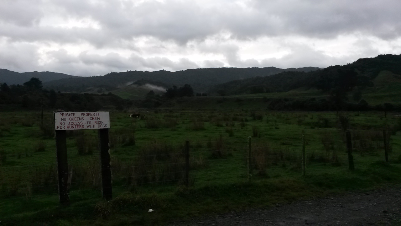
I park by the bridge (next to the sign that says there is no Queen's chain) and at 0750 leave the car with a little bit of trepidation. This spot is a bit more visible and I wonder if it will still be in one piece on my return.


Car park

There's space between the fence and the river to walk to reach the stream - which is quite a good size (and a little up). The paddocks soon give way to bushy banks and a gorge, however the bottom is generally wide enough that there is only a couple of scrambles to avoid deep bits. There's a few terraces and flats with lots of lovely punga.


In the gorge

A little over 2 hours later I reach the flats. There's an initial false alarm (a small open area before diving back into a narrow section) before reaching a long series of flats with lots of cutty grass. It's generally pretty good going although you can get mired in the grass if you pick the wrong line. I discover that it is fairly easy to miss the side streams which is a little bit tricky when you are trying to navigate by them.

About 25 minutes up from the start of the flats there's a(nother bloody) hunters' camp on the true left. It looks like it got a lot of use once but is now just a pile of litter, like most of these structures.  I think this one might be near an old route to the ridge above Spion Kop, but I have my eye on a spur further up.


Hunters' rubbish


The flats - Panatewaewae to right of centre (probably)

There's another camp about 15 minutes later in a similar state and 10 minutes after that (about 1050) I just about miss my stream as it flows out between clumps of cutty grass.


Another camp

It's a bit of scramble onto the base of the spur with no signs of tracks. It's relatively young forest - lots of slippery black humus and healthy fungus but open enough. A little over an hour later (1100) I emerge on the ridge top to find a good ground trail with old orange spray blazes. I follow this down to the edge of the farm land where it pops out onto a grassy knoll with a survey pipe by an old farm track. The track leads down to a series of little knobs - one of which is Spion Kop (about 12.30).


Not Spion Kop but it does have feet


Magnificent vista from Spion Kop (I think)

The cloud ceiling is about 1500m so it's a bit of a gloomy view to look at while I have a bite. The farm here consists of a narrow strip of land around the tops of the spurs - there's a few cattle beasts about. 

Back in the bush it's getting cool and the wind is coming up. The track leads nicely up to Panatawaewae where the markings finish and the trail becomes far less distinct.  There are only two spots though where the compass is needed - both where the ridge drops into a saddle. The bush up here is reasonably mature with some windfall to contend with. I assume it is largely regrowth following logging and the 1936 storm.

For some reason I'm feeling a bit tired so stop for a breather - after which I set off purposefully in the direction from whence I had come. This could possibly be characterised as some sort of bias, but I think it is more an example of some sort of stupid. Fortunately I twig before I've gone too far.

It's taken a lot longer than I had thought to get this far so, by the time I reach the ridge junction south of 890 I've decided I won't be dropping into the Otaki headwaters tonight. Depending on progress from here I will either stay near the top of Oriwa (Lake Hollow where this is a roof with a water tank and plenty of camping spots) or maybe pop through to Waiopehu hut.


Look, a marker - this must be a track ...

I have been along this part of the ridge twice before - both times finding it easy to get mislaid in the flattish, swampy bit just south of the junction point. It's 1530 and fairly cool but not raining. There's a few old plastic markers but little ground trail until the ridge top sharpens on the stretch towards 918.

The drop to the saddle is a little tricky - it's the sort of place you would expect to see a useful marker because people must come through here. I don't notice anything and overshoot slightly, following what turns out to be another one of those ubiquitous disappearing game trails (another example of bias?).

A bit of a scramble brings me back onto a better formed spur with occasional wee windows down Makaretu Stream, it's about 1610.  I suspect the trick through this saddle is to keep close to the north face and follow the spur NE into the saddle then grab one of the two sketchy spurs that head SE up to Oriwa and Lake Hollow (I think I follow the later and can't say there is a significant ground trail).


Makaretu Stream

The bush is quite mixed through the saddle but ends up with a climb through reasonably open trunks chasing shafts of burnt orange sunset up the hill. At 1710 I'm at the ridge top seeing the last of the sun dip below the horizon beneath a lowering sky.


Lake Hollow in the last of the light


A roof without a hut
(second time my only photo here has been rubbish)

Lake hollow is as soggy as usual, I pause to clear the guttering on the roof then get a move on to make the most of the rapidly fading light - sights firmly set on a dry hut for the expected overnight southerly rain.

There are a few tape markers and a reasonable ground trail but both rapidly become invisible in the gloom. The ridge is well formed and, following the compass, I manage to keep to a line, although frequently wander off and end up clambering through more tree falls than you would in daylight.

The wind rises and it starts getting quite cold - the odd piece of orange tape is a welcome confirmation of progress.

Finally, the ridge starts climbing steeply and the trees give way to leatherwood before the canopy disappears completely. The open sky swallows the headlight and this lone tramper suddenly feels a lot more exposed and vulnerable. Shortly afterwards I lose the trail in the tussock and thrash around the slope expecting to drop onto the track at any moment.

Here the dreaded bias comes back into play - when I eventually reach the track it is running at an unexpected angle - my brain runs a convincing argument that the only way it would be running in this direction is that I crossed it at some point and have circled back. Full of confidence I turn in the wrong direction and head off  thinking that the lights on my left (probably Palmerston North) are Levin. Ironically, this direction is taking me to  Twin Peaks - the site of a memorial to some trampers that died in that storm of 1936.

The track drops and then starts climbing - finally my brain accumulates enough dissonant feedback to suggest that we stop and regroup. The compass seems to be pointing in the wrong direction and I can see a light behind me. I think the light must be the hut but taking a bearing on it makes no sense whatsoever (it was probably around Lake Hollow but I didn't see anyone there when I came through). Finally - trusting the compass and the line of the track, and applying some logic (the muddy track has such high use it can only be the main thoroughfare) I turn around and trudge back into the saddle and up to Waiopehu to finally drop down to the hut.

At 1930 I came in from the cold to be met by candlelight and a growling dog. A party of three (plus dog) are retiree friends who came in Wednesday aiming for a northern crossing but wisely turning back with poor weather on the tops. The two women have turned in but the chap obligingly heats water while I slough off wet and muddy kit. 

Things are decidedly more cheerful in dry clothes and with a full stomach. My hut companions are reasonably quiet (once the dog settles down).

For the record - although the dog was reasonably well behaved I am still of the view that dogs don't belong in huts. I'm not about to start an argument though so keep my thoughts to myself.

The rain starts in the early hours of the morning and keeps a steady blatter against the windows - in the morning it transpires that it is driving straight into the porch so some of the things left to dry are not as dry as hoped. The dog takes one look outside and decides it can hold on a bit longer.

As usual, my brain has come to some conclusions during the night - in this case, that we won't drop down a spur to what might be a swollen Makaretu Stream so the most practical exit is straight down the track.

I'm first out at about 0800 - it's raining but not windy and the cloud ceiling is a good 100m higher than the ridge. The track itself is alternately a bog and a stream stream, but once under the canopy I warm up and soon shed gloves and balaclava and start regretting the merino layer.


Morning

It gets quite dim under the canopy but the rain stops and it's nice to potter down through the wet bush.

The rest of the trip? Not much to report really - the intersection with 6 discs track at 0930; the bottom of the spur about 1010. The paradise ducks set up their habitual racket as I wander across the farm flats to arrive at the usual road end at 1020. 10 minutes later I'm reunited with the car, which I'm delighted to find in one piece.


6 discs intersection

Postscript

Not all boxes ticked but some new countryside and a satisfying wee explore. Makaretu is worth a look but watch for hunters and be careful about access. The Otaki headwaters are still very much unfinished business - unfortunately there is now one less unexplored route to get there.

Nil spot-heights for the weekend? Oh yeah - the rules (more like guidelines really) are that only spot-heights in the forest park count - most of this trip was actually outside the park boundaries or covered points I've already been.

Tuesday, 26 December 2017

Mid Tararua crossing

An appropriate response to Christmas over-indulgences is a bracing 4.30am alarm on boxing morning followed by four days in the wilderness on iron rations.

The main aims of the exercise are to explore Oriwa ridge, visit the Mid-Otaki 'hut' (a two bed shelter installed by DOC for bio-diversity work), cross the headwaters of  the Park River (exhibiting some of the clearest signs of glaciation you will see in the Tararuas), traverse Carkeek Ridge, pop through the Waiohine River headwaters on the way to Dorset Ridge then Dorset Creek, cross the Broken Axe Pinnacles and pick up various spot heights on the way.

As with all cunning plans, parts turned out to be overly optimistic and some flexibility on the fly was required. The first hiccup was the weather forecast - midsummer in the Tararuas was apparently going to involve hail and wind chill ratings of below -10 deg C on the tops. The first order of business on Christmas night was therefore to swap-out the pith helmet and safari clothing for more suitable attire.

In the end there were firm ticks next to pretty much all the goals of the trip - the exception was a possible diversion to the Waiohine River and back up to Angle Knob which will keep for another day. About 29 new spot-heights visited which is a large dent in the list.

What:     Tararua crossing - navigation trip and spot-heighting
When:    26-29 December 2017
Where:   Manakau Road to Holdsworth
Why:      Navigation, new territory, hut and spot-height bagging, burn off xmas calorie overload
Who:      Solo
Map:     

Not exactly the shortest route

Day one - to the wee triangle

It's a wee bit of a struggle to get out of bed early on boxing day. The support crew is nothing if not obliging and rustles up some coffee to keep us awake on the drive up the coast. She also keeps threatening to slip extra food into my pack convinced that I will starve to a withered husk despite the gargantuan quantities of Christmas fodder consumed in the previous 24 hours.

With a five day trip plan I've just managed to stuff everything into my medium pack so the only addition possible is some slices of the sister-in-law's fruit cake (destined to be squashed beyond recognition).

The weather is gloomy but holding as we bid farewell at the Manakau Road end about 6.44 on a threatening morning. The wander up the road and scramble across the slip are well familiar now. I take a slightly more sedate pace up the spur to Waitewaewae in deference to the days ahead.


Five day pack looks about the same size as a weekender!

At 0900 on Waitewaewae it's cool and trying to rain so there's no tarrying. I've been through here a few times now but this is the first time in reverse. This time I don't divert to the plane crash site (11am). There's a minor hiccup when a lapse in attention sees a premature diversion down the wrong spur but this is soon rectified. It starts to drizzle and keeps it up until early afternoon.

At pt 918 I'm leaving the main ridge and heading into new territory. This is where the adventure begins. Rather than the usual route east to Oriwa I follow a spur down to the south to pick up spot-height 815. Some maps show a road route through the saddle here but I can find no evidence of it so it is either completely overgrown or was only ever a paper road.

Back in the saddle below 815 it's a mucky scramble down to the stream then a steep climb to pt 985 on the Oriwa Ridge. The ridge is famous for tree fall from the 1936 storm making it time consuming and laborious. I find it not too bad. It's undulating and long, but mostly straight forward until after pt 937 where navigation gets tricky and it's easy to wander onto a side spur. There's a bit of a ground trail that comes and goes but a couple of remedial scrambles across gullies is required to keep on route.

The ridge is also home to Notoriwa - I'd seen the name before but not really thought about it's origins - I idly wondered about it as I pottered along - assuming it came about from people travelling north over the innumerable bumps towards the high point Oriwa ... the conversation probably went something like:

"Is this Oriwa?"
"No"
"Is this Oriwa?"
"No!"
"Is this Oriwa?"
"No!! this is not Oriwa!!"
"Notoriwa?"
"Yeah, why not."

Google confirms that this is in-fact pretty close to the truth.  Butcher, who proposed the name, noted that "I have the strongest objection to bastard Maori, I agree that some other name will have to be found for the knob." Clearly he wasn't successful in doing so.

Towards the tail end of the ridge I realise that I will be spending the night under the fly - Mid-Otaki hut is way out of range for today. At least the weather has cleared a bit.


Otaki River from tail end of Oriwa Ridge

On the valley floor the river is up on previous weeks and a little turbid but passable. I end up crossing and scrambling up a stream to find the old route up valley I followed a few weeks back. The blue triangles run out pretty quickly but I manage to follow the faint trail until the approaching twilight dictates it's time to find  a spot to camp.

This is the first use of my new DD Hammocks fly - it's light-weight and an odd size (plenty long enough but only 1.5m wide).  It takes a while to sort out and in the end was pitched pretty badly, but the threatened rain doesn't eventuate and the southerly blasts over the tree tops far above so I'm comfortable.


Day two - the short day (campsite just off screen, bottom left)

In the morning I follow, lose and find the old path until it deposits me on a low terrace and disappears completely. It's easy going following the river and crossing terraces, the only tricky thing is keeping an eye out to pick where to leave the river to pick up a couple of spot-heights (452 and 480). Both turn out to be relatively straight-forward but as the valley tightens, care needs to be taken not to get caught on a terrace with a high bank above the river.


Morning in the forest

Random slip and flats (looking down river)

Old fire place on one of the terraces

I thumb my way up the map to the bend with a large marked slip on the true right, north of Kelleher Creek. On approach though, it turns out that the river has carved a new course across the large terrace (the online map is also out of date) - this causes a little disassociation, but is quickly worked through. The new course has a massive log dam to negotiate.

On the far side, four deer and three goats are grazing the flats and take a while to notice my approach. Soon after, Mid-Otaki hut is basking on an immaculately grazed lawn in the hot sun.


Halfway through the log jamb - tiny, tiny deer in the background

It's a tidy wee hut with two beds and double opening doors. A picnic table outside is a good spot for a pause to study the map and have a midday snack. It's been a great wander up the river - easy going and beautiful bush.


Mid-Otaki Hut


I've worked out a complicated route to link spot heights on three consecutive spurs to ultimately arrive at Dracophyllum Knob (and hut) on the main range.

595 requires a steep scramble up from the river to a flat top then a down-slope bash to an unnamed creek and a pause for camembert, fruit bread and a squash of very nice christmas cake. The rain briefly washes through.

580 is a mucky scramble to a small saddle then a short climb to the knob. A light shower passes through but is not entirely sure it wants to stop.  The wind is whipping through overhead.

The short drop from 580 to Puketoro stream marks the start of the proper climb. There is surprisingly little ground trail. The rain holds off and the temperature stays high.  It's a familiar uphill grind with trails coming and going.  There are some interesting clearings and flat spots around 958 then a final climb to the hut. It's hot and sunny when I arrive at the top around 4pm.


South down main range from Dracophyllum


East to Carkeek Ridge - high point is probably Carkeek


North East - Pukematawai on horizon

I'm a little worried that the two bedder will be full of Te Araroa walkers but hopeful that my early arrival will secure me a bed. There is one chap there who is getting ready to leave - I make encouraging noises about Nichols hut not being so far away - he needs no convincing as there are a bunch of his mates already there and shots off with the parting remark that there may be three more following him. He has come up from the Outdoor Pursuits centre this morning so has put in a solid day already - I find out later that his knick name is 'Rocket' - very apt.

With a stake safely claimed on the top bunk I while away the afternoon drying soggy gear in the sun and sending a few texts. The log book is about 90% TA walkers.

A couple of TA walkers turn up later in the afternoon - he introduces himself as Prancer and she says I can call her Natalie but her 'trail name' is Toothpaste.  It seems that the TA walkers are trying to create a tradition of knick names although are finding that Kiwis are not so quick to take to the idea.

As the shadows lengthen the strong southerly sees the temperature drop rapidly and we're all a bit chilled when we finally climb into bed. Three bodies in the small hut make it reasonably cosy though.  Fortunately, the third possible companion must have stayed at Te Matawai hut as it would have been a bit of a stretch to fit him in.


Day three (or most of it)

Thursday morning is wet and windy.  The clag around the hills is high and there are glimpses of a dusting of snow on the highest peaks. I'm up and out first at 0800, heading north towards Butcher's Knob. The aim this morning is to drop into the Park River and climb the opposite side to Carkeek. The upper Park is a lovely glacial U but the route I am looking at is further down where it starts to turn gorgish.


Snow on Pukematawai, cloud on Carkeek

A short way up the range there are two knobs just south of Butcher's Knob and on the northern of these there is an inexplicable cairn by the track as it sidles below the knob.  I take this as a sign that there is a route down a steep spur into the valley.  This turns out to be mostly true. 


The glaciated form of the upper Park Valley

I can't see a foot trail but the spur is negotiable until near the bottom where it steepens and a fair amount of trial and error is required to find a way down through some impressive bluffs - not for the faint-hearted. I would suggest veering left towards the bottom of the spur.

At this point the Park River is small and clear, the stones are lethally slippery though from the light morning rain. At the Thompson Stream forks there's a pool and the valley ahead starts changing from bush-clad gorge to scrubby glacial U. Time to regroup for the climb.


Thompson - Park forks


Down stream - you don't want to come down some of those bluffs

I'm hoping that this is an obvious route up to the peak but discover no real sign that anyone else has had the same thought. It's a steep climb through unrelenting scrub - nothing for it but to sweat and swear my way upwards.

The spur is like a hip jointed roof - the climb up the hip to the ridge line of the roof is scrubby and tough but once on the flat top the going is easy with a strong game trail.  The spur then climbs steeply through more open vegetation to Carkeek (1435m). Wee patches of snow start appearing in the last 150m and the wind carries more. This is supposed to be mid summer!

It's cold on Carkeek so I take a bearing and head off - taking great care not to wander onto a spur in the murk. It soon becomes quite sharp and easy to follow with some impressive erosion towers and shutes plunging into the Waiohine 400m below to the east.

Although there is a bit of foot trail and the odd cairn, this certainly feels like one of the most isolated parts of the range.  There's a lot of ridges and river systems between here and the coast in the west and the Wairarapa in the east.  It's a reminder to be careful although not paranoid.

The ridge runs up and down but is easy to follow - Carkeek hut is just inside the bush line and is visible from quite a distance above but disappears as you approach until you are right on it. There's some ominous bits of mangled helicopter as you round a corner and suddenly there it is. 


Carkeek Hut

A standard six bunker it is light and cheerful. I head down to bag spot-height 1080 which is in beautiful goblin forest.  The track down to Park/Waiohine forks appears well traveled and marked. It's about 1.30.


Pt 1080

Back at the hut, lunch of camembert and fruit bread satisfies the inner man. A map check confirms the next steps and reminds me that there is a spot-height hovering off the side of the ridge that I meant to pick up (1212) - fortunately it is on my way back to 1285 for the route down.  It would have been a bit of a self inflicted disaster to miss it.


Looking west from pt 1212 - across the main range


North east from pt 1212 - towards Carkeek


The rest of day three

The spur running SSE from 1285 provides good travel down and has some markers. There are no real problems although some fairly steep bits. At a little before 4pm the Waiohine River is clear and it is tempting to follow up to its headwaters but my route is up a spur from a side creek to Dorset ridge. This is apparently an old cullers route and I do see some old permolat markers but little ground trail. It is another steep climb but much easier than the one out of the Park. In places there's a lot of cutty grass under a relatively sparse and low canopy.


Spur up to Dorset

The wind is cold and strong at the top so I take a bearing and head off for Dorset Ridge Hut - in retrospect I should have traveled further SW along the ridge as I ended up sidling through some roughish tussock country before finding a good foot trail down to the hut.

Peering through rain spattered glasses I try to see if there is smoke coming from the chimney and half hope there is (a warm hut) and there isn't (solitude). The latter is the case - I light a fire, spread through the hut and take stock. 


Dorset Hut

It's a six bunker but a closed in porch has provided a really useful extension. It provides a very comfortable night and some of my gear even gets relatively dry.


The start of day four

In the morning I don't rush so it's almost 8am when I drop down the spur to Dorset Creek. The track is reasonably well marked and traveled but in some ways a little tricky - it could just be the misting rain but I find myself slipping and sliding a fair amount.

Dorset Creek a little under an hour later is beautiful - deep clear pools and carved rock. There are a few challenging little scrambles but overall it's good travel.  At the selected confluence I scramble up to spot-height 830 (nothing to see here) then drop to the unnamed creek for a steep scramble to 1118. As expected there is no sign that anyone would bother to follow this route.


Dorset Creek

At 1118 I join the quite well traveled route down to the Waiohine/Dorset forks - I'm intending to head down to point 912. Plan A had me continuing down to the river and back up to Shingle Slip Knob via 1145.  I decide to pull the plug on this as I figure this will likely have me bivvying on the steep spur or the tops.

The route down to pt 912 is what you would expect from looking at the map. From there it's back up to McGregor Biv for a late lunch around 2.30.  Both the tops and the valley floor are in clag so there isn't much to see but it's pleasant in the middle and not cold.  The wind has dropped right away.


Bushline and cloud line looking down spur near McGregor Biv


McGregor Biv

The next goal is the Broken Axe Pinnacles. I have read about them and am aware that there is a snow poled sidle route around the steepest section.  However, someone has put a spot-height on top of one of them so I see no choice but to go over the top all the way.

McGregor is one of the +1500m peaks in the Tararuas - I've been here before and in the absence of a view merely pause to text confirmation of continued existence to home command.


McGregor

The pinnacles emerge, one by one from the clag and it's easy but careful work to follow along the spine. An unmissable DOC sign indicates the sidle route - there are pretty clear indications that people have been over the top though so I'm pretty comfortable following suit. It would probably be more scary on a clear day and it isn't really until the last wee scramble down to the ridge line that I feel that there is any real challenge (someone with a shorter wheelbase may have more trouble). It's about 4pm as I turn my back to head towards the Kings.


The first of the pinnacles

And the next, and ...


Looking back at the last - note bypass sign at base

Just below South King I'm back on familiar turf for the 800m drop via the well named Baldy to the saddle below.  Somewhere en route I figure that I can either put the hammer down and maybe get out tonight or will have to find a source of water and campout.


Last day

Pinnacle ridge is very nicely tracked and marked so I can rocket along as best as aching legs allow. At 846 I'm back into new territory for the crossing from one ridge to the next via a saddle, however it is still well marked and travelled. At 862 I divert NNE to pick up a spot height at 800 - there is an old trail with little marking and a bit overgrown, but a mostly discernible foot trail that sidles to the east of the ridge.

The race with daylight is now on. The track makes a short climb through clearings to Pinnacle itself. On the way up I startle a couple of kereru stooging about on the ground - I can't see I've seen them doing this before.

At the top I stop to not look at the non-existent view and to call brother number one ascertaining that, yes he is available for a pick up and we reckon I'm about an hour out (all going well). There has also apparently been a SAR call out in the Holdsworth area - a group of three lost on a trip to Rocky Lookout - given the highway nature of the tracks you have to admire the determination that must have been involved to get mislaid.

The track down continues to be well formed and marked albeit somewhat slippery.  It is a well used predator control route with a virtual museum of trap types.

The track eventually emerges at the top of a large slip near Donnelly Flats (about 8.30pm) then works its way down the true left. It's getting quite dim in the trees but I'm determined not to stop to hunt at a light. The track parallels the river sidling up and down and along terraces. Eventually it pops out right beside the main foot bridge over the Atiwhakatu. 

A few minutes later - just before 9pm I'm at the carpark and meet bro number who one has kitted up and is just about to head out and miss me completely by heading up the main track to Donnelly Flat. Apparently the missing party managed to self extract with the help of the DOC ranger and were currently taking a member to hospital with a strained back.

I relax into the car seat and take an inventory - being out for four days has meant double the number of the usual minor injuries including a hole rubbed in one leg by the gaiters, a large bruise on the bum, a weepy eye from a stick poke and diverse other knicks and bruises. Nothing that a hot bath won't fix.


I thought that sit down was a bit hard

Postscript

A lot of ticks in boxes this trip.
  • Oriwa ridge is enjoyable jaunt - long and a few challenges but nowhere near as tedious as expected.
  • The wander up the Otaki river is pleasant culminating in Mid-Otaki hut.
  • Now that I have a an idea about the eastern spurs onto the main range I would be pretty confident about tackling most of them (some of the headwater ones could be a bit scrubby though). 
  • Caution is warranted dropping into the Park Valley, the spurs are steep and can bluff out.
  • Some challenging scrub on the spur I choose to get on to Carkeek Ridge - I think there is a more travelled route further down valley.
  • Carkeek Ridge is isolated and has dramatic views. Would like to see it without the cloud. The hut looks like a good spot and has some of the mossiest goblin forest - sort of like a green bouncy castle. The spur to Waiohine is navigable and been used before.
  • The spur up to Dorset is apparently an old route - not a lot of indications left but perfectly fine.  The hut is aways off the ridge and is a perfectly fine retreat. The route down to Dorset Creek is marked and navigable. The Creek itself is right nice.
  • Spurs below McGregor Biv have good marking on the main route to the Dorset/Waiohine forks. The other spurs not so much.
  • Broken Axe Pinnacles - not as scary as I was expecting. 
  • Pinnacle Ridge was a delight, again. Pinnacle is a nice jaunt and route to the road end. 

Gear - The Tararuas are always dishing up weather lessons. The forecast was accurate enough but snow in summer!? I decided to take a lighter rain jacket and this was fine. The DD Hammock's fly is light, small and useful but the width demands careful pitching.


The pack explodes in the sun