Showing posts with label Ruahines. Show all posts

Saturday, 29 February 2020

Wakelings

I feel like I'm hammering the area around Sunrise Hut but there is so much to explore behind the first range. Te Atuaoparapara sits like a spider in a web - the nexus of big ridge systems connecting north, and south - and with interesting (gnarly) looking spurs plummeting to other points.

Behind the scarred ramparts visible from across the Hawkes Bay plains, major river valleys run in parallel roughly north, forming more ridge and range systems before diverging or joining and heading west: the Kawhatau, Waikamaka and Maropea Rivers.

There's a few things in mind this weekend:
  • The ridge west off Te Atuaoparapara
  • A waterfall on a side stream off the Waikamaka River
  • Wakelings Hut 
  • The long ridge running directly north from Te Atuaoparapara
And, in an attempt to avoid already travelled territory, I've spotted a spur that drops steeply off the slopes of Te Atuaoparapara to the Waipawa River.

Let's see if it goes a little more to plan than last weekend ...

What:     Nav trip
Where:   Te Atuaoparapara and Wakelings Hut
When:     29 Feb - 1 March
Who:      Solo
Map


After the, now familiar, long drive it's 8.50 when I leave the car at the end of the road. This time I'm starting from the romantic sounding Swamp Track.

The track takes about 20 minutes to circle beside an ancient swamp that is in the process of reverting to forest before reaching the main track to Sunrise Hut. The remnant kahikatea are still present but beech is well on the way to ascendency. There's some good wee info boards describing what's going on.

Shortly up the main track I bump into an older couple who have been at Sunrise and visited Top Maropea Huts over the last couple of days. They had poked their noses up the hill this morning and she warns me seriously about the fierce wind on the tops.

Approaching the intersection to the Waipawa River there's an older (mid 50's?) chap with a younger Asian woman taking a breather on the way up. I wonder if it's a guide and punter but don't stop to find out after a brief hello. I've noticed advertising for guided trips in the area so wouldn't be surprised.

A little later a younger chap comes down with a sports bag and chilly bag - completely unsuited for tramping so I assume he's just done an overnighter. A little later a young couple come past - this place is busy!

Someone has left some untouched 'up and go's, and a couple of snacks by the track - it's fresh and I wonder if the young chap just couldn't be bothered carrying it down. I stash them in my pack intending to drop them at the hut where there's a chance they might get et.

It's warm enough and a bit muggy - as I climb I get closer to the cloud ceiling.


About 10.25 I round the final corner to see the hut. There's a chap in residence who is sitting by the fire. He's been in the area for the last few days and is intending to wait the day out in the hut - not sure why he thought a fire was needed though.


The hut is right at the cloud ceiling so I drag my coat out as well as topping up water and filling in the log book.  It gets colder and blustery as soon as I start along the ridge behind the hut. By the time I get to Armstrong Saddle the wind is getting boisterous and by the junction to Top Maropea Hut the wind is strong and the rain is starting.

I'm soon saturated and stop to add another layer. The rain is not heavy but is being lashed along by a strong northwester.

The trail comes and goes on the way up out of the saddle and it's easy to wander off into a bit of scrub. Towards the top the wind and rain ease a bit but it's still pretty unpleasant. About 12.25 I'm close to the top of Te Atuapoarapara and hunker in the tussock for a break and to set a compass bearing for the ridge west off the top. It's taken about three and a half hours from the car including a goodish break at the hut so I'm comfortable about the amount of daylight to get to the hut - if not the amount of visibility for the the route off the slopes.


At the top I barely pause before veering right and following the compass down into the clag. The spur turns out to be pretty obvious with a reasonable animal trail. The map implies it could be a bit spiky but it's good until it flattens. The first spike is readily sidled on an animal trail on the left; up and over the next one, then towards the end of the level bit I sidle left but end up doing a bit of scrambling across the top of some steep crumbly bits. I suspect it would be pretty straight forward in good visibility. I watch the compass and make sure I follow the part of the spur that veers right (NW) and starts to drop steeply.

It gets a bit scrubby and I find and lose trails through scrub and low forest. Eventually the going improves as the ridge drops into better forest through a saddle then climbs to a wee knob. So far so good - nothing too dramatic or horrible.

The forest is a bit more open now - I've decided I want to follow the spur to the junction of the river and the stream off Te A on my right - it starts ok but after awhile the signs of a trail get weak and towards the bottom disappear entirely. Eventually I am scrambling down a steep, sharp spur and emerge on a steep face just above the river. It takes a bit of maneuvering to scramble down grabbing handfuls of vegetation before emerging at the river.


It's about 2.25 and this is the Waikamaka River. The day is still misty and damp. Looking back at the spur and the map I suspect it might have been easier to bear left down from the knob and come out at the next intersection up - but too late now. In summary, the ridge is viable from the top but the bottom bit I chose is a bit tricky and there is probably better options to finish by.


Junction and end of my spur (middle)


The river bed is wet but the water is clear and the level seems to be unaffected. The valley sides are steep to precipitous. It's good going down the river and the weather starts to ease but I have to be careful about footing.

Just after 3 pm I reach the intersection to the waterfall side stream. It's pretty obvious.


Stream to waterfall


It takes about half an hour walk up stream to reach the waterfall. The stream has a few sections where it is cutting through the bedrock rather than flowing over stones. There's also a fairly good sized slip a little below the waterfall that has dumped large boulders into the stream but it presents no problems.

The waterfall itself is pretty even at low flow, and the sun is now making a serious effort to break through. I don't stay long before returning to the main river.


Back at the river I have a short stop for a spot of late lunch (a bit after 4pm) before setting off down river for the hut.

Less than 15 minutes later I emerge off a terrace to hear whistling from a short way upstream. A couple of whio are cruising about on a pool - I wouldn't have seen them at all if he'd kept his beak shut.

The river bed is pretty much dry now and the travel is easy. I reach the next significant stream junction just after 5pm and a few minutes later pause to watch a large trout flick lazily away in a pool. Just a few minutes later at 5.10 I see a marker on a tree and just out of sight on an old terrace is the hut.


Although old with an open fire it has transparent roof sections and has been painted white so feels pretty fresh and light. There's a platform with four mattresses (you could fit more people easily). I hang gear about for as much drying as the late afternoon might provide and set up for an early dinner.

There's a bit of wind about the tops but down here is calm and it's a quiet night.

The morning is mild and although there is mist in the valley I get the feeling it could be a sunny day.  After tidying the hut I set off a little after 7.30. I can hear a whio whistling somewhere on the river and there's fresh deer prints in the sand. A duck takes flight as I approach the water's edge (couldn't see if it was a whio).

It's a nice wee spot - I think not as pretty as Maropea Forks Hut but getting up there.

The marker across the river isn't immediately obvious but the track starts about where you would expect it to - approx. NNE from the hut. The climb starts straight away.

I plod up with a few wee birds commenting as I pass and eventually get a glimpse out that is not just into mist. Rongotea (1568) floats above the cloud in brilliant morning sun.


This is quite an old route judging by the age of some of the markers that are still doing service. It's a little after 8 am as the track eases onto the top of the ridge and starts heading north.


I can't see a foot trail heading south on the broad ridge top so just pick my way through cutty grass and bushlawyer while trying to avoid the hidden wind fall and stumps. I mutter about the propensity of beech to shed branches.

Where the ridge narrows there could be some ground trail and from the Wakelings log I know that this is a common route to take before dropping to the next valley and climbing to Top Maropea Hut. But for all that I don't see a lot of signs of people.

The morning sun is slanting across the ridge under the canopy and the undergrowth has just the lightest touch of dew so I'm not getting soaked which is nice.  There's a couple of knobs before the ridge climbs gradually to a point (with a slip on the west face on the map). I think this is the launching off point to drop to the next valley so I'm expecting the ridge south from here to have less ground trail.

The bush so far has been reasonably benign - a few tight bits with close growing saplings and you have to keep your eyes peeled or you can end up in dense low beech.


Down Waikamaka Valley - volcanic plateau on horizon

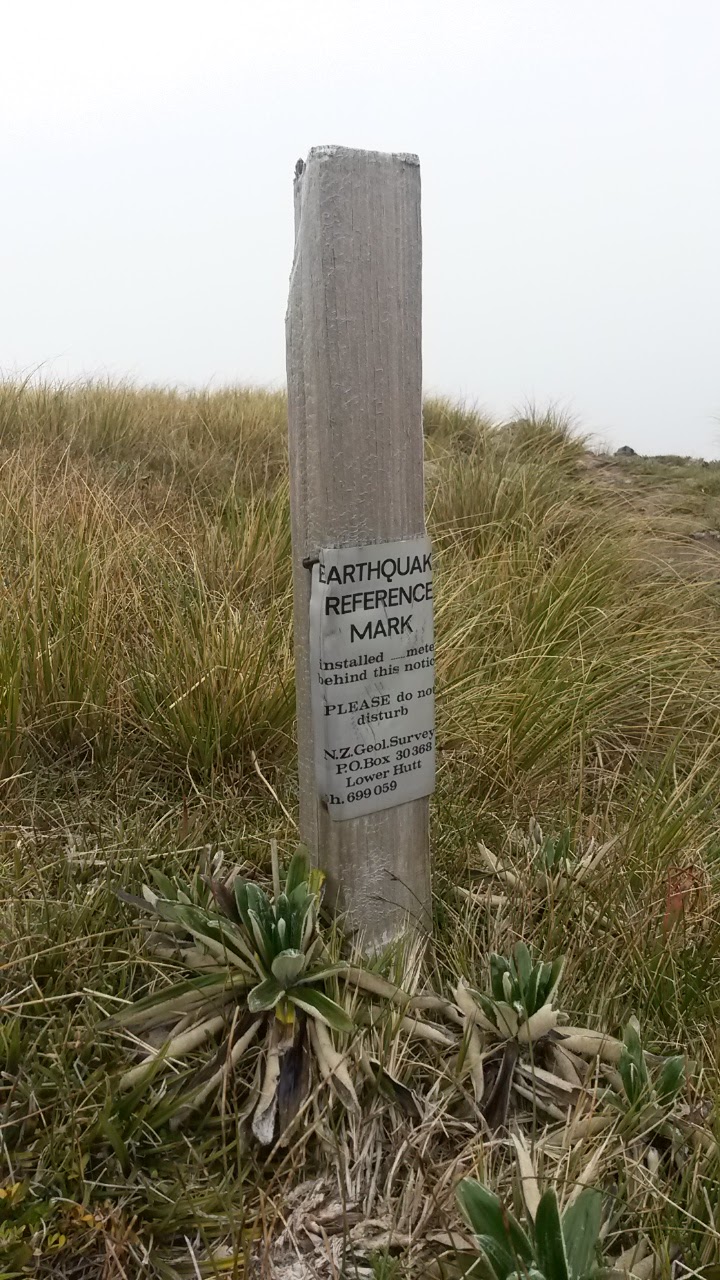
It gets a little hairier with more tight bush and some scrambles across the top of slip faces. At one point I end up gingerly edging up the loose surface on the marked slip face on the east of the ridge (just south of a saddle at 1320m). Shortly after this there's a wee dell on the ridge with an old metal trig like thing. I have a bit of a sit down and drink - it's about 9.45. After this I sidle the ridge top for a while then it opens up for good going under clear skies.


Back down the ridge

Once I get high enough and can see over the Rongotea - Rangioteatua Ridge to the slopes of the Hikurangi Range I hunt for a sign of McKinnon Hut. Sure enough, there's a wee white dot right on the bushline.

A movement above catches my eye - a falcon is sitting on the ridge keeping an eye on me labouring up. I stop and watch - it's relaxed and occasionally tilts its head to see what I'm up to. I try to sidle around so as not to disturb it but as soon as I drop out of sight it heads off around the slope and disappears behind a spur. I climb back to the ridge to where it was sitting and admire the view.


The falcon's view

Sometime later I see a feather on the ground and idly wonder if it belongs to a falcon when a couple of steps later there's a mummified animal (hare?).  Perhaps related?

It's pretty good going up the ridge and there are some useful animal sidles in a few places (don't pick the ones where they are just wondering onto a face to feed). 

I've had so many claggy days on the tops around here that it is a novelty to be able to see the full range of surrounding peaks, ridges and valleys. There's also some small pleasure in a growing feeling of familiarity - when you visit a place often enough you start to recognise the landmarks from different angles and this strengthens your sense of location in the landscape. It's sounds obvious but there is a huge difference between knowing you're at co-ordinates x,y and knowing that I'm at point x,y so, that must be Ridge B that I just about got blown off, and that's peak A with the low sidle, and if I look over my shoulder I might be able to see the hut in valley C.

So far, the impression I have of this ridge from previous glimpses from Hikurangi and the ridge north of Sunrise Hut is craggy with lots of slips. So far it has had a few slips but hasn't been really craggy but there's an interesting looking bit looming ahead.


North up ridge - getting a bit rockier

It proves to be steepish with a fair amount of loose footing but with no wind and good visibility it's perfectly navigable.

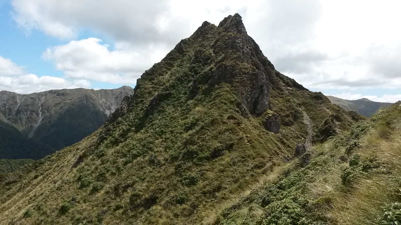
Getting towards the top I essay a sidle that proves a waste of time taking me across a few loose chutes and tussock faces without gaining any advantage. I sweat back up to the ridge just short of the junction and can now see the top of Te Atuaoparapara properly for the first time.


North from near the top of the ridge

Ridge to top of Te Atuaoparapara

At 11.30 I join the ridge I came along in the clag yesterday. About 4-500m away is the top, below is the Waipawa River and on the other side (south) is Three Johns - my first real view of it. In the east the Hawkes Bay is wondering where the sun is.


Three Johns on left, Te Atuaoparapara on right

Intended spur to Waipawa River

About 15 minutes later I'm at the top of my target spur - this navigation thing is a doddle without clag! There's a wee cairn at the right spot which gives me hope that the spur might have a good trail. However, right now it's time for an early lunch.


There's a bit of a cool breeze so I hunker down and spread some soggy gear out to dry while I munch on wraps, camembert and hummus. A wee fat spider catches my attention as it sets lines of web between the waving blades in a clump of tussock. 

It's almost 12.15 when I've had my fill and stashed the somewhat drier gear. The spur starts ok with a bit of foot trail but it tends to drop left off the spur - it might be that there are routes down one of the streams but they look pretty steep on the map so I'm not game to try.

It starts to get a bit scrubby and it becomes rapidly apparent that people aren't using this route with any frequency. The vegetation never really becomes easy - even after the scrub there tends to be a fairly messy understory and the shape of the spur is a bit tricky in a few spots. I'm expecting the slope to ease towards the bottom but it doesn't - I suspect I have drifted off line but after a steep clamber down I emerge pretty much bang on the junction between two streams.

It's taken about an hour 25 minutes from the ridge so not excessively long, but although it's not the trickiest descent I won't be queuing to do it again.

It's hot and bright in the debris fan around the stream; a few minutes of boulder hopping and I'm at the river. There's a reasonably well beaten trail down the true left so I can potter along at a reasonable speed.  I exchange pleasantries with a family group of five who have come in for a day trip then head on down river.

Last time through this stretch was in fairly dim conditions - this time in daylight the river is prettier than expected as it meanders through some rocky bluffs.

I keep an eye out for the side stream that I should have passed when I climbed to Three Johns; it's a bit hidden in buddleia but is a reasonable size. It's probably only about 2-300m past the one I mistook it for, so I excuse myself a little.

At 2.35 I'm at the road end gate - about 7 hours after leaving Wakelings hut so I'd have to say that the ridge and spur route was reasonably efficient.

On the way out I pick up the chap from Sunrise Hut and drop him where his girl-friend is coming to pick him up. Then it's just the long drive home.

Postscript

Yeah - a bit more 'to script' than last weekend. One of the better tops trips I've had in the Ruahine Range.

Swamp track - worth a look. Track to Sunrise = superhighway.  Route to Te Atuaoparapara - easy to wander off the trail in a few bits, but pretty straightforward. Ridge west off Te A - top is quite navigable but be careful of any sidles you take, expect a bit of a battle with the veg around the bushline and be warned that some of the routes off the bottom end in little cliffs. Waikamaka River - nice wander. Waterfall - pretty enough to warrant an hour+ diversion.  Wakelings Hut - nice spot. Ridge north of Te A - don't expect a strong trail below bushline, a bit of muckiness underfoot hidden in cutty grass, some dense stands of saplings and scrambles through tight low beech, a few erosion faces you might need to skirt, good going once you hit the tops with one bit that's a bit craggy and loose. Spur off Te Atuaoparapara - doable but a bit aggravating.


Friday, 7 February 2020

Six ways to waterfall

The ridges and peaks around the centre of the Ruahine ranges have caught my attention: Te Atuaoparapara, Rangioteatua, Paemutu, Mangaweka ... My last two trips proving that there's plenty of entertaining exploring to be had. 

This weekend, with three days at my disposal, I can plan a more detailed exploration with the goals of:
  • checking out a north eastern approach to the Three Johns
  • exploring the spur NW from 1715 and seeing if it's navigable to Waterfall Hut
  • following Pinnacle Creek to Hawkes Bay Ridge
  • visiting Purity Hut
  • popping up to the highest point in the park - Mangaweka (1731m) and along the range to Hikurangi (1710m),
  • exploring the feasibility of a spur descent off Mangaweka to the Kawhatau River
  • climbing Broken Ridge to Paemutu
  • trying a side spur approach to Smiths Stream
And in the process of all this rack up my third night at Waterfall Hut using six different approach/departure routes.

What:     Navigation trip
Where:   Central Ruahine Range
When:    7-9 February 2020
Who:      Solo
Map


Friday: Road end, over Three Johns and down 1715 spur to Waterfall Hut


Wednesday night is the Queen concert, Thursday is a Waitangi Day powhiri with Angela at Paekakariki (hosted by Ngati Haumia), then chilling with friends for the arvo. This all sets me up nicely for a restful break in the hills.

The drive up the Wairarapa confirms that the weather is shaping to be wetter than predicted. Sure enough, cold drifting rain greets me as I nip out of the car to open the farm gates on the final approach to the road end.

I decide to risk it and drive to the furthest car park. The farm track is ok for a townie car and it's a more casual set up then the main park, but there's room for at least five or six cars - if people park carefully. There's a couple of cars in situ plus someone camped up - I find a spot and drag on my raincoat and boots.


Toyota envy?


Windfall in the Waipawa River


A short walk down the hill and I'm heading up the Waipawa River looking for a stream on the true right. There's a couple of spurs I could take to Three Johns and I have picked the second one. Passing a wee creek I pick a spot and start climbing through mixed bush. There are plenty of animal trails.

In the back of my mind I'm entertaining the possibility that the creek I passed was not marked, and that this is the first spur - but up is up and I'm not too bothered.

After an initial clamber I meet a fence line in the forest - pretty much confirming it's the wrong spur. I follow it up and then around the slope to pasture. Picking a point I clamber over and follow animal trails up through tolerably open forest.


Rimu fence post


It's pretty good most of the way - there's a few patches of leatherwood and low trees to push through and it looks like people have passed, but not frequently. Although it has stopped raining I'm soon saturated.

A sudden clearing has a survey marker (about 1180m) and an excuse to stop and add a layer.


A bit soggy at 1180m

Later there's a rounded knob with leatherwood, and an uninterrupted view of clag that requires two compass checks to get past (I drift off line both times).  Otherwise the going never gets really horrible and I can keep pottering up through forest, and eventually into scattered scrub and tussock.

The ridge top sharpens and I pass the top of erosion faces disappearing into the grey on my right.  Eventually, the next knob emerging from the clag has a survey mark - 12.35 so a slow 3 hour climb.


I don't need to check my compass and map to work my way along the ridge, following a stronger ground trail that drops into the saddle. All still in clag.

The next section is easy going with the exception of some deeper tussock towards the top with liberal scattering of spaniard. I keep to the left most of the way up, veering to the right for an easier route further up (didn't find one). At one point, a large animal sets off a small avalanche as it plunges off the south eastern face.

Coming off the top of 1635 (1.20pm) I remember to drift to the right of the ridge top, to avoid having to cross a wee tussocky slot.

At Rangioteatua (1.35pm) - the clag is finally starting to thin so I sit for a leisurely lunch facing the ridge I plan to descend, waiting for it to appear. Which it does, to show a slippy, craggy, roller-coaster.


Rangioteatua

My target ridge dropping right

From the map it looks like I can leave my current ridge just as it starts to rise for the final climb to pt 1715, cut across the NW face of pt 1715, and gain the saddle to pt 1673. With the cloud ceiling now approaching 1700m I can see that the face is clear and am delighted to find a strong animal trail going exactly my way.


Rangioteatua at left - deer trail drops diagonally to right from lowest point of ridgeline
Taken looking back from sidle on pt 1673

I sidle 1673 on the north which is ok going but suspect the south may have had a better game trail. Regaining the ridge line I'm looking down the ridge and can see a strong trail down to a flat section linking to more sidle trails on the south side. These all prove to be solid going.


From other side of 1673 - the trail is visible on the ridge top then drops to game trails on left
Rangi Creek on right

The trail I'm on starts dropping towards a wallow in a bit of a wrinkle on the south side of the ridge, just before a saddle and a wee crag. I head up to the saddle to investigate the crag, but have a feeling the good trails on the south might continue lower down the slope.


Craggy bit that the sidle avoids

Dropping about 40m down the face there is indeed a great trail that takes me further along and down the ridge, eventually popping out on the crest again.


From Broken Ridge - rough line of the deer super highway

I'm feeling pretty chuffed with myself by now. There are a few craggy bits and patches of scrub and trees, but the trail always seems to reappear and there always seems to be a relatively secure way around the obstacles.

It's a wonderful place to be - the clag is a distant memory, although the clouds still haunt the peaks, and there is no one for miles.  Looking around: to the north east Rangioteatua comes and goes with some impressive slip faces dropping into the headwaters of Rangi Creek; to the north Rangi Saddle is starting to come into view; south I can case out the tail of Broken Ridge (which can keep until Sunday); across the Kawhatau Valley Mangaweka on the Hikurangi Range is tomorrow's business but looks rounded and friendly in comparison to the forbidding Paemutu.

Below there look like several viable routes into Rangi Creek (north) and a few promising spurs towards Waterfall Creek - but I can't work out where the waterfalls are so we won't be risking any of those.


Rangioteatua - scar face


Broken Ridge

Paemutu

Back up the ridge

Hikurangi Range

Having a ball

Once below the bush line things are still going surprisingly well, and I keep heading down until a long flat section (1300m). Here the trails seem to follow the line of a spur which drops towards Rangi stream. I'm tempted but hubris insists that I attempt to navigate directly to the hut.

As soon as I veer west across the spur the vegetation deteriorates and I start dropping steeply south west on a little formed slope. A wee spur starts to form then splits - I opt for the left then change back as it starts to head towards Waterfall Creek. The spur sharpens and drops steeply in what feels like the right direction (I'm not bothering with the compass) until I'm rewarded with the orange of the hut through the trees below.

There's a yellow tent outside and washing - not a good sign for getting a bed.


J is a little surprised when someone appears off the hill behind the hut and it is quickly apparent that he knows the area very well. Although he hadn't been down the ridge he knows someone that has, and understands exactly how it fits into the landscape.  He and Laura are the only two in residence - they had camped near Rangioteatua last night and come through the saddle to Paemutu then down Broken Ridge today. They got rained on during the morning and were drying things out.

J grew up on the east side of the Tararua and Ruahine ranges and has tramped a fair swathe of them both and, although based in Auckland, they manage frequent trips all over New Zealand. I pick their brains as much as I can and can give a bit of recent intel on the state of their intended route tomorrow over Rangi and Waipawa Saddles.

Three people is a civilised number for the hut and we don't get in each other's way. As seasoned trampers they have good hut etiquette and the time passes easily.

In the morning they get up and away efficiently and I say goodbye, before following them out shortly after (7.25am).  The plan for today is to climb to Hikurangi Range (the western most range in this part of the park) via Hawkes Bay Ridge (a local name that is not marked on the maps), do a there and back to check out Purity Hut, head north up the range over Mangaweka to Hikurangi, then backtrack to drop down a spur to the river and return to Waterfall Hut.


Saturday: loop with a couple of horns

My first route is up Pinnacle Creek - on the map it looks like the head waters could be a bit bluffy and steep so I wouldn't have picked it myself - however it is a well known route so I don't expect it to be tricky.


From spur above hut looking up Pinnacle Creek


From the wide shingle fan where it meets the Kawhatau River, the creek climbs increasingly steeply towards Hawkes Bay Ridge. It's a pretty straight valley so I can pause (frequently) and look back to see Rangi Saddle on the horizon - and for a little while the orange of the hut. There are side streams but the main valley is obvious.

Near the top there are a few little scrambles and a steep plod up with some loose footing, but nothing particularly complicated. I am however rapidly climbing into the cloud ceiling and have lost the view by the time I get to the signs on the ridge at (8.35 - DOC allow a generous 1 hr 30 down).


The signs aren't really needed today, as navigation is simple - turn right and keep going. There is one spot requiring a couple of steps across the top of an erosion face on sketchy footing, but this is quickly dispatched with. It's a bit cold and windy

I am a little too casual in my attention to map and compass, so am a little surprised that it takes me an hour to get to Iron Peg on the Hikurangi Range. The tops here are wide and flat and in the clag I'm close to getting the compass out when I bump into an old post with a tiny punched tin sign. The ridge drops to a saddle, then a wee climb and I'm at Wooden Peg - taking all of the 15 minutes DOC predicted. The signs are the only things to be seen in the cloud.


The ridge track down to Purity Hut reminds me of the route to Rangiwahia Hut. There's a good ground trail and an easy slope through tussock. About twenty minutes after leaving Wooden Peg I drop below the cloud ceiling - sun dappled plains appear below the forbidding grey line of the cloud.

Closer to the hut there are one or two spots where there aren't any poles to be seen and the trail fades, but nothing a compass wouldn't solve in bad weather.


35 minutes after Wooden Peg I arrive at Purity Hut (just before 10.30 so a couple of minutes over 3 hours from Waterfall Hut). The hut is tucked off the edge of a rounded knob and has a fantastic view. It's modern and in good nick. 

A party of three are gearing up to walk out down the ridge and are a little surprised to see someone appear from up hill at this early(!) hour. They came in via Kelly Knight Hut and camped on the tops before popping across to Mangaweka then down to this hut yesterday. They've had a bit of fun and games with permission from the Purity Track landowner (refusal because there's too many hunters and trampers up there - which there clearly weren't). They have a plan to skirt his land to get back to the carpark for the Kelly Knight Track - looking at the map I'm not sure how that will have worked out for them.

They're from Palmerston North and are just getting into tramping.  They're interested in taking on the Sawtooth Circuit - which, given the placement of huts, a western approach might be a bit of a challenge for them to tackle next up.


After asking a few questions, comparing pack sizes, and a general chat they head off before me.


It's a bit over 45 minutes back to Wooden Peg - the cloud has lifted a bit, and the wind has strengthened.  I can see down into the steep and eroding headwaters of the Pourangaki River and across the back of Iron Peg to Hawkes Bay Ridge.

15 minutes back to Iron Peg where the wind is getting boisterous and the clag is thick around Mangaweka. 22 minutes later I've climbed a bit of a slope and wandered along a broad top to what looks like a kit set trig - Mangaweka.


At 1230 it's time for lunch - even tucked on the lee of the ridge I need another layer. It does feel like the cloud will lift though.

It's a pretty easy wander along the range, a few ups and downs, but the clag dissipates to start revealing the eastern range around Te Atuaoparapara.


By the time I get to Hikurangi (1.50) the cloud ceiling is above the tops and it's a different day. It looks like the range continues pretty much the same (rolling) and the spur north east off the top looks pretty interesting.


Hikurangi right, Ruapehu left

North from Hikurangi

It ain't warm yet


South towards Mangaweka

The spur I want to come down starts about 200m below the wee saddle just north of Mangaweka. The face it is on looks pretty benign, so I decide to try a long sidle from two saddles along. There's a bit of deep tussock but it's pretty good and at 2.55 I'm just above where the spur forms and ready to descend. It's even getting warm now.


Up slope towards Mangaweka


I've heard that the creek beside the spur (Trig Creek) is navigable and there look like a few routes down to it - but I'm keen to see what the spur is like. 

It's fine through the tussock and low scrub with a bit of trail that comes and goes. It gets a little mucky in the transition to forest, but it's generally only briefly before there's a bit of trail to follow. At a few points the trail is wide and solid.


Useful game trail

Towards the bottom there is a flat spot on the spur and a wrinkle on the map that looks like there could be a direct route off the side of the spur to the creek junction. It turns out to be steepish and covered in cutty grass, but quite a good option as I pop out bang on the junction at 3.55. The river is in sunshine and is low enough that I can cross with dry feet to potter up stream.


Broken Ridge

The river bed travel is easy and I'm traversing the flats opposite Rangi Creek before I know it and Waterfall Hut soon after. It's 4.20 and there's no one at the hut or visited since I departed.

I settle down for the rest of the afternoon drying kit and tidying the hut. Seeing as I'm heading out tomorrow I parcel up some of the hut rubbish.

The last order of business is to confirm my route for tomorrow: up Broken Ridge and along to the end, join the route I took from Sawtooth Ridge to Hinerua, leave it at the last knob and follow a spur down to the stream and Smiths Stream Hut, then out via the marked track.

It's a quiet, mild night.


Sunday: Waterfall to Smith Stream

I head out at a leisurely 8am - passing the loo, crossing the stream and striking up the steep slope.  There's no obvious trail, but it's open enough and just a question of grunting on up. Eventually the spur starts to take a bit of shape and there are a few scrambles. The bush is a little damp.


 A bit of clag hanging around Hawkes Bay Ridge

The slope on my right towards Kawhatau River tends to be steep with scree chutes and crumbling rock. It's mostly pretty straight forward keeping away from the edge, but a few spots require careful hand and foot placement.

At one craggy bit about 45 minutes from the hut I sidle on the wrong side and end up struggling through leatherwood to regain the ridge. Pretty soon though I'm into tussock and herbs and it's just a steady climb.


Across Waterfall Creek I can study the ridge from yesterday and can just see the lines of the deer tracks I followed. The morning stays reasonably cool with a light wind and a bit of cloud.


Down Broken Ridge - flats below hut just visible


At a slow but steady pace I finally reach Paemutu at 9.50. There's a bit of clag but much clearer than last time.


I have another good look at the saddle from 1715 - it really was a fun route and I can see why it was a bit of a challenge finding it in low visibility.


Scooting along the ridge there is a bit of a craggy section then easy tops with a view down rugged spurs into the headwaters of Smiths Stream (or Creek?).


Smiths Stream

A long pause at the end of Broken Ridge as I try to send texts, and look across at Black Ridge (Tarn Biv not visible from here) and a shrouded Ohuinga. Then it's the familiar trail down towards Hinerua over two knobs. This time I get the sidles right and arrive in good order at the saddle before the final knob above the Hut (the one that is about 1350m).

It's 11.15 - I sidle north around the knob to follow the marked clearing down to the bushline.


View back up - From right: 1715, saddle to Paemutu, Broken Ridge and ridge down to Hinerua Hut


Looking up east side of park from clearing on the last knob


The clearing gives me an easy route down to the bush edge at about 1260m - and a bearing takes me onto the spur running about ENE. Once in the forest I find some tracks and a bit of litter indicating human use.

I get a bit slack with the compass and lose the trail to drift onto the spur heading upstream of the stream junction - an attempt to get back to the spur heading slightly downstream leaves me on a steep, nasty, bracken covered slope. I bash my way down to the top of some bluffs right on the junction. A bit of a sidle and scramble sees me at the creek around  12.20 - and the hut about five minutes later (a short way up the true right branch). Time for lunch.


Down stream from junction
You don't want to be arriving at the top of those bluffs

Smiths Stream Hut


The hut is old and unlined but tidy enough. DOC has cleaned the dead rat out of the water tank that previous log entries comment on. 


Sunday: Smiths Stream to road end

A leisurely lunch sees me departing about 12.55 - past the sign that says 4 hr 30 to the road end. There's a short climb behind the hut, then a bit further up the spur towards 1715 to climb above a large slip and reach a marked track that heads back to the stream.

The stream is easy enough travel (dry feet) up to an obvious junction (35min from hut). There's a wee triangle and some tape to indicate that you take the true left fork. It gets a little tighter in the smaller creek but at 1.35 there are some triangles on the true left marking where to climb to the next saddle.

The day is hot now so I take a few minutes for a top wash in the creek and fill up my water.

In the saddle there's a sign indicating 2 hours to the hut (it's taken an hour) and three hours to the road end (that's a total of five hours - it's getting further away!).


The track climbs a bit and sidles below the top of the ridge before dropping through open, regenerating scrub land. It's dry and baking with the smell of sun warmed manuka heavy in the air.

There are sporadic warratahs and triangles and a good foot trail but in a few spots I have to cast about a bit to find the route.


Looking north from the open scrubby bit

The slope steepens, and the trail ducks in and out of larger trees, then plummets down a fairly steep face to Middle Stream. It's slippery enough with loose grit on hard clay and I imagine it could be treacherous in the wet. It's 2.30 so just over an hour and a half from the hut.

There's a bit of a scramble up from the stream to another DOC sign that says 3-4 hrs to the hut and 2 hours to go (it's still stretching). The track then follows a series of clearings and through mixed bush over a couple of spurs before dropping again to the other branch of Middle Stream. There's some interesting fossilised shell beds in the stream, that at first I mistake for old concrete, then it takes me a minute or two to identify where the track continues on the other side (not upstream).

The next high point marks the last downhill to the Waipawa River. The track follows beside a deer fence through long grass and descends gently to a gate and then the bridge. It's a few minutes from here up the other side to the car - just after 3.30 (a little under 2hr 40).

The day is hot and blue as I peel off boots that smell like wet Labradors, and reach for the first, still-cool ginger beer.

Postscript

All goals achieved for the weekend. The six different approaches/departures to Waterfall Hut is a bit of fun - technically two of them were via the river but I reckon that's ok as they are substantially different routes otherwise (Mangaweka Spur and Rangi Saddle). In fact a river approach all the way from, say Crow Hut would also count as a different route - but that means I would have to find another one to match it ...


Six ways to (or from) Waterfall Hut
This weekend in red, previous trip in purple

This truly is a fantastic part of the range - the tops are entertaining with a few little challenges and there is far less leatherwood to contend with than in some other parts.

The spur up to Three Johns is doable but took a bit longer than I expected - it would be interesting to see if the spur I meant to take is any easier. The spur down from 1715 was a blast - a few challenging bits and I would hesitate recommending going straight to the hut - it would be interesting to see if the game trails from the flat spot actually take you on an easy route to Rangi Creek.

Pinnacle to Purity was fine - the hut is really nice and it is a shame that landowner truculence is denying access.

Hikurangi Range is fairly benign - more of a tick-in-the-box for the highest peak than anything else really. But it was good fun doing the sidle and finding the spur above Trig Creek quite navigable.

Broken Ridge also had a few fun bits - a long grind up and over and nice to see the top this time.

I muffed the descent to Smiths Stream. I suspect good trails continue down the spur that comes out downstream of the junction. Ah well.

The track out felt like a bit of a commute. There are some nice sections but where the bush is regenerating is a bit scrappy and I can take or leave tracks over farmland.

I can't complain about the weather - sure there was a bit of clag but I got enough views to compensate.

All up, a great fun trip.