A bit of a knee wrecker
Solo day tripClick to access map in new window
To make the most of these winter days you've got to be about early; I'd say 5am classifies. It's five to seven when the car door slams at Otaki Forks car park and the beam from my head torch picks out the ghostly white of frosty grass. A bit of a jog is indicated to stave off the chill and get the day moving.
The plan is to do a loop from Otaki Forks, past Field Hut to drop into Penn creek, climb Pakihore Ridge to McIntosh on the Tararua Range, follow the range back to Kime Hut and return back down Judd Ridge to Field Hut and the car park. The two thirds I have done before is fine; the Penn Creek segment is a bit of an unknown so I'm a bit fixated on watching the clock today.
The pre-dawn light is not yet quite bright enough but the path is a real highway so I could probably have got by without a torch for all but the first couple of hundred metres.
An hour later at Tirotiro Knob (855m) the sun lances in under the high cloud and briefly lights the bush. There's not much more sight of it for the rest of the day. A few minutes on is a clearing where Mike and I saw a pretty sunset over Kapakapanui (1102m); this time Kapa' is picking up the morning sun and the bare tops and slip are clearly visible. A photo stop is a must; having recently visited the top for the first time I feel I have a proprietorial interest.
 |
| Kapakapanui catches the first and last of the sun |
It's good to chat as they make their tea and exchange plans for the day. One of to the TTC blokes notes that there are warnings about dangerous slips on Penn track. I'm aware that the old gorge track is dodgy but this is the first I've heard that my route for the day might be a problem.
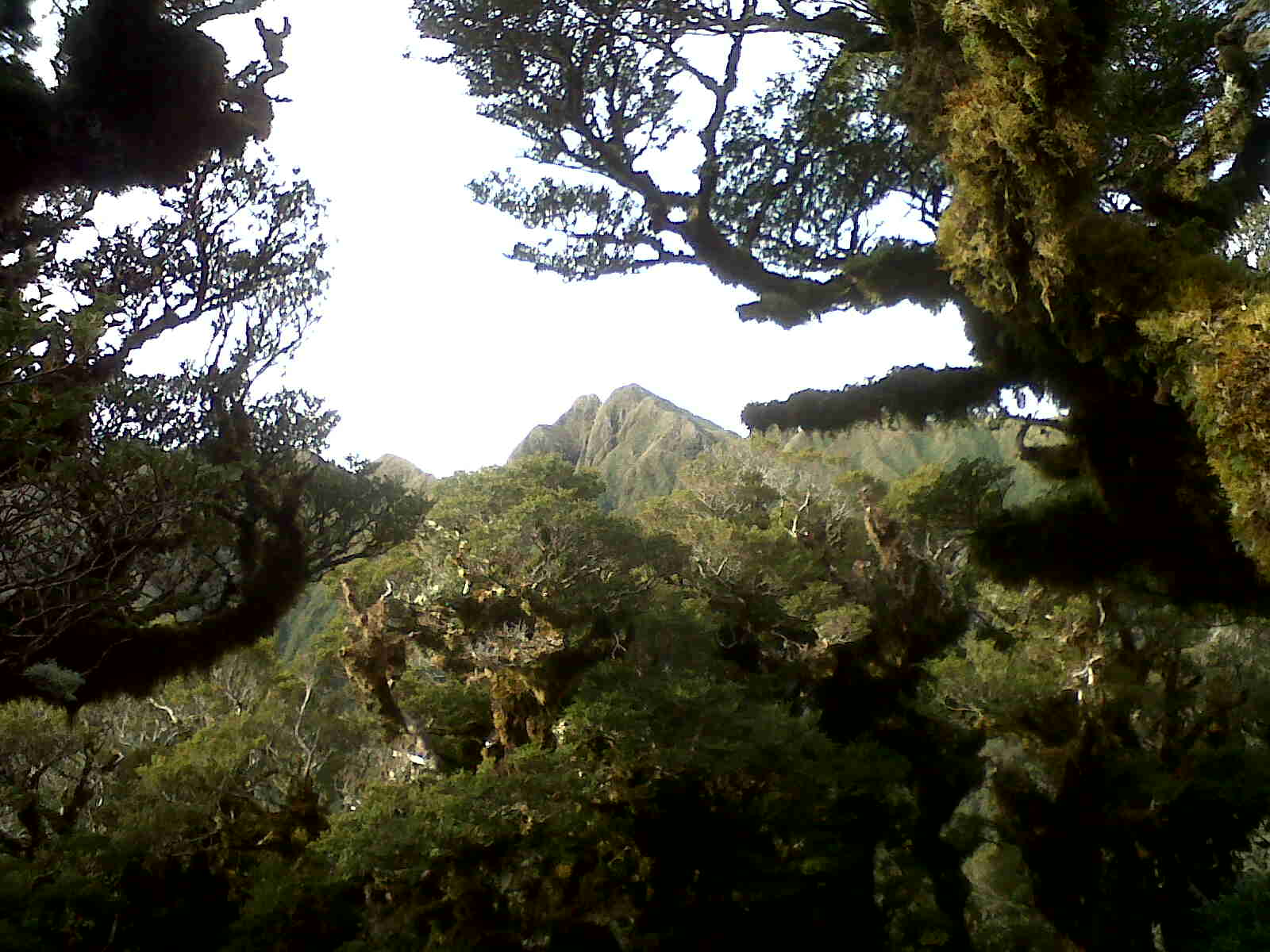
Heading up the hill the frost is getting decidedly firm and puddles are iced over. Across the Penn catchment is Pakihore Ridge. My track plunges into the depths of the valley then struggles onto Pakihore which will take me up to the main range (which is looking decidedly long and lumpy from this angle). Out of sight is Hut Mound and Kime Hut which is where I will begin the descent back down the ridge I'm standing on. It's all looking a bit daunting but being ahead of time is a good start.
 |
| Judd Ridge near Penn turn off, a bit of frost on the track. Bridge Peak on right |
Some photo attempts have limited success in the dim light and it is twenty to nine when the track to Penn Creek peels off at about 1050m. A short way along there is a stern sign warning about slips and people having to be rescued. I figure that I'll head on down and decide when I see the slips in question. The track is a little rough but fine and easy to follow. It wends across the tussocks before diving through the scrub and into the bush where it drops and drops.
On the left at about 700m a stream appears in a deep gully and the sound of Penn Creek drifts up on the right. Eventually the bottom and a stream crossing which has been known to be impassable but is fine today.
The track continues down the valley climbing onto and following old terraces. Somewhere on the left is a navigable route up a spur but there's no time to try to find it today.
It's 0940 when the track opens to a small grassy flat and Penn Hut (220m). There was no slip damage evident anywhere on the track and I'm a bit tetchy about the DoC sign which inaccurately warns people out of the catchment when there is access to the hut and another exit route. The sign is repeated down stream of the hut which is where the access to the old gorge route is and where I would expect the slips to be.
The hut is a standard 6 birth and is clean and tidy. The last resident was last Sunday. Heading off at 0950 the first order is crossing the creek. Its a good size and nippy so I grab a stick, although not really necessary, the third leg is helpful.
This was always going to be the tough part of the day. The climb is about 1,000m on a track that is not as well maintained as some. The start is chaotic as the foot of the slope is wet and loose so there are a number of tree falls to negotiate with lots of loose soil and rock and rotting vegetation. The track is marked but with the tree falls it is easy to miss. However, the track soon dives upwards and into drier forest providing easier going. It climbs steeply to 973m where the spur meets the Pakihore Ridge, here it turns right and meanders upwards at a more leisurely pace. It takes 2 hrs to get to the intersection with the Tararua Range just before McIntosh (1286m).
On the way as the trees thin there are views across to Judd Ridge and up to the main range. At one point the Tararua Peaks can be glimpsed but are soon hidden.
 |
| Tunui and Tuiti, quite close together from this angle |
The whole way up the ridge there are fresh deer prints on the track. Just after seeing the peaks I round a corner and am at least as startled as the deer standing 10m away (not for long), it quickly moves away and is lost to sight. It looked fat and healthy on all that good native forest kai.
Reaching the main ridge is a milestone; it's semi familiar territory and there are no more big climbs (oh, except for a small matter of 300m up Bridge peak and a few intervening knobs). There's more ice about and the wind has got up. An extra layer and gloves are necessary, as is some voltarin for a couple of knees that are complaining about the outrageous abuse.
The trip along the ridge is a little slow due to tired legs and a few stops to look at the stunning views. The cloud ceiling is so high that no peak is obscured and the South Island is clear to see. Kapiti Island hovers just off the coast and patches of sun pick out parts of the Wairarapa.
Finally the next lump on the ridge is the last 300m up to Bridge Peak. I take the sidle to Hut Mound and over to New Kime Hut. On the way noting that the tarns are covered in thin ice and some poor bugger has dropped his cell phone in the track. It has water in it so is probably stuffed but I pick it up to leave in the hut to dry.
Approaching Kime the ground is frozen but it's the new hut that is of interest, it looks pretty flash; larger and more comfortable than its predecessor. It's 1340 when I open the door to the new vestibule.
 |
| New Kime |
I expect to see one of the groups from this morning but there is another solo chap from Levin chatting to his wife on his cell phone. He's just up for the day but has brought a reasonable amount of gear including a billy. I decline a cup of tea as I want to keep moving. Then stick around and talk for 15 minutes; twit!
 |
| Inside new Kime |
Despite the double glazing and orientation it's cold inside but I can imagine that with a full house it would get pretty warm. Apparently the TTC group have been through already and the Vic group haven't got back from Hector yet. They start turning up as I leave, taking photos behind as I go.
 |
| New Kime from a distance. Old Kime was just in front of it |
It's down hill now so a bit of pace is possible despite cold and tired legs. A couple of people have pottered a short way along the track down to Penn but they're not from a group I have seen today.
Just above Field two lasses are heading up for what I suspect will be a dim arrival and cold night at Kime. Given the front that is coming they are also likely to be in for a bit of a wet and wild trip down on Sunday.
Field seems to be full but this may be due to the presence of some children (and possibly the reason for the lasses departure?). The TTC group are about to head out and I'm just in front of them at 1500, after filling in the hut log.
The trot down is uninterrupted with only one new person a few minutes from the bottom. She seems a bit young to be out on her own but is heading out on a good track so I jog past. Heading out onto the flats the first fingers of cramp start poking my left calf at each step. Lifting the toes and leading with the heel is just enough to stave them off until arrival at the car just before 1555.
Post Match Analysis
Everything went according to plan and the weather agreed with the forecast. The time up to Field (1:15) set things up well to keep ahead of schedule all day. The tracks down and out of Penn were rough in places and steep but navigable. The main ridge is exposed (Duh!) even in mild weather and the amount of climbing slows estimated progress. The track from Kime down is good and getting better allowing a cracking pace; 2 hours back to the car despite photos and chatting at Field. So about 9 hours all up making this a feasible one day trip.And why call it the knee wrecker? A rough estimate is that there is something over 2,800 vertical metres of climbing with (obviously) the same amount of descent. I think I might go back to biking for a couple of weekends.
No comments :
Post a Comment