There's been much talk of the 'SK' in tramping circles recently with some recent record times being posted for the trip from the back of Eketahuna to Kaitoke down the spine of the Tararuas. It's a trip that I would like to be fit enough to do over a weekend but I'm not in that ball park at present. I have however been aiming to pick off sections of the route on various excursions over recent years. The northern parts in particular I had very little exposure to until filling in the piece from Mt Crawford and Pukematawai over Easter this year. This weekend I am planning to fill in more of the northernmost part.
There are a few options for through trips but these always raise transport problems. Looking at the map there is a promising loop from the Putara Road end behind Eketahuna around the tops, dropping into the headwaters of the Ruamahunga and climbing over Cattle Ridge to exit at the same point. The ascents and descents look a bit challenging though.
The Tararua Tramping Club (TTC) websites provides useful info with the route listed as the Dundas Circuit and being one of their three '
classic Tararua routes' no less.
"
The Mangatainoka Herepai Dundas Cattle Ridge Roaring Stag Hut circuit tramp is a classic medium two to three day trip that involves travel above the bush line. Some experience is required including navigation skills, appropriate equipment, and reasonable fitness." (TTC website)
Their route notes include track times, huts and route-finding directions. With a bit of amendment these provide a guide sheet and route intentions for the weekend. Out of interest I noted my track times during the trip (off the photos) and have compared them to the TTC times at the end - in general they are pretty close with the exception of the section from Dundas hut to the Ruamahanga.
In the grand tradition of Tararua tramping I'm at the road end and setting off in the pitch black at 8.30pm. Initial impressions are of a track that is wet, slippery, narrow and a little bit tricky. However on the return it is actually well benched with a good surface and easy going. Must have hardened up during the trip.
An hour ten minutes later a steady 370m climb ends with the choice of Roaring Stag Lodge or Herepai Hut. I stick to plan and head right for a short dip into a saddle then a climb to Herepai hut arriving at 10:15pm. The evening is mild, the moon is out although not helping under the canopy and the only hardship is steamy glasses from the humidity. The occasional roar of a stag floats up from the valley (unless it was hunters practicing - quite possible). All up, a straight forward torchlight track - certainly easier than getting to Te Matawai.
 |
| Choices in the dark |
A corrugated iron wall looming into the headlight is the first sight of Herepai hut. Hopes of tip toeing into a quiet hut are dashed when I note mattresses and sleeping bags on the porch. There's a group of 12 fourteen year olds from Sacred Hearts on an outdoor adventure with three supervising adults - there is apparently not even floor space available at the inn. I never dare to look inside the hut but accept the offer of a fly (rather than my bivvy bag) and pitch it over a section of flat track.
 |
| Friday night campsite |
It's a perfectly comfortable night zipped up tight in my bag but I have to admit to being quietly a bit grumpy about people that go into an area in groups big enough to completely use up the known hut capacity. Still, I appreciate the loan of the fly.
Up at 6am, I pack up, spread the fly over an Astelia by the hut to dry, fill my camel back and eventually get away at 6.40, just before sunrise. A slab of Iona's excellent cathedral window cake in my pocket provides breakfast and keeps me nibbling until lunch time.
Although at only 810m, the track above the hut is in scrub so when I turn around I have a good view of the rising sun above dark hills and misted valleys.
The track briefly climbs into bush again with intensely orange-red light filtering through the canopy which quickly fades into full morning light.
Above the bush the wind is cool and steadily rises but it is clear and sunny around the tops. 45 minutes after starting I'm on Herepai (1125m).
 |
| On Herepai looking up to Ruapae |
And 21 minutes later on Ruapae (1279m). Looking north from Ruapae the Tararuas dwindle as the range steps down towards the Manawatu gorge. In the east the Wairarapa runs south hemmed by rolling hills, north and east Woodville and Dannervirke are hidden in cloud which seems to stretch to the Hawkes Bay. North and west is the Manawatu. The view south hasn't really opened up yet but it's already stunning.
South west along the range a cloud is lurking suspiciously in the vicinity of Pukemoremore which is on my intended route. It indicates strong winds from the west, probably bringing moist air off the Tasman that will condense as it rises up the range to form thick direction-confusing clag.
 |
From Ruapae to East peak
Pukemoremore and suspect cloud behind |
25 minutes later, on top of East Peak (1355m) the wind is strong and cold and the cloud is coming in from the north west. My fancy watch tells me that the barometric pressure is dropping fast.
 |
| From East Peak looking east - nice day in the Wairarapa, a bit cloudy in Eketahuna |
 |
From East Peak looking south into the Ruamahanga catchment
Cattle Ridge on left - quite a nice day |
 |
From East Peak; Pukemoremore under cloud
Note the clag creeping in, upper right |
It's easy to lose the track down and through the saddle as, like a fair chunk of the track throughout the morning, it's a bit overgrown by tussock and scrub but there is enough visibility to keep things going in the right direction without requiring the compass. It's about 55 minutes and a 200m drop and climb from East to West Peaks (1335m).
The vegetation hides what's under foot and at one point a foot disappears into a deep boot sized hole hidden in the tussock shooting a stream of cold, muddy water straight up the shorts.
 |
From West Peak looking back at East Peak
55 minutes later, the clag has come in and is starting to lift again |
After West Peak the cloud quickly clears and keeps away from me for the rest of the day. The view east and north opens up with the dark outlines of Ruapehu (lumpy) and Taranaki (a perfect cone) visible on the horizon. The Manawatu fades into haze and Horowhenua and the Kapiti Coast are laid out to the east. I can even make out the Waiopehu ridge (the route of Te Araroa). Some enticing spurs run from the main range east into the Mangahau valley, definitely something for another day.
At 1474m Pukemoremore is the highest point on my route so I take a few moments for photos and a wee sit to contemplate the views. It's easy to look at these hills and see them as bare and barren in stark contrast to the soft edged slopes below the bush line. But close up there's a plethora of plants; shrubs, grasses and ground hugging herbs all adapted for snow, scree, wind and searing sun - the sort of rockeries that gardeners would kill for. Makes you wish you'd paid more attention during botany.
I contemplate popping up to the next peak (Logan; 1500m) but the thought is forming that it might be possible to make it around the whole circuit by the end of the day so I decide to push on according to plan.
The turn off for Dundas hut is well marked at spot height 1415 and the DoC time to the hut is accurate (10min). I arrive 4 minutes under the 2 hrs TTC estimate for the trip from West peak to find a spruce wee 6 bunker nestled on a small terrace near the head of the valley below Pukemoremore. Steep rocky slopes hem it in.
 |
Not so hard to find the turn off to Dundas hut now
Pukemoremore and Dome behind |
 |
| Dundas hut |
It's been a while since my pocket full of breakfast ran out so I crack out fruit loaf, salami and cheese. Sun is streaming through the skylight and I use the opportunity to dry out my sleeping mat while I munch and fill out the log book. Two and a half weeks since the last entry; either people aren't filling it in or there's been fairly light usage. It's also a chance to look at the map; as if I didn't know that there is a 700m descent followed by a steeper 600m climb ahead.
As I regain the spur above the hut I notice what looks like a very obvious fault scarp descending in a line like a scar across the face of the range. I could have sworn I saw horizontal striations on Cattle Ridge also, reminders of how tectonics and glaciers have shaped this place. Turning around, the scree below Pukemoremore indicates how erosion and water are continuing the job.
 |
Spur above Dundas hut
fault scarp running diagonally up and left
from above the sign |
The track is reasonably well formed and follows the spur between two stream valleys as it descends at a steady pace. Towards the bottom it gets into thick damp bush and is a little gnarly in places. Eventually it drops me at the junction of two streams; not quite as marked on the map but pretty easy to follow.
 |
| Confluence of streams below Dundas hut |
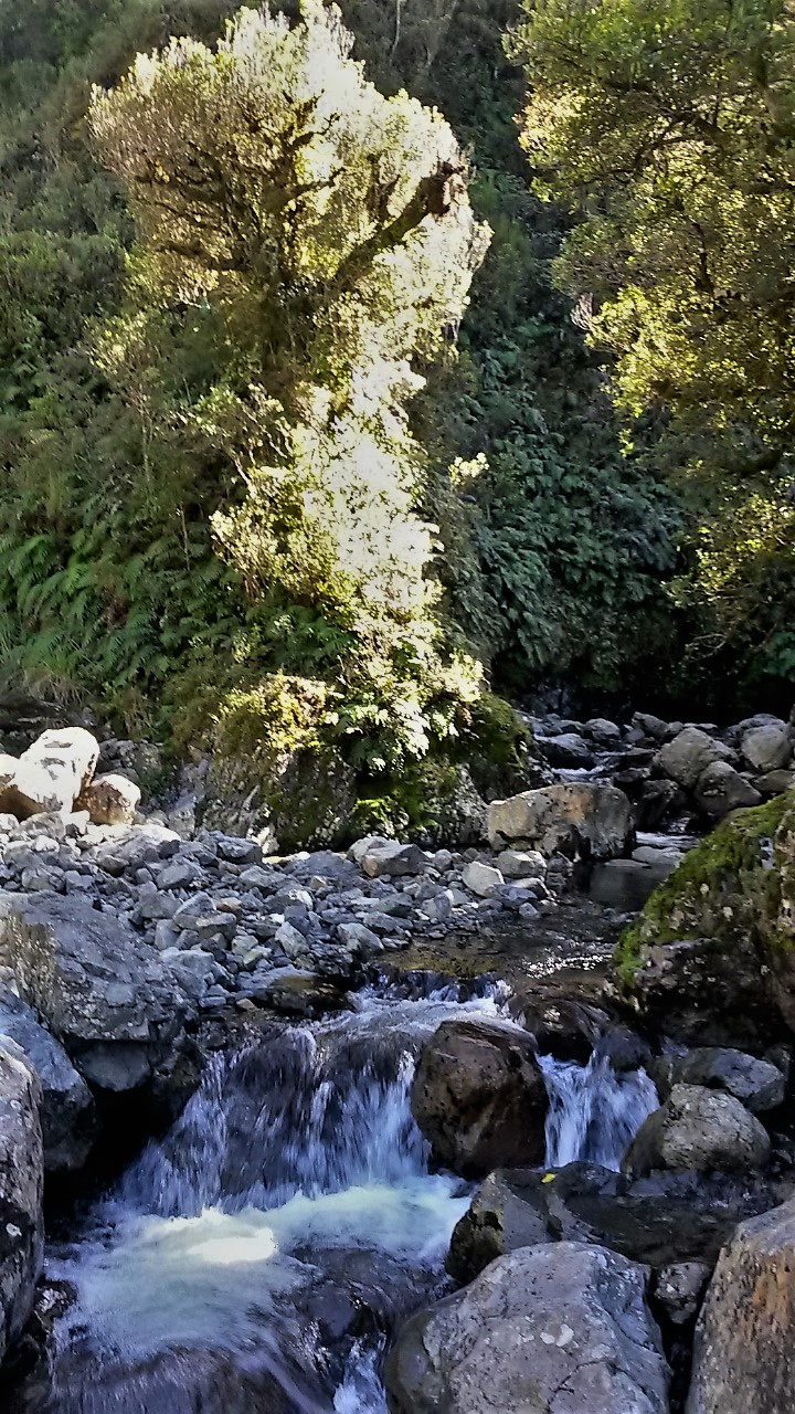
It's a pretty setting with crystal clear water and graywacke boulders. A beech tree blazes in backlit contrast against the dark gullies where the streams emerge. I try to get some good photos but the phone and I just can't do it justice.
 |
Another attempt to capture the scene
The track comes in somewhere on the bank in the upper left |
Looking at the map the next section promises to be tricky and is. The track scrambles into the bush on the true left and staggers along in overgrown, unmaintained, rocky and slippery fashion. It's fairly slow and careful going. At one point I lean against a 10' diameter trunk which sways easily and unnervingly to the touch. It turns out to be a massive branch hanging by not very much from the tree it has snagged on. I get out from under quickly and am not game to go back to dislodge it on my own and without a rope.
 |
| First sight of the Ruamahanga |
This is the roughest bit of track of the trip and somewhat slower going than TTC's time estimate to get to the Ruamahanga from Dundas hut.
I don't like crossing rivers on my own as I figure it is one of the most dangerous parts of tramping. The wire bridge has long since been removed from this crossing so I fully intend to return to Dundas if the Ruamahanga looks dodgy. I am pleasantly surprised - the river tumbles over large boulders forming deep pools and narrow, swift cascades and giving plenty of opportunity to leap across with dry feet. The catchment is still pretty sizable upstream with a lot of bare tops so I suspect it can rise and fall dramatically. The map indicates gorges up and down stream so alternative crossing places are probably in short supply. But I'm a little more focused now on the 600m climb straight up the steep side of Cattle Ridge.
It's tough going with the track overgrown with scrub and tussock and difficult to follow in many places. The sun is shining directly onto the slope and it's decidedly hot. I find good reasons to stop frequently and look back up at the main range to note the gathered cloud, to spot where Dundas hut is and any other excuse to rest my sorely abused knees. The broad ridge top is a very welcome sight and the legs are quite wobbly for the short walk down to the turn off to Cattle Ridge hut.
 |
From Cattle Ridge to the main range
The Dundas hut spur is the small one in the middle left of the photo |
 |
| The sadly neglected Cattle Ridge hut looking across the Wairarapa |
The hut is in a pretty rough state and the log book makes it clear what people think about a perceived DoC policy of allowing the hut to degenerate to the point it has to be removed as a hazard. It does suggest that the state of the track I've just been on may also be a symptom of the prioritisation required in order to fund the flasher, more accessible facilities. There is however a new wood shed, timber stacked outside and building materials inside signalling that someone has decided to invest.
The hut provides another opportunity to eat and drink out of the cold wind and check the map and route notes. It's mid afternoon so I figure I may as well drop to the next hut and see how I feel about continuing to the road end. There is also cell phone reception so I text home command who promptly rings back.
 |
| And down again, Roaring Stag hut a speck on the valley floor |
As soon as the track clears a knob below the hut there is a clear view down to Roaring Stag Lodge which is catching the afternoon sun about 700m below. The knees cringe at the insult about to be heaped on the injury already sustained.
It's quite a good track providing a quick descent to the valley floor which has by now lost the sun. A short, blissful stint across the flats (oh yes, flaaat!), noting where the down river route departs for future reference, and I'm wandering into an empty hut a little under an hour after leaving Cattle Ridge.
 |
| Roaring Stag hut across the Ruamahanga River |
It is clear where the funding has been going. Roaring Stag is a large facility in good repair and sporting a meat safe. I figure I will still have day light for a chunk of the trip out so don't hang around after writing in the log book.
The track is wide and pretty well maintained. It is in fact strikingly wide; the TTC website refers to it as an "ancient pack track formation." It crosses river terraces and the occasional stream then gently eases up and along the ridge and eventually to the junction I had arrived at just last night. It's ever so considerate of tired knees.
 |
| Looks familiar - 20 hours later |
The sun manages one final peek around the end of Cattle Ridge but the bush is dense and high so little filters down to the floor. It's getting dim by the time I reach the junction around 5.30 and dark by the bottom of the hill. I have an idea of what's coming so the trip out under lights is relaxed, ticking off the features that mark progress (swing bridge, wooden bridges, slip, swing bridge ...). The river is a constant but largely invisible presence, the sound varying with the terrain and occasional flashes of moonlit rocks catch the corner of the eye through the trees. I wonder how the large group from Herepai hut have gone given how long they took to get in. On the final section of track I note some foot prints recent enough that there are still wet marks on the rocks but it doesn't seem enough for a party that large.
At the road end a hunter is just heading off in his ute and stops to chat. He has been hunting on the ridge east of the track to Roaring Stag and has just got out (hence the foot prints). He is aware of the other party that came out not too far ahead of him and seem to have made fairly heavy weather of it. Hopefully the experience has not put them off tramping completely.
At 7pm with the moon above I'm in the car and finishing the weekend's tramping as I started; with another fine tradition. This one is to descend on brother number one's house filthy, famished and looking for a comfortable bed. As always, he and Janne accept the imposition with good grace and a little surprise (they had been expecting the invasion for brunch the next day).
Coda
In good weather this is a trip of many and spectacular views. In clag? I think it might be a navigational challenge.
The track in is fine for torch light travel - a good option on a Friday night. On the tops you often have to push through scrub and tussock and there's a section where a bit of erosion is cutting into the ridge. The drop and sidle to the Ruamahanga crossing is pretty rough in places and took me longer than TTC estimates. The climb up to Cattle Ridge is overgrown through the scrub and hard work. From then on the going is pretty good. In general the ascents are not so bad - until you hit Cattle Ridge.
I wouldn't rely on Herepai having space so you need a fly or biv bag - Roaring Stag has a large floor space so should be able to cater for large crowds. Cell cover was good on the tops I didn't have any after Cattle Ridge until in the car and well down the road. I had no water problems with rain tanks at all huts. The odd tarn didn't look very enticing (one had been used as a wallow by some animal).
All up a great wee trip and doable in a day if you are of a mind, have good conditions and cast iron knees.
Times
For future reference; Tararua Tramping Club times and mine are noted below. They provide a good estimate of travel times although I suspect that some are based on tracks that were once better maintained. I have not counted time spent at the four huts but included the time spent farfing about taking photos, gawping at views etc.
|
TTC
|
Me
|
Road end to junction
|
1:20
|
1:10
|
Junction to Herepai hut
|
00:30
|
00:25
|
Herepai hut to Herepai
|
<1:00
|
00:45
|
Herepai to Ruapae
|
00:30
|
00:21
|
Ruapai to East Peak
|
00:30
|
00:25
|
East Peak to West Peak
|
1:00
|
00:54
|
West Peak to Walker
|
00:30
|
00:26
|
Walker to Dundas hut
|
1:30
|
1:30
|
Dundas hut to Ruamahanga
|
1:15
|
1:38
|
Ruamahanga to Cattle Ridge hut
|
1:47
|
1:34
|
Cattle Ridge hut to Roaring Stag
|
>1:00
|
0:56
|
Roaring stag to road end
|
2:30
|
2:20
|