After quite a few forays into the eastern Tararuas, the gaps between the explored areas are noticeably deminishing. With the exception of the Waiotauru valley.
The Waiotauru originates north east of the Akatarawa saddle and south west of Otaki forks (where it joins the Otaki River). The area was heavily milled and the scars remain in the bush. It's never had a great deal of appeal, with a reputation for 4WD damage and a really grotty hut.
It isn't until Saturday morning that I finally string together a plan - perhaps a sign of psychological avoidance? The plan does however take in some other areas of real-estate.
What: Weekend navigation trip
Where: Around Kapakapanui, Waiotauru and Renata ridge
When: 19-20 August 2017
Why: New territory - see if Wiotauru hut is as bad as reputed (it is)
Who: Solo
Map:
It's 0900 as I reach the road end and park next to four people disgorging from their car. Shortly after, another couple turn up. Both parties are doing the Kapakapanui loop but in opposite directions and the couple are staying the night in the hut.
 |
| Record shot of the wrong driveway |
The day is fine with some clouds as first the large party then I set off. I stop to chat as I pass them at a river crossing. They are not from NZ (narrows the options a bit) and are a little non-plussed by the idea of wandering of track and up an unmarked river.
My plan is to follow the Ngatiawa River towards its headwaters then follow a steep spur to near the top of Kapakapanui - it looks doable on the map.
The river is quite charming and changes character on the way up. Sometimes wide and shingly, at others narrow rocky gorges and the occasional tumbling white water. All quite navigable in normal flow, the occasional jamb of logs suggests a different prospect at other times.
With recent rain there are a few pretty waterfalls slashing down the steep valley sides. I look at a couple and think what you would do if you were following a wee stream and it came to such a drop.
However, on the valley bottom it is all good travel with a few scrambles up rocky bits.
 |
| Torrentous bit - the stick in the centre proved very useful |
 |
Junction with largest tributary (left)
Note the useful but no longer required stick |
It's been said before: navigating up rivers and down spurs is hardest. However, with an eye on the compass and counting side streams I'm pretty confident when I reach my junction just after 11. It's been a lovely trip up river but now comes the challenge.
The spur climbs steeply up with the crumbling lower slope covered in the usual assortment of unfriendly vegetation. There seems to be a few goats about though so there are enough trails to pick a way upwards.
I find myself smiling at the prospect of the 800m climb and am immediately reminded of a dear friend that used to say: "you're a sick bastard!" But surely it isn't aberrant to relish the challenge early in the day when you've still got energy?
Once past the lower section the spur is easy to follow and the goats seemed to have cleared out a fair amount of the understory. I plod on up to pt 751- which takes about an hour and looks like every patch of bush with the exception of having a wee flat spot. I take a photo to prove I was there and a couple of steps later find the tiniest gap for a view out to Kapiti Island. It's a really nice day out there.
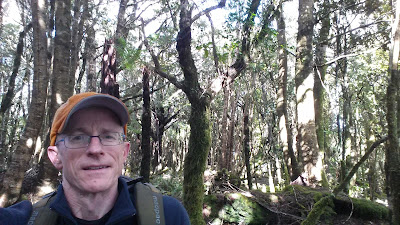 |
| Chillin' at 751 |
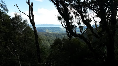 |
| A glimpse of the day |
At the top, the spur joins a muddy track with fresh foot prints heading both up and down. I figure two belong to the couple but I'm not sure about the others. It becomes clear at the top - the couple are relaxing at the trig and report seeing a party that over nighted at the hut. It's 12:50 and we chat as I take in the view - the weather is still holding although there is some cloud lurking.
 |
East from Kapakapanui - top of southern crossing in cloud
Target spur for tomorrow in mid-ground |
 |
| From Kapakapanui - usual route up in foreground |
A little further along the tops I come across the other group reclining having wine and cheese which they kindly offer. I linger for a bit then leave them to bomb down the featureless east face aiming for a certain spur.
 |
| Looking east and down - my spur in foreground |
It starts as astelia, grasses and low leatherwood, there's a tricky band of denser leatherwood but not too bad and with good visibility I have no trouble getting to the bushline as my spur starts to form - it would be a different matter in clag. There's isn't much ground trail but the spur is not too bad to follow with a bit of compass assistance.
 |
Random bush on the way down
slightly better shot than I can normally get with cell phone under canopy |
A lone piece of pink tape suddenly appears informing me that I have reached the intersection with a wee ridge - I follow it north to pt 601 then backtrack (with a bit of an overshoot) to follow it south down to the valley floor. A bit of rain starts dropping through the canopy.
On the way down I come across a feature of the area that will be with me for the rest of the weekend. It seems that everywhere below about 500m is crisscrossed with old logging trails. They are covered in trees now but the vegetation is different and the shape can still mostly be discerned. They offer more even travel and generally solid footing, but invariably head off in the wrong direction.
Consequently I hit the river a bit further north than intended but it's short work to wade up valley, eventually crossing to join the marked track. The weather is starting to close in around the tops.
 |
Glimpse west towards Kapakapanui
From Waiotauru River |
There is little in the way of track marking but a solid 4WD track is hard to miss. My map however differs from the ground with a bridge now gone and the track crossing the river further down river. I idly wonder what the crossing would be like with the river up.
A short while later I arrive at a disreputable excuse for a hut but there's still a little daylight so head further along to follow a spur up to pt 555 - this uses the time available (arriving about 5.10) but gives no views. On the way down one of the ubiquitous logging trails dumps me in a creek and disappears. It's getting dark so I find my way down either in the creek or on the adjacent spur just reaching the bottom without having recourse to lights.
6pm and back at the hut - it's still a dump and the inside lives up to expectations - shows what 4WD access does to a place. There's shot gun holes in the walls, linings are gone, no mattresses, empty windows covered in tarpaulins, been set fire to at least once ... it appears that even the rats have left. And I couldn't find any long drop.
Someone has however left an air mattress and (after a little judicious use of meths) it seems it will stay inflated. I cook dinner and climb into bed leaving soggy clothes to drip.
About 3pm I wake to blow the mattress up again and listen to heavy rain drumming on the roof. The table is saturated and there's a lake on the floor - my sleeping platform is dry though and none of my gear is under the drips - so back to bed to wonder about the river crossing in the morning.
 |
| Leading candidate for the crappiest hut in the Tararuas |
After breakfast I bid a completely unfond goodbye to the 'hut' and head out into the rain, looking for a good stick on the way to the river crossing. It's about 7.15. The river is up and fast but with a branch, an even bottom and taking a diagonal approach with a good run out it works out fine, although strong and up to midthigh.
Down river I cross a creek and find a spot to break off the track to climb a spur up through thick bush. I'm soon following and leaving logging trails until I come across a really solid one that someone has gone to a great deal of effort to clear in recent memory. It serves me well until it suddenly stops to revert to the old trail covered in saplings. This takes me to the ridgeline and a handful of tape markers.
This bit is easy - at the ridgeline I just have to turn right to follow along and up. So when my route starts dropping there's a brief head scratching moment. It appears that the logging trail curved across the spur to approach the top from the opposite direction and without view or sunlight I didn't notice the change in direction. Slightly chagrined I head on up past pt 687.
There are sporadic markers and lots of branches down so although there is some foot trail it is slow going. It's nice mossy forest apart from that horrible beech stuff that drops its limbs everywhere. The rain comes and doesn't go.
Navigation is generally pretty easy - I know there will be a jink left to a steep climb - the drop into a narrow saddle is slightly unexpected and the climb out is certainly steepish. Soon enough I pop out onto a broad, flat mossy, boggy plateau. Casual use of the compass is sufficient to find the spur up and the long slow climb to pt 925 and the Renata track. I'd estimated 11am and 11am it is.
 |
The top!
Water on the lens - not a heavenly aura |
A southerly is sliding over the ridge - not strong but cold and wet enough to want to keep moving. As the kilometers tick by I remember how long this ridge is and how much it meanders up and down. There's also plenty of branches down so all up I figure a stop at Renata hut is a must.
The exertions are starting to take their toll and I'm glad to arrive around 1250 - no-one has been in for a couple of weeks apart from quite a few rats by the look of it. I get about donning another layer, eating a bumper slice, filling in the log book, struggling back into wet gear and realising that I am now looking for excuses to stay longer.
 |
| Renata hut looking better than it ever has |
I pause at the next saddle where there is supposed to be an old track running off to the left - it's still marked on one of my maps. Even knowing it's there I can't make it out although there is a ribbon on a tree. It makes me feel better about missing it last
time.
Over the top of the knob the track drops suddenly onto a very well formed road. The going has now become somewhat easier. The rain has let up a bit but the cloud is still close about the hills. Off to the right there are some steep drops into the Ngatiawa headwaters
I'm pottering down when I here an engine - an old ute about 200m away is just completing a turn and disappears off down the road leaving me to follow in the lingering stench of exhaust. Closer to the spot I find that a massive erosion scarp has eaten into the road making it decidedly dodgy - hopefully this will put an end to the pests getting further along the road.
I hive off the road at a few spots to visit Kakanui (nothing to see) and a few other marked points (also nothing to see). However the weather starts to clear in the west albeit the temperature doesn't rise.
Approaching the vicinity of my next turn the map and road are not completely seeing eye to eye and the altimeter is refusing to agree with either of them. This leads to some dithering around amidst an array of possibilities, a few false starts and what I thought was a false start but turned out not to be once I backtracked and got another line on my bearings. Lost is a bit too strong a word for it but suffice to say I should have gone with first instincts and saved over half an hour.
The area has a lot of signs of 4WDs and the sort of people that partake - litter everywhere, deep puddles, churned out tracks and parts of vehicles. At one point someone has set up a shooting alley complete with tin cut out of a person - nice.
By now from having a slim margin I am now racing daylight and losing. I keep the pace up in order to get within a reasonable distance before headlight time. The trail marked on my track peters out before it should and I'm left to piece together some of the old logging trails which inevitably deposit me on an evil slope - steep, and covered in supplejack, kiekie and lawyer. Oh, and by now dark.
It's a tough bash down with the sounds or rushing water drifting up giving the only sense of progress. I'm a bit apprehensive about coming out at the top of one of the cliffs I'd seen on the way up river yesterday morning. The final slide down over loose rock however drops me gently beside a stream - a big stream admittedly, but not the Ngatiawa River. And I've lost the end off my camel back with no prospect of getting it back this time.
Ah well - any stream around here will lead in only one direction so I don't bother with map and compass - there are a few trees down but not too bad travel. Until the first water fall - a bit tricky but soon sorted. Down stream another roar takes shape - the second water fall is a little trickier - I briefly wonder what it would be like if I have to climb back up it.
The throaty rumble of the third water fall is ominous in the dark - sure enough it drops into a deep pool with no prospect of down climbing - I have no idea how deep or shallow so although only a few meters high I'm not about to jump. Looking back up stream I'm in a gorge with no prospect of climbing out. There's a possible climb above on the left which with a bit of application turns into a dirty grovel using elbows and eyebrows - grasping clumps of anything and everything.
Safely past this obstacle I'm still holding my breath for a final and unnavigable drop. However, the stream becomes gentle and suddenly I stumble onto a grassy bank. The river at last.
The Ngatiawa is up and has to be treated with respect but with the help of a stick I cross and recross down to the track and eventually the road end. 7.10pm and about 12 hours since Waiotauru hut - quite a day. Having a car with a working heater is a wonderful thing and I actually manage to thaw out on the way over the Akatarawa hill.
Post script
A bit of a mixed bag. Ngatiawa and Kapakapanui were a high and a lot of new country was covered. I should have been more onto it with my map reading on Sunday afternoon and paid the price. It was a bit dicey coming down the steep valley side and then the stream in the dark - however if I'd got stuck I had a bivvy bag and things would have been easier in morning light.


