"
A large leatherwood infested area to the west of the upper Mangahao River, known as
Tawirikohukohu, or “The Camelbacks", due to their profile, are untracked, and seldom visited
by trampers. Need I say more?"
(Tony Gazely, A trampers guide to the Mangahao catchment)
This was one of the few references I could find on the net about the intended route for the weekend. It also may go some way towards explaining why on Monday my work mates thought it a great lark to find reasons to make me get up and walk so they could laugh at my painful hobble.
The usual pattern for the week before a tramping weekend is to vaguely speculate about possible routes then narrow down the options until one crystalises about Wednesday. This time it was Friday when a glance through the map finally reminded me of some intriguingly named hills behind Levin: The Camelbacks, Camelhead, Marquee, Tawirikohukohu, Pyramid Knob. Surely this concentration of names indicates an area of unique aspect worthy of exploration?
The route planned is to leave from Poads Road, gain the plateau around 332 then head south-east until a spur forms up to Square Knob. From there, follow the ridge to just below Tawirikohukohu and strike north-east to Scrub Dome (hmm should have sounded a warning) and on around to Camelhead. Then follow the spur north-east and pick a spot to drop to the Mangahao River to find a spot to set up my fly. The next day head up the spur from 733 to Tawirikohukohu completing a circumnavigation of the Johnson Stream catchment before heading out either Ohau River or the way I came in.
Where: Western Tararuas behind Levin
What: Navigation scrub bash
Why: In retrospect ... not sure because there certainly were warning signs
Who: Solo
When: 31 March 2017
Map:
Map
It's still dark as I park the car at the Poads Road end. As the first order of the day is to cross the Ohau River I'm content to kit up at a leisurely pace and avoid the need for the head torch. I take care to give the farmer a cheerful wave as he heads by - access is across his property and I imagine he doesn't always have a positive impression of visitors.
At 7.10 I head across the paddock following a now familiar route into the range. But this time I leave the marked path and find a spot to climb the fence and scramble off the terrace and down through scrappy bush to the river. Wet boots first up - not the best planning but unavoidable in this case.
The pines on the other side are being felled and I figure that there will be a way up to the plateau around 332. The tracks are muddy and it's a bit tricky negotiating the shattered trees that have been pushed over the banks but the churned up tracks soon give way to mature pines and overgrown tracks that are relatively easy going.
The pines lead to a clear felled face with bulldozer tracks and skid haul lines which I follow until the top flattens just before a fence and an abrupt transition into native bush - about 400m north-west of 332. Setting a bearing I walk in between tall dark trunks and a sparse under story.
 |
| Poads Road end is the cluster of buildings in middle-left third |
A trail soon becomes apparent in the dry leaves and although I see no markers it looks fairly well established. It's heading in the direction I want so I'm content to follow it for as long as it does. This turns out to be all the way to my turn off below Tawirikohkohu.
There is little in the way of views on the way up to Square Knob (836m) and the occasional glimpse south and west merely shows the Waiopehu Ridge disappearing into cloud. At one point below Square Knob the bush opens out and a tape marked track heads off to the left, it soon starts dropping so I leave it to its own devices. A little group of white heads gather and comment as I farf about with compass and map.
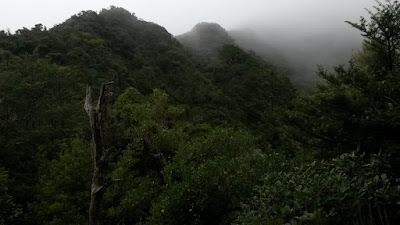 |
| A little past 794 looking at the route forward |
It's about 10am and less then three hours underway when I reach the ridge to the Camelbacks. Better time than I had anticipated and all down to the quality of the trail I stumbled over.
The trail clearly heads on up towards the peak but I'm looking at a hole in the scrub which seems to indicate where I turn off. There are signs that people may have traveled through before but certainly not often.
 |
| Looking back down the ridge to clag on Square Knob |
 |
| And ... the way forward to Scrub Dome and beyond is there somewhere |
 |
| Not so much a track ... |
It's a bit of a scramble through bush and scrub with possible trails that come and go. It takes about an hour 30 to get to Pyramid Knob; an hour to get to Camelback, and two hours 50 (including a wee break) to Camelhead.
There's no sign of markers apart from a series between (I think!) Pyramid Knob and Camelback with an obvious trail. Otherwise progress is pretty mixed - but there's only a few steep sections. The clag closes in on the steepish approach to Marquee and I'm hopeful that at the top there might be more of a trail to be found. Maybe there was a little bit more and the going is a bit easier to Camel Head for a while but it's soon back to pushing through thick scrub.
The ridge skirts around the Johnson Stream catchment. At one point a deer roars and I resist the urge to roar back in case there are trigger happy hunters about - I scramble quickly across any open patches and whistle loudly. Across the valley is the ridge running from Tawirihokuhoku down to the Mangahau River - I'm already starting to wonder if it's a goer to be able to get along it in time tomorrow.
 |
| Ridge up to Pyramid Knob |
 |
| Near Pyramid Knob looking back to Tawirihokuhoku (obscured) and the ridge up from Square Knob on the right |
 |
| Around Pyramid Knob looking north west |
On the way up to Camelback there's a bit of a break in the clouds and a gecko catches my eye sunning itself on a gnarled leatherwood trunk. It sticks around briefly for an almost satisfactory photo then disappears. It's a bit of a surprise given the noise I'm making struggling along. Rod Hitchmough from DOC kindly identified it as a
ngahere gecko of the genus
Mokopirirakau which is found around Wellington, the Tararuas and in the east up to Gisborne.
It soon clags in again.
 |
| Gecko |
There's a bit of more open travel after Marquee and then plenty of Leatherwood again. Eventually I'm struggling through chest to over head-height scrub onto the top of Camelhead. It's here that one of the less endearing aspects of Leatherwood trips me up. Hanging off a branch it splinters suddenly dropping me onto another bush that collapses jabbing a painful spike into one thigh and ripping the arse out of my leggings with another.
A stream of expletives probably serves some form of anesthetic effect but it takes a few moments to gather things together sufficiently to regain an upright aspect. With strips of material hanging out the back and a bit of a whimpering hobble I turn north east to do further battle with the scrub. Any hope that there might be a bit of a trail along the ridge is well and truly dashed.
 |
| From Camelhead south east |
 |
| Hot and bothered on Camelhead |
 |
| Looking back from Camelhead across Camelbacks |
Let's not dwell on the three hours it takes to travel less than three kms along the ridge to point 759. It's tough, bruising, my right leg is playing up and I run out of water. At one point I'm semi-collapsed halfway through a patch of bush lawyer infested scrub when a possum fixes a mad-eyed stare at me from 2 meters away before disappearing around a stump. I can't even muster the enthusiasm to give it a hoozle-up.
At 6.20pm and point 759 I figure that with light about to wane it's past time to drop to the river and pick up a source of water on the way down. It's a bit steep in places but after getting a drink I steer clear of the stream as it drops through slots and over water falls. There's a few scrambles but nothing too hairy and the under-story is mostly fairly sparse until near the bottom. I join the stream for the last couple of hundred flat metres resorting to the head torch along the way.
The orange triangle on the Mangahao Track at ref 085982 is a relief to see as it emerges from the gloom. It's a bit over an hour from the top and now there's a small matter of 10 odd km to the hut (or a night under the fly).
 |
| Phew |
The track is so much easier going even though with a gammy leg it's going to take a while to get to the hut. Mentally I divide the distance into: first bridge, second bridge, third bridge, slip, hut. The first bridge over the Mangahao River finally appears and I can feel that I'm getting somewhere.
 |
| Bridge 3 - Barra Stream |
 |
| Bridge 1 - Mangahao |
 |
| Bridge 2 - Harris Creek |
As each milestone emerges from the darkness I'm going slower and having more trouble bending my right leg. A large lump has developed in the muscle. The night is mild though and the odd denizen of the dark appears in the torchlight - a black snail, a small weta, a skiff of glow-worms across a dark bank. Where a stream flows down the track koura with a eyes reflecting red scutter away from the light. Only a couple of possums though, and something large that crackles away through the undergrowth.
The track is not bad. It climbs up and down a bit and there's a bit of mud but the vegetation has been cleared at some point. Near the big slip there's an option to follow the river - I take the option thinking it will skirt the bottom of the slip. Nope - it's a bit of a let down to look at a deep dark river and realise that dragging my sorry leg up over the slip is a safer option then risking a fall on an invisible rock. I retrace my steps to the turnoff and head up the bypass track.
It's after 11.30pm when the hut finally appears - over 16 hours on the go. It's everything you want in a hut; tidy dry and empty. The tidy inhabitants have even put some dry wood on the table ready to split for kindling.
 |
| Mangahao Flats Hut welcome |
The log book says no-one has been in for a week. It also doesn't have any references to trips over the Camelbacks - hardly surprising really. Dehy for dinner and bed. Not a comfortable night given the bruises but quiet.
In the morning my leg is no better so I figure on taking the shortest route back to Poads Road. The main options are following the tracks via Girdlestone Saddle and Te Matawai hut, Deception Spur and Ohau River, or Tawirikohukohu and out the way I came in. The last seems the best being shortest and taking advantage of the good trail up from yesterday. The unknown being a steep bash up out of the valley and about 1.2km of untracked ridge.
 |
| Option three - bash up the ridge across from the hut. |
It's drizzling as I leave the hut about 7.05. The river is easy to cross and I pick a random spot to enter the bush on the other side. There are no apparent trails so I follow the path of least resistance up the steep slope towards 1040.
 |
| Mangahao Flats Hut |
There's nothing remarkable about most of the trip up; steepish, mostly open under a high canopy but nothing but random animal trails; increasing undergrowth further up. Clag drifts through the trees and the valley sides are invisible. Towards 900m the scrub starts and it steepens. There's a couple of short nasty clambers up scrubby mossy bluffs and then it's just worming up through scrub. There's a few open sections along the spur crest and more animal trails.
About 50m from the top a deer breaks cover from nearby and crashes away - then pauses to look back, almost muffled in the cloud. Although elegant looking, the way it breaks through the scrub demonstrates a strength and toughness of hide that is impressive given the beating I'm taking.
 |
| The view from 1040 |
My altimeter has packed up but the top is hard to miss. It has taken a little under an hour and a half. I'm hoping that there is a trail along the ridge as it seems an obvious route. There could be something there but hardly a highway. There's no visibility and intermittent drizzle.
I'm looking forward to a short 1.2km jaunt along the ridge to the peak where I am confident there will be a good ground trail. It takes 3 hr 25.
There are no obvious signs that anyone has been this way before. There are short stretches where there seems to be some trail but these always quickly fade. The scrub is horrendous, bruises are quickly added to scratches on top of those from yesterday.
I overshoot the ridgeline at one point and end up struggling across an erosion chute and a nasty leatherwood face to get back on track. Otherwise the navigation is straight forward despite no visibility.
Towards the peak the ridge turns into a series of knobs and steep sided slots. The faces are near vertical in places requiring careful route finding and precarious clambering - scrabbling for handholds amidst wet grass, flax and brittle scrub. More than once I roll over a lip dragging my leg behind and all I can do is lie face down in the moss for a few moments. Forcing through the scrub to the top another slot and knob drift into view through the clag ahead.
It's difficult to describe how harsh the scrub is to get through. The leatherwood trunks are lethally slippery in the wet; bending and twisting across every possible route. Branches snag behind the pack, and occasional tendrils of bush lawyer rip across skin or catch clothing. Totara saplings flick hard spiky leaves across the face and hard branches bruise legs and arms. As often as not the path of least resistance is above the ground.
Near the actual top there are some old cut trunks suggesting that someone has come part way down towards the ridge. I am left wondering whether there is a route hidden in the bush below the ridgeline but the steepness of the slope seems to suggest this is unlikely.
 |
| Tawirikohukohu |
It's 12.50 - later than I had been hoping to be here but it's a huge relief to know that although there's a lot of tramping still to be done the worst is over. Sure enough there is a solid ground trail that in 15 minutes takes me down to the point where I departed for the Camelbacks - a day and one mangled leg ago.
It takes another 3:50 to get back to the car. It's drizzly, then dry, then very rainy. When the track reaches the edge of the pines I follow bulldozer tracks that are deep wet clay to the bottom. I find an easy way down to the river but no easy way up to the opposite terrace. A very inelegant grovel over a chest-high alluvial bank being the last of the indignities for the weekend.
Back at the road end at 4pm I peel off wet gear, chuck everything in a rubbish bag and maneuver my leg into the car.
 |
| Wet, mucky and oh so relieved |
Postscript
The route up to Tawirikohukohu is fine but access to the bottom may require permission. The Camelbacks through to Camelhead are tough going. Same for the ridge north from Camelhead.
The climb up to 1040 starts fine but gets tough near the top but is nothing on the ridge from 1040 to Tawirikohukohu. The final climb to the peak is not for the faint hearted and is made trickier in the wet.
You can get an idea of the challenge in each section based on the times I've noted.
The leg came right in a few days albeit covered in multicoloured bruises and what looked like a case of measles. Unnoticed bruises and cuts turned up in all sorts of places.


