What: Otaki forks to Kime and Mt Hector
Who: Scott (leader), Rachel, Vignesh and me
When: Sat 18 and Sun 19 June
Why: Meet-Up group trip
Map of slip: Link
Scott puts a tramp up on Meet-Up early in the week and I decide to check it out. I have been in the habit of avoiding group tramps but this is a chance to get out with some of the leaders from the Meet-Up group and to check out the slip on the Otaki Gorge Road. An unanticipated advantage of a group trip becomes apparent after the trip when Rachel posts her photos - they are far better than I have managed on my phone and she graciously agrees to let me display them here (only the photos around the slip are mine).
The weather forecast is rubbish for the Sunday so the plan shifts towards the end of the week to a trip up to Kime then return to Field for the night. It should be pretty easy going although there is a small matter of an odd extra 4 Km and 300 metres climb to get past the slip.
After a few delays and a stop for coffee it's about 10am when we leave the car on a grey day at the car park on Shields Flat. It's about a kilometre short of the slip. Diggers and bulldozers are operating on a vast hill of spoil but the slip itself is out of sight. A group of four (two chaps and two women) has arrived just ahead of us and head along the road to see if they can get across the slip. They are soon back after being told in no uncertain terms that they're not crossing.
 |
| The slip isn't visible but the pile of spoil is just to the left of centre |
 |
| The bypass starts up the gully to the left of the caravan |

The bypass is well marked from the carpark, crossing a paddock then heading steeply up an old forestry track under pines. It climbs fairly steeply and there's little to see through the trees although machines can be heard working below. It's sort of pleasant when the track levels to stroll along with soft pine needles underfoot.
The track soon rounds a spur and enters a gully that has been clear felled and replanted. After a total of about 300m climbing it turns left into a more recently upgraded 4WD track and immediately starts descending. The road soon reaches a wide space with a couple of vehicles parked and the marked route heads off into the bush to follow a winding track down a spur, at one point steep enough for someone to have attached a very long rope through the trees.
 |
| Vignesh emerges out of the gully |
 |
| Vignesh and Scott negotiating the descent |
At the bottom there's a left turn (you would have thought right) on to an old but very well cut 4WD track which finally deposits us onto the Otaki Forks Road again - about a Km past the slip which is out of sight around the hill.
There's a further kilometer to the bridge over the Waiotauru River and the start of the tramp proper.
We're pretty slow up the hill so it's a late lunch at Field where the group from the carpark has settled in and a few others are sleeping or milling around. I discover that my topo map has Field hut in the wrong place - a bit odd given the hut has been around for quite a long time. There is a flash new toilet though - the old one has been pushed on it's side and I assume will be removed some day.
 |
| Field Hut |
As the weather forecast has improved we are going to head on up to Kime for the night with maybe a jaunt up to Mt Hector. It's still cold though and probably a bit windy up the hill so I crack out the coat. The tops start pretty much straight after Field hut and there is nothing to see in the clag. Even less to see once my glasses fog up (mental note to get the contacts out for the next trip). The wind is not strong which is lucky as it's pretty cold and there's a fair amount of moisture in the air.
 |
| Clag on Judd Ridge - the track is not all so over engineered |
We are making very slow progress so the day starts drawing in as we are still heading up the ridge. It's a pretty straight forward route though so there are no concerns.
At one point we suddenly notice that the tussock has taken on a golden light - it's a bit weird as there is no change in the cloud but we figure that somewhere behind us the sun is setting. It quickly fades and it's just about dark when we arrive at Kime around 6pm.
There's one chap in residence who we think has come up from Tutuwai Hut via Bull Mound - good travel given the short daylight hours. Scott is keen to head on up to Hector as it is a strategic point in a strategy game that he is involved in. I figure that there is an outside chance of a break in the cloud and a view of city lights on the horizon, besides, I haven't really done enough for the day so I add some more layers and we head out under lights.
As we leave the calm in the dell around the hut, the wind steadily rises and the wind chill increases. We're just short of the top of Field Peak when Scott gets an attack of the cramps which are not about to go away - nothing for it but to head back to the hut.
Kime hut has a harsh rap as a cold hole. I suspect this is probably because the old hut was a cold hole and there were some issues with the building of the new hut so it hasn't managed to throw off the reputation. Let's face it - at 1400m next to a tarn and with a few traces of snow about - of course it's cold! The temperature in the evening is just under 8 degrees dropping to a bit over 5 during the night. The hut is clean, spacious and light, certainly better than its predecessor.
Nostalgic diversion
 |
| Old Kime and building materials for new Kime |
 |
| New Kime taking shape |
 |
| You can't even tell where she stood now |
Dinner for the evening is a fine chicken curry courtesy of Vignesh and his wife. I do my best not to burn it on my gas burner (not using my penny stove for a change). Scott also drags various treats out of his pack including Garage Project beer and pop-corn. Augmented by Rachel's marshmallows we have more than enough and turn in a little after 9.
It's a pretty quiet night. The other tenant gets up well before dawn and disappears. Then Scott is up and about to head up the hill - Rachel and I decide to join him so we kit up rapidly and head out.
 |
| Kime Hut almost sees the dawn |
It's windy on the ridge but not wet and the cloud is breaking around the peaks providing tantalising glimpses of the sun and surrounding ridges and peaks.
 |
| Here comes the sun - just off the top of Field Peak |
 |
| Coming off Field and eyeing up Hector |
 |
| A minute or two later - Neill Ridge to the left |
At the top of Hector Scott hunkers down over his cell phone behind a rock to do arcane things. This is Rachel's first trip up here and it's good that we get a few views across into the Wairarapa, glimpses of the Southern Crossing and Marchant Ridge and Cone come and go. Neill Ridge looks pretty uninviting in this wind with cloud shredding through the dips but it would be fun to head along and down.
 |
| Memorial at top of Hector |
 |
| Gazing at the view |
 |
| Neill Ridge |
We head back to Field for breakfast. Vignesh is ready to go so he and Scott head on down while Rachel and I have breakfast and tidy the hut. 10 minutes latter Scott pops back in to pick up the clothes he'd left behind.
 |
| Yep - there's a little bit of winter about ... just |
Rachel sets a cracking pace and we are at Field hut not too long after the others and I've shed a few layers on the way. The other tenants are gone after neither filling in the log book nor replacing the firewood they used. Probably didn't pay their hut fees either.
We pause briefly then Vignesh launches off down the ridge at speed. We see an older couple on the way up but otherwise it is pleasant travel in damp bush and little wind; not too cold and the forecast rain never arrives. It's a really good track through nice bush.
 |
| Trackside fungus |
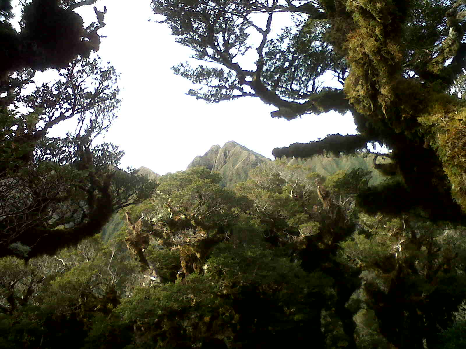
For the last 300 vertical meters the track breaks in and out of bush and we get a few views into surrounding valleys but nothing as far as the main range.
At the bottom we elect to pop along and check out the slip. It's an impressive sight - the road is covered in shattered rock, mud and shredded trees. The slip drops steeply to the river far below and is not safe to cross at the road level but workers have bulldozed terraces across further up. We grovel up through scrappy bush and supplejack beside the slip until we are above one of the terraces. The ground around the slip is fractured and loose but there's enough vegetation to provide hand and foot holds.
 |
| Heading up to the slip which is ahead and up to the right |
 |
| The edge of the slip |
 |
| Rachel, Scott and Vignesh |
Scott ventures onto the slip - there doesn't appear to be any material likely to come down from above and the surface is stable enough, about 10m out he turns and bum slides down to the bulldozed track. Vignesh then Rachel follow suit and finally I essay a somewhat more elegant scree run down.
There have clearly been a few other people taking the same route however I wouldn't recommend it unless you assess the risks pretty carefully (condition of the slope, loose material that may come down from above, run-out below etc) and don't even think of it when the machines are operating.
We walk across the terrace and down through pines to a staging area with a lot of diggers then down to the road for the short walk back to the car. A couple of chaps are chatting next to a 4WD and we wonder if they are going to challenge us but they don't seem to be connected with the site works, we exchange a few words and head on our way.
We've made much better time than yesterday and it's good to get back to Wellington in daylight and without having to contend with the worst of the Coast traffic.
So all up, the weather wasn't flash but was better than expected. We got some glimpses of view from Hector and a number of us managed some firsts - for me a night in the new Kime and an up close look at the slip. Good fun.