I've been eyeing up the far north of the Ruahine Forest Park but I'm starting to run out of trips that can be done in a weekend from the available public access points.
The north west of the park has some fantastic country - Kokopunui (Colenso) lake, limestone landscapes, beautiful forest, the expansive tussocklands at Ruahine Corner. A little further east and north the park gets a little complicated with a couple of chunks of private land and some farms that are a bit miserly about public access. There's a scattering of tracks and DOC huts as well private roads and huts. You can drop in from the north via Komata off the Taihape - Napier Road, but that's a helluva drive at either end of a weekend.
This weekend I've lined up a trip to string together a few huts and explore the area just north of the headwaters of the Makaroro River. DOC's Masters Shelter is possibly the northern most public access point on the east side of the park. It's a way to get to Apias Stream which runs across the range from the east to join the Ikawatea Stream. I'll be leaving it at that point, but after the forks the stream turns north to join the Taruarau River which turns back east and into the Ngaruroro River which meets the sea just south of Napier.
What: A bit of tops and rivers
Where: Northern Ruahine Range
Who: Solo
When: 13-14 June 2020
Map

I'm away at 5am for the long drive. The only excitement is no open petrol stations until Pahiatua after a few Ks with the fuel light on.
At Woodville it's thinking about getting light but I'm straight into thick mist - possibly one of those weird effects the Manawatu Gorge seems to have on local weather. This doesn't stop some hero overtaking doing over 120km/h; his tail lights rapidly disappearing in the fog.
It's always been dark with someone else driving when I've come this far previously, however, I find the Gwavas Road turn off SH 50 and follow it up into the forestry blocks. It turns into a good, wide gravel surface - there's plenty of utes about so some care is needed.
Masters Shelter is off Mangleton Road a bit north of Sentry Box Hut - the entry point for the WTMC trap lines. DOC notes that there is public access across farmland to the shelter.
Less than a km after the seal runs out there's a DOC sign on the left indicating a driveway on the right. No parking by the gate but there's a good gravel track which finishes at another gate - this one has been padlocked at some stage - as evidenced by the remains of a lock that someone has taken bolt cutters to. From here the track degenerates to ruts across the paddock sticking close to the fence line and stopping at another gate.
I have to check but it does look like the track heads left through the gate into a narrow paddock beside bush. A couple of horses in the paddock are very keen to come over for a chat and, if they can possibly manage it, sneak into the larger greener paddock I'm in. It takes a bit of convincing to get them far enough away from the gate that I can get the car through and the gate closed.
It's a little borderline for the wee carolla but it copes with the bumps and scrapes on the under carriage before arriving at another gate. This time the track is under trees for a short distance before reaching a small parking area and Masters Shelter.
The shelter is a reasonable size but is a bit manky. The nearby toilet has seen better days and the weathered chip board top on the long drop has one a little worried about being ignominiously deposited A first into the khazi.
The shelter is named after Lester Masters who explored the ranges in the 1920s to 50s.
Despite clag on the hills the weather is holding off as I get away just after 9. The DOC sign reckons 2-3 hours to the ridge, 800m above.
Someone has done a good job wide clearing the track - since lockdown judging by how green the cut branches are. The bush looks a bit scrappy for a start, but it has it's own story to tell - manuka is turning spindly as it is topped out by forest species vying for the space and light. Slippery black hummus is starting to build up underneath.
The track follows up in bush on the edge of farmland and a gully (Mathews Stream). After a few minutes it breaks into the open and starts to climb - there's a short while when I have a bit of a view of the surrounding farmland but soon enough I'm in clag and climbing a steep spur through what looks like alpine scrub but is below the bushline.
The track climbs back into bush again and I'm treated to more lush fungi doing their bit for turning old trees into nutrients.
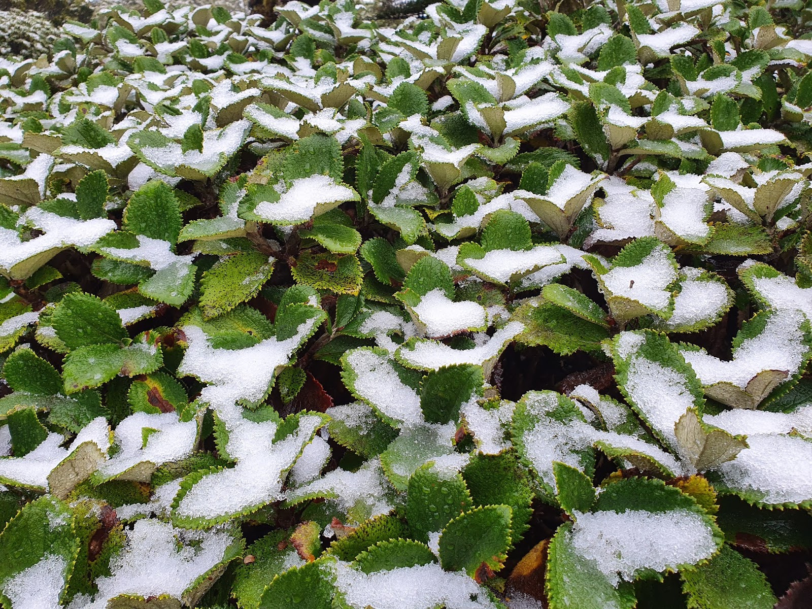
About 10 minutes from the ridge I'm startled to see a skiff of snow on the moss. The prospect had not even occurred to me - I'm not too bothered as I'm pretty much as high as I'm going to get today and the forecast for tomorrow is OK.
About 1hr 40 after leaving the bottom I'm at the ridge track - the snow is a bit thicker here but I know the tracks here abouts are wide so I shouldn't get too much dumped on me from the trees. The only thing is that the flat tops are prone to being boggy and I don't really want wet feet yet.
I join a trap line now and follow it south for half an hour to reach the junction with the track to Parks Peak. At one point the track drops a little off the ridge line to cross the headwaters of a wee tributary to Apias Creek. It's slightly unusual country with the wee rivulets forming surprisingly deep channels in the spongy bog surrounded by stunted beech.
The junction marks territory I have covered a couple of times before on trapping trips. I keep following the boggy trail through the light dusting of snow towards Aranga Hut (13 minutes).
Aranga Hut is no longer run by DOC. I think this is private land owned by one of the local hapu - the hut is still there but is no longer maintained. It would do for shelter at a pinch but is a bit of a mess.
I'm doing OK for time - it's taken about 2hr 10 from the car but it's cold and I need some more layers. From here I'm leaving the track to head north along a flat topped ridge to a wee spur down to Mistake Biv. I've found references to an old track that starts about 100m down the stream from the hut and cuts through undergrowth to the ridge. I'm expecting to lose the trail and to get thoroughly wet and cold struggling through leatherwood. This may explain why I find myself procrastinating and require a stern word to overcome the inertia.
The stream is easy to find but I waste a bit of time failing to find any indication of a track departing from it. In the end I pick what feels like the most likely spot and follow my nose through undergrowth along and then right and up towards the ridge top. There seems to be a bit of a channel and the going is not too bad. On the ridge top - possibly around pt 1351, I join and follow pink markers which are going my way.
Around 12:00 the route pops out at a clearing covered in dracophyllum - pink ribbons mark a route across and into the bush edge opposite. The vegetation has been pretty good so far with none of the expected leatherwood.
 |
| First clearing |
10 minutes later I pop out of the bush again at the open tops marked on the map north of pt 1309.
The clag is thin enough that I can see a good distance along the tops, there's no indication of a trail. The scrub and tussock isn't too bad though so I potter along trying to find the path of least resistance - joining and drifting off various animal trails. Around pt 1312 the tussock gets deeper and progress slows. I eventually find some easier veg towards the west and potter along until I run out of high ground - about half an hour after leaving the last bush edge.
The ground ahead is bare and disappears down into the gloom with nothing to distinguish one direction from another. I make an educated guess of my position and set a bearing to drop to the edge of the scarp marked on the map with the aim of following it around onto the spur.
As so often is the case - after stashing the map and taking three steps, the landscape ahead fades into view with the spur pointing to the faintest indication of the Biv in its clearing 500m below.
The scree is in that tricky state of not being loose enough to scree run but still unstable enough to sit you down in a hurry if you're not paying attention. I pick may way down into scattered scrub where the pink ribbons turn up again.
The ribbons lead me to the bush edge and in. It's steep, slippery and a bit overgrown in places - the bush looks like regrowth and a bit prone to rotten branches. There's no view until a tiny window to the biv opens, a few minutes from the bottom.
After the last wee scramble I pop out near the junction to cross Apias Creek and then the unnamed northern tributary to reach Mistake Biv about 1.10pm. Probably a bit over 1hr 30 from Aranga and around 4hr 5 since leaving the car.
The biv is the standard old NZFS two bedder with a handy and more recently added open vestibule. Like Aranga, it is no longer a DOC facility but there is an old log book dating back to the early 1970s. I add my name but afterwards wonder if I should have as it looks like few people are - like, only one entry in 2018 and there is no way hut baggers aren't wanting to notch this one up.
 |
| From Mistake Biv back up the spur to the ridge top |
The weather has cleared a little on the way down and I can see the bare top of the ridge I left less than half an hour ago. It would be nice to stop for lunch but I would like to get to Ikawatea Forks tonight and I've seen an estimate of it being 5 DOC hours from here - which gives me about negative one hour of daylight up my sleeve. I grab my pack and around 1.25 head off down stream.
It's much better travel than I expected. The rocks are not too slippery and I potter along at a reasonable pace. Although the map labels it a creek, it's already a good size.
A few hundred metres downstream a whistle heralds a couple of whio who keep ahead of me for a while before taking wing and disappearing back up valley. I feel guilty about disturbing them but the narrow valley allows little prospect for sneaking past.
I come across a couple more singles - one of which takes off down valley and out of sight. A few minutes later I'm absent mindedly wading past a rock face when there's a loud whistle 3m from my ear and the whio explodes out of the water and hurtles up stream. I'm next to a rock face with an unnoticed overhang a couple of inches off the water - the whio had been hiding, probably mostly submerged but could not contain itself when I came so close.
The stream passes various rock slides and I'm starting to worry that I've missed the one that gives its name to Rockside Biv. However, it is pretty big and obvious when you get to it - the river is in a rare straight stretch with a manuka terrace on the left and the slip on the right. About half way along the slip face there's a gap in the scrub on your left and a triangle marking the track to the Biv.
It's taken an 1hr 25 from Mistake Biv. Rockslide Biv is DOC managed and is in pretty good nick. The vestibule has been painted and has a canvas cover over the door; inside is a bench, shelves and a bunk with room for more on the gravel floor. The biv is the NZFS standard dog box and has all the signs of being a hunters retreat. The last logged visit was in Feb.
I take a 20 minute break to chuck some lunch together but with the clock ticking and some possibly tricky river sections ahead I want to push on. I have shelter if daylight runs out but would prefer to make the hut as there is no guarantees of a flat place to pitch. I head out at 3.10.
What I know about the next section is sketchy. One account points to some high sidles or swims. I have confidence though that the whio protectors have been through enough that there will be some useful marking.
As it turns out, progress is faster than expected. So much so that I can't quite believe I've got to the point to leave the river when I see the large orange triangle. But let's back track.
A bit under 45 minutes from Rockslide I come to a junction and think it's fairly sizable but don't stop to check the map - I do a quick sidle on the true right terrace as it looks like there is a wee deep bit, and rejoin the river. In retrospect this was the junction where Apias Creek swings north.
A little downstream is another deep bit - some marking indicates a rope to scramble up the bank on the right to bypass it.
About an hour from Rockslide a massive terrace opens on the right. I leave the river and meander through mature forest for a good while before filtering back towards the river.
Shortly after, there are a few more bits of river that are best avoided and pink markers indicate good sidles. The last sidle drops near the mouth of the side stream about half a K upstream of the marked track. I suspect one or two of the sidles might be a little harder to find coming up stream, but you would pretty quickly work out where not to follow the river.
At quarter to five (a bit under 1hr 40 from Rockslide) I'm starting to get mildly anxious about the light when I see a large orange triangle a little way up and back on the left beside a rock overhang. There are also trap markers. I waste minutes casting around for the track - eventually working out that it jinks back from the triangle, across the rock overhang (complete with stoat trap) before diving straight up the slope.
It's steep, loose and slippery with stones and humus. As the light steadily dims I step gingerly upwards, holding off breaking out the torch on the basis that the opposite side faces north west so should be lighter. I suspect the map doesn't quite match the actual track but I find my way to the top, up a bit of a spur and then start the descent which proves to be more open. It's still just about dark as I exit at the bottom and stumble into a flat area and a sharp edged structure - the helipad.
The Ikawatea Forks Hut is just beyond. At 5.30 it is pretty much on dark - 8hrs 30 from the car, just over 4 from Mistake and 2hr 20 from Rockslide.
The hut is tidy - 7 beds and an open fire. Although I'm cold and wet I decide not to bother with a fire as I won't have time to gather wood in the morning. The evening is quiet outside - well, apart from the sound of two sizable streams meeting a short distance away below the terrace.
There's a lot of trapping trips recorded in the log as well as hunters of course. I'm impressed to read an entry from a few months ago by Lisa and Geoff Whittle who note their 51st trapping trip. I understand that they have been the pioneers and stalwarts of the trapping effort around here - it's a truly remarkable investment of time and energy (and money given that they are Wellington based).
All up, I think I saw 8 whio in my trip down the stream and judging by the number of stoats that are reported as being pulled out over the years, you would have to agree that these birds owe their existence to the volunteers.
I'm less than impressed at a couple of log entries by some self-styled conservationists who have come through with the clear intent of collecting 'evidence' that 1080 is killing the birds.
In the morning I can see that the hut is perched in a clearing on a terrace surrounded by tall beech trees. There's a clear sky - no frost but cold enough that my hands and feet quickly go numb in my damp boots and gloves.
I take my time and get away about quarter to 8.
Contrary to the map, the track runs straight away from the door of the hut and down a spur to the junction of the two streams. I'm a bit confused to see that there are three streams coming together before working out that there is a largish island at the mouth of the Apias Stream. Somewhere upstream is a 20m waterfall which I would normally want to go and see, but can't quite muster the enthusiasm this cold morning.
I skip across the first branch of the stream with dry feet but have to go knee deep to cross the second and enter the bush at the base of the spur upwards. My feet are so cold by now that the dousing actually seems to warm them up a bit.
 |
| Looking back at the spur up to the hut |
A sign just inside the bush edge promises five minutes back to the hut and 4 hours upwards to No Mans Hut. My watch says 7.53 as I start plodding upwards.
What you see on the map is what you get - 200m steep climbing on a sharp spur, then rounding off over the next 100m (vertical) on to a long flattish meander for a couple of Ks to the next sharp climb of 400m to the top. By the time I get to the flattish bit my hands and feet are pretty much warm and I've rolled my sleeves up.
It's interesting if not always beautiful country. It's been a while since the track has been cleared and there's a bit of windfall - in a few places the track is not that easy to follow (although someone has often positioned a few pink ribbons to good effect). There are a few glimpses of view on the way up across to sunlight on the Potae Ridge or the flat tops around Aranga.
About two hours from the bottom some crunchy white stuff underfoot turns out to be frost and a few minutes later I pop out of the bush into a hard frost and a bright sunny morning.
It's a stunning reveal - after a day and a bit surrounded by clag, valley and forest, my world suddenly expands to the horizon in all directions. Ruapehu hulks white on the horizon with the elegant Ngaruhoe a short way off, the straight edge of the ridge to Potae, the dun colours of the Makirikiri tussock lands, morning cloud in the Taruarau River Valley, the surprisingly flat topped ridges immediately south. I take a bit of a sit down to drink it all in.
A short climb through tussock takes me near the top of Tuwharepokoru. There's a trig and a view across gently sloping tussock land.
It's early enough that the sun hasn't quite thawed the hard frost so I'm getting through the tussocks without getting soaked. The route is poled with old warratahs but might be a little challenging to follow in cloud. At 1020 I get to a sign that points north to Shute's Hut along a wide gravelly track (almost a road - 5hr 30), back to Ikawatea Forks Hut (3hr) and southish to No Mans Hut (30min).
I follow what looks like an old vehicle track through the tussock. The frost has done interesting things to the surface - in places strands of ice like asbestos fibres have lifted the dirt so it's soft under foot, in other places ice crackles and breaks with flowing rivulets underneath. There's some large pools and the boy, never too far from the surface, takes delight in breaking the ice with a walking pole or boot.
Just short of the high point Ikawatea, the track starts veering east and becomes boggy. There are a few old sticks to mark the way but it's another spot that could be a little tricky in clag. Pretty soon though, it's a muddy trail with some not-so-old motorbike tracks - it winds around the corner of a copse and I'm a little startled to see a hut. A little sooner than expected but I guess this must be No Mans Hut.
It isn't. But it's not until I've had a poke around inside and sat down on the porch to study the map with the aid of a sante bar that I realise this.
 |
| Looking north from the hut |
It's a private hut with gas and what must be a generator power supply - 'hut' is an inadequate descriptor as it is well above the usual standard. With a long 4WD trip across private land it probably doesn't get the usual riffraff that wreck public facilities. There's no log book. A tiny dot marks its location on the map, about half way between the last marked junction and the actual No Mans Hut.
After 10 minutes or so I potter off again along a now much more solid vehicle track.
The road passes a trig at pt 1389 (complete with nicked street sign) and drops to a bend that marks the end of No Mans Road and the turnoff to follow the main range south. I want to check out No Mans Hut though so continue north down the road.
It's less than 10 minutes from the corner down to the hut. It's taken about 3hr 15 (including 10 minutes farfing at the other hut) from the '4 hrs to No Mans Hut' sign at Ikawatea Forks. This is in good conditions so the 4 hours seem to be a reasonable estimate. However, I wouldn't bother coming here - the hut is private and not as cared for as the other one.
A microlight buzzes overhead as I'm noseying about, but not close enough to be taking an interest in the hut and a lone tramper.
Around 11.20 I'm back at the junction for the ridge south. There's no sign marking the turn which is a little surprising but there's a reasonable foot trail through the tussock.
I'm looking for the memorial that is marked on the map. I see a cairn off to the right but the pile of boulders turn out to be recently (and a bit crudely) concreted in place. It's a memorial to some local hunter - I'm assuming it is on private land - I'd have to say I'm not that keen on cairns to hunters and trampers creeping onto public land.
A little further along is the memorial to Lester Masters - I don't know anything about him, but by now am a bit thoughtful about who and what we commemorate in the names and structures we apply to our landscapes.
As I'm thinking these things and gazing over the vista that the memorial commands - I realise I'm looking at a falcon perched on the knob just beyond. It's aware of me but far enough away that it continues to check out the slopes below for prey. The sleek shape and colours couldn't be a sharper reminder about who and what really belong here.
I step quietly backwards to the trail and head on my way, glancing back to confirm the small shape is still poised, undisturbed on its rock.
The tops here are broad and covered in low tussock - it would be a nightmare to navigate in clag (or it would be but for the steady line of warratahs marking the way). The ridge eases gently up to a trig in an ephemeral pond at Ohawai (1368m). The inner child continues to take pleasure at poking holes in icy pools.
About 600m past Ohawai the tussock starts getting deep and there's some gnarly old bush on the ridge. The poles however drift right off the ridge and there's the odd triangle to mark where the trail drops into a wee gully, follows it down a short distance and then starts sidling up and down along the west side of the ridge.
Travel suddenly becomes a bit aggravating with the trail frequently disappearing in the tussock or diving up and down around erosion gullys. It seems to defy logic so I can only assume that it's following this line because of land ownership issues. At one point I see what I think is another memorial near the ridge line, but it turns out to be an old sign bearing the word "Farmland". Judging by the map it has been an awful long time since that has had any ring of truth to it.
 |
| "Farmland" |
The ridge drops slowly away towards a saddle and the going stays a bit tetchy for a while. Once it starts climbing towards pt 1314 though it breaks into bush and things improve.
 |
| Looking back (north) on the way up to pt 1314 |
Somewhere near pt 1314 I notice that a trap has an occupant and that the top isn't screwed tightly down. I prize the remains of the stoat out with my walking pole and reset the trap.
I don't notice the next few traps but then see another one - this time with a mashed weasel. I start paying more attention and progress slows as I peek into each trap and end up extricating 3 more maggoty corpses.
The time passes nicely between this worthy pursuit and the occasional view across the local tops. I am particularly taken by how long and flat the ridge is from Aranga to the drop off to Mistake Biv. It's days like this when you get a lateral view of a route you have traveled in low visibility and can appreciate how the two dimensional map reflects the lived experience.
At 1.05 with the smell of decomposing mustelid clinging to my nostrils I've closed the loop and am back at the junction to Golden Crown Track. The two hour estimate to No Mans Hut from here seems reasonable enough today but I suspect would be a bit lean in any less benign conditions.
 |
| A bit less snow today |
There's no more traps to distract me so I set off back down the ridge at a reasonable clip. This time there are views to a hazy blue horizon and I can occasionally see the knobs on the ridge below.
There's a somewhat ridiculous number of cairns in the open scrubby section but the steep track is easy to follow and has been well cleared. I just have to take a bit of care not to go A over K on the loose foliage.
As the lower slopes come into view I can pick out the paddock I drove across, and the bush edge between Mathews Stream and the farmland that the track follows.
About 2.15 I pop out at Masters Shelter to find the car in one piece and ready for the long trip home.
Postscript
Some trips just seem more satisfying for some reason.
Masters is a useful road end, although I suspect there may be some prickliness with the land owner (judging by the cut lock on the gate). The track up is good, and the route along the tops is distinctive - stunted beech, flat boggy herb fields … The ridge from Aranga is navigable and interesting although the drop off the end isn't exactly pretty.
Apias Creek is lovely, but I am mindful that it flows through private land - I haven't seen that permission is required but the area should be respected. Probably the best way to really explore would be to volunteer to do some trapping. I enjoyed the stream travel - seeing whio is such a privilege - and humbling when you think about the dedication of the volunteers.
It was probably a little bit ambitious to aim for Ikawatea Forks starting from Lower Hutt near the shortest day. But we made it ok.
The Forks are also a special area - I would like to go back and explore up the Ikawatea valley.
The last day was a bit of a mixed bag - the weather I've had on so many of my Ruahine trips makes these rare pearlers all the more special. There was however a slightly bitter after taste from the sense that landownership is being used to restrict access. There are probably other reasons, but its hard to escape the impression that comfortable huts with 4WD access into the heart of the park indicate that limits on access are more about exclusive hunting reserves than the public disturbing farm activities.
Although I often give times, I actually don't pay too much attention at the time - I just get them off the photos afterward. Out of interest I note (in retrospect) that it took 2hr 10 for the 800 odd metre climb from Masters to the ridge and 1hr 10 down.