Showing posts with label panatewaewae. Show all posts

Saturday, 12 May 2018

Makaretu Stream and Spion Kop

Call it confirmation bias, wishful thinking, stag fever, pattern matching ... our minds are easily fooled into seeing what we want (or are expecting) to see. I must have been a bit absent minded this weekend as I manage to illustrate a number of examples of this particular cognitive failure.

The first example of bias is wishful thinking - in this case looking at the map and hopelessly overestimating how much distance I will cover in a day.  I had been thinking to get into the Otaki headwaters before dark, but in the end sundown catches me at Lake Hollow on Oriwa.

As a result of this and the weather, the intended spot-height bagging returns a net score of nil. I do however visit Spion Kop (which sounds far more intriguing than it actually is) and circumnavigate the catchment of the Makaretu Stream.

According to Wikipedia, Spion Kop was the site of a battle in the second Boer War which was won by the Boers. It took place from 23-24 January 1900. Wikipedia is not so forth coming as to why the name has been attached to an obscure knob on the edge of marginal farmland in the Horowhenua.


What:    Navigation trip
Where:  Spion Kop and Makaretu Stream
When:   12-13 May 2018
Who:     Solo
Maps:

Large scale view

Start and end bits

Middle bits

The trip up the coast is punctuated by a successful foray off the express way to the Olde Beach Bakery - highly recommended purveyors of delicious baked products.

I had been intending to head out to Tangimoana Road to take a farm track up to Spion Kop (marked on the topo map), unfortunately the land owner there is less than obliging so that's off the cards. Instead, I follow Poads Road to the end and bump into the leaseholder in those parts as he is heading out with a boot full of chainsaws. He indicates that the land by the mouth of Makaretu stream has a new leasee but it should be ok to follow the stream bed.

I park by the bridge (next to the sign that says there is no Queen's chain) and at 0750 leave the car with a little bit of trepidation. This spot is a bit more visible and I wonder if it will still be in one piece on my return.
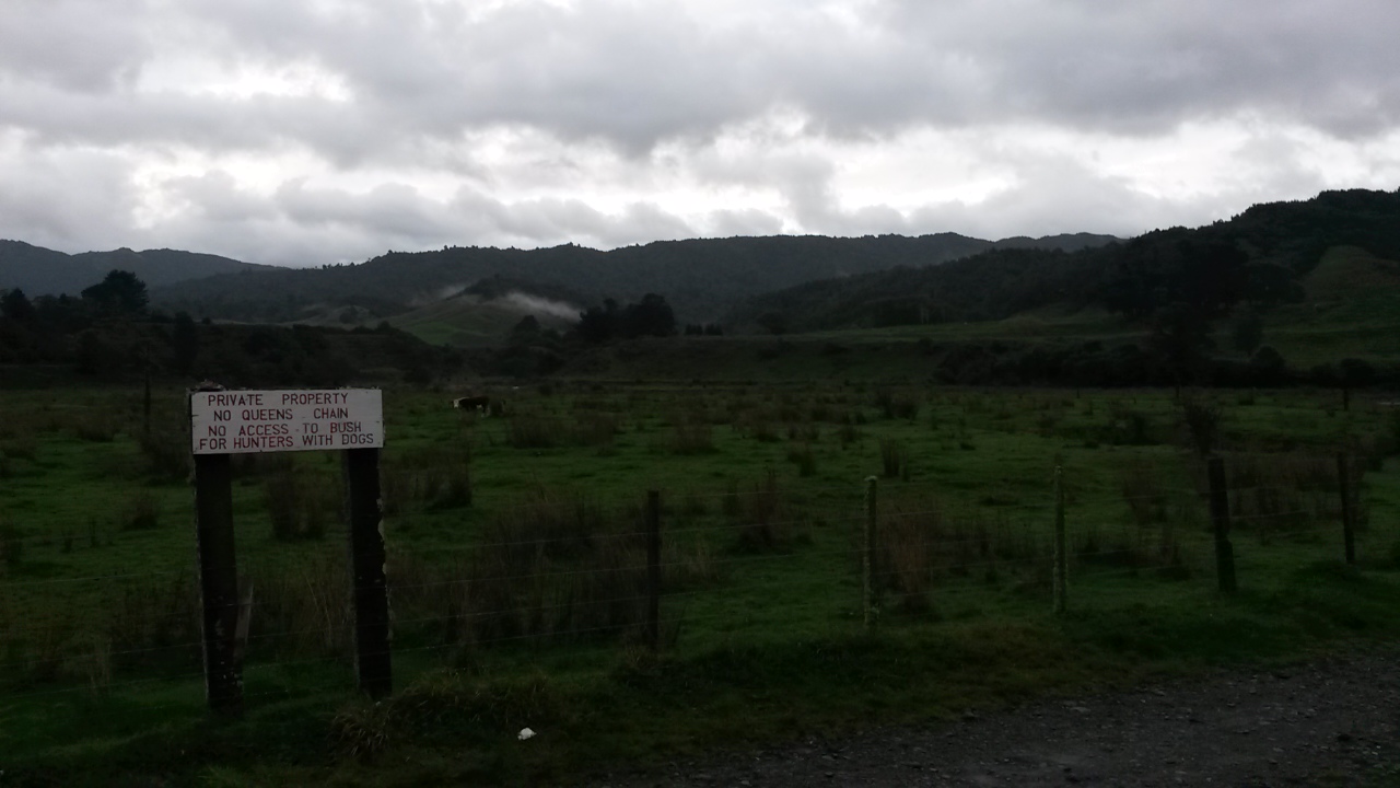

Car park

There's space between the fence and the river to walk to reach the stream - which is quite a good size (and a little up). The paddocks soon give way to bushy banks and a gorge, however the bottom is generally wide enough that there is only a couple of scrambles to avoid deep bits. There's a few terraces and flats with lots of lovely punga.


In the gorge

A little over 2 hours later I reach the flats. There's an initial false alarm (a small open area before diving back into a narrow section) before reaching a long series of flats with lots of cutty grass. It's generally pretty good going although you can get mired in the grass if you pick the wrong line. I discover that it is fairly easy to miss the side streams which is a little bit tricky when you are trying to navigate by them.

About 25 minutes up from the start of the flats there's a(nother bloody) hunters' camp on the true left. It looks like it got a lot of use once but is now just a pile of litter, like most of these structures.  I think this one might be near an old route to the ridge above Spion Kop, but I have my eye on a spur further up.


Hunters' rubbish


The flats - Panatewaewae to right of centre (probably)

There's another camp about 15 minutes later in a similar state and 10 minutes after that (about 1050) I just about miss my stream as it flows out between clumps of cutty grass.


Another camp

It's a bit of scramble onto the base of the spur with no signs of tracks. It's relatively young forest - lots of slippery black humus and healthy fungus but open enough. A little over an hour later (1100) I emerge on the ridge top to find a good ground trail with old orange spray blazes. I follow this down to the edge of the farm land where it pops out onto a grassy knoll with a survey pipe by an old farm track. The track leads down to a series of little knobs - one of which is Spion Kop (about 12.30).


Not Spion Kop but it does have feet


Magnificent vista from Spion Kop (I think)

The cloud ceiling is about 1500m so it's a bit of a gloomy view to look at while I have a bite. The farm here consists of a narrow strip of land around the tops of the spurs - there's a few cattle beasts about. 

Back in the bush it's getting cool and the wind is coming up. The track leads nicely up to Panatawaewae where the markings finish and the trail becomes far less distinct.  There are only two spots though where the compass is needed - both where the ridge drops into a saddle. The bush up here is reasonably mature with some windfall to contend with. I assume it is largely regrowth following logging and the 1936 storm.

For some reason I'm feeling a bit tired so stop for a breather - after which I set off purposefully in the direction from whence I had come. This could possibly be characterised as some sort of bias, but I think it is more an example of some sort of stupid. Fortunately I twig before I've gone too far.

It's taken a lot longer than I had thought to get this far so, by the time I reach the ridge junction south of 890 I've decided I won't be dropping into the Otaki headwaters tonight. Depending on progress from here I will either stay near the top of Oriwa (Lake Hollow where this is a roof with a water tank and plenty of camping spots) or maybe pop through to Waiopehu hut.


Look, a marker - this must be a track ...

I have been along this part of the ridge twice before - both times finding it easy to get mislaid in the flattish, swampy bit just south of the junction point. It's 1530 and fairly cool but not raining. There's a few old plastic markers but little ground trail until the ridge top sharpens on the stretch towards 918.

The drop to the saddle is a little tricky - it's the sort of place you would expect to see a useful marker because people must come through here. I don't notice anything and overshoot slightly, following what turns out to be another one of those ubiquitous disappearing game trails (another example of bias?).

A bit of a scramble brings me back onto a better formed spur with occasional wee windows down Makaretu Stream, it's about 1610.  I suspect the trick through this saddle is to keep close to the north face and follow the spur NE into the saddle then grab one of the two sketchy spurs that head SE up to Oriwa and Lake Hollow (I think I follow the later and can't say there is a significant ground trail).


Makaretu Stream

The bush is quite mixed through the saddle but ends up with a climb through reasonably open trunks chasing shafts of burnt orange sunset up the hill. At 1710 I'm at the ridge top seeing the last of the sun dip below the horizon beneath a lowering sky.


Lake Hollow in the last of the light


A roof without a hut
(second time my only photo here has been rubbish)

Lake hollow is as soggy as usual, I pause to clear the guttering on the roof then get a move on to make the most of the rapidly fading light - sights firmly set on a dry hut for the expected overnight southerly rain.

There are a few tape markers and a reasonable ground trail but both rapidly become invisible in the gloom. The ridge is well formed and, following the compass, I manage to keep to a line, although frequently wander off and end up clambering through more tree falls than you would in daylight.

The wind rises and it starts getting quite cold - the odd piece of orange tape is a welcome confirmation of progress.

Finally, the ridge starts climbing steeply and the trees give way to leatherwood before the canopy disappears completely. The open sky swallows the headlight and this lone tramper suddenly feels a lot more exposed and vulnerable. Shortly afterwards I lose the trail in the tussock and thrash around the slope expecting to drop onto the track at any moment.

Here the dreaded bias comes back into play - when I eventually reach the track it is running at an unexpected angle - my brain runs a convincing argument that the only way it would be running in this direction is that I crossed it at some point and have circled back. Full of confidence I turn in the wrong direction and head off  thinking that the lights on my left (probably Palmerston North) are Levin. Ironically, this direction is taking me to  Twin Peaks - the site of a memorial to some trampers that died in that storm of 1936.

The track drops and then starts climbing - finally my brain accumulates enough dissonant feedback to suggest that we stop and regroup. The compass seems to be pointing in the wrong direction and I can see a light behind me. I think the light must be the hut but taking a bearing on it makes no sense whatsoever (it was probably around Lake Hollow but I didn't see anyone there when I came through). Finally - trusting the compass and the line of the track, and applying some logic (the muddy track has such high use it can only be the main thoroughfare) I turn around and trudge back into the saddle and up to Waiopehu to finally drop down to the hut.

At 1930 I came in from the cold to be met by candlelight and a growling dog. A party of three (plus dog) are retiree friends who came in Wednesday aiming for a northern crossing but wisely turning back with poor weather on the tops. The two women have turned in but the chap obligingly heats water while I slough off wet and muddy kit. 

Things are decidedly more cheerful in dry clothes and with a full stomach. My hut companions are reasonably quiet (once the dog settles down).

For the record - although the dog was reasonably well behaved I am still of the view that dogs don't belong in huts. I'm not about to start an argument though so keep my thoughts to myself.

The rain starts in the early hours of the morning and keeps a steady blatter against the windows - in the morning it transpires that it is driving straight into the porch so some of the things left to dry are not as dry as hoped. The dog takes one look outside and decides it can hold on a bit longer.

As usual, my brain has come to some conclusions during the night - in this case, that we won't drop down a spur to what might be a swollen Makaretu Stream so the most practical exit is straight down the track.

I'm first out at about 0800 - it's raining but not windy and the cloud ceiling is a good 100m higher than the ridge. The track itself is alternately a bog and a stream stream, but once under the canopy I warm up and soon shed gloves and balaclava and start regretting the merino layer.


Morning

It gets quite dim under the canopy but the rain stops and it's nice to potter down through the wet bush.

The rest of the trip? Not much to report really - the intersection with 6 discs track at 0930; the bottom of the spur about 1010. The paradise ducks set up their habitual racket as I wander across the farm flats to arrive at the usual road end at 1020. 10 minutes later I'm reunited with the car, which I'm delighted to find in one piece.


6 discs intersection

Postscript

Not all boxes ticked but some new countryside and a satisfying wee explore. Makaretu is worth a look but watch for hunters and be careful about access. The Otaki headwaters are still very much unfinished business - unfortunately there is now one less unexplored route to get there.

Nil spot-heights for the weekend? Oh yeah - the rules (more like guidelines really) are that only spot-heights in the forest park count - most of this trip was actually outside the park boundaries or covered points I've already been.

Monday, 30 October 2017

Panatewaewae Stream and there abouts

This weekend is a western Tararuas mop-up expedition.  There are a few random spot-heights behind Otaki and Manakau that have not quite managed to be on the agenda for previous trips. Unfortunately there are no obvious ways of joining them to form an elegant weekend trip. 

After a couple of days of letting ideas kick their way around the brain pan, the plan resolves: two one-day trips, one located around the Panatewaewae/Waikawa Stream and another around the Waitohu Stream. Efficient if not aesthetic.

What:     Day one of two one day navigation trips
Where:   Back of Manakau - Panatewaewae and Waikawa Streams
When:    30 September 2017
Who:      Solo
Why:      Mopping up orphan spot-heights
Map:

A bit of Sunday's trip appears in the bottom right

After an early start and drive up the coast, the Waikawa DOC campsite has a few empty vehicles scattered around in the dark.  First up - a quick reccy to see what it will be like to camp overnight - the ground is boggy but the shelter should pass muster - even with the hole in the roof.

It's an overcast Saturday and 7am as I wander the short distance up Manakau Road to the first gate. Soon after, an old 4WD track on the left looks viable - the blackberry is threatening a resurgence but it's good today. This sidles up and around to a pylon and a spur which climbs at a steady pace through misty pines.

At the top, a large brown bird explodes out of the undergrowth and hurtles off into the clag - I can only guess that I'm looking at the south end of a northbound pheasant but haven't seen one around the Tararuas before.

The ridge top is flat, so to confirm bearings I pop along to the Panatewaewae track then retrace my steps to take a bearing to point 509 through mucky bush.  There are a surprising amount of foot prints going that way but not a lot to indicate why - still, one spot-height down for the day.  The rest of the trip up to 635 is unremarkable - damp, claggy and a little familiar. The turnoff from the logging trail onto a foot trail up to 635 is well marked (9:20am).


Typical part of track up Panatewaewae ridge


Turn off to 635 and beyond - orange tape is obvious


From 635 I'm looking for a spur running southish down to a fork in the Panatewaewae Stream.  It takes a bit of thrashing around to find the top but once on, it's a fairly straightforward ramble down, although the supplejack which will haunt the rest of the weekend makes itself felt. The spur becomes a bit indistinct towards the bottom but I'm pleased to come out bang on the forks.  There's some rubbish remaining from a hunters camp but nothing of note apart from the rather energetic noises the stream is making. It's 10.30 so progress is about on track.


Panatewaewae Stream - could be slow wading around in that


My route is downstream about half a K. However the stream has cut down into the valley bottom and soon drops through a chute - not overly dramatic but I decide to take a handy log across with dry feet. After that it's slow work scrambling along goat tracks on steep banks above the stream (you could probably just bite the bullet and get very wet and may be a little bruised).


Bridge

About 20 minutes later, at the next forks another old hunters bivvy is rotting into the bush (do they ever take their crap out!). Across the stream the hillside is precipitous and festooned with supplejack and kiekie. I find what looks like a spur up stream a little way which takes me onto a clear knob before disappearing. Then it's just plain hard yakka for the first 100 vertical metres before the bush opens out.


Hunter's rubbish

Time for a breather - damp but still cheerful

I'm hoping one of the ubiquitous logging trails will turn up, but no such luck until a series of clearings up the now gently shelving spur make the going much easier. At one point I step out of the forest edge to see two deer staring intently at me from 40m away - the tableau holds for a full half minute before they trot into the bush.


Lots of pigs here abouts


The rain has mainly been holding off, but the scrub around the clearings is saturated and, pretty soon, so am I. At the top of the spur though I join a route I have travelled before and am back in forest on a respectable track.


Old - but still marked

At 12:20 (at 600m contour) I'm contemplating leaving the track for what is likely to be the trickiest navigation of the day as there are no clean spurs. I'm aiming to drop to a fork in the stream up valley of the old mill site and pretty much do so, although manage to lose the spur towards the bottom so have to bash down a creek a few  hundred metres up stream of my target. Then it's time to start climbing ... again. 


A bit of supplejack to contend with ...


And a little bit more

The trail up starts from the stream junction and I'm expecting it to be marked and well travelled as it is an obvious route. Sure enough there are markers (not by DOC, but markers none-the-less) and there's no navigation required as I pick up the next spot-height (490) on the way to the ridge 500m above. The markers are ones I have seen before on the ridge - I think they mark a nice little loop trip from the Waikawa Stream with the option of a popping up to Waitewaewae.


Waitewaewae Ridge line - turn off to spur is well marked

The spur emerges onto a wee knob on the ridge into tall regrowth and familiar territory - it's 2.45 so time is still good but a fair amount of territory to cover. I turn right (south-west) and potter along paying little attention, but giving a nod to the route from a low saddle to West Waitewaewae stream from a previous trip. The markers stop after a bit and it becomes easier to wander off the ground trail until it pops out on the well travelled old logging trail at pt 730 (3.45), for what I am thinking will be the last slightly tricky bit of navigation.

The second spot-height 490 for the day is off down a spur somewhere to the right of the road - the tricky bit is finding the spur as there are no views. This means estimating how long it will take to get to the approximate location. My minimum guess turns out to be wrong as a quick thrash onto a too rapidly descending spur determines. A hundred or so meters later there is a wide logging trail leading away providing fast travel down a broad spur through spindly saplings. Soon another one bites the dust.


To 490 - easy travel

Just before Thompson (4:50) there's a junction that 4WDs obviously frequent - it's fairly churned up. Left (southish) is a sidle road down towards the Waitohu Stream and country I will be frequenting tomorrow, right is down towards the Waikawa Stream and Manakau Road end. I go straight ahead to find an overgrown track to the top of Thomspon - where another track heads southwest down the crest of the spur. This place is riddled with trails.

I continue over Thompson to a 4WD road on its north face and views over a sunny Kapiti Coast. It's 5pm and just the long downhill on 4WD tracks through active forestry. I head off down the wrong road briefly until an unexpected gate gets me checking the compass for a quick back track to the correct road. There are old signs in a few places but no marking to be seen.


Kapiti Island - from near Thompson


Just short of pt 595 I reach a junction where I took a right to reach the Manakau Road end last time - this time I hang a left for the DOC camp ground.


Junction before 595 - right to Manakau


And left to the DOC campsite and carpark


View north to the Panatewaewae Ridge (route from this morning - but dry now)


I briefly follow a large modern logging road for a while before determining it is heading the wrong way and isn't on the map. A bit of backtracking and the correct route has the decency to be faithful to the map for the rest of the way down. 

At 6.40 a couple are enjoying the afternoon sun outside their tent after a claggy day and another chap has a fire going in the shelter. Rather than camping fare I decide to find a local pub for dinner - Shannon provides a meal of a quality consistent with the price and the décor. I don't even bother asking about craft beer (what a Wellingtonian).

Back at the road end I tiptoe across the bog and lay out my mat in the shelter where it is least likely to get rained on. A chap has a fire going by the carpark with his stereo on and three or four other vehicles indicate others are spending the night - a surprising number of people really.

There's a bit of rain during the night and, as I discover the next day - lots of mosquitos.

Postscript

The near country has recently cut and still clear 4WD tracks. Some trails are still accessible by vehicle and 4WDers have cut these up (and left rubbish).  Further back, many old logging tracks remain - on some, the ground is still clear as the rock has offered little purchase for regrowth - these can offer delightfully fast travel through a tunnel of thin trunked trees competing for canopy space. Over time, dense groves of saplings, punga and ground fern start to colonise as the trail starts merging back into the bush.

These trails are found on many spurs and can be quite steep. They seem to thin out significantly above about 500m. Animals tend to adopt them so there is often a good ground trail to be had and the footing is much better as they are clear of the older rotten logs. Water will often also follow them so sometimes the bank on the down hill side will be where the clearer animal trails are.

Although useful, you can't rely on them going where you think they might be going as some will leave a perfectly good spur to dive into a gully - presumably dead ends to rip out logs from everywhere remotely accessible. Another endearing trait is to lead you on an easy path upwards with no view spots and gradually swing around the slope to approach the high point from an unexpected direction. Lesson: keep an eye on your compass.

This isn't my favourite catchment in the Tararuas - but it does have its isolated corners and offers ample challenges for off track navigation. It is also a good gateway for some more interesting places like the Waitewaewae headwaters.

Saturday, 8 July 2017

Waitewaewae headwaters

The trip plan is a little audacious - explore as much of the Waitewaewae river headwaters as possible in a weekend. The design is efficient whilst leaving some scope for future exploration (i.e. the east branch which looks a bit daunting).

The Waitewaewae is one of those rivers whose story is subsumed by a larger river. Most people never get near it as there are no tracks or huts marked. On the map the whole system looks like a rose - the flower consisting of three tributaries: Prout Stream in the middle with the East and West Waitewaewae Rivers curling around on each side and delineating two spurs between. These join to flow south down the stem - about 5km to be swallowed by the Otaki river.

I've pottered across the top of the catchment on a couple of previous occasions but it's time to get off the tops and have a good poke around.  And it went mostly to plan, the bit that didn't was accommodated within the contingency plan and provided a useful reminder about confirmation bias.

What:    Weekend tramping trip in western Tararuas
Why:     Navigation and hut bagging
Where:  Waitewaewae headwaters
Who:     Solo
When:   8 and 9 July 2017
Map:


It's pitch black at the second gate at the Manakau Road end - a couple of pig hunters are collaring their dogs by torchlight. They set off ahead while I fluff around with a recalcitrant head light. At 7am the light is necessary as I stroll along the road, over the slip and to the, now isolated, road end.


Road end clearing

I continue straight past the redundant bollards. A short way along an old sign marks the turnoff to cross the river and climb the spur to Mt Thompson (where I came down a couple of weeks back - but turned down river and missed the crossing in the evening light).  

The track drops to the stream bed just before the Panatewaewae forks. Crossing with dry feet is easy followed by a few meters up to a clearing at the foot of my target spur. A track heads off up the true right of the Waikawa stream valley but I quickly find an unmarked route heading directly up. There's an obvious trail.

The pig hunters are polite when I catch up but, I imagine, not best pleased that a tramper might disturb the game. They are heading for another spur though so hopefully not too much loss.

After a bit over an hour on the go I reach pt 708 and veer SSE to keep climbing - this is clearly an old route with one of the markers embedded deep into its tree.

The climb is steady but not steep - I'm enjoying the exercise and the prospect of the unknown territory ahead when suddenly I'm conscious that my sense of my surroundings has altered. There is sometimes a breath that you take when you start on a trip - by the time you've exhaled, your awareness has shifted from driving and work, to a wider landscape and the sounds and smells of the bush. It's not always noticeable but it's pleasant to be conscious of the change.

Just past a turn to the ridge to Thompson, I'm on Waitewaewae, still not much to see but at 0900 it's a good start to the day. 15 minutes more pt 969 gives some views and marks the turnoff to the convoluted ridge into the headwaters that I'm after.

There is no obvious track to start with but as the ridge forms, a trail of sorts comes and goes. It's generally pretty good going. There are a few clearings giving views north and east. It's irresistible to pause and identify the ridges and points from two weeks back in the near ground; and behind ... Oriwa, Waiopehu; and beyond again, the peaks of the main range dusted with snow.

Pt 955 in the near ground with ridge to Panatewaewae running left

A little further on windows open southwards; Judd ridge and Hector on the horizon with the characteristic jagged Tararua peaks to the left. Periodically a flock of whiteheads twitter in the low stunted trees - I chirp at one of them and it comes over and we cheerfully shout at each other for a bit. Occasionally a kereru blunders loudly off. There's little wind - a perfect tramping day.


Probably one of the Pt 1030's in near ground - southern and Tararua peaks behind

Main range on the horizon

By 11.25 I've followed my nose with no significant problems to pt 957. The ridge top is fairly flat here so the start of my spur NNE is not immediately obvious but with a bearing it soon starts shaping up. There is a bit of trail and occasional pest control markers, an old vegetation tag and some other Venetian markers with measurements on them. All quite old but clearly DOC has been in the area. 

The trip down the spur is pretty straight forward - it gets mucky at the bottom for the final drop into Prout Stream, about 40 minutes from the top. Travel upstream in the tight, dim and damp valley bottom is somewhat different.  However, Prout stream is pretty - mossy with a few minor water falls and pools but pretty navigable.


Prout Stream

I follow up the diminishing stream until it starts getting clogged with mossy logs then take a spur up to just short of pt 969 - the climb is pretty mucky and I'd have to say it's not until I'm on the ridge heading west towards the top of Waitewaewae that I actually know exactly where I am. At 2.25pm I'm on Waitewaewae ... again.

The spur isn't obvious immediately but before long I'm pottering along with sporadic views towards Kapiti Island. I expected the trail on this ridge to be more obvious but I'm not sure that it is really. There are the usual trails that could be animal or tramper so I keep an approximate line with the compass.


Daylight is waning as I get to the flatter sections below pt 650 - the key, I figure, is to head more east and not pop out on the edge of the gorge on the West Waitewaewae. I drop into the head of a wee stream and follow it down to the top of a cliff over Prout Stream and eventually find a place to scramble down. A little after 5 and it's pretty dim.

The game plan now is to head downstream to Island Forks (Prout and West YTYY), through the gorge and up East YTYY to Island Forks hut. Except in the dark I miss the West branch confluence and bowl through the gorge and past the East confluence.

In retrospect it probably took 25 minutes to get from where I dropped into Prout Stream (for the second time) to the East branch forks but confirmation bias ensured I shot past looking for something that wasn't there. I just assumed that I'd dropped into Prout Stream further up and had traveled slower than expected so just kept going.  Eventually the penny drops but by now I'm a fair chunk of the way to the Otaki confluence so figure it is best to keep going to YTYY hut.

Sure enough, about 7.30 a large river joins from the left and I know it's a short stint downstream to find a swing bridge and the track to the hut.

At 8.10pm I'm pleased to arrive and not too disappointed to see I have company. A father and son have a radio set up listening to the All Blacks draw with the Lions and another chap has already turned in. I eat dinner, and warm icy feet by the fire before also turning in.


Otaki river from the hut

In the morning the third hut guest turns out to be a chap I shared Elder hut with one night over a year ago. To his credit he makes the connection first. It's good to catch up.

I'm first away a bit after 0800 - the advantage of the extra distance last night is that I can nick up to the ridge behind the hut and follow it north to a spur I've had my eye on (it was one of the possible permutations for the weekend). I head along the track towards Otaki Forks leaving it about 10 minutes later when it climbs to it's highest point on the spur. The top of the spur has a long, wide top that is easy to get mislaid on with lots of very large, old logs scattered about. Once it starts climbing it's easier to follow but there's not really much of a trail.

At 0940 I'm on the ridge and turn north (after notifying home command of the plan change by text). I've come down this ridge before but it looks completely unfamiliar - no snow for a start. The trail is easy to lose and there's not much view until further north. I'm keen to keep moving as I don't want to be caught by darkness too far from the road end.


Tantalising glimpses of ridges from yesterday

This ridge forms the true left of the Waitatapia stream in the valley below (west). At the top end there are a few clearings and it's easy to find yourself struggling through leatherwood rather than under a high canopy. Still - the clearings give great views west.

Tangata Maunga Ridge with Kapiti behind


Towards the top end of the ridge I find a trail on the east side which avoids the leatherwood. It get's pretty flat and a bit hard to tell where my target spur starts to diverge but someone has thoughtful laid some pink ribbons out and I follow them north east, through a clearing and down through open bush as the spur gradually forms. It's taken about three and a half hours to get from the hut to the turnoff to the spur.

The ribbons seem to be relatively new but are a bit sporadic so I keep an eye on the compass and manage to follow the somewhat messy spur down to the flat top near pt 650. From here it's steep and I can't really tell if I'm on a trail or not. Whatever - I'm chuffed to emerge at the top of a bank bang on the forks. An hour 20 from the top.


Waitewaewae Forks 

Island Forks hut is about three minutes up from the forks. It's a tidy little number - low door, bunks and bench. That's pretty much it. There's a loo in the bush behind and a picnic table and fire place out front. The five visits recorded in the hut book in the last year might explain the tidiness - not frequently visited.


Island Forks hut


After a bite to eat it's only 10 minutes before I'm heading out again and, in 15 minutes, through the gorge above YTYY forks - a much easier proposition in daylight.  A pool that was up to my midrift last night proves to have a shallow pass on the other side.


Not-really-an Island Forks
The rivers must be low as island forks island is connected to land. The reason I missed it in the dark becomes apparent - West YTYY feeds into a deep quiet pool which I must have just assumed was a backwater. I scramble around on the true right and head up into the next gorge.  

I head up the valley counting the side streams, painfully aware of the time but not wanting to rush on the lethally slippery rocks. The weather is  overcast with patches of sun - precious little of which reaches the valley bottom. Like Prout Stream there are scrambles up little water falls and some quite deep pools to sidle. A few large slips and log jambs are reminders of how active this landscape is.

At long last the stream rounds a bend and takes a bearing that I am waiting for - it's 3.40pm and time to look for a route up to a low saddle above the Waikawa catchment. A tree in the river bed has an old marker and there are more on the bank - there's not much trail and the markers run out but the slope is not too steep or high so before long I'm standing in the lowest point on the ridge between YTYY and Thompson.


West YTYY upper headwaters - a bit messy

There's a spur running down from near the saddle so I sidle around and take a bearing down. It's a little hard to follow at first but some very old ribbon soon appears, almost invisible but enough to keep me in the right direction.  I lose it toward the bottom and end up in supple jack but eventually bash down to a stream and start following it down.

There are occasional terraces which could have had old logging tracks on them and once I get to the Waikawa this is more common although there are still periods in the river. It's worth casting around for them as the pace is considerably faster than the stream bed.  There's an old sawmill site marked on the map - I find a large grass clearing with lumps on it but don't hang around to see if any of these are old machinery. The track is now reasonably well formed and each time it opens out I'm hoping it's the clearing where I headed up yesterday morning.

It is well dark under the canopy but light enough in the clearings so I keep plodding without a torch until I reach the original clearing. From here on it's more open and I'm on familiar territory again so I eschew the light to arrive at the car in the pitch black just before 6pm.

Post script

The Waitewaewae head waters caught my intention some time ago and I had heard about Island Forks hut, but didn't really have the confidence to take the trip on until now. A few previous trips near the area provided the necessary familiarity (and possible escape routes) and the weather indicated low flows and no rain - perfect for thrashing around in gorgish streams.

Missing the forks in the dark is a salient reminder that if you're relying on reaching somewhere and stuff your navigation up you could be in big trouble. In this case I knew the river route was navigable, had considered the possibility of travelling to YTYY hut, knew how far it was and where it was (although about 1cm off the bottom of my map) and was therefore quite happy not to turn back when I finally realised what was going on.

Despite the lesson (and discovering a wee gash on my forehead when I got home - apparently from head butting a log), it was a really pleasing trip - a little bit of unfinished business in the shape of East Waitewaewae river but I have to say it doesn't look entirely pleasant ... maybe I've seen enough of the reclusive Waitewaewae headwaters for now.