Showing posts with label Burn hut. Show all posts

Saturday, 28 April 2018

Island Ridge

The Mangahao dams area of the Tararuas has been extensively interfered with - historic logging and fires, a long access road, farming, forestry and accommodation. And of course the extensive modifications that come with Hydro development. The road and dams are obvious, but less so is the impact of water being hoicked out of the Mangahao river to pass west through the range to Shannon - leaving a trickle that follows it's normal course north east to join the Manawatu River miles away near Woodville.

Te Araroa passes through here and there are certainly some interesting corners - there are also some physical challenges, particularly if scrub is your thing. Overall this isn't my favourite part of the range but Island Ridge has caught my eye and (of course) there is a small matter of a bunch of spot-heights that require seeing to.

What:       Navigation, scrub bashing and spot-heighting
Where:     Island ridge (Mangahao)
When:      28-29 April
Who:        Solo
Maps:


Deep in the hills behind Shannon ...


Most of Saturday


Sunday (and start of Saturday)

Island Ridge is just that - a wee lump defined by a the Mangahao River, Baber Creek and connected to Ngapuketurua by a low saddle. Most people whistle up the river valley hardly glancing at it. A few others head up College Creek passing the north end of the ridge. After wandering around it and looking down on it I figure it's about time to pay a visit.

An 0445 start sees me bumping up the Mangahao Road after 0700. It seems like a while since the grader has been through. I park by the warning sign in the small carpark by the dam for reservoir two, and sort my life out. This includes donning flak jacket (flouro vest to try to discourage hunters from shooting me).


It still has the typo - hope they never change it

The lake is showing a muddy rim indicating it's down a bit, and the spill way isn't doing much, so there's little flow in the Mangahao River. At 0730 the sky is grey but not threatening as I head off for the 4 km (ish) walk to reservoir one - mildly tedious but not unpleasant.


Not much happening in the Mangahao river 


Reservoir two - showing a bit of mud

I'm less than half way when a ute offers a lift. Perched on the tray it's a far more satisfactory method of travel.  The chap and friends are shuttling a car to be ready when they complete the loop walk from reservoir two via Burn Hut.

The first order of business is a bit of a nothing really - pt 512 is a knob near the road end. Mr pink ribbon man has been up there - possibly for pest control although I can't see anything. I skid back down through the supplejack to the dam and the proper start to the day - it's now 0845.


The evocatively named Pt 512

The upper reservoir is also showing a bit of mud. The track to College Stream crosses the dam and across the water the base of Island Ridge comes down to the water.


Reservoir One - Island Ridge ahead


At the first opportunity I drop off the track and out of the bush to find a way across the stream mouth. Someone plus dog has already been through this morning but the footprints return so I'm less concerned about a hunter on the loose.


Tide's out


At the foot of the spur the shore is steep and there's a bank to scale to get into the bush. It takes a bit of fossicking to find a place to haul myself up. There are no signs of a track.

The scramble up starts as a steep clamber on a crumbling slope. There's a reasonable canopy with a few tangled clear patches on the way up.

At the ridge top, things look great - the canopy is high enough and the trees open enough that I can potter along at a good rate. It doesn't last. Soon it's tight saplings and then scrub. Generally not the worst type of scrub but slow nonetheless.


North back along Island Ridge - 'Peak' on the horizon

The scrub does mean lots of chances to look across towards the Camelbacks and Tawirikohukohu, and up to the ridge north of Ngapuketurua which, as the day wears on, starts to gather clag about its shoulders.

Towards the end of the ridge I can make out the saddle - it has a bit of a complex shape. Towards pt 870 and the end of the ridge the scrub gets more dense. At 1145 it has taken me 3 hours to get from the dam to pt 870.


Approaching south end of Island Ridge
Ngapuketurua in cloud on left - Saddle in middle 


From 870 (south end of Island Ridge) SW up Mangahao valley
Tawirikohukohu on right 


I keep hoping that people will have worn a trail up to here from the mouth of Dick Creek but can find no evidence. So, it's scrub bashing down until there's enough canopy to duck underneath.

I drift a little left onto a side spur but cut across to find an erosion scar that points to the saddle. Once in the saddle the bush is more open and, as expected, there are plenty of animal trails with the understory pretty much cleaned out (a common sight in low saddles). The wind in the trees almost drowns out the occasional roar drifting up from the Dick Creek side.

I pause for a bite and to regroup - things are much slower than expected so I figure I will only be going as far as the hut tonight - I'm still hoping to divert to two spot heights off the side of the range near Ngapuketurua.

Climbing out of the saddle is the reverse of climbing in - forest gives way to low canopy then, inevitably to scrub - still no trails. A handy rock gives a nice wee view back into the saddle but otherwise it's just a long grind up taking well over an hour to get through the saddle from 870. I'm hoping for a trail coming up the major spur to Ngapuketurua from Harris Creek - nope. More and worse scrub. Some game trails higher up but these wander off and disappear. The cloud comes and everything gets progressively damper.

This may all sound a little depressing but there's a certain mindless satisfaction in rolling out of the scrub to the top with bleeding knees having unequivocally 'knocked the bugger off.' The scrub is also very healthy with the usual suspects present - leatherwood being the most annoying (slippery, contorted and prone to breaking suddenly), totara (much harder and springier than the rest of the shrubbery and surprisingly spikey), and around here; mountain cedar (dense to push through with low branches - but smells nice), and mountain toatoa (just gets in the way). Dracophyllum filifolium can be tricky when thick but at least you can grab hold to haul your way up without it splintering. Higher up the grasses and tussocks add their own little tripping hazard as they tangle into the leatherwood.


Looking west across the saddle at 870

There's a wee cairn tucked into the tussock at the top of Ngapuketurua but still not a lot in the way of trails. It's not cold although there's a bit of wind moving the clag about.

It's a bit after 1500 - I figure it will be tight but I should be able to knock of at least one of the two spot-heights that someone has carelessly placed off the east side of the main ridge. After thrashing through more scrub and popping a short way down a dead end spur, the clag shifts enough to show that I'll not be sleeping in a hut if I continue. So ... back to the top - a compass bearing into the featureless gloom and off we go - it's now 1540.

Last time I was through there was a trail running diagonally SE up the north face of Puketurua - I manage to find it but then lose it again. It's pretty easy to pick up though once on the ridge.


Finding the way off Ngapuketurua

From Ngapuketurua there is an old, but well cut trail along the ridge. It forms a tunnel through the clumps of leatherwood, and a foot trail through the low scrub and tussock. Although the day is getting on, progress is good - until the top of the spur to Baber forks that is. I suspect this is where a lot of people exit/enter the tops as it is harder finding the trail from here on. I lose it completely on the drop to 840. The top here is broad and featureless so you just follow the compass and pick your way through low, knee-shredding scrub and tussock.


This bit is definitely a track

The light wanes and the clag refuses to lift. The track comes and goes and in the gloom is easily lost - at 5.30 it's getting mighty close to headlamp time. I hold out until finally reaching the track. By now it's dark and all but raining. Visibility is down to about seven meters but the track is a wide swathe in the headlamp. The rain sets in just as I arrive at the hut at 1900.

Empty: downside is no hot brew ready for a wet, scratched tramper. Upside is no snoring or dogs, and I can spread out. It isn't cold but with no fire I get dry and into my bag while the water boils for dinner.

By candlelight the hut is tidy and cosy. Someone has left a few books and I while away the time reading old scifi (minus the last chapter unfortunately).


Burn Hut

The rain splatters against the hut all night - not too heavy and not too cold, but incessant. By morning I have talked myself out of thrashing around in the scrub chasing spot-heights through the clag. I figure it will take two more trips to tidy this area off - hopefully with a view of more than the inside of the next patch of leatherwood.

There's time for coffee, porridge and to finish the book before braving the elements at 0845. There's cellphone coverage up here and home command has acknowledged the plan change.

It turns out to be not so bad. Sure, it's the inside of a cloud but the track is (at least initially) open and the temperature mild. It's as muddy and slippery as you would expect given the rain.

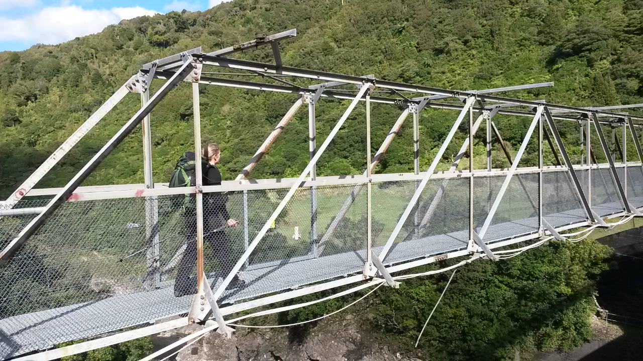
About 0955, I'm standing on the humpback bridge at the bottom above a high flowing creek as it cascades into the Mangahao (which has more water than I've seen previously). A fantail pops by to say hello - the rain has stopped and the clag is left behind on the tops.

In a tactical move I thrash up a messy spur to pick off a low hanging spot-height - in theory the next trip will be just a little bit simpler for the effort.

The slip way at the dam is operating and the lake level looks like it has come up about a meter overnight. At 1130 it's been less than a half day tramp but I'm more than ready to hit the road - hopefully ahead of the end of school holiday traffic.


Saturday


Sunday

Saturday, 18 March 2017

Burn Hut

Tramping with other people two weeks in a row - this is getting to be a bit of a habit.

Jenine posts a trip to Burn Hut on Meet-up around Wednesday and I am in two minds.  I have been meaning to visit that area for a while and transport is a bit tricky - but on the other hand I do prefer pottering around on my own and not having to worry about group decision making. On a bit of a whim I hit the 'I'm going' button and put my original plan on the back burner.

What:    Overnight tramp to Burn Hut
Where:  Mangahao, behind Shannon
Why:     New hut, new track and hopefully a little bit of navigation
Who:     Rodger, Jenine and me
When:   17-18 March 2017
Map:      Map

In the end there are just three of us and we get away from Wellington a bit after 1.30pm on Friday. It's a smooth trip north and no problems finding the Mangahao Lower No. 2 reservoir.

We park next to a Mazda 6 by the dam and try to guess who might have headed up the track to the hut ... not really a hunter's car, two coffee cups, children's toys, invoice from Levin shop ...


Typo in the second to last line perhaps ...


Janine and Rodger rearing to go


View up the reservoir

And they're off


Down river


It's a pleasantly sunny day as we head across the dam and into the bush about 4.30. The track runs down the true right of what is left of the Mangahao River - water is piped through the hill to the No 3 reservoir then through another hill to the Mangahao power station while the rest of the river is left to meander north and east to eventually join the Manawatu river shortly before the gorge.


The track is in quite good nick and is easy to follow. A couple of side streams are small enough to mean no wet feet and the last larger one has a bridge. The track turns and climbs under a high canopy, there aren't many view spots although we get a nice wee view at one point up the valley to the tops near the hut.

Our pace is pretty slow so the sun is heading to the horizon as we enter the scrubby 'tops.' We are well below the normal bush line but an old burn means the vegetation has still not fully re-established. Someone has however cut a wide swathe for the track so it is pretty easy going. Although, as the track turns south and west the going gets a little more overgrown. Jenine is taking point and very decently finds all the holes for Rodger and I to avoid.

On the horizon we get a brief glimpse of Mt Taranaki before mist starts rising from the valley.

Looking northish - hut is on the spur in the left quarter

Jenine forging ahead

Last of the light behind 'Peak'

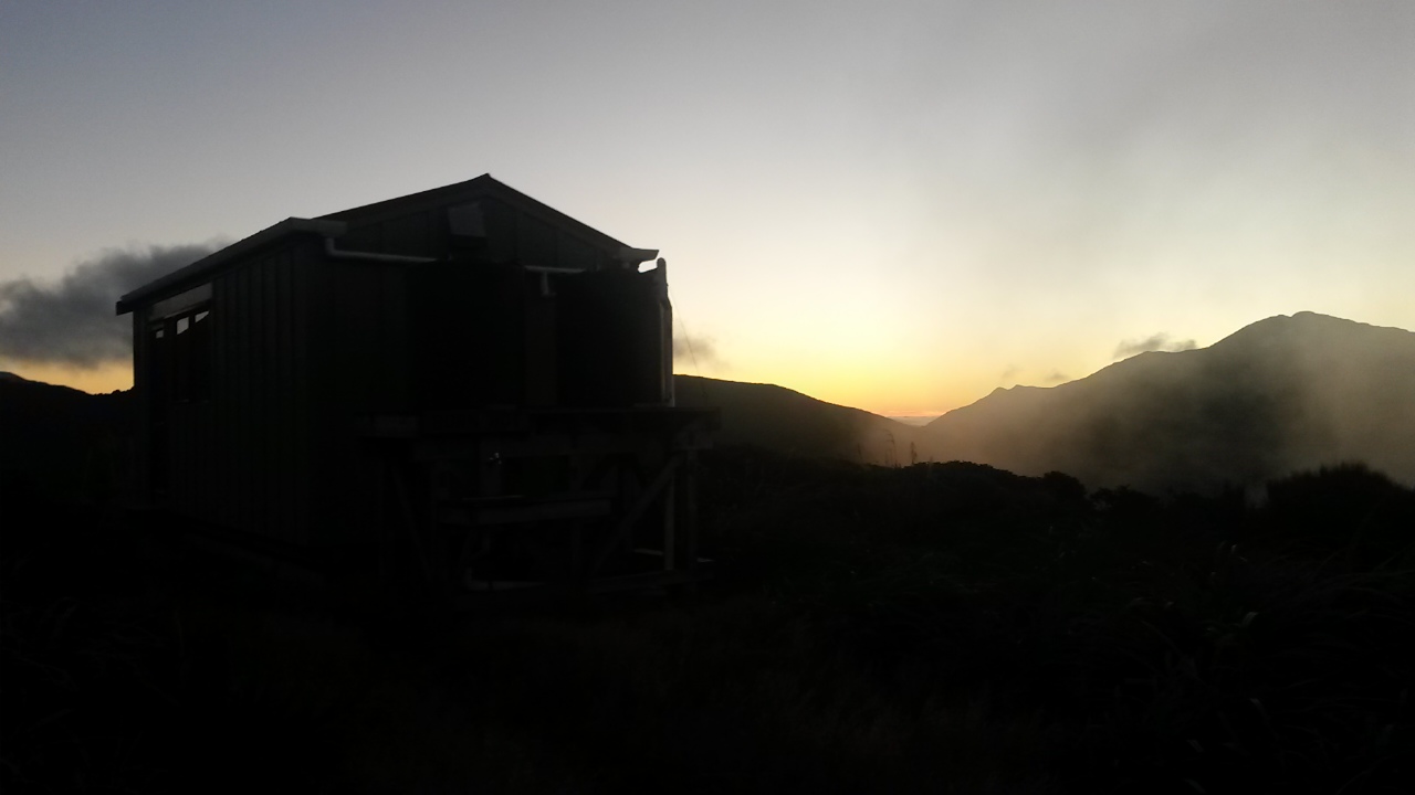
Burn hut and the first of the evening clag

The hut is in sight and less than a kilometer away as the sun sinks below 'Peak', so we arrive in the light around 7.45.

A hunter is well settled in - when we arrive he thoughtfully removes his rifle from the common area and stashes it by his bunk. He turns out to belong to the Mazda ("it's actually the wife's car") and says he is expecting a mate to turn up after milking. Rodger pulls together a very decent con carne, potato, nacho, cheese and sour cream dinner and we chat until a crashing and scrambling indicates his mate and dog have turned up.

He reports that it has clagged right in and the overgrown section of track caused him a couple of moments of indecision trying to find the track, although the dog was quite clear where to go. We now have 5 for a 6 bed hut with a dog in the vestibule. The hut is comfortable and warm despite the rising wind outside. Both hunters are clearly quite familiar with the area and are happy to tell us about their favourite spots.

Outside, the clag is blowing up from the valley below and swirling around the ridge, but above is a clear night sky. It's not a bad wee spot.

There's a bit of a moment when the young dog gets a bit excited and bites Jenine. It's quite a chomp but no broken skin. The owner is mortified and whenever anyone heads towards the door he is quickly on hand to keep the dog in check. It has a bit of a jump at me at one point also but no harm done. It does, however confirm my view that dogs don't belong in busy huts and if they are near a hut they should be well trained or kept away from others.

The next morning is grey but the weather forecast indicates that we should be ok before a southerly change and rising wind and spot of rain in the afternoon. Having studied the map I'm interested in an option that Rodger has also identified - following the track towards College Stream then leave it to follow the ridge south for about 2km to come down the Puketurua track.

The hunters indicate that this should be fine and that the Puketurua track is well traveled. The ridge looks gentle and straight forward to navigate but it will be the ground cover that might be the kicker. The hunters also suggest the section down College Stream may be a bit slow going. We decide to head to the ridge and make a call when we get there.


Rodger set for the weather

Burn Hut catches a patch of sun

Clag is scudding across the ridges and we are periodically in cloud. There's a short, gentle climb from the hut to what looks like a trail leading left towards Taramea (and maybe north along the ridge beyond?) then the track skirts along the ridge in a southerly direction.

We are keeping an eye out for an obvious trail to follow along the main ridge but end up just over shooting it. Rodger spots it when we back track a few meters - it skirts around the west side of a wee knob before the saddle to 835.  The ground trail is a bit over grown but shows signs that it has been cleared at some time in the distant past.


Jenine is somewhere in the scrub there

Easy going at last


There are quite a few spots where the trail across open scrub is difficult to follow and we end up finding our own way. There's also a bit of bush with occasional old tape markers.

It's not too bad travel overall but there is a fair amount of pushing through  scrub and some scrambling required. On the plus side the cloud lifts and the day becomes warm and pleasant. The wind drops and shifts to the south but it remains calm.

Approaching the top of the Puketurua track there is a wide cut swathe along the ridge and the going gets easier. The top of the track is not so easy to find though as it is somewhat overgrown - not quite what the hunters indicated. However, it follows a clear spur down so it is pretty straight forward. When we reach the tree line the going gets easier again and we potter on downwards.

There are a couple of spots where we cast about briefly for the track but the spur is quite well formed and it's pretty easy to follow. Jenine and Rodger have GPS apps on their phones so I don't even have to get the compass out.


First glimpse of the top reservoir down Pakaturua spur

There are some old school markers but no orange triangles - on my 2011 topo paper map the track is marked and named but I note that the online topo map has dropped the name. I assume it is no longer being maintained as a track - however given that it is still on the map I take the opportunity to whip out the bush saw and do a bit of track clearing on the way.

Lower on the spur someone has done ridiculously extensive marking with blue spray paint for downwards not upwards travel. The bottom of the spur steepens and we are soon clambering down hanging off roots and saplings. At the bottom the track emerges at Baber forks - a sign points up College Creek to the track we could have taken (Mack's track) and orange triangles give us the choice of following the stream down to the reservoir or sidling through the bush.

I'm feeling a bit guilty about enjoying the off track sections which haven't been as much fun for everyone so volunteer to go on ahead and bring the car up from the lower reservoir. There's not much point everyone walking the 4km of road.

The reservoir is reasonably full so the hunters suggestion that we cross to the track on the other side is not a goer and there is no space to skirt along the shore - the sidle track is not too bad although I miss the start of it and cast about in the bush a little before hooking on to it. Rodger and Janine later report the same experience. It's a short way to the dam with a brief pause to clear the branches around a tree fall.


No 1 Reservoir


Looking back up the reservoir to our ridge

At the dam there are three cars so the road is clearly navigable. I divest a few layers and trot up the road in the afternoon sun. Just short of the 2nd dam there are a couple of hunters heading up the road so I pick them up on the way back. It turns out they heard us go by on the track this morning and have just come back down the way we came in yesterday. They say there is a large family party heading up to the hut so I suspect our hunters from last night will be re-evaluating how long they stay (especially with kids around the bitey dog).

Back at No 1 reservoir Jenine and Rodger have been waiting in the sun for about 10-15 minutes and sensibly haven't started down the road. Rodger decides to take a quick dip in the dam before we head off for an uneventful trip down the coast.

Post Script

The track up to Burn Hut was easy to follow. The hut itself is compact but tidy and warm - it seems it gets a bit of traffic from hunters, and day and overnight walkers. The route south along the ridge towards Ngapuketurua is reasonably straight forward navigation but there isn't always a good ground trail. It's not as bad as some of the Rimutaka tops but those of a shorter wheel base or carrying walking poles might find it a bit of a challenge.  Puketurua track is pretty good but a bit of a scramble at the bottom, a bit over grown at the top and there are one or two spots where you may need to check your navigation. The route from Baber Forks to the dam is not too bad but the marking can be a bit confusing in places - if you are following your map you should be able to work things out pretty quickly though.